Category:Carl-Schüller-Straße 1
Jump to navigation
Jump to search
| Object location | | View all coordinates using: OpenStreetMap |
|---|
Cultural heritage monument in Bavaria, Germany  | |||||
| Upload media | |||||
| Instance of | |||||
|---|---|---|---|---|---|
| Location | Bayreuth, Upper Franconia, Bavaria, Germany | ||||
| Street address |
| ||||
| Heritage designation | |||||
 | |||||
This is the category of the Bavarian Baudenkmal (cultural heritage monument) with the ID D-4-62-000-37 (Wikidata)
|
Media in category "Carl-Schüller-Straße 1"
The following 2 files are in this category, out of 2 total.
-
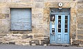 Bayreuth Carl-Schüller-Straße 1, front door.jpg 4,599 × 2,759; 3.77 MB
-
 Bayreuth Carl-Schüller-Straße 1.jpg 4,350 × 3,263; 7.78 MB
