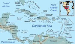
Category:Caribbean in the 1970s
Appearance
Insular countries of the Caribbean: The Bahamas · Barbados · Cuba · Dominican Republic · Haiti · Jamaica · Saint Lucia · Saint Vincent and the Grenadines · Trinidad and Tobago
Continental countries: Belize · Colombia · Costa Rica · Guatemala · Guyana · Honduras · Mexico · Nicaragua · Panama · Suriname · Venezuela
Other territories: Aruba · British Virgin Islands · Curaçao · French Guiana · Puerto Rico · Sint Maarten · United States Virgin Islands
Continental countries: Belize · Colombia · Costa Rica · Guatemala · Guyana · Honduras · Mexico · Nicaragua · Panama · Suriname · Venezuela
Other territories: Aruba · British Virgin Islands · Curaçao · French Guiana · Puerto Rico · Sint Maarten · United States Virgin Islands
Caribbean in the 20th century: ◀ · 1900s · 1910s · 1920s · 1930s · 1940s · 1950s · 1960s · 1970s · 1980s · 1990s · ▶
English: Caribbean in the 1970s
Español: Caribe en los años 1970
Wikimedia category | |||||
| Upload media | |||||
| Instance of | |||||
|---|---|---|---|---|---|
| Category combines topics | |||||
| Caribbean | |||||
region to the center-east of America composed of many islands / coastal regions surrounding the Caribbean Sea | |||||
| Instance of | |||||
| Part of |
| ||||
| Named after | |||||
| Culture | |||||
| Located in or next to body of water | |||||
| Has part(s) |
| ||||
| Highest point | |||||
| Population |
| ||||
| Different from | |||||
 | |||||
Subcategories
This category has the following 28 subcategories, out of 28 total.
Media in category "Caribbean in the 1970s"
The following 3 files are in this category, out of 3 total.
-
Political Evolution of Central America and the Caribbean 1979.png 1,000 × 750; 161 KB
-
United States Caribbean map 1972-09-01 to 1979-10-01.png 2,000 × 1,182; 237 KB
-
United States Caribbean map 1979-10-01 to 1981-09-17.png 2,000 × 1,182; 235 KB


