Category:Car parks in the City of Bradford
Jump to navigation
Jump to search
Subcategories
This category has the following 3 subcategories, out of 3 total.
B
- Car parks in Bradford (17 F)
I
Media in category "Car parks in the City of Bradford"
The following 22 files are in this category, out of 22 total.
-
 Apperley Bridge station, car park - geograph.org.uk - 5050880.jpg 1,024 × 768; 107 KB
-
 Apperley Bridge station, cycle park - geograph.org.uk - 5050886.jpg 1,024 × 768; 136 KB
-
 Apperley Bridge to Esholt (33801692883).jpg 6,000 × 4,000; 10.71 MB
-

-
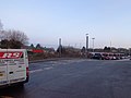
 Asda, Rooley Lane, Bowling, Bradford - geograph.org.uk - 886940.jpg 640 × 412; 78 KB
-
 Car park of the Rock and Heifer, near Thornton - geograph.org.uk - 5019942.jpg 1,024 × 768; 154 KB
-
 Car park on Rooley Lane, Bradford - geograph.org.uk - 6317494.jpg 2,000 × 1,449; 2.44 MB
-
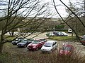
 Car park, Menston railway station (30th December 2014).JPG 4,608 × 3,456; 6.34 MB
-
 Central Car Park, Haworth - geograph.org.uk - 6158974.jpg 1,024 × 768; 148 KB
-
 Covered walkway at Morrison's Supermarket - geograph.org.uk - 4965009.jpg 1,600 × 1,065; 576 KB
-

-
 Cutler Heights Methodist Church, Cutler Heights Lane - geograph.org.uk - 2248231.jpg 2,000 × 1,359; 526 KB
-
 Drop off area and car park, Menston railway station (30th December 2014).JPG 4,608 × 3,456; 6.36 MB
-
 Dudley Hill Business Centre Car Park, Knowles Lane - geograph.org.uk - 3398675.jpg 1,600 × 1,200; 333 KB
-

-
-
 Hilmore House ^ Car Park - Gain Lane - geograph.org.uk - 2195631.jpg 640 × 480; 72 KB
-
 Jaggers Quarry Car Park, Haworth - geograph.org.uk - 128218.jpg 640 × 480; 123 KB
-
 Oxenhope Station, Sign - geograph.org.uk - 1619790.jpg 640 × 480; 129 KB
-

-
 Shipley Scrap Train - geograph.org.uk - 1737085.jpg 2,592 × 1,944; 1.47 MB
-
 Trolley Bus Wires over the Car Park - geograph.org.uk - 6012972.jpg 1,137 × 1,600; 478 KB


.jpg)


.JPG)


.JPG)


