Category:Cape du Couedic Lighthouse
Jump to navigation
Jump to search
| Object location | | View all coordinates using: OpenStreetMap |
|---|
lighthouse in South Australia  | |||||
| Upload media | |||||
| Instance of |
| ||||
|---|---|---|---|---|---|
| Location | Parndana, Finniss, South Australia, AUS | ||||
| Street address |
| ||||
| Heritage designation |
| ||||
| Service entry |
| ||||
| Inception |
| ||||
| Source of energy | |||||
| Area |
| ||||
 | |||||
English: Cape du Couedic Lighthouse
Media in category "Cape du Couedic Lighthouse"
The following 21 files are in this category, out of 21 total.
-
 -i---i- (5099049309).jpg 3,493 × 2,327; 5.57 MB
-
 -i---i- (5099684306).jpg 3,888 × 2,592; 1.49 MB
-
 Cape de Couedic Lighthouse, Kangaroo Island, South Australia.jpg 3,456 × 4,608; 3.19 MB
-
 Cape Du Couedic and the two Casuarina Islands, circa 1912 SRG-67-20-21.jpeg 1,024 × 745; 256 KB
-
 Cape du Couedic Lighthouse (11050989965).jpg 3,456 × 5,184; 6.24 MB
-
 Cape du Couedic Lighthouse - South Australia.jpg 3,888 × 2,592; 2.16 MB
-
 Cape du Couedic Lighthouse 01 @minutoli.JPG 3,456 × 2,304; 2.11 MB
-
 Cape du Couedic Lighthouse 01.jpg 3,285 × 4,928; 3.48 MB
-
 Cape du Couedic Lighthouse 02 @minutoli.JPG 2,304 × 3,456; 1.64 MB
-
 Cape du Couedic Lighthouse 2, South Australia.JPG 2,448 × 3,264; 1.49 MB
-
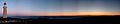 Cape du Couedic lighthouse at sunset.jpg 2,889 × 582; 253 KB
-
 Cape du Couedic Lighthouse on a cloudy day.jpg 6,016 × 4,000; 536 KB
-
 Cape du Couedic Lighthouse.jpg 3,264 × 2,448; 3.6 MB
-
 Cape Du Couedic lightouse plus Kangaroo - panoramio.jpg 1,600 × 1,200; 241 KB
-

-
 Caves at Cape du Couedic(GN05443).jpg 3,264 × 2,448; 1.12 MB
-
 Kangaroo Island (2052422062).jpg 2,048 × 1,536; 640 KB
-
 Light house Flinders chase national park.jpg 3,024 × 4,032; 2.57 MB
-
 Lighthouses of Kangaroo Island (2550938060).jpg 3,888 × 2,592; 6.78 MB
-
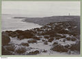
 Panorama of Cape du Couedic and the Casuarina Islands.jpg 1,524 × 600; 140 KB
-
 Phare de Cap Couedic.jpg 1,536 × 2,048; 283 KB
.jpg)
.jpg)


.jpg)


.(GN01489).jpg)
.jpg)
.jpg)

.jpg)
Categories:
- Lighthouses in Australia by name
- Lighthouses on Kangaroo Island
- Flinders Chase National Park
- Built in Australia in 1909
- Lighthouses built in 1909
- Lighthouses with second order Fresnel lenses
- Black and white photographs of lighthouses in Australia
- Landfall lights
- Lighthouses by range, 15 to 19 nm
- Lighthouses with focal heights above 100 metres
- Chance Brothers lighthouse lights
- Lighthouses with third order Fresnel lenses