Category:Cape Hatteras National Seashore
Jump to navigation
Jump to search
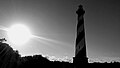
English: The Cape Hatteras National Seashore in North Carolina, on the east coast of the United States.
protected area  | |||||
| Upload media | |||||
| Instance of | |||||
|---|---|---|---|---|---|
| Location | North Carolina | ||||
| Visitor center | |||||
| Operator | |||||
| IUCN protected areas category | |||||
| Visitors per year |
| ||||
| official website | |||||
 | |||||
Subcategories
This category has the following 8 subcategories, out of 8 total.
Media in category "Cape Hatteras National Seashore"
The following 200 files are in this category, out of 1,436 total.
(previous page) (next page)-
 (1-4) Bodie Island Waterfowl Hunting Areas (318cf083-8218-44d6-b7f5-aabe41cc099f).jpg 3,400 × 4,400; 7.69 MB
-
 (12-20) Bodie Island Waterfowl Hunting Areas (3cc23744-72f9-43cc-ad5a-051f2ea2a9f3).jpg 3,400 × 4,400; 8.81 MB
-
 (5-11) Bodie Island Waterfowl Hunting Areas (6cf5945c-7e8e-4e63-8384-482fc27919af).jpg 3,400 × 4,400; 8.05 MB
-

-
-
 1874 Little Kinnakeet Life Saving Station building (50831649222).jpg 4,032 × 3,024; 2.64 MB
-
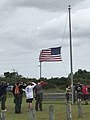
 2014 Memorial Service in Buxton (14176283842).jpg 4,825 × 2,714; 4.1 MB
-

-

-
 A brown pelican north of Ramp 25 on Hatteras Island (51306857118).jpg 3,696 × 2,448; 3.2 MB
-
 A common loon takes a break in the foreshore on Bodie Island (51306856153).jpg 4,928 × 3,264; 5.9 MB
-
 A common loon takes a break on Bode Spit (51307668275).jpg 3,024 × 4,032; 2.83 MB
-

-
 A common yellowthroat on Bodie Spit (51307681950).jpg 2,648 × 1,909; 1,021 KB
-
 A corn snake slithers across a service road near the Bodie Lighthouse (51306864118).jpg 3,559 × 2,395; 1.18 MB
-

-
 A diamondback terrapin crossing NC-12 on Ocracoke Island (50123481302).jpg 3,070 × 2,678; 3.66 MB
-
 A double rainbow over South Point 07-02-2021 (51306674586).jpg 2,731 × 1,536; 790 KB
-
 A dovekie near the high tide line (50856346497).jpg 3,696 × 2,448; 3.71 MB
-
-
 A great crested flycatcher with its next meal (51306675076).jpg 3,470 × 2,443; 1.34 MB
-
 A great horned owl hunting behind seasonal housing (51499613152).jpg 2,304 × 1,536; 1.07 MB
-
 A green heron foraging in the tidal creek next to Ramp 72 (50123262366).jpg 2,807 × 2,701; 1.18 MB
-
 A green heron showing off on Ramp 72 (51352651953).jpg 2,305 × 1,536; 449 KB
-

-
 A group of yucca plants (51306867213).jpg 2,464 × 1,632; 2.08 MB
-

-

-
 A large congregation of cormorants on Bodie Spit (51307687820).jpg 3,696 × 2,448; 3.51 MB
-

-
 A least tern chick out on South Point, Ocracoke Island (50829189126).jpg 3,131 × 3,022; 3.58 MB
-

-
 A loggerhead sea turtle false crawl on South Point (51502685292).jpg 2,560 × 1,920; 1.02 MB
-

-
 A Mighty Gust (16477393196).jpg 640 × 640; 85 KB
-

-

-

-
 A peaceful sunrise (51759570495).jpg 512 × 288; 33 KB
-
 A Question (13308918524).jpg 4,571 × 2,571; 2.81 MB
-

-
-
-
 A snowy egret erupts in flight near Oregon Inlet (51503457316).jpg 3,389 × 2,217; 1.01 MB
-
 A Sora foraging along the canal on Ramp 72 (51305944042).jpg 1,406 × 1,406; 715 KB
-
 A storm front creeps over South Point (51502659742).jpg 1,024 × 768; 143 KB
-
 A sweet little American Oystercatcher chick on Ocracoke Island (50123485122).jpg 1,872 × 1,714; 453 KB
-

-

-

-
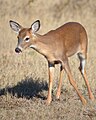
 A white-tailed deer near the Bodie Island Lighthouse (51307693880).jpg 2,877 × 1,991; 937 KB
-
 A whitetail doe tends to her fawn near the Bodie Island lighthouse (51500690848).jpg 4,928 × 3,264; 8.32 MB
-
-
 A young whitetail buck meanders through the forest on Bodie Island (51306879698).jpg 4,928 × 3,264; 6.92 MB
-

-
 Accessibility matting at Oregon Inlet kayak launch (51757878742).jpg 2,000 × 1,500; 1.08 MB
-
 Accessible beach mat at Buxton Beach Access (51758953178).jpg 1,235 × 926; 232 KB
-
 Adorable fawn near Bodie Island Lighthouse (51390380321).jpg 2,464 × 1,632; 1.07 MB
-
 Adorable fawn near Bodie Island Lighthouse (51390632448).jpg 2,464 × 1,632; 1.37 MB
-
 Adult American oystercatcher with chicks near Cape Point (50123270096).jpg 3,024 × 4,032; 1.08 MB
-

-
 Adult least tern within active colony in Ramp 23 area (50122708183).jpg 3,024 × 4,032; 3.27 MB
-
 Aerial photo of debris associated with house collapse - 53753979367.jpg 9,248 × 6,944; 9.74 MB
-
 Aerial photo of debris associated with house collapse - 53753983467.jpg 9,248 × 6,944; 11.11 MB
-
 Aerial photo of debris associated with house collapse - 53753987642.jpg 9,248 × 6,944; 22.59 MB
-
 Aerial photo of debris associated with house collapse - 53753988522.jpg 9,248 × 6,944; 22.33 MB
-
 Aerial photo of debris associated with house collapse - 53753996632.jpg 9,248 × 6,944; 19.67 MB
-
 Aerial photo of debris associated with house collapse - 53754887206.jpg 9,248 × 6,944; 9.95 MB
-
 Aerial photo of debris associated with house collapse - 53754894561.jpg 9,248 × 6,944; 10.86 MB
-
 Aerial photo of debris associated with house collapse - 53754904781.jpg 9,248 × 6,944; 17.21 MB
-
 Aerial photo of debris associated with house collapse - 53755081143.jpg 9,248 × 6,944; 10.06 MB
-
 Aerial photo of debris associated with house collapse - 53755086773.jpg 9,248 × 6,944; 10.89 MB
-
 Aerial photo of debris associated with house collapse - 53755087563.jpg 9,248 × 6,944; 9.76 MB
-
 Aerial photo of debris associated with house collapse - 53755093583.jpg 9,248 × 6,944; 17.7 MB
-
 Aerial photo of debris associated with house collapse - 53755102203.jpg 9,248 × 6,944; 19.59 MB
-
 Aerial photo of debris associated with house collapse - 53755199979.jpg 9,248 × 6,944; 12.21 MB
-
 Aerial photo of debris associated with house collapse - 53755204604.jpg 9,248 × 6,944; 12.38 MB
-
 Aerial photo of debris associated with house collapse - 53755207069.jpg 9,248 × 6,944; 11.82 MB
-
 Aerial photo of debris associated with house collapse - 53755213319.jpg 9,248 × 6,944; 10.32 MB
-
 Aerial photo of debris associated with house collapse - 53755217824.jpg 9,248 × 6,944; 10.45 MB
-
 Aerial photo of debris associated with house collapse - 53755222474.jpg 9,248 × 6,944; 19.9 MB
-
 Aerial photo of debris associated with house collapse - 53755223079.jpg 9,248 × 6,944; 20.22 MB
-
 Aerial photo of debris associated with house collapse - 53755223434.jpg 9,248 × 6,944; 18.66 MB
-
 Aerial photo of debris associated with house collapse - 53755233544.jpg 9,248 × 6,944; 19.06 MB
-
 Aerial photo of debris associated with house collapse - 53755306730.jpg 9,248 × 6,944; 11 MB
-
 Aerial photo of debris associated with house collapse - 53755307480.jpg 9,248 × 6,944; 10.03 MB
-
 Aerial photo of debris associated with house collapse - 53755310325.jpg 9,248 × 6,944; 20.58 MB
-
 Aerial photo of debris associated with house collapse - 53755318550.jpg 9,248 × 6,944; 19.14 MB
-
 Aerial photo of debris associated with house collapse - 53755320275.jpg 9,248 × 6,944; 20.14 MB
-
 Aerial photo of debris associated with house collapse.jpg 9,248 × 6,944; 20.38 MB
-
 Aerial photo of Ocracoke Village, 06-17-1955 (51757893702).jpg 1,464 × 1,179; 292 KB
-

-
 Aerial view looking toward Cape Point (51503718158).jpg 4,032 × 3,024; 2.45 MB
-
 Aerial view of Cape Point on August 7, 2020 (50209657868).jpg 3,016 × 2,371; 1.78 MB
-
 Aerial view of Cape Point on August 7, 2020 (50209658483).jpg 3,497 × 2,123; 1.35 MB
-
 Aerial view of Cape Point on August 7, 2020 (50210454617).jpg 4,032 × 3,024; 2.15 MB
-
 Aerial view of Cape Point on August 7, 2020 (50210455862).jpg 3,797 × 2,880; 2.59 MB
-
 Aerial view of the Bonner Bridge Pier (51540353311).png 1,920 × 1,080; 3.39 MB
-
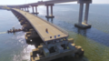 Aerial view of the Bonner Bridge Pier (51540354506).png 1,920 × 1,080; 3.63 MB
-
 Aerial view of the Bonner Bridge Pier (51540593348).png 1,920 × 1,080; 2.24 MB
-
 Aerial view of the Bonner Bridge Pier (51541073099).png 1,920 × 1,080; 3.63 MB
-
 Aerial view of the Bonner Bridge Pier (51541074404).png 1,920 × 1,080; 3.1 MB
-
 Aerial view of the Bonner Bridge Pier (51541279005).png 1,920 × 1,080; 3.39 MB
-
 Aerial view of the Bonner Bridge Pier parking area (51539560182).png 1,920 × 1,080; 4.45 MB
-
 Aerial view of the Ramp 4 area (51759591205).jpg 1,024 × 768; 219 KB
-
 Airplane accident at Ocracoke Island Airport (51757884382).jpg 2,312 × 1,734; 927 KB
-

-
 Allies at Attention (14175606562).jpg 3,640 × 2,912; 3.28 MB
-
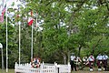
 Allies in Ocracoke (13991613518).jpg 3,658 × 2,056; 2.12 MB
-
 American oystercatcher scrape on spoil dune, Ocracoke Island (49787462068).jpg 2,250 × 3,000; 3.61 MB
-

-

-

-
 An orchard oriole among the pines near the Bodie Lighthouse (51306886928).jpg 3,769 × 2,627; 1.22 MB
-
 An osprey with a freshly caught meal on Bodie Spit (51306887053).jpg 3,446 × 2,332; 677 KB
-
 Anglers at Cape Point October 2020 (50828469733).jpg 4,032 × 3,024; 2.41 MB
-
 Anglers on the Bonner Bridge Pier (51538752896).jpg 4,032 × 3,024; 2.32 MB
-
 Anglers on their way to use the Bonner Bridge Pier for the first time (51539679825).jpg 4,032 × 2,778; 2.78 MB
-
 Anglers ready to use Bonner Bridge Pier on opening day (51537966982).jpg 3,428 × 3,024; 2.92 MB
-
 Arthur and the Lighthouse (14417696570).jpg 3,264 × 2,448; 1.36 MB
-
 Atlantic at 25 (14083482905).jpg 5,184 × 2,916; 4.84 MB
-
 Atlantic Devil Ray caught during Surf with a Ranger program (51757905972).jpg 1,360 × 660; 128 KB
-
 Autumn Sunrise (14943845957).jpg 4,718 × 2,653; 2.41 MB
-
 Avon Fishing Pier (50828473618).png 445 × 334; 356 KB
-
 Bagpipes & Graves (16808055603).jpg 1,073 × 696; 300 KB
-
 Bald Eagle (16265875705).jpg 640 × 640; 41 KB
-
 Bald eagle on the beach at Ocracoke (51352440556).jpg 3,024 × 4,032; 918 KB
-

-

-
 Barrow Pit parking area on Ocracoke Island (51759601270).jpg 4,032 × 3,024; 2.88 MB
-
 Beach Access Information Ranger (5d137899-1dd8-b71c-079d-cea8b669e3f7).jpg 5,184 × 2,915; 5.95 MB
-
 Beach Ambassador at ORV ramp (51757902847).jpg 3,024 × 4,032; 5.06 MB
-
-
 Beach debris between Ramp 49 and Cape Point (50829229401).jpg 2,016 × 1,512; 820 KB
-
 Beach debris Ramp 49 and Cape Point (50829312757).jpg 2,016 × 1,512; 656 KB
-
 Beach equipment left behind (51759389994).jpg 4,032 × 3,024; 3.41 MB
-
 Beach equipment left behind by visitors (51759603485).jpg 4,032 × 3,024; 4.18 MB
-
 Beach equipment left on beach overnight (51757903942).jpg 1,500 × 2,000; 984 KB
-
 Beach Hazards - Large Hole (50087772236).jpg 4,032 × 3,024; 2.76 MB
-
 Beach Hazards - Sand Castles (50088011572).jpg 4,032 × 3,024; 4.02 MB
-
 Beach Hazards - Volleyball Net (50087195608).jpg 3,024 × 4,032; 2.29 MB
-
 Beach hole (51360936868).jpg 940 × 1,936; 236 KB
-
 Beach hole in front of village of Avon (51359959547).jpg 3,024 × 4,032; 6.91 MB
-
 Beach near Ocracoke Campground (51603209685).jpg 4,032 × 3,024; 1.83 MB
-
 Beach view from Ramp 49 boardwalk (50829228676).jpg 960 × 1,280; 422 KB
-
 Beautiful Beaches (14264364119).jpg 640 × 640; 106 KB
-
-
 Beauty on the Seashore (15141161715).jpg 640 × 640; 79 KB
-

-
 Below the Bonner Bridge Pier (51547135604).jpg 960 × 1,280; 328 KB
-
 Billy Mitchell Airport Terminal.jpg 2,592 × 1,944; 2.25 MB
-
 Birding Boardwalk (14198593950).jpg 640 × 640; 72 KB
-
 Black-and-white view of Ocracoke Lighthouse. (5d499462-1dd8-b71c-07cc-6efc5b500144).jpg 3,456 × 5,184; 7.62 MB
-
-
 Black-bellied plover in the foreshore; Bodie Island (50829326932).jpg 2,464 × 1,632; 1.82 MB
-
 Black-crowned night heron roosting in a tree on bodie Island spit (50829241211).jpg 2,464 × 1,632; 2.28 MB
-

-
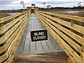 Blind Closed sign at Bodie Island Marsh Blind (50856321626).jpg 4,032 × 3,024; 3.08 MB
-
 Blue Button Jellyfish washed up near Ramp 70 (51758994663).jpg 859 × 768; 212 KB
-
 Boardwalk at 25 (13896862438).jpg 5,184 × 2,916; 4.05 MB
-

-
 Bodie Island Lighthouse (364e7971-1dd8-b71c-07e2-5621b422c1ac).jpg 480 × 640; 153 KB
-
 Bodie Island Lighthouse (364fb0ec-1dd8-b71c-0765-ebd8db7942be).jpg 400 × 445; 71 KB
-

-

-

-
 Bodie Island Marsh Blind Wayside Sign (51757924822).jpg 3,024 × 4,032; 2.88 MB
-
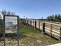 Bodie Island Marsh Blind with sign (51758757426).jpg 1,067 × 800; 210 KB
-
 Bodie Island Marsh View (3657ccc3-1dd8-b71c-07ed-610f7c666915).jpg 576 × 432; 161 KB
-
-
 Borrow Pit Road parking area on Ocracoke Island 12-17-2020 (50828477853).jpg 768 × 1,024; 152 KB
-
 Borrow Pit Road parking area on Ocracoke Island 12-17-2020 (50829229501).jpg 1,024 × 768; 217 KB
-
 Borrow Pit Road parking area on Ocracoke Island 12-17-2020 (50829313087).jpg 1,008 × 756; 156 KB
-
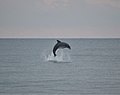 Bottlenose dolphin breaching near Ramp 63 (51504467490).jpg 1,280 × 1,010; 137 KB
-
 Bottlenose Dolphin playing in the waves near Ramp 70 (50831532301).jpg 2,262 × 2,138; 501 KB
-
 Boy Scout Troop at Oregon Inlet Campground 09-2020 (50831531966).jpg 3,024 × 4,032; 925 KB
-
 British Cemetery 2015 (17428058425).jpg 1,128 × 751; 343 KB
-
 British Royal Marine Attaché in Ocracoke (13991654960).jpg 3,456 × 3,456; 2.8 MB
-
 Brooding Final Day of Winter (13272984973).jpg 4,320 × 2,432; 3.99 MB
-
 Buoy removal from the South Point resource protection area (50122730898).jpg 2,048 × 1,536; 662 KB
-
 Burrowing crayfish found on Hatteras Island after a large rain storm (50123297111).jpg 4,032 × 3,024; 2.76 MB
-
 Buxton Woods Trail 1.jpg 3,024 × 4,032; 5.97 MB
-
 Buxton Woods Trail 2.jpg 3,024 × 4,032; 5.72 MB
-
 Bypass Road an hour after high tide, 01-13-2021 (50832551736).jpg 4,032 × 3,024; 3.41 MB
-
 Bypass Road an hour after high tide, 01-13-2021 (50832634207).jpg 4,032 × 3,024; 2.47 MB
-
 Bypass Road and Small Salt Pond Drainage at AM high tide 09-15-2020 (50830797563).jpg 4,032 × 3,024; 2.77 MB
-
 Bypass Road cliff on August 14, 2020 (50226558911).jpg 4,032 × 3,024; 2.19 MB
-
 Bypass Road closure 11-18-2020 (50830795343).jpg 4,032 × 3,024; 2.65 MB
-
 Bypass Road condition on August 14, 2020 (50225911128).jpg 3,024 × 4,032; 3.53 MB
-
 Bypass Road escarpment 09-17-2020 (50830793478).jpg 1,196 × 897; 133 KB
-
 Bypass Road escarpment 09-17-2020 (50831624657).jpg 1,196 × 897; 148 KB
-
 Bypass Road looking west where an ORV route is located 08-14-2020 (50226555836).jpg 4,032 × 3,024; 3.23 MB
-
 Bypass Road Reopened 10-01-2020 (50831537601).jpg 1,280 × 622; 160 KB
-
 Camouflage on Bodie Island Marsh Blind (51757931102).png 800 × 599; 701 KB
-
 Camping near Cape Hatteras Lighthouse (50853869417).jpg 688 × 387; 51 KB
-
 Campsite at Ocracoke Campground (50831635552).jpg 1,130 × 848; 218 KB
-
 Canada Wreath in Buxton (14174344471).jpg 3,158 × 2,106; 2.5 MB
-
 Canadian Remarks in Buxton (14178895845).jpg 3,900 × 3,120; 3.06 MB
-

-
 Cape Hattears National Seashore entrance sign (50831635342).jpg 1,167 × 434; 110 KB
_Bodie_Island_Waterfowl_Hunting_Areas_(318cf083-8218-44d6-b7f5-aabe41cc099f).jpg)
_Bodie_Island_Waterfowl_Hunting_Areas_(3cc23744-72f9-43cc-ad5a-051f2ea2a9f3).jpg)
_Bodie_Island_Waterfowl_Hunting_Areas_(6cf5945c-7e8e-4e63-8384-482fc27919af).jpg)
_Designated_Bodie_Island_Waterfowl_Hunt_Areas_(a085c683-865c-4b5c-8cdc-56fcdf770323).jpg)
.jpg)
.jpg)
.jpg)
.jpg)
.jpg)
.jpg)
.jpg)
.jpg)
.jpg)
.jpg)
.jpg)
.jpg)
.jpg)
.jpg)
.jpg)
.jpg)
.jpg)
.jpg)
.jpg)
.jpg)
.jpg)
.jpg)
.jpg)
.jpg)
.jpg)
.jpg)
.jpg)
.jpg)
.jpg)
.jpg)
_(50828438353).jpg)
.jpg)
.jpg)
.jpg)
.jpg)
.jpg)
.jpg)
.jpg)
.jpg)
.jpg)
.jpg)
.jpg)
.jpg)
.jpg)
.jpg)
.jpg)
.jpg)
.jpg)
.jpg)
.jpg)
.jpg)
.jpg)
.jpg)
.jpg)
.jpg)
.jpg)
.jpg)


.jpg)

.jpg)
.jpg)
.jpg)
.jpg)
.jpg)
.png)
.png)
.png)
.png)
.png)
.png)
.png)
.jpg)
.jpg)
.jpg)
.jpg)
.jpg)
.jpg)
_in_an_attempt_to_attract_a_female_mate_(50829210301).jpg)
.jpg)
.jpg)
.jpg)
.jpg)
.jpg)
.jpg)
.jpg)
.jpg)
.jpg)
.jpg)
.jpg)
.jpg)
.png)
.jpg)
.jpg)
.jpg)
.jpg)
.JPG)
.jpg)
.jpg)
.jpg)
.jpg)
.jpg)
.jpg)
.jpg)
.jpg)
.jpg)
.jpg)
.jpg)
.jpg)
.jpg)
.jpg)
.jpg)
.jpg)
.jpg)
.jpg)
.jpg)
.jpg)
.jpg)

.jpg)
.jpg)
.jpg)
.jpg)
.jpg)
.jpg)
.jpg)
.jpg)
.jpg)
.jpg)
.jpg)
.jpg)
.jpg)
.jpg)
.jpg)
.jpg)
.jpg)
.jpg)
.JPG)
.jpg)
.jpg)
.jpg)
.jpg)
.jpg)
.jpg)
.jpg)
.jpg)
.jpg)
.jpg)
.jpg)


.jpg)
.jpg)
.jpg)
.jpg)
.jpg)
.jpg)
.jpg)
.jpg)
.jpg)
.jpg)
.png)
.jpg)
.jpg)
.jpg)
.jpg)
.jpg)
.jpg)
.jpg)
Categories:
- Cape Hatteras
- Outer Banks
- Parks in North Carolina
- National Seashores of the United States
- National Park Service in North Carolina
- Dare County, North Carolina
- Hyde County, North Carolina
- 1953 establishments in the United States
- Protected areas established in 1953
- IUCN Category V
- IUCN Protected areas of the United States