Category:Cap-Martin
Jump to navigation
Jump to search
| Object location | | View all coordinates using: OpenStreetMap |
|---|
headland in the commune of Roquebrune-Cap-Martin  Le Cap vu depuis Monaco. | |||||
| Upload media | |||||
| Instance of | |||||
|---|---|---|---|---|---|
| Location | Roquebrune-Cap-Martin, canton of Menton-Ouest | ||||
 | |||||
Subcategories
This category has the following 2 subcategories, out of 2 total.
M
S
- Sémaphore du Cap-Martin (4 F)
Media in category "Cap-Martin"
The following 41 files are in this category, out of 41 total.
-
 Bogolyubov Rough sea in Cap Martin.jpg 1,029 × 665; 301 KB
-
 Peder Mønsted - Parti fra Cap Martin - 1907.png 606 × 420; 695 KB
-
 Alpes-Maritimes Cap Martin - panoramio.jpg 2,131 × 1,318; 759 KB
-
 Alpes-Maritimes Roquebrune-Cap-Martin Eglise Eglise Sainte-Marguerite - panoramio.jpg 4,816 × 3,080; 2.82 MB
-
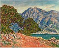 Au Cap Martin (1884) Claude Monet (W896).jpg 747 × 601; 172 KB
-
 Cap Martin - Rotsen groot monument met houten kruis, RP-F-F17829-Z.jpg 7,726 × 6,156; 3.37 MB
-
 Cap martin hôtel.jpg 367 × 470; 58 KB
-
 Cap-Martin from Roquebrune 2.jpg 4,416 × 3,312; 1.24 MB
-
 Cap-Martin from Roquebrune.jpg 3,312 × 4,416; 1.69 MB
-
 Cap-Martin from Saint-Jean Cap-Ferrat.jpg 4,416 × 3,312; 783 KB
-
 Cap-Martin P1040825.jpg 4,000 × 3,000; 6.44 MB
-
 Cap-Martin seen from the heights of the highway.jpg 2,816 × 2,112; 2.29 MB
-
 Cap-Martin-PACA-gb.jpg 720 × 505; 447 KB
-
 Cliff at the Cap-Martin.jpg 3,312 × 4,416; 2.14 MB
-
 D6098 capmartin pirate.jpg 800 × 800; 167 KB
-
 D6098 capmartin sentier.jpg 800 × 800; 159 KB
-
 D6098 capmartin sentier2.jpg 800 × 600; 115 KB
-
 Euphorbia characias CapMartin.jpg 4,416 × 3,312; 2.82 MB
-
 Figuier de Barbarie au Cap-Martin.jpg 2,816 × 2,112; 3.26 MB
-

-
 Gezicht op Menton Menton vie prise du Cap Martin (titel op object), RP-F-2001-7-156-10.jpg 7,942 × 4,892; 3.81 MB
-

-
 Le Cap Martin MET DP211515.jpg 3,955 × 2,858; 3.7 MB
-
 Le cap Martin vu depuis le haut de Monaco.jpg 3,648 × 2,736; 3.13 MB
-
 Littoral path beneath the railway in Cap-Martin.jpg 4,416 × 3,312; 2.3 MB
-
 Max Beckmann-Cap Martin DSC4490.jpg 3,271 × 3,936; 10.06 MB
-
 Monaco, vu de l'aire de repos de Beausoleil.jpg 3,956 × 2,940; 3.25 MB
-
 Monet - cap-martin-3.jpg 280 × 219; 18 KB
-
 Monet - cap-martin.jpg 280 × 224; 18 KB
-
 Monet - the-red-road-near-menton-1884.jpg 280 × 223; 15 KB
-

-
 Monet - Cap Martin, near Menton, 1884.jpg 1,600 × 1,321; 397 KB
-
 Promenade Le Corbusier-Cap Martin-France PACA.JPG 519 × 720; 171 KB
-
 Rame TER 2N à Roquebrune.JPG 2,832 × 2,128; 2.63 MB
-
 Roquebrune-Cap-Martin déc 2017 2.jpg 4,160 × 3,120; 2.67 MB
-
 Sentier littoral du Cap-Martin 1.jpg 2,112 × 2,816; 2.13 MB
-
 Sentier littoral du Cap-Martin 2.jpg 2,816 × 2,112; 2.8 MB
-
 Sémaphore et villa Cypris du Cap-Martin.jpg 2,816 × 2,112; 630 KB
-
 Villa au Cap-Martin.jpg 2,816 × 2,112; 1.56 MB
-

-
 Villa Zamir au Cap-Martin.jpg 1,517 × 1,138; 574 KB


_Claude_Monet_(W896).jpg)


,_RP-F-2007-359-7.jpg)
,_RP-F-2001-7-156-10.jpg)
,_RP-F-00-316.jpg)


