Category:Canyons of the Escalante
Jump to navigation
Jump to search
collective name for the erosional landforms created by the Escalante River and its tributaries | |||||
| Upload media | |||||
| Instance of | |||||
|---|---|---|---|---|---|
| Location |
| ||||
 | |||||
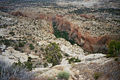
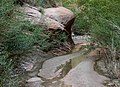
English: Media related to the Canyons of the Escalante, a collective name for the erosional landforms created by the Escalante River and its tributaries (the Escalante River Basin), which are located in Garfield and Kane counties in southern Utah, United States.
Subcategories
This category has the following 15 subcategories, out of 15 total.
*
C
D
- Death Hollow (15 F)
E
- Escalante Natural Bridge (2 F)
H
N
- Neon Canyon (6 F)
P
- Peek-a-boo Canyon (Utah) (11 F)
- Phipps Wash (1 F)
S
- Spooky Gulch (9 F)
- Stevens Arch (4 F)
- Sunset Natural Arch (6 F)
- Sunset Natural Bridge (empty)
Z
- Zebra Slot Canyon (Escalante) (13 F)
Pages in category "Canyons of the Escalante"
This category contains only the following page.
Media in category "Canyons of the Escalante"
The following 31 files are in this category, out of 31 total.
-
 Canyons of the Escalante DyeClan.com - panoramio (1).jpg 2,448 × 3,264; 6.44 MB
-
 Canyons of the Escalante DyeClan.com - panoramio.jpg 3,264 × 2,448; 6 MB
-
 Canyons of the Escalante, Escalante River, Utah (101365398).jpg 1,600 × 1,200; 944 KB
-
 Canyons of the Escalante, Escalante River, Utah (101366277).jpg 1,600 × 1,200; 915 KB
-
 Canyons of the Escalante, Escalante River, Utah (101366419).jpg 1,600 × 1,200; 856 KB
-
 Canyons of the Escalante, Escalante River, Utah (101366521).jpg 1,600 × 1,200; 886 KB
-
 Canyons of the Escalante, Escalante River, Utah (101366613).jpg 1,600 × 1,200; 801 KB
-
 Canyons of the Escalante, Escalante River, Utah (101367287).jpg 1,600 × 1,200; 772 KB
-
 Canyons of the Escalante, Escalante River, Utah (101367547).jpg 1,600 × 1,200; 777 KB
-
 Cosmic Navel - Flickr - snowpeak.jpg 9,828 × 7,134; 35.69 MB
-
 D7K 3161 - Canyoneering Escalante (8014292450).jpg 3,264 × 4,928; 3.3 MB
-
 DeerCreekUT.jpg 858 × 600; 117 KB
-
 Escalante Canyons, UT (3684660195).jpg 1,000 × 572; 288 KB
-

-
 Escalante River & Rt 12 (3685112300).jpg 1,200 × 1,600; 479 KB
-
 EscalantePowellUT.jpg 1,350 × 500; 92 KB
-
 JuniperTreeUT.jpg 800 × 600; 129 KB
-
 PineCreekUT.jpg 800 × 600; 114 KB
-
 Scenic Byway 12 - Cloud Formations over Escalante Canyons - NARA - 7721778.jpg 3,008 × 2,000; 1.5 MB
-

-

-
 SoonerRocksUT.jpg 855 × 600; 111 KB
-
 Spooky Gulch (3679564104).jpg 1,057 × 1,600; 311 KB
-
 Spooky Gulch (911543810).jpg 400 × 600; 29 KB
-
 Spooky Gulch Detail (911543740).jpg 600 × 400; 51 KB
-
 Spooky Gulch, from top (3679565558).jpg 1,057 × 1,600; 806 KB
-
 Spooky Gulch, Grand Staircase-Escalante National Monument, Utah, USA.jpg 500 × 333; 102 KB
-
 Ut escalante canyons1.jpg 1,536 × 1,024; 747 KB
-
 Ut escalante canyons2.jpg 1,536 × 1,024; 540 KB
-
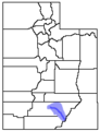 UTMap-doton-COE.png 153 × 200; 1 KB
-
 WillowStream.jpg 832 × 600; 129 KB
.jpg)

.jpg)
.jpg)
.jpg)
.jpg)
.jpg)
.jpg)
.jpg)

.jpg)

.jpg)

.jpg)


.jpg)
.jpg)
.jpg)
.jpg)


