Category:Canterbury and Whitstable Railway
Jump to navigation
Jump to search

English: The Canterbury and Whitstable Railway is a defunct railway line which is now known as the Crab and Winkle Way as part of the National Cycle Network.
Early British railway line, opened in 1830   | |||||
| Upload media | |||||
| Instance of | |||||
|---|---|---|---|---|---|
| Location | Kent, South East England, England | ||||
| Inception |
| ||||
| Date of official opening |
| ||||
| Date of official closure |
| ||||
| Length |
| ||||
| Replaced by | |||||
| |||||
Subcategories
This category has the following 4 subcategories, out of 4 total.
Media in category "Canterbury and Whitstable Railway"
The following 52 files are in this category, out of 52 total.
-
 Bench and church - geograph.org.uk - 275469.jpg 640 × 480; 175 KB
-
 Blean & Tyler Hill Halt 1832585 b6e9dd33.jpg 640 × 402; 135 KB
-
 Bridge over the Crab and Winkle - geograph.org.uk - 381808.jpg 640 × 480; 87 KB
-
 Brooklands Farm, Whitstable - geograph.org.uk - 1520852.jpg 640 × 427; 52 KB
-
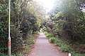
 Canterbury to Whitstable cycle path - geograph.org.uk - 276274.jpg 640 × 480; 124 KB
-
 Church Street Recreational Ground - geograph.org.uk - 1520793.jpg 640 × 427; 60 KB
-
 Clowes Wood - geograph.org.uk - 371844.jpg 640 × 480; 94 KB
-

-

-

-

-
-

-

-

-

-

-

-
 Crab and Winkle Way, National Cycleway 1 - geograph.org.uk - 1133335.jpg 640 × 430; 126 KB
-
 Cycle path as it crosses Tyler Hill Road - geograph.org.uk - 751889.jpg 640 × 480; 197 KB
-
 Dismantled Railway, Clowes Wood - geograph.org.uk - 1211510.jpg 640 × 430; 79 KB
-

-
 Fields near South Street - geograph.org.uk - 371896.jpg 640 × 480; 40 KB
-

-

-
 Former Whitstable Crab & Winkle Railway Bridge.jpg 8,220 × 2,446; 5.21 MB
-
 Gas Street, Canterbury - geograph.org.uk - 367363.jpg 640 × 427; 137 KB
-

-
-
 Looking NW along the Crab and Winkle Way - geograph.org.uk - 1144927.jpg 640 × 430; 118 KB
-

-

-
 Old Crab and Winkle line - geograph.org.uk - 275507.jpg 480 × 640; 177 KB
-

-

-

-
 South Street towards Whitstable - geograph.org.uk - 1520839.jpg 640 × 427; 80 KB
-
 South Street, Whitstable - geograph.org.uk - 1520825.jpg 640 × 427; 59 KB
-

-

-

-

-
 The A299 towards Whitstable - geograph.org.uk - 1520856.jpg 640 × 427; 56 KB
-

-
-

-

-
 The Winding Wheel Seat, Clowes Wood - geograph.org.uk - 1520926.jpg 640 × 427; 101 KB
-
 Trackway junction in Clowes Wood (2) - geograph.org.uk - 1520884.jpg 640 × 427; 72 KB
-
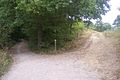 Trackway junction in Clowes Wood - geograph.org.uk - 1520879.jpg 640 × 427; 92 KB
-
 Whitstable Harbour station around 1920.jpg 604 × 333; 115 KB
-
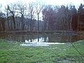 Winding Pond, Clowes Wood - geograph.org.uk - 371873.jpg 640 × 480; 89 KB


_-_geograph.org.uk_-_1520884.jpg)


