Category:Cann, Dorset
Jump to navigation
Jump to search
English: Cann is a village in north Dorset, England, situated on the A350 road one mile south of Shaftesbury. The village has a population of 955 (2001).
village and civil parish in Dorset, United Kingdom | |||||
| Upload media | |||||
| Instance of | |||||
|---|---|---|---|---|---|
| Location | Dorset, South West England, England | ||||
| Population |
| ||||
 | |||||
Media in category "Cann, Dorset"
The following 57 files are in this category, out of 57 total.
-
A30 heading west - geograph.org.uk - 5805683.jpg 1,024 × 684; 234 KB
-
B3091 near Guy's Marsh - geograph.org.uk - 5153725.jpg 1,920 × 1,280; 864 KB
-
B3091 north of Guy's Marsh - geograph.org.uk - 5153753.jpg 1,996 × 2,530; 1,012 KB
-
B3091 north of Guy's Marsh - geograph.org.uk - 5153782.jpg 3,060 × 1,895; 1.54 MB
-
Buckets by the stile, Gore Cottage - geograph.org.uk - 5126415.jpg 3,072 × 2,048; 1.31 MB
-
Bullocks - geograph.org.uk - 5153810.jpg 1,920 × 1,280; 804 KB
-
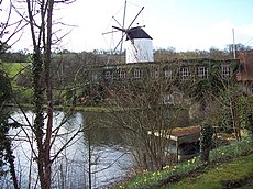
Cann Mill, Melbury Abbas.jpg 640 × 480; 142 KB
-
Cann, a snowscape of fields - geograph.org.uk - 1153148.jpg 640 × 480; 77 KB
-
Cann, postbox in hedge - geograph.org.uk - 1989717.jpg 480 × 640; 157 KB
-
Cann, postbox No. SP7 38, Foots Hill - geograph.org.uk - 1508553.jpg 640 × 480; 92 KB
-
Cann, view to Melbury Hill - geograph.org.uk - 1153192.jpg 640 × 480; 66 KB
-
Countryside near St James's Common - geograph.org.uk - 5153790.jpg 3,072 × 2,048; 1.38 MB
-
Field boundary near St James's Common - geograph.org.uk - 5153799.jpg 3,072 × 2,048; 1.22 MB
-
Field by the B3091 - geograph.org.uk - 4972243.jpg 1,920 × 1,280; 753 KB
-
Field, Guy's Marsh - geograph.org.uk - 5153713.jpg 3,072 × 2,048; 1.2 MB
-
George V postbox, Guy's Marsh - geograph.org.uk - 906905.jpg 480 × 640; 126 KB
-
Gore Cottage - geograph.org.uk - 5126334.jpg 3,072 × 2,048; 1.18 MB
-
Grass field near St James's Common - geograph.org.uk - 2801570.jpg 640 × 480; 60 KB
-
Hedge, St James's Common - geograph.org.uk - 2801579.jpg 640 × 480; 60 KB
-
HM Prison Guy's Marsh - geograph.org.uk - 335782.jpg 640 × 480; 97 KB
-
Junction on B3091 - geograph.org.uk - 5153698.jpg 1,920 × 1,280; 851 KB
-
Lane near Paynthouse Farm - geograph.org.uk - 5127458.jpg 1,920 × 1,280; 879 KB
-
Lane past Little London Farm - geograph.org.uk - 5127660.jpg 3,072 × 2,048; 1.44 MB
-
Lane past Paynthouse Farm - geograph.org.uk - 5126997.jpg 3,072 × 2,048; 1.41 MB
-
Lane past Springreen Cottage - geograph.org.uk - 5126840.jpg 3,072 × 2,048; 1.33 MB
-
Little London Farmhouse - geograph.org.uk - 5153665.jpg 3,072 × 2,048; 1.35 MB
-
Paynthouse Farm - geograph.org.uk - 4972159.jpg 1,886 × 1,189; 648 KB
-
Pond, Guy's Marsh - geograph.org.uk - 5153679.jpg 3,072 × 2,048; 1.52 MB
-
Pond, Guy's Marsh - geograph.org.uk - 5153691.jpg 2,962 × 2,017; 1.63 MB
-
Spotted pigs at Cann Mill - geograph.org.uk - 369763.jpg 640 × 480; 163 KB
-
St. James's Common - geograph.org.uk - 514813.jpg 640 × 480; 71 KB
-
Telephone box, Cann Common - geograph.org.uk - 2015617.jpg 640 × 481; 65 KB
-
Towards Duncliffe Hill - geograph.org.uk - 5127598.jpg 3,064 × 1,789; 1.36 MB
-
Unlucky for Some - geograph.org.uk - 1297700.jpg 640 × 464; 63 KB
-
Where The Wilderness begins - geograph.org.uk - 3639774.jpg 2,304 × 1,704; 1.76 MB
-
B3081 entering Cann Common - geograph.org.uk - 400998.jpg 430 × 640; 88 KB
-
Barn beside Cann Common - geograph.org.uk - 400986.jpg 640 × 430; 76 KB
-
Cann Common - geograph.org.uk - 400981.jpg 640 × 430; 90 KB
-
Coles Lane Farm, St James's Common - geograph.org.uk - 361113.jpg 640 × 480; 99 KB
-
Footpath to Cann Farm - geograph.org.uk - 369767.jpg 640 × 480; 131 KB
-
Footpath to the A350 from Foot's Hill - geograph.org.uk - 369771.jpg 640 × 480; 151 KB
-
Hill beside Cann Common - geograph.org.uk - 400974.jpg 640 × 430; 78 KB
-
Junction at St. James's Common - geograph.org.uk - 514816.jpg 640 × 480; 89 KB
-
Mill Pond - geograph.org.uk - 369758.jpg 640 × 480; 133 KB
-
Pasture, Shaftesbury, Dorset. - geograph.org.uk - 440456.jpg 640 × 480; 132 KB
-
Struggling oak, Shaftesbury, Dorset. - geograph.org.uk - 440474.jpg 480 × 640; 151 KB


