Category:Can Manté del Sallent
Jump to navigation
Jump to search
| Object location | | View all coordinates using: OpenStreetMap |
|---|
house in Santa Pau, Spain .jpg) | |||||
| Upload media | |||||
| Instance of | |||||
|---|---|---|---|---|---|
| Part of | |||||
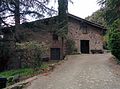
| Location | Santa Pau, Garrotxa, Province of Girona, Catalonia | ||||
| Architectural style | |||||
| Heritage designation |
| ||||
| Elevation above sea level |
| ||||
 | |||||
Català: Can Manté del Sallent (Santa Pau)
This is a category about a building listed in the Catalan heritage register as Bé Cultural d'Interès Local (BCIL) under the reference IPA-10886. |
Media in category "Can Manté del Sallent"
This category contains only the following file.
-
 Cant Manté d'El Sallent (Santa Pau).jpg 3,200 × 2,368; 3.39 MB