Category:Can Duran del Puig
Jump to navigation
Jump to search
| Object location | | View all coordinates using: OpenStreetMap |
|---|
building in Gelida, Alt Penedès, Catalonia _-_2.jpg) | |||||
| Upload media | |||||
| Instance of | |||||
|---|---|---|---|---|---|
| Location | Gelida, Alt Penedès, Barcelona Province, Catalonia | ||||
| Street address |
| ||||
| Architectural style | |||||
| Heritage designation |
| ||||
 | |||||
Català: Can Duran del Puig. Pl. del Puig - Ctra. C-243, km 11,3 (Gelida)
This is a category about a building listed in the Catalan heritage register as Bé Cultural d'Interès Local (BCIL) under the reference IPA-2664. |
Media in category "Can Duran del Puig"
The following 4 files are in this category, out of 4 total.
-
 Can Duran del Puig (Gelida) - 1.jpg 800 × 1,213; 443 KB
-
 Can Duran del Puig (Gelida) - 2.jpg 794 × 502; 300 KB
-
 Can Duran del Puig (Gelida) - 3.jpg 1,024 × 737; 598 KB
-
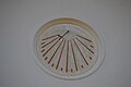 Rellotge de sol de Can Duran del Puig, Carrer del Puig, Gelida.jpg 4,608 × 3,072; 3.85 MB
_-_1.jpg)
_-_3.jpg)
