Category:California State Route 84
Jump to navigation
Jump to search
state highway in California, United States    | |||||
| Upload media | |||||
| Instance of | |||||
|---|---|---|---|---|---|
| Location |
| ||||
| Transport network |
| ||||
| Connects with |
| ||||
| Owned by | |||||
| Maintained by | |||||
| Length |
| ||||
 | |||||
English: Media related to California State Route 84, a 96-mile (154 km) in the San Francisco Bay Area in California, United States.
Subcategories
This category has the following 3 subcategories, out of 3 total.
D
Media in category "California State Route 84"
The following 18 files are in this category, out of 18 total.
-
-
 AC Transit route 216 bus on Mission Boulevard, April 2024.JPG 4,580 × 3,052; 6.31 MB
-
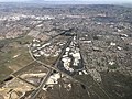
 Aerial view of Belle Haven, September 2019.JPG 5,184 × 3,888; 4.71 MB
-
 CA 238 approaching CA 84.jpg 4,608 × 3,456; 7.7 MB
-
 CA-84 Woodside April 2023 001.jpg 5,464 × 3,640; 14.13 MB
-
 CA-84 Woodside April 2023 002.jpg 5,464 × 3,640; 11.52 MB
-
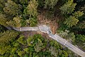 CA-84 Woodside April 2023 003.jpg 5,464 × 3,640; 11.24 MB
-
 CA-84 Woodside April 2023 HDR.jpg 5,464 × 3,640; 8.44 MB
-
 California 84 1957.svg 601 × 625; 25 KB
-
 California 84.svg 385 × 401; 12 KB
-
 California State Route 84 Reed Ave West Sacramento.jpg 3,264 × 2,448; 663 KB
-
 California State Route 84.svg 1,152 × 640; 479 KB
-
 Dumbarton Bridge from Skeggs.png 1,588 × 1,162; 2.37 MB
-
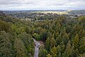
 La Honda.png 2,992 × 1,416; 5.85 MB
-
 Mission Boulevard over Alameda Creek 3323.JPG 2,048 × 1,536; 643 KB
-
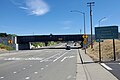 Oakland Subdivision bridge over Mission Boulevard, April 2024.jpg 3,887 × 2,594; 4.72 MB
-
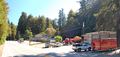
 Ryer Island ferry.jpeg 1,620 × 1,080; 436 KB
-
 Three hills seen from CA SR 84.jpg 5,184 × 3,456; 4.77 MB


