Category:Caldecott, Rutland
Jump to navigation
Jump to search
village in the county of Rutland in the East Midlands of England  | |||||
| Upload media | |||||
| Instance of | |||||
|---|---|---|---|---|---|
| Location | Rutland, East Midlands, England | ||||
| Population |
| ||||
| Area |
| ||||
 | |||||
English: Caldecott is a village in the county of Rutland in the East Midlands of England. It is located about four miles (6.4 km) south of Uppingham and is the most southerly village in Rutland.
Subcategories
This category has only the following subcategory.
Media in category "Caldecott, Rutland"
The following 61 files are in this category, out of 61 total.
-
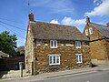
 1 The Green, Caldecott (geograph 7169052).jpg 1,024 × 768; 231 KB
-
 10 Main Street, Caldecott (geograph 7170359).jpg 1,024 × 768; 244 KB
-
 6 Main Street, Caldecott (geograph 7169789).jpg 1,024 × 768; 224 KB
-
 Alongside Uppingham Road - geograph.org.uk - 2903781.jpg 640 × 474; 66 KB
-
 Approach to the church, Caldecott (geograph 7169057).jpg 1,024 × 768; 223 KB
-
 Church Close, Caldecott - geograph.org.uk - 300815.jpg 640 × 480; 71 KB
-
 Entrance to Caldecott from the south - geograph.org.uk - 300820.jpg 640 × 480; 60 KB
-
 The Eye Brook upstream of Caldecott - geograph.org.uk - 362433.jpg 640 × 480; 80 KB
-
 The Old Vicarage, north of Caldecott - geograph.org.uk - 561732.jpg 640 × 367; 87 KB
-
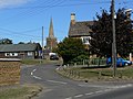 The village of Caldecott, Rutland - geograph.org.uk - 561727.jpg 640 × 480; 106 KB
-
 The Welland Valley - geograph.org.uk - 564093.jpg 640 × 499; 108 KB
-
 Caldecott - geograph.org.uk - 6545442.jpg 4,320 × 3,240; 2.91 MB
-
 Caldecott village - geograph.org.uk - 3885269.jpg 640 × 480; 408 KB
-
 Church Lane at Caldecott - geograph.org.uk - 2903778.jpg 640 × 480; 102 KB
-
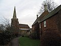
 Churchyard at Caldecott - geograph.org.uk - 2903779.jpg 640 × 477; 123 KB
-

-
 Fairchild's Wood - geograph.org.uk - 362417.jpg 640 × 480; 78 KB
-
 Farm on Lyddington Road - geograph.org.uk - 3885736.jpg 640 × 480; 483 KB
-
 Field by Uppingham Road - geograph.org.uk - 2903782.jpg 640 × 474; 74 KB
-
 Footpath to Lyddington Road - geograph.org.uk - 362393.jpg 640 × 480; 70 KB
-
 Gas Pumping station - geograph.org.uk - 5038148.jpg 640 × 480; 56 KB
-
 Gates and footpath - geograph.org.uk - 2903806.jpg 640 × 472; 74 KB
-
 Great Easton Road at the junction of Rockingham Road - geograph.org.uk - 6224187.jpg 1,920 × 1,280; 1.4 MB
-
 Looking south on Uppingham Road - geograph.org.uk - 6699866.jpg 768 × 1,024; 113 KB
-
 Lyddington Road towards Caldecott - geograph.org.uk - 2903807.jpg 640 × 477; 69 KB
-
 Lyddington Road towards Lyddington - geograph.org.uk - 2903808.jpg 640 × 470; 66 KB
-
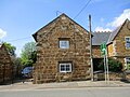
 Monkey Tree Cottage, Caldecott (geograph 7170382).jpg 1,024 × 768; 246 KB
-
 Muddy field entrance near Caldecott - geograph.org.uk - 3885731.jpg 640 × 480; 475 KB
-
 On the Rutland Round heading towards the A6003 - geograph.org.uk - 5921422.jpg 3,776 × 2,520; 4.23 MB
-
 Ridge and furrow near Caldecott - geograph.org.uk - 3885745.jpg 640 × 480; 463 KB
-
 River Welland - geograph.org.uk - 362426.jpg 640 × 480; 81 KB
-
 Southern approach to Caldecott - geograph.org.uk - 3885268.jpg 640 × 480; 460 KB
-
 St John the Evangelist, Caldecott - geograph.org.uk - 2995887.jpg 800 × 600; 118 KB
-
 St John the Evangelist, Caldecott - geograph.org.uk - 3877667.jpg 466 × 640; 81 KB
-
 The A6003 (Uppingham Road) north of Caldecott - geograph.org.uk - 5921412.jpg 3,776 × 2,520; 4.02 MB
-
 The Plough Inn, Caldecott - geograph.org.uk - 2995891.jpg 800 × 600; 122 KB
-
 The Plough Inn, Caldecott - geograph.org.uk - 561729.jpg 640 × 600; 126 KB
-
 The Plough Inn, Caldecott - geograph.org.uk - 5905740.jpg 4,414 × 3,047; 4.84 MB
-
 The Rutland Round - geograph.org.uk - 5038146.jpg 640 × 480; 67 KB
-
 The Rutland Round - geograph.org.uk - 5038149.jpg 640 × 480; 54 KB
-
 The Rutland Round - geograph.org.uk - 5038150.jpg 640 × 480; 59 KB
-
 The Rutland Round - geograph.org.uk - 5038156.jpg 480 × 640; 74 KB
-
 The Rutland Round - geograph.org.uk - 5038159.jpg 640 × 480; 81 KB
-
 The Rutland Round - geograph.org.uk - 5038160.jpg 480 × 640; 89 KB
-
 The Rutland Round - geograph.org.uk - 5038161.jpg 640 × 480; 92 KB
-
 The Rutland Round heading north from the A6003 - geograph.org.uk - 5921403.jpg 3,776 × 2,520; 4.08 MB
-
 The Uppingham Road - geograph.org.uk - 5038147.jpg 640 × 480; 60 KB
-
 Threeways, Caldecott (geograph 7169781).jpg 1,024 × 768; 170 KB
-
 Uppingham Road into Caldecott - geograph.org.uk - 2903780.jpg 640 × 471; 85 KB
-
 Uppingham Road towards Corby - geograph.org.uk - 2903785.jpg 640 × 477; 67 KB
-
 Uppingham Road, Caldecott - geograph.org.uk - 561734.jpg 640 × 439; 100 KB
-
 Weldon House, Caldecott (geograph 7169064).jpg 1,024 × 768; 172 KB
-
 Wentworth Cottage, Caldecott (geograph 7170354).jpg 1,024 × 768; 179 KB
-
 A6003 to Uppingham - geograph.org.uk - 377896.jpg 640 × 480; 40 KB
-
 Bridleway towards Eyebrook Reservoir - geograph.org.uk - 377910.jpg 640 × 480; 61 KB
-
 Caldecott, Rutland - geograph.org.uk - 561722.jpg 640 × 480; 100 KB
-
 Dismantled railway line - geograph.org.uk - 362409.jpg 640 × 480; 121 KB
-
 Field boundary - geograph.org.uk - 417270.jpg 640 × 480; 102 KB
-
 Lyddington Road in Rutland - geograph.org.uk - 561731.jpg 640 × 453; 92 KB
-
 The Old School House, Caldecott - geograph.org.uk - 561730.jpg 640 × 485; 120 KB
-
 Transco gas grid station - geograph.org.uk - 300807.jpg 640 × 480; 77 KB
.jpg)
.jpg)
.jpg)

.jpg)


.jpg)


_north_of_Caldecott_-_geograph.org.uk_-_5921412.jpg)


.jpg)


.jpg)
.jpg)


