Category:Cal Rafel (Castellnou de Seana)
Jump to navigation
Jump to search
| Object location | | View all coordinates using: OpenStreetMap |
|---|
building in Lleida Province, Spain  | |||||
| Upload media | |||||
| Instance of | |||||
|---|---|---|---|---|---|
| Location | Castellnou de Seana, Pla d'Urgell, Province of Lleida, Catalonia | ||||
| Heritage designation |
| ||||
 | |||||
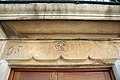
Català: Casa de Cal Rafel, al C. Major, 13, de Castellnou de Seana (Pla d'Urgell)
This is a category about a building listed in the Catalan heritage register as Bé Cultural d'Interès Local (BCIL) under the reference IPA-14744. |
Media in category "Cal Rafel (Castellnou de Seana)"
The following 3 files are in this category, out of 3 total.
-
 Castellnou de Seana Cal Rafel.JPG 3,456 × 2,304; 4.14 MB
-
 Castellnou de Seana Cal Rafel01.JPG 3,456 × 2,304; 4.99 MB
-
 Castellnou de Seana Cal Rafel02.JPG 2,304 × 3,456; 4.06 MB

