Category:Cadastral maps of New South Wales
Jump to navigation
Jump to search
States of Australia: New South Wales · Queensland · South Australia · Tasmania · Western Australia
Internal territories of Australia: Northern Territory
External territories of Australia:
Internal territories of Australia: Northern Territory
External territories of Australia:
maps of cadastral regions, i.e. counties and parishes in New south wales
Media in category "Cadastral maps of New South Wales"
The following 187 files are in this category, out of 187 total.
-
Amungula Parish NSW.jpg 855 × 826; 322 KB
-
Argyle NSW.PNG 350 × 286; 30 KB
-
Arrawatta NSW.PNG 350 × 286; 30 KB
-
Ashburnham NSW.PNG 350 × 286; 30 KB
-
Auckland NSW.PNG 350 × 286; 30 KB
-
Australian Capital Territory border Murray Cowley 1909.jpg 1,200 × 1,200; 263 KB
-
Baradine NSW.PNG 350 × 286; 30 KB
-
Barrona NSW.PNG 350 × 286; 30 KB
-
Bathurst NSW.PNG 350 × 286; 30 KB
-
Benarba NSW.PNG 350 × 286; 30 KB
-
Beresford NSW.PNG 350 × 286; 30 KB
-
Bherwerre Parish NSW.jpg 2,572 × 2,256; 863 KB
-
Bland NSW.PNG 350 × 286; 30 KB
-
Blaxland NSW.PNG 350 × 286; 30 KB
-
Bligh NSW.PNG 350 × 286; 30 KB
-
Bong Bong Parish.jpg 2,230 × 2,922; 1,001 KB
-
Booroondarra NSW.PNG 350 × 286; 30 KB
-
Bourke NSW.PNG 350 × 286; 30 KB
-
Boyd NSW.PNG 350 × 286; 30 KB
-
Brisbane County.jpg 540 × 788; 96 KB
-
Brisbane NSW.PNG 350 × 286; 30 KB
-
Buccleuch NSW.PNG 350 × 286; 30 KB
-
Buckland NSW.PNG 350 × 286; 30 KB
-
Buller NSW.PNG 350 × 286; 30 KB
-
Burnett NSW.PNG 350 × 286; 30 KB
-
Burra Parish NSW.jpg 696 × 671; 201 KB
-
Cadell NSW.PNG 350 × 286; 30 KB
-
Caira NSW.PNG 350 × 286; 30 KB
-
Camden NSW.PNG 350 × 286; 30 KB
-
Canbelego NSW.PNG 350 × 286; 30 KB
-
Canberra Parish NSW 1888.jpg 2,262 × 2,892; 874 KB
-
Carwoola Parish area transferred to ACT.jpg 640 × 480; 261 KB
-
Clarence NSW.PNG 350 × 286; 30 KB
-
Clarendon NSW.PNG 350 × 286; 30 KB
-
Clarke NSW.PNG 350 × 286; 30 KB
-
Clive NSW.PNG 350 × 286; 30 KB
-
Clyde NSW.PNG 350 × 286; 30 KB
-
Colo Parish NSW.jpg 2,708 × 2,136; 1.16 MB
-
Cook NSW.PNG 350 × 286; 30 KB
-
Cooper NSW.PNG 350 × 286; 30 KB
-
County of Argyle NSW 1840s.jpg 2,220 × 2,838; 816 KB
-
County of Bathurst NSW 1840s.jpg 5,940 × 6,820; 36.91 MB
-
County of Cook NSW 1840s.jpg 5,742 × 6,765; 32.52 MB
-
County of Cumberland 1840s.jpg 9,208 × 6,048; 58.01 MB
-
County of Gloucester NSW 1840s.jpg 6,480 × 8,504; 8.34 MB
-
County of Macquarie NSW 1840s.jpg 5,775 × 6,193; 33.63 MB
-
County of Northumberland NSW 1840s.jpg 5,889 × 6,984; 40.87 MB
-
County of Westmoreland NSW 1840s.jpg 5,544 × 6,633; 30.26 MB
-
Courallie NSW.PNG 350 × 286; 30 KB
-
Cowley NSW.PNG 350 × 286; 30 KB
-
Cowper NSW.PNG 350 × 286; 30 KB
-
Culgoa NSW.PNG 350 × 286; 30 KB
-
Cumberland County 1840.jpg 6,388 × 10,079; 6.23 MB
-
Cumberland NSW.png 350 × 286; 30 KB
-
Cunningham NSW.PNG 350 × 286; 30 KB
-
Dampier NSW.PNG 350 × 286; 30 KB
-
Darling NSW.PNG 350 × 286; 30 KB
-
Delalah NSW.PNG 350 × 286; 30 KB
-
Denham NSW.PNG 350 × 286; 30 KB
-
Denison NSW.PNG 350 × 286; 30 KB
-
Dowling NSW.PNG 350 × 286; 30 KB
-
Drake NSW.PNG 350 × 286; 30 KB
-
Dudley NSW.PNG 350 × 286; 30 KB
-
Durham NSW.PNG 350 × 286; 30 KB
-
Electoral and police districts of NSW 1859.jpg 7,849 × 7,242; 58.53 MB
-
Evelyn NSW.PNG 350 × 286; 30 KB
-
Ewenmar NSW.PNG 350 × 286; 30 KB
-
Farnell NSW.PNG 350 × 286; 30 KB
-
Finch NSW.PNG 350 × 286; 30 KB
-
Fitzgerald NSW.PNG 350 × 286; 30 KB
-
Fitzroy NSW.PNG 350 × 286; 30 KB
-
Flinders NSW.PNG 350 × 286; 30 KB
-
Forbes NSW.PNG 350 × 286; 30 KB
-
Franklin NSW.PNG 350 × 286; 30 KB
-
Georgiana NSW.PNG 350 × 286; 30 KB
-
Ginninderra Parish NSW.jpg 984 × 1,110; 404 KB
-
Gipps NSW.PNG 350 × 286; 30 KB
-
Gloucester NSW.PNG 350 × 286; 30 KB
-
Googong Parish Murray NSW.jpg 698 × 916; 223 KB
-
Goorooyarroo Parish NSW 1932.jpg 1,389 × 997; 507 KB
-
Gordon NSW.PNG 350 × 286; 30 KB
-
Gough NSW.PNG 350 × 286; 30 KB
-
Goulburn county 1886.jpg 1,027 × 957; 260 KB
-
Goulburn NSW.PNG 350 × 286; 30 KB
-
Gowen NSW.PNG 350 × 286; 30 KB
-
Gregory NSW.PNG 350 × 286; 30 KB
-
Gresham NSW.PNG 350 × 286; 30 KB
-
Gunderbooka NSW.PNG 350 × 286; 30 KB
-
Harden NSW.PNG 350 × 286; 30 KB
-
Hardinge NSW.PNG 350 × 286; 30 KB
-
Hawes NSW.PNG 350 × 286; 30 KB
-
Hume NSW.PNG 350 × 286; 30 KB
-
Hundred of Evan.png 300 × 462; 49 KB
-
Hundred of Sydney.png 300 × 462; 42 KB
-
Hunter NSW.PNG 350 × 286; 30 KB
-
Inglis NSW.PNG 350 × 286; 30 KB
-
Irrara NSW.PNG 350 × 286; 30 KB
-
Jamison NSW.PNG 350 × 286; 30 KB
-
Jinderboine 1898 cadastral map key.jpg 1,102 × 776; 157 KB
-
Kennedy NSW.PNG 350 × 286; 30 KB
-
Kilfera NSW.PNG 350 × 286; 30 KB
-
Killara NSW.PNG 350 × 286; 30 KB
-
King NSW.PNG 350 × 286; 30 KB
-
Land District of Queanbeyan NSW.jpg 500 × 545; 50 KB
-
Landsborough NSW.PNG 350 × 286; 30 KB
-
Leichhardt NSW.png 350 × 286; 30 KB
-
Lincoln NSW.PNG 350 × 286; 30 KB
-
Livingstone NSW.PNG 350 × 286; 30 KB
-
Macquarie NSW.PNG 350 × 286; 30 KB
-
Majura Parish exclave NSW 1924.jpg 640 × 480; 88 KB
-
Majura Parish NSW 1924.jpg 1,098 × 809; 379 KB
-
Manara NSW.PNG 350 × 286; 30 KB
-
Marulan Parish Argyle.jpg 1,928 × 1,412; 419 KB
-
Menindee NSW.PNG 350 × 286; 30 KB
-
Mitchell NSW.PNG 350 × 286; 30 KB
-
Monteagle NSW.PNG 350 × 286; 30 KB
-
Mootwingee NSW.PNG 350 × 286; 30 KB
-
Mossgiel NSW.PNG 350 × 286; 30 KB
-
Mouramba NSW.PNG 350 × 286; 30 KB
-
Murchison NSW.PNG 350 × 286; 30 KB
-
Murray NSW.PNG 350 × 286; 30 KB
-
Murrumbidgee District 1860s.jpg 1,396 × 857; 268 KB
-
Nandewar NSW.PNG 350 × 286; 30 KB
-
Napier NSW.PNG 350 × 286; 30 KB
-
Narrabundah Parish NSW 1904.jpg 2,224 × 2,636; 958 KB
-
Narran NSW.PNG 350 × 286; 30 KB
-
Narromine NSW.PNG 350 × 286; 30 KB
-
New South Wales 1832.jpg 1,016 × 916; 248 KB
-
Nicholson NSW.PNG 350 × 286; 30 KB
-
Northumberland NSW.PNG 350 × 286; 30 KB
-
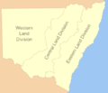
NSW Land Divisions.png 700 × 602; 62 KB
-
Old parish map of New Mountain Rush.tif 3,838 × 2,528; 27.82 MB
-
Olive, Warri, Olive Downs - 1940.jpg 1,314 × 1,368; 1.06 MB
-
Oxley NSW.PNG 350 × 286; 30 KB
-
Parry NSW.PNG 350 × 286; 30 KB
-
Perry NSW.PNG 350 × 286; 30 KB
-
Phillip NSW.PNG 350 × 286; 30 KB
-
Poole NSW.PNG 350 × 286; 30 KB
-
Pottinger NSW.PNG 350 × 286; 30 KB
-
Queanbeyan Parish NSW 1920.jpg 1,041 × 847; 340 KB
-
Raleigh NSW.PNG 350 × 286; 30 KB
-
Rankin NSW.PNG 350 × 286; 30 KB
-
Richmond NSW.PNG 350 × 286; 30 KB
-
Robinson NSW.PNG 350 × 286; 30 KB
-
Rous NSW.PNG 350 × 286; 30 KB
-
Roxburgh NSW county map 1872.jpg 5,000 × 3,613; 9.11 MB
-
Roxburgh NSW.PNG 350 × 286; 30 KB
-
Sandon NSW.PNG 350 × 286; 30 KB
-
Selwyn NSW.PNG 350 × 286; 30 KB
-
St vincent NSW.PNG 350 × 286; 30 KB
-
Stapylton NSW.PNG 350 × 286; 30 KB
-
Sturt NSW.PNG 350 × 286; 30 KB
-
Taila NSW.PNG 350 × 286; 30 KB
-
Tandora NSW.PNG 350 × 286; 30 KB
-
Tara NSW.PNG 350 × 286; 30 KB
-
Thoulcanna NSW.PNG 350 × 286; 30 KB
-
Tongowoko NSW.PNG 350 × 286; 30 KB
-
Town of Parramatta 1840s.jpg 1,869 × 1,332; 2.35 MB
-
Townsend NSW.PNG 350 × 286; 30 KB
-
Tuggeranong Parish NSW 1904.jpg 1,224 × 947; 398 KB
-
Ularara NSW.PNG 350 × 286; 30 KB
-
Urana NSW.PNG 350 × 286; 30 KB
-
Vernon NSW.PNG 350 × 286; 30 KB
-
Village of Seaham, NSW c1855.jpg 5,101 × 6,453; 9.18 MB
-
Wakool NSW.PNG 350 × 286; 30 KB
-
Waljeers NSW.PNG 350 × 286; 30 KB
-
Wallace NSW.PNG 350 × 286; 30 KB
-
Waradgery NSW.PNG 350 × 286; 30 KB
-
Weetangera Parish NSW 1904.jpg 1,084 × 1,092; 369 KB
-
Wellesley NSW.PNG 350 × 286; 30 KB
-
Wellington NSW.png 350 × 286; 30 KB
-
Wentworth NSW.PNG 350 × 286; 30 KB
-
Werunda NSW.PNG 350 × 286; 30 KB
-
Westmoreland NSW.PNG 350 × 286; 30 KB
-
White NSW.PNG 350 × 286; 30 KB
-
Windeyer NSW.PNG 350 × 286; 30 KB
-
Woore NSW.PNG 350 × 286; 30 KB
-
Wynyard county NSW 1897.jpg 2,570 × 2,357; 998 KB
-
Wynyard NSW.PNG 350 × 286; 30 KB
-
Yancowinna County 1886.jpg 1,200 × 1,200; 150 KB
-
Yancowinna NSW.PNG 350 × 286; 30 KB
-
Yanda NSW.PNG 350 × 286; 30 KB
-
Yantara NSW.PNG 350 × 286; 30 KB
-
Young NSW.PNG 350 × 286; 30 KB
-
Yungnulgra NSW.PNG 350 × 286; 30 KB


