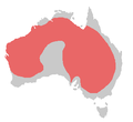
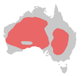
Category:Cacatuidae distribution maps
Jump to navigation
Jump to search
Media in category "Cacatuidae distribution maps"
The following 21 files are in this category, out of 21 total.
-
Baudin's Black Cockatoo ebird data map.png 3,718 × 1,861; 433 KB
-
Bird area palm cockatoo.png 886 × 771; 33 KB
-
Bird range Calyptorhynchus funereus-2.png 300 × 275; 3 KB
-
Bird range Calyptorhynchus funereus-2.svg 300 × 250; 328 KB
-
Bird range cockatiel.png 300 × 275; 3 KB
-
Bird range for Calyptorhynchus latirostris-8.png 300 × 275; 1 KB
-
Bird range galah.png 300 × 275; 3 KB
-
Bird range gang-gang cockatoo.png 300 × 275; 3 KB
-
Bird range glossy black cockatoo.png 300 × 275; 3 KB
-
Bird range little corella.png 300 × 275; 10 KB
-
Bird range long-billed corella.png 300 × 275; 11 KB
-
Bird range major mitchells cockatoo.png 300 × 275; 3 KB
-
Bird range map for Calyptorhynchus baudinii-8.png 300 × 275; 2 KB
-
Bird range palm cockatoo.png 886 × 771; 32 KB
-
Bird range red-tailed black cockatoo.png 300 × 275; 3 KB
-
Bird range sulphur-crested cockatoo.png 300 × 275; 3 KB
-
Bird range yellow-tailed black cockatoo.png 300 × 275; 3 KB
-
Cacatua sulphurea range map.png 235 × 221; 14 KB
-
Cockatoo distribution.png 798 × 968; 74 KB
-
Cockatoo range.png 798 × 968; 85 KB
-
Gelbwangenkakadu.png 1,018 × 714; 69 KB


