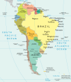
Category:CIA World Factbook maps of South America
Jump to navigation
Jump to search
Media in category "CIA World Factbook maps of South America"
The following 19 files are in this category, out of 19 total.
-
"Political Central America" CIA World Factbook.jpg 851 × 660; 156 KB
-
"Political South America" CIA World Factbook.jpg 455 × 600; 240 KB
-
"Political South America" CIA World Factbook.svg 631 × 833; 5.73 MB
-
America.png 379 × 552; 64 KB
-
Kaart Zuid Amerika.jpg 1,401 × 1,838; 851 KB
-
Map of South America.jpg 1,125 × 1,448; 323 KB
-
Mapa político América do Sul (english).svg 1,133 × 1,310; 2.75 MB
-
Mapa político América do Sul.svg 1,133 × 1,310; 2.74 MB
-
N&SAmerica-pol.jpg 964 × 1,455; 1.32 MB
-
Political Map of the Americas.jpg 960 × 1,449; 399 KB
-
South america es.svg 505 × 670; 558 KB
-
South america fr cadre Uruguay Argentine.svg 505 × 670; 562 KB
-
South america fr.svg 505 × 670; 565 KB
-
South america la.svg 505 × 670; 559 KB
-
South america mk.svg 505 × 670; 543 KB
-
South america sv.svg 505 × 670; 560 KB
-
South america tr.jpg 1,556 × 2,000; 1.23 MB
-
South america.jpg 1,556 × 2,000; 434 KB
-
South america.svg 505 × 670; 560 KB


