Category:Byways in Oxfordshire
Jump to navigation
Jump to search
Media in category "Byways in Oxfordshire"
The following 18 files are in this category, out of 18 total.
-
 Byway across a field in Chipping Norton, Oxfordshire.jpg 4,000 × 3,000; 2.94 MB
-
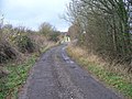
 Byway at Hill Bottom near Whitchurch Hill - geograph.org.uk - 26725.jpg 450 × 600; 161 KB
-
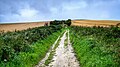
 Byway through Glympton Heath - geograph.org.uk - 463880.jpg 480 × 640; 179 KB
-
 Byway, Knollend Down - geograph.org.uk - 631534.jpg 640 × 480; 125 KB
-
 Byway, Knollend Down - geograph.org.uk - 631535.jpg 640 × 480; 132 KB
-
 Byway, near Finstock - geograph.org.uk - 1516381.jpg 480 × 640; 328 KB
-
 Concrete barriers on the Ridgeway near Waylands Smithy.jpg 3,264 × 1,836; 2.01 MB
-
 Crowell, Restricted Byway to Crowell Hill - geograph.org.uk - 753268.jpg 640 × 480; 111 KB
-
 Restricted Byway - geograph.org.uk - 1297071.jpg 640 × 480; 85 KB
-
 Restricted Byway - geograph.org.uk - 1297087.jpg 640 × 480; 96 KB
-
 Restricted Byway - geograph.org.uk - 1546544.jpg 640 × 480; 128 KB
-
 Restricted byway - geograph.org.uk - 1603367.jpg 640 × 480; 110 KB
-
 Restricted Byway - geograph.org.uk - 781533.jpg 640 × 427; 387 KB
-

-
 Restricted byway, Nuffield - geograph.org.uk - 677203.jpg 640 × 480; 139 KB
-
 Restricted Byway, Shotover - geograph.org.uk - 192064.jpg 640 × 480; 139 KB
-
 The Ridgeway approaching Cuckhamsley Hill in Oxfordshire from the east.jpg 1,578 × 888; 376 KB
-
 The Ridgeway National Trail ascending Whitehorse Hill from the east.jpg 2,811 × 1,581; 1.22 MB


