Category:Byford
Jump to navigation
Jump to search
village in United Kingdom  | |||||
| Upload media | |||||
| Instance of | |||||
|---|---|---|---|---|---|
| Location | Herefordshire, West Midlands, England | ||||
| Population |
| ||||
 | |||||
English: Byford is a village and civil parish on the River Wye in Herefordshire, England, about 7 miles west of Hereford. According to the 2001 census it had a population of 119.
Subcategories
This category has the following 3 subcategories, out of 3 total.
Media in category "Byford"
The following 51 files are in this category, out of 51 total.
-

-
 A fairly new cider orchard near the River Wye - geograph.org.uk - 3723222.jpg 2,592 × 1,944; 1.39 MB
-
 A fairly recent cider orchard near the River Wye - geograph.org.uk - 3723212.jpg 2,592 × 1,944; 1.25 MB
-
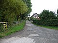
 Byford Common Lane - geograph.org.uk - 2786965.jpg 1,024 × 577; 329 KB
-
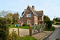
 Byford House - geograph.org.uk - 6382905.jpg 1,994 × 1,496; 674 KB
-
 Byford village - geograph.org.uk - 3723230.jpg 2,592 × 1,944; 1.44 MB
-
 Canoes on the Wye, at The Weir - geograph.org.uk - 735467.jpg 640 × 480; 113 KB
-
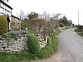
 Church Lane (Byford) - geograph.org.uk - 6381727.jpg 3,648 × 2,736; 4.79 MB
-
 Country north of Byford - geograph.org.uk - 3723235.jpg 2,592 × 1,944; 1.25 MB
-
 Cricket ground, Garnons - geograph.org.uk - 2584452.jpg 3,201 × 1,634; 5.04 MB
-
 Fallsbrook Farm, Byford - geograph.org.uk - 3918584.jpg 3,852 × 2,415; 2.17 MB
-
 Fallsbrook Farm, Byford - geograph.org.uk - 3918612.jpg 4,512 × 3,000; 4.54 MB
-
 Ford at Byford - geograph.org.uk - 4293889.jpg 3,872 × 2,592; 4.65 MB
-
 Former Barn, Lower Farm, Byford - geograph.org.uk - 6318317.jpg 3,323 × 2,209; 2.61 MB
-
 Former Barn, Lower Farm, Byford - geograph.org.uk - 6318326.jpg 3,323 × 2,209; 2.35 MB
-
 Gardener's Cottage, Garnons - geograph.org.uk - 2586368.jpg 3,301 × 2,142; 6.83 MB
-
 Gardener's Cottage, Garnons - geograph.org.uk - 2586371.jpg 3,178 × 2,089; 5.65 MB
-
 Home Farm Cottages - geograph.org.uk - 4274042.jpg 640 × 480; 60 KB
-
 House and pond at Byford - geograph.org.uk - 2788211.jpg 1,024 × 768; 534 KB
-
 House in Byford, Herefordshire (geograph 6318376 by Philip Pankhurst).jpg 3,323 × 2,209; 2.52 MB
-
 Lodge - geograph.org.uk - 4274047.jpg 640 × 480; 139 KB
-
 Lodge, Garnons - geograph.org.uk - 2584420.jpg 3,424 × 2,164; 7.39 MB
-
 Lower Farmhouse, Byford - geograph.org.uk - 6318250.jpg 3,498 × 2,098; 1.87 MB
-
 Milestone Cottage - geograph.org.uk - 4274039.jpg 640 × 480; 70 KB
-
 Ordnance Survey Cut Mark - geograph.org.uk - 4757826.jpg 480 × 640; 123 KB
-
 Parkland at Garnons - geograph.org.uk - 2788216.jpg 1,024 × 577; 318 KB
-
 Parkland at the Garnons - geograph.org.uk - 729274.jpg 640 × 426; 101 KB
-
 Path to St. John the Baptist Church (Byford) - geograph.org.uk - 6381775.jpg 3,648 × 2,736; 4.82 MB
-

-
 The Steps, Garnons - geograph.org.uk - 2586363.jpg 3,456 × 2,592; 6.27 MB
-
 Tractor muddied parkland - geograph.org.uk - 4274045.jpg 640 × 480; 120 KB
-
 Apple orchard near Byford - geograph.org.uk - 317658.jpg 640 × 426; 141 KB
-
 Bridleway to Preston-on-Wye - geograph.org.uk - 349075.jpg 640 × 480; 126 KB
-
 Cider Press, Lulham Court - geograph.org.uk - 359054.jpg 640 × 480; 136 KB
-
 Early rape - geograph.org.uk - 373561.jpg 640 × 480; 97 KB
-
 Farm at Byford - geograph.org.uk - 318207.jpg 640 × 426; 106 KB
-
 Farmland by Chestnut Coppice, Byford - geograph.org.uk - 316236.jpg 640 × 426; 104 KB
-
 Fields near Mancel Lacy - geograph.org.uk - 167937.jpg 640 × 480; 46 KB
-
 Forest of polytunnel frames - geograph.org.uk - 373563.jpg 640 × 480; 82 KB
-
 Garnons, Mansell Gamage - geograph.org.uk - 316220.jpg 640 × 426; 116 KB
-
 Hereford to Brecon Line 1 - geograph.org.uk - 373571.jpg 640 × 480; 114 KB
-
 Hereford to Brecon Line 2 - geograph.org.uk - 373577.jpg 640 × 480; 122 KB
-
 Hop Fields - geograph.org.uk - 359061.jpg 640 × 480; 131 KB
-
 Houses by the Roman Road - geograph.org.uk - 373534.jpg 640 × 480; 86 KB
-
 Marsh Court - geograph.org.uk - 362882.jpg 640 × 480; 110 KB
-
 Old farm buildings at Lulham - geograph.org.uk - 349070.jpg 640 × 480; 102 KB
-
 Over the Wye - geograph.org.uk - 349076.jpg 640 × 480; 87 KB
-
 Rape field - geograph.org.uk - 167926.jpg 640 × 480; 32 KB
-
 Roman Road - Offa's Dyke intersection - geograph.org.uk - 362905.jpg 640 × 480; 108 KB
-
 The A438 at Byford - geograph.org.uk - 318210.jpg 640 × 426; 122 KB
-
 Verdant glade at "The Weir" - geograph.org.uk - 82276.jpg 480 × 640; 147 KB


_-_geograph.org.uk_-_6381727.jpg)


.jpg)


_-_geograph.org.uk_-_6381775.jpg)
.jpg)


