Category:Bus stops in the London Borough of Bromley
Jump to navigation
Jump to search

Subcategories
This category has only the following subcategory.
B
- Buses at Elmers End station (2 F)
Media in category "Bus stops in the London Borough of Bromley"
The following 53 files are in this category, out of 53 total.
-
 1971 CRYSTAL PALACE (8267636819).jpg 4,798 × 3,190; 5.03 MB
-
 20030614 08 Orpington High Street.jpg 1,536 × 1,024; 192 KB
-
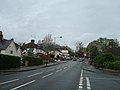
 Addington Road, West Wickham, Kent - geograph.org.uk - 1161810.jpg 640 × 480; 55 KB
-
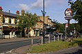
 Anerley Hill, London SE19 - geograph.org.uk - 1336666.jpg 640 × 480; 52 KB
-
 Anerley Railway Station - geograph.org.uk - 1322011.jpg 640 × 480; 67 KB
-
 Anerley Town Hall 2017.jpg 3,280 × 1,840; 2.51 MB
-

-
 Au Morandarte Flickr DSC00793 (11026686833).jpg 3,072 × 2,304; 2.61 MB
-
 Au Morandarte Flickr DSC00810 (11026709813).jpg 3,072 × 2,304; 2.38 MB
-
 Au Morandarte Flickr Metrobus 253 (SN54 GPZ) on Route R3, Orpington (15517097155).jpg 3,888 × 2,592; 3.97 MB
-
 Au Morandarte Flickr Metrobus 884 on Route 75, Elmers End (11026564856).jpg 3,072 × 2,304; 2.34 MB
-
 Au Morandarte Flickr Metrobus 897 on Route 75, Elmers End (11027652586).jpg 3,072 × 2,304; 2.5 MB
-
 Beckenham Grove Stop - geograph.org.uk - 2428429.jpg 800 × 600; 159 KB
-
 Bickley, Oldfield Road - geograph.org.uk - 240772.jpg 640 × 480; 135 KB
-
 Bromley North Railway Station - geograph.org.uk - 4623369.jpg 3,718 × 2,656; 7.28 MB
-
 Bus on Anerley Hill, Crystal Palace - geograph.org.uk - 4834138.jpg 1,024 × 747; 111 KB
-

-
 Bus stop in High Street Downe - geograph.org.uk - 1887730.jpg 480 × 640; 124 KB
-
 Bus stop in Towncourt Lane - geograph.org.uk - 1983126.jpg 640 × 480; 76 KB
-
 Bus stop on Burnt Ash Lane - geograph.org.uk - 2671836.jpg 640 × 428; 114 KB
-
 Bus stop on Chislehurst Common - geograph.org.uk - 2321711.jpg 640 × 480; 74 KB
-
 Bus stop on Crockenhill Road - geograph.org.uk - 2888853.jpg 1,600 × 1,200; 542 KB
-
 Bus stop on Perry Street, Chislehurst - geograph.org.uk - 3270368.jpg 2,048 × 1,536; 1.57 MB
-
 Bus stop on World's End Lane^ - geograph.org.uk - 2804277.jpg 640 × 428; 127 KB
-
 Bus Stop, Copers Cope Rd - geograph.org.uk - 1943728.jpg 640 × 430; 173 KB
-
 Bus stop, Downe - geograph.org.uk - 1731760.jpg 2,048 × 1,536; 974 KB
-
 Bus Stop, Norman Park, Bromley - geograph.org.uk - 2318290.jpg 640 × 480; 130 KB
-
 Bus Stop, Worsley Bridge Rd - geograph.org.uk - 1943806.jpg 640 × 430; 176 KB
-
 Chislehurst Road, Orpington - geograph.org.uk - 702193.jpg 640 × 480; 91 KB
-
 Chislehurst village sign - geograph.org.uk - 1715920.jpg 429 × 640; 155 KB
-
 Christ Church - geograph.org.uk - 678718.jpg 640 × 480; 104 KB
-
 Corkscrew Hill - Steep Hill 11^ - geograph.org.uk - 1436063.jpg 640 × 400; 88 KB
-
 Corkscrew Hill, West Wickham - geograph.org.uk - 1245549.jpg 640 × 480; 52 KB
-
 Crofton Lane shops.jpg 2,016 × 1,512; 1.04 MB
-
 Croydon Road A232 and West Wickham Common - geograph.org.uk - 499375.jpg 640 × 480; 113 KB
-
 Farnborough Village Sign on Farnborough High Street.jpg 3,072 × 2,304; 2.02 MB
-
 High Street, Bromley - geograph.org.uk - 669860.jpg 640 × 480; 70 KB
-
 High Street, Downe - geograph.org.uk - 1718870.jpg 2,048 × 1,536; 1.16 MB
-
 Kirkdale - geograph.org.uk - 58020.jpg 640 × 401; 121 KB
-
 Leesons Hill, St Paul's Cray - geograph.org.uk - 1766238.jpg 3,072 × 2,304; 2.38 MB
-
 Logs Hill bus stop - geograph.org.uk - 2794421.jpg 640 × 480; 127 KB
-
 McDonalds - geograph.org.uk - 1103237.jpg 640 × 480; 86 KB
-
 MEC66 in Green Street Green.jpg 4,032 × 3,024; 2.94 MB
-
 Petten Grove - geograph.org.uk - 1352075.jpg 640 × 480; 87 KB
-
 Pizza Express, High Street, Orpington - geograph.org.uk - 1218759.jpg 640 × 480; 100 KB
-
-
 Saving the planet in New Eltham - geograph.org.uk - 141101.jpg 640 × 480; 97 KB
-
 Seat by the bus stop in Summer Hill - geograph.org.uk - 1905680.jpg 640 × 480; 121 KB
-
 Sevenoaks Road, Orpington - geograph.org.uk - 1224609.jpg 640 × 480; 91 KB
-
 Stagecoach London LT124 LTZ1124 SL3 @ Bromley North Station (53549020221).jpg 4,032 × 3,024; 3.46 MB
-
 Station Approach, St Paul's Cray - geograph.org.uk - 650550.jpg 640 × 480; 57 KB
-
 Waldens Road, Kevingtown - geograph.org.uk - 1352105.jpg 640 × 480; 67 KB
-
 Widmore Road, Bromley - geograph.org.uk - 1162710.jpg 640 × 480; 82 KB
.jpg)


.jpg)
.jpg)
_on_Route_R3,_Orpington_(15517097155).jpg)
.jpg)
.jpg)


.jpg)


