
Category:Burythorpe
village in North Yorkshire, England, UK Jun2006.jpg) | |||||
| Upload media | |||||
| Instance of | |||||
|---|---|---|---|---|---|
| Location | Ryedale, North Yorkshire, Yorkshire and the Humber, England | ||||
| Population |
| ||||
 | |||||
Subcategories
This category has the following 4 subcategories, out of 4 total.
Media in category "Burythorpe"
The following 200 files are in this category, out of 260 total.
(previous page) (next page)-
 A bridleway towards Manor Farm - geograph.org.uk - 2502481.jpg 800 × 600; 262 KB
-
 A public footpath to Kennythorpe - geograph.org.uk - 2326436.jpg 800 × 600; 241 KB
-
 A pylon view toward Carthagena farm - geograph.org.uk - 7211191.jpg 5,152 × 3,864; 5.96 MB
-
 A road junction near Whitegrounds farm - geograph.org.uk - 2502474.jpg 800 × 600; 205 KB
-
 Access track from The Hermitage - geograph.org.uk - 6114820.jpg 4,608 × 3,456; 3.21 MB
-
 Access track to Carthagena farm from Menethorpe Lane - geograph.org.uk - 7211175.jpg 5,152 × 3,864; 6.22 MB
-
 Aldmoor Farm - geograph.org.uk - 2837408.jpg 1,024 × 768; 155 KB
-
 Approaching the hills - geograph.org.uk - 6064660.jpg 4,320 × 3,240; 2.16 MB
-
 Bad potholes - geograph.org.uk - 5772112.jpg 2,048 × 1,536; 1.15 MB
-
 Barley west of Burythorpe - geograph.org.uk - 6523553.jpg 1,024 × 683; 497 KB
-
 Bay Horse in Burythorpe - geograph.org.uk - 6523468.jpg 1,024 × 683; 478 KB
-
 Bay Horse. Burythorpe - geograph.org.uk - 7270686.jpg 4,710 × 3,291; 3.3 MB
-
 Bean field and Burythorpe House Hotel - geograph.org.uk - 4616747.jpg 1,024 × 768; 282 KB
-
 Beans and All Saints Church, Burythorpe - geograph.org.uk - 4616566.jpg 1,024 × 768; 239 KB
-
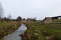
 Beck at Kennythorpe - geograph.org.uk - 6064628.jpg 3,240 × 4,319; 5 MB
-
 Beck Houses over meadow - geograph.org.uk - 7211188.jpg 5,152 × 3,864; 4.95 MB
-
 Bin day in Burythorpe - geograph.org.uk - 3536529.jpg 1,024 × 698; 379 KB
-
 Bird-scarer in crop field - geograph.org.uk - 2837599.jpg 1,024 × 768; 198 KB
-
 Bridge Maintenance - geograph.org.uk - 2093992.jpg 4,000 × 3,000; 2.97 MB
-
 Bridge over Menethorpe Beck - geograph.org.uk - 7172818.jpg 1,024 × 683; 242 KB
-
 Bridge over Thornthorpe Beck - geograph.org.uk - 6964023.jpg 1,024 × 768; 285 KB
-
 Bridleway at Burythorpe - geograph.org.uk - 5596188.jpg 1,600 × 1,064; 718 KB
-
 Bridleway by the churchyard - geograph.org.uk - 4622368.jpg 1,024 × 768; 282 KB
-
 Bridleway heading East from Menethorpe - geograph.org.uk - 5494326.jpg 5,184 × 3,456; 6.24 MB
-
 Bridleway leading towards Burythorpe - geograph.org.uk - 5595848.jpg 1,600 × 1,064; 803 KB
-
 Bridleway leading towards Burythorpe - geograph.org.uk - 5595849.jpg 1,600 × 1,064; 803 KB
-
 Bridleway through Manor Farm - geograph.org.uk - 7211306.jpg 5,152 × 3,864; 4.98 MB
-
 Bridleway to the woods - geograph.org.uk - 6064614.jpg 4,320 × 3,240; 3.09 MB
-
 Bridleway west of Burythorpe - geograph.org.uk - 4622373.jpg 1,024 × 768; 246 KB
-
 Brook Farm, Burythorpe - geograph.org.uk - 5596210.jpg 1,600 × 1,064; 559 KB
-
 Burythorpe - geograph.org.uk - 5596186.jpg 1,600 × 1,064; 868 KB
-
 Burythorpe - geograph.org.uk - 6523465.jpg 1,024 × 683; 474 KB
-
 Burythorpe 1920 (archive ref PO-1-28-2) (25050177843).jpg 836 × 485; 76 KB
-
 Burythorpe cricket ground - geograph.org.uk - 6064639.jpg 4,301 × 2,668; 1.86 MB
-
 Burythorpe House Hotel - geograph.org.uk - 2000026.jpg 640 × 479; 74 KB
-
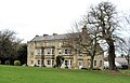 Burythorpe House Hotel - geograph.org.uk - 6064637.jpg 4,320 × 2,790; 2.58 MB
-
 Burythorpe House Hotel - geograph.org.uk - 7270648.jpg 5,152 × 3,864; 6.49 MB
-
 Burythorpe Telephone Exchange - geograph.org.uk - 3229953.jpg 3,072 × 2,304; 1.8 MB
-
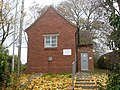
 Burythorpe Village Hall (former School) built 1857 - geograph.org.uk - 6114395.jpg 4,608 × 3,456; 3.36 MB
-

-
 Burythorpe village hall - geograph.org.uk - 6064644.jpg 3,743 × 2,415; 1.49 MB
-
 Burythorpe(StephenHorncastle)Jun2006.jpg 640 × 480; 120 KB
-
 Byway to Leavening Brow - geograph.org.uk - 5596220.jpg 1,600 × 1,064; 807 KB
-
 Byway to Leavening Brow - geograph.org.uk - 5596273.jpg 1,600 × 1,064; 941 KB
-
 Byway to Leavening Brow - geograph.org.uk - 5596274.jpg 1,600 × 1,064; 801 KB
-
 Change in field use - geograph.org.uk - 2837339.jpg 1,024 × 768; 147 KB
-
 Church View, Burythorpe - geograph.org.uk - 4619615.jpg 1,024 × 768; 188 KB
-
 Countryside off Menethorpe Lane - geograph.org.uk - 5494332.jpg 5,184 × 3,456; 6.14 MB
-
 Crossing the Derwent - geograph.org.uk - 3560028.jpg 4,608 × 3,456; 6.14 MB
-
 Crossing the Derwent at Low Hutton - geograph.org.uk - 7212390.jpg 1,024 × 768; 230 KB
-
 Crossroads west of Langton - geograph.org.uk - 6523440.jpg 1,024 × 683; 411 KB
-
 Derwent and railway - geograph.org.uk - 7172804.jpg 1,024 × 683; 231 KB
-
 Distant view of All Saint's church Burythorpe - geograph.org.uk - 7270666.jpg 3,864 × 5,152; 6.52 MB
-
 Downstream view of the Derwent - geograph.org.uk - 3589086.jpg 1,600 × 1,200; 592 KB
-
 Edge of Moor Covert. Rabbit Hill - geograph.org.uk - 4144876.jpg 4,608 × 3,456; 3.93 MB
-
 Entering Burythorpe - geograph.org.uk - 2502511.jpg 800 × 600; 294 KB
-
 Entering Burythorpe - geograph.org.uk - 4616735.jpg 1,024 × 768; 268 KB
-
 Entering Burythorpe, North Yorkshire - geograph.org.uk - 2326190.jpg 800 × 600; 230 KB
-
 Entering Eddlethorpe - geograph.org.uk - 2917523.jpg 1,600 × 1,129; 541 KB
-
 Entering Kennythorpe - geograph.org.uk - 6523446.jpg 1,024 × 683; 466 KB
-
 Entrance to Quarry - geograph.org.uk - 4144891.jpg 4,608 × 3,456; 4.04 MB
-
 Farm building, Ruffin Lane - geograph.org.uk - 2011900.jpg 640 × 480; 51 KB
-
 Farmland and hedgerow south west of Burythorpe - geograph.org.uk - 6523561.jpg 1,024 × 683; 509 KB
-
 Farmland at Burythorpe - geograph.org.uk - 7313271.jpg 5,184 × 3,888; 4.5 MB
-
 Farmland by the crossroads - geograph.org.uk - 6523441.jpg 1,024 × 683; 506 KB
-
 Farmland east of Malton Road - geograph.org.uk - 2837361.jpg 1,024 × 768; 92 KB
-
 Farmland near Kennythorpe - geograph.org.uk - 2000042.jpg 640 × 479; 49 KB
-
 Farmland near Kennythorpe - geograph.org.uk - 6523445.jpg 1,024 × 683; 510 KB
-
 Farmland near Langton - geograph.org.uk - 2000051.jpg 640 × 479; 102 KB
-
 Farmland near Manor Farm - geograph.org.uk - 2011899.jpg 640 × 480; 73 KB
-
 Farmland near Menethorpe Hall - geograph.org.uk - 2011914.jpg 640 × 480; 48 KB
-
 Farmland next to the Westow junction - geograph.org.uk - 3405655.jpg 640 × 427; 78 KB
-
 Farmland north of Kennythorpe - geograph.org.uk - 6523443.jpg 1,024 × 683; 481 KB
-
 Farmland north of Kennythorpe - geograph.org.uk - 7313273.jpg 5,184 × 3,888; 5.01 MB
-
 Farmland north of Leavening - geograph.org.uk - 1999946.jpg 640 × 479; 79 KB
-
 Farmland north of Penhowe Lane - geograph.org.uk - 2837569.jpg 1,024 × 768; 163 KB
-
 Farmland off Menethorpe Lane - geograph.org.uk - 3405715.jpg 640 × 427; 74 KB
-
 Farmland off Ruffin Lane - geograph.org.uk - 2917500.jpg 1,024 × 768; 262 KB
-
 Farmland off the old Malton road - geograph.org.uk - 3405666.jpg 640 × 427; 79 KB
-
 Farmland south of Burythorpe Church - geograph.org.uk - 2837373.jpg 1,024 × 768; 117 KB
-
 Farmland south west of Burythorpe - geograph.org.uk - 6523556.jpg 1,024 × 683; 524 KB
-
 Farmland towards Menethorpe - geograph.org.uk - 3405663.jpg 640 × 427; 71 KB
-
 Farmland, Burythorpe - geograph.org.uk - 2000012.jpg 640 × 479; 69 KB
-

-
 Field boundary near Menethorpe Hall - geograph.org.uk - 2011912.jpg 640 × 480; 89 KB
-
 Field edge conservation strip. Young trees and wild grasses - geograph.org.uk - 7211317.jpg 5,152 × 3,864; 5.32 MB
-
 Field edge footpath - geograph.org.uk - 4146261.jpg 4,608 × 3,456; 4.35 MB
-
 Field entrance off Ruffin Lane - geograph.org.uk - 2011902.jpg 640 × 480; 54 KB
-
 Field path planted over - geograph.org.uk - 6033560.jpg 1,024 × 768; 153 KB
-
 Fields near Mount Farm - geograph.org.uk - 6523548.jpg 1,024 × 683; 506 KB
-
 Fields north of Menethorpe - geograph.org.uk - 6522924.jpg 1,024 × 683; 492 KB
-
 Fields west of Burythorpe - geograph.org.uk - 6523550.jpg 1,024 × 683; 491 KB
-
 Footbridge at Brook Farm - geograph.org.uk - 5596215.jpg 1,600 × 1,064; 849 KB
-
 Footpath emerging from trees into crop - geograph.org.uk - 4530378.jpg 4,608 × 3,456; 7.64 MB
-
 Footpath through woods to Kennythorpe - geograph.org.uk - 4144880.jpg 4,608 × 3,456; 6.33 MB
-
 Footpath to Langton from Kennythorpe - geograph.org.uk - 4530396.jpg 4,608 × 3,456; 4.83 MB
-
 Footpath to Low Hutton - geograph.org.uk - 6163948.jpg 1,024 × 768; 342 KB
-
 Footpath to the Derwent - geograph.org.uk - 6522882.jpg 1,024 × 683; 794 KB
-
 Ford at Burythorpe - geograph.org.uk - 4659426.jpg 600 × 400; 473 KB
-
 Ford at Burythorpe - geograph.org.uk - 4659430.jpg 600 × 400; 449 KB
-
 Ford at the southern end of Burythorpe - geograph.org.uk - 6064645.jpg 4,320 × 3,240; 1.75 MB
-
 Ford on the 'Roman Road' - geograph.org.uk - 6064656.jpg 3,239 × 4,319; 2.99 MB
-
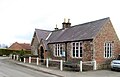
 Former Schoolhouse, Burythorpe - geograph.org.uk - 4619619.jpg 1,024 × 768; 156 KB
-
 Four Lane Ends junction - geograph.org.uk - 6823414.jpg 1,024 × 724; 158 KB
-
 Fox Covert Plantation - geograph.org.uk - 3405649.jpg 640 × 427; 74 KB
-
 Garden, Menethorpe Hall - geograph.org.uk - 2011926.jpg 640 × 480; 144 KB
-
 Grass fields and tree, Howlbeck Bank - geograph.org.uk - 6163952.jpg 1,024 × 768; 125 KB
-
 Grazing land north of Burythorpe - geograph.org.uk - 2000033.jpg 640 × 479; 71 KB
-
 Growing crop alongside large plantation - geograph.org.uk - 7211179.jpg 5,152 × 3,864; 5.27 MB
-
 Hard walking by High Penhowe - geograph.org.uk - 4616625.jpg 1,024 × 768; 229 KB
-
 Hedge in Kennythorpe - geograph.org.uk - 6523447.jpg 1,024 × 683; 606 KB
-
 Hedgerow between the road and river - geograph.org.uk - 7172810.jpg 1,024 × 683; 263 KB
-
 High Penhowe Farm - geograph.org.uk - 5595700.jpg 1,600 × 1,064; 658 KB
-
 High Penhowe Farm - geograph.org.uk - 5595705.jpg 1,600 × 1,064; 755 KB
-
 High Penhowe Farm - geograph.org.uk - 5595709.jpg 1,600 × 1,064; 771 KB
-
 Horses north of Burythorpe - geograph.org.uk - 6523455.jpg 1,024 × 683; 472 KB
-
 Houses at Burythorpe - geograph.org.uk - 5596195.jpg 1,600 × 1,066; 807 KB
-
 Houses in Burythorpe - geograph.org.uk - 6523458.jpg 1,024 × 683; 500 KB
-
 Houses in Burythorpe - geograph.org.uk - 6523536.jpg 1,024 × 683; 511 KB
-
 Huttons Ambo railway bridge over the River Derwent - geograph.org.uk - 3868796.jpg 1,600 × 1,200; 981 KB
-
 Junction for Kennythorpe - geograph.org.uk - 6523442.jpg 1,024 × 683; 516 KB
-
 Kennythorpe - geograph.org.uk - 5772114.jpg 2,048 × 1,536; 1.11 MB
-
 Land Army Celebration - geograph.org.uk - 2556383.jpg 1,600 × 1,046; 472 KB
-
 Langton crossroads - geograph.org.uk - 5772122.jpg 2,048 × 1,536; 945 KB
-
 Laysike Wood - geograph.org.uk - 3405732.jpg 640 × 427; 91 KB
-
 Laysike Wood - geograph.org.uk - 5786453.jpg 800 × 600; 101 KB
-
 Left for Malton, right for Burythorpe - geograph.org.uk - 2837386.jpg 1,024 × 768; 103 KB
-
 Little used field edge footpath in Barley field - geograph.org.uk - 7211299.jpg 5,152 × 3,864; 4.43 MB
-
 Little used footpaths can get overgrown - geograph.org.uk - 4530366.jpg 3,456 × 4,608; 6.78 MB
-

-
 Low cliff north of Low Lane - geograph.org.uk - 2837715.jpg 1,024 × 768; 253 KB
-
 Low Hutton suspension bridge - geograph.org.uk - 4353595.jpg 4,320 × 3,240; 3.38 MB
-
 Manor Lane over Thornthorpe Bridge - geograph.org.uk - 1330593.jpg 640 × 364; 72 KB
-
 Menethorpe - geograph.org.uk - 3405725.jpg 640 × 427; 97 KB
-
 Menethorpe Beck - geograph.org.uk - 3405721.jpg 640 × 427; 75 KB
-
 Menethorpe Beck - geograph.org.uk - 6522901.jpg 1,024 × 683; 524 KB
-
 Menethorpe Beck near Park Farm - geograph.org.uk - 7172822.jpg 683 × 1,024; 321 KB
-
 Menethorpe Bridge - geograph.org.uk - 1330509.jpg 640 × 480; 99 KB
-
 Menethorpe Lane - geograph.org.uk - 3405714.jpg 640 × 427; 92 KB
-
 Menethorpe Lane - geograph.org.uk - 6522905.jpg 1,024 × 683; 499 KB
-
 Menethorpe Lane - geograph.org.uk - 6522926.jpg 1,024 × 683; 463 KB
-
 Menethorpe Lane approaching Menethorpe - geograph.org.uk - 5494329.jpg 5,184 × 3,456; 6.61 MB
-
 Menethorpe Lane toward Menethorpe - geograph.org.uk - 3951933.jpg 3,264 × 2,448; 2.53 MB
-
 Mill dam at Manor Farm - geograph.org.uk - 6064606.jpg 4,251 × 2,252; 2.42 MB
-
 Minor road through Laysike Wood - geograph.org.uk - 2011909.jpg 640 × 480; 132 KB
-
 Minor road towards Norton - geograph.org.uk - 2000048.jpg 640 × 479; 93 KB
-
 Moles at work - geograph.org.uk - 4353589.jpg 4,320 × 2,577; 2.71 MB
-
 Moor Hill - geograph.org.uk - 3483875.jpg 640 × 427; 93 KB
-
 Moor Hill - geograph.org.uk - 6955279.jpg 1,024 × 683; 618 KB
-

-
 Mount Farm - geograph.org.uk - 6523544.jpg 1,024 × 683; 497 KB
-
 Narrow Lane entering Laysike Wood - geograph.org.uk - 5494321.jpg 5,184 × 3,456; 6.35 MB
-
 Narrow road leaving Burythorpe - geograph.org.uk - 3536533.jpg 1,024 × 709; 344 KB
-
 NW of Kennythorpe - geograph.org.uk - 132968.jpg 640 × 480; 113 KB
-
 Old Malton Road - geograph.org.uk - 3405668.jpg 640 × 427; 79 KB
-
 Oliver Hills, west of Malton Road - geograph.org.uk - 2837348.jpg 1,024 × 768; 134 KB
-
 Over a hedge towards the Derwent - geograph.org.uk - 7172809.jpg 1,024 × 683; 243 KB
-
 Over fields toward Langton - geograph.org.uk - 4146247.jpg 4,608 × 3,456; 4.44 MB
-
 Paddock at Cuba Cottage - geograph.org.uk - 6523453.jpg 1,024 × 683; 545 KB
-
 Paddocks at Aldmoor Farm - geograph.org.uk - 2837394.jpg 1,024 × 768; 121 KB
-
 Path and pig unit, High Penhowe Farm - geograph.org.uk - 4625245.jpg 1,024 × 768; 198 KB
-
 Path at High Penhowe Farm - geograph.org.uk - 5595782.jpg 1,600 × 1,064; 958 KB
-
 Path at High Penhowe Farm - geograph.org.uk - 5595785.jpg 1,600 × 1,064; 1.23 MB
-
 Path in Fox Covert Plantation - geograph.org.uk - 6033566.jpg 1,024 × 768; 246 KB
-
 Path near Manor Farm - geograph.org.uk - 5772108.jpg 2,048 × 1,536; 1.47 MB
-
 Peacefully grazing - geograph.org.uk - 2917484.jpg 1,024 × 768; 421 KB
-
 Penhowe Lane towards Burythorpe - geograph.org.uk - 5595811.jpg 1,600 × 1,064; 834 KB
-
 Penhowe Lane towards Burythorpe - geograph.org.uk - 5595815.jpg 1,600 × 1,047; 951 KB
-
 Penhowe Lane towards Burythorpe - geograph.org.uk - 5595817.jpg 1,600 × 1,064; 700 KB
-
 Penhowe Lane towards Burythorpe - geograph.org.uk - 5595844.jpg 1,600 × 1,064; 907 KB
-
 Poppy field at Langton - geograph.org.uk - 3231850.jpg 2,304 × 1,728; 988 KB
-
 Postbox, Burythorpe - geograph.org.uk - 5651353.jpg 1,600 × 1,064; 775 KB
-
 Power lines along Beck Dale - geograph.org.uk - 3908717.jpg 1,024 × 768; 230 KB
-
 Powerline near Menethorpe - geograph.org.uk - 7172832.jpg 1,024 × 683; 215 KB
-
 Pylon on Howlbeck Bank - geograph.org.uk - 2917487.jpg 773 × 1,024; 177 KB
-
 Quarry Works and fields - geograph.org.uk - 4144884.jpg 4,608 × 3,456; 3.66 MB
-
 Railway Bridge Maintenance - geograph.org.uk - 2093999.jpg 4,000 × 3,000; 3.32 MB
-
 River Derwent from the footbridge - geograph.org.uk - 3589083.jpg 1,600 × 1,200; 644 KB
-
 River Derwent from the road - geograph.org.uk - 7172815.jpg 683 × 1,024; 396 KB
-
 River Derwent near Low Hutton - geograph.org.uk - 2011907.jpg 640 × 480; 128 KB
-
 River Derwent, Low Hutton - geograph.org.uk - 3201368.jpg 4,608 × 3,072; 1.61 MB
-
 Riverside Footpath River Derwent - geograph.org.uk - 2489197.jpg 3,264 × 2,448; 1.76 MB
-
 Road junction in Burythorpe parish - geograph.org.uk - 7313275.jpg 5,184 × 3,888; 3.02 MB
-
 Road junction south of Norton - geograph.org.uk - 7313277.jpg 5,158 × 3,256; 2.59 MB
-
 Road near Kennels Farm - geograph.org.uk - 6955276.jpg 1,024 × 683; 440 KB
-
 Road near Mount Farm - geograph.org.uk - 6523543.jpg 1,024 × 683; 482 KB
-
 Road next to the bridge - geograph.org.uk - 7172826.jpg 1,024 × 683; 237 KB
-
 Road north from Kennythorpe - geograph.org.uk - 4530412.jpg 4,608 × 3,456; 4.32 MB
-
 Road out of Burythorpe at its southern end - geograph.org.uk - 6114365.jpg 4,608 × 3,456; 3.57 MB
-
 Road past Menethorpe Hall - geograph.org.uk - 6209748.jpg 1,024 × 768; 202 KB
-
 Road south of Menethorpe - geograph.org.uk - 7172828.jpg 683 × 1,024; 340 KB
-
 Road south of Menethorpe - geograph.org.uk - 7172839.jpg 683 × 1,024; 337 KB
-
 Road through Kennythorpe - geograph.org.uk - 6523449.jpg 1,024 × 683; 562 KB
-
 Road through woodland - geograph.org.uk - 7172817.jpg 683 × 1,024; 348 KB
-
 Road to Burythorpe - geograph.org.uk - 6523456.jpg 1,024 × 683; 548 KB
-
 Road to Howlbeck Bridge - geograph.org.uk - 6522898.jpg 1,024 × 683; 532 KB
-
 Road to Kennythorpe - geograph.org.uk - 6523444.jpg 1,024 × 683; 477 KB
-
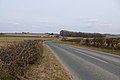
 Road to Norton-on-Derwent - geograph.org.uk - 2917539.jpg 1,024 × 677; 190 KB
-
 Rough pasture near Mill Farm - geograph.org.uk - 2011906.jpg 640 × 480; 53 KB
-
 Ruffin Lane junction in Eddlethorpe - geograph.org.uk - 6823406.jpg 1,024 × 724; 191 KB


_(25050177843).jpg)


_built_1857_-_geograph.org.uk_-_6114395.jpg)
_entrance_-_defibrillator_-_geograph.org.uk_-_6114404.jpg)


