Category:Burwash
Jump to navigation
Jump to search
village in United Kingdom  | |||||
| Upload media | |||||
| Instance of | |||||
|---|---|---|---|---|---|
| Location | Rother, East Sussex, South East England, England | ||||
| Area |
| ||||
 | |||||
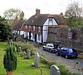
English: Burwash is a village and civil parish in the Rother District of East Sussex, England. It is located five miles (8 km) south-west of Hurst Green, on the A265 road, and on the River Dudwell, a tributary of the River Rother.
Subcategories
This category has the following 13 subcategories, out of 13 total.
B
C
- Burwash Common (36 F)
D
- Dallington Forest (10 F)
H
- Holmshurst Manor (1 F)
K
- Kipling statue, Burwash (3 F)
O
P
R
- Rampyndene, Burwash (2 F)
V
- Burwash Village Sign (3 F)
W
Media in category "Burwash"
The following 200 files are in this category, out of 1,017 total.
(previous page) (next page)-
 A deer grazing among sheep, Westdown Farm - geograph.org.uk - 5530864.jpg 2,816 × 2,112; 2.33 MB
-
 A Lane in Burwash - geograph.org.uk - 227580.jpg 640 × 480; 123 KB
-
 A line of feeding troughs - geograph.org.uk - 3660581.jpg 640 × 430; 85 KB
-
 A line of trees off the bridleway - geograph.org.uk - 1253641.jpg 640 × 430; 93 KB
-
 A row of cottages - geograph.org.uk - 455190.jpg 640 × 427; 112 KB
-
 A small pond - geograph.org.uk - 4945900.jpg 640 × 426; 54 KB
-
 A265 - geograph.org.uk - 3647605.jpg 640 × 430; 91 KB
-
 A265 - geograph.org.uk - 3647606.jpg 640 × 430; 97 KB
-
 A265 - geograph.org.uk - 3647607.jpg 640 × 430; 90 KB
-
 A265 - geograph.org.uk - 3647610.jpg 640 × 430; 93 KB
-
 A265 - geograph.org.uk - 3687467.jpg 640 × 430; 113 KB
-
 A265 - geograph.org.uk - 3687474.jpg 640 × 430; 109 KB
-
 A265 - geograph.org.uk - 4755447.jpg 640 × 426; 107 KB
-
 A265 - geograph.org.uk - 4755731.jpg 640 × 426; 75 KB
-
 A265 - geograph.org.uk - 4755749.jpg 640 × 426; 88 KB
-
 A265 - geograph.org.uk - 4759915.jpg 640 × 426; 95 KB
-
 A265 at Burwash - geograph.org.uk - 2423785.jpg 1,600 × 1,200; 400 KB
-
 A265 at Cooper's Hill - geograph.org.uk - 4755744.jpg 640 × 426; 84 KB
-
 A265 near Burwash - geograph.org.uk - 5322321.jpg 4,896 × 3,672; 5.02 MB
-
 A265 to Burwash - geograph.org.uk - 3647590.jpg 640 × 430; 109 KB
-
 A265 to Burwash - geograph.org.uk - 3647602.jpg 640 × 430; 117 KB
-
 A265 to Burwash Weald - geograph.org.uk - 3687469.jpg 640 × 430; 112 KB
-
 A265 west towards Burwash - geograph.org.uk - 333872.jpg 640 × 480; 121 KB
-
 A265, Burwash - geograph.org.uk - 4755710.jpg 640 × 426; 66 KB
-
 A265, Burwash Common - geograph.org.uk - 4759912.jpg 640 × 426; 93 KB
-
 A265, Burwash Weald - geograph.org.uk - 3687553.jpg 640 × 430; 66 KB
-
 A265, Burwash Weald - geograph.org.uk - 4759908.jpg 640 × 426; 81 KB
-
 A265, westbound - geograph.org.uk - 4755443.jpg 640 × 426; 100 KB
-
 A265, westbound - geograph.org.uk - 4755444.jpg 640 × 426; 89 KB
-
 A265, westbound - geograph.org.uk - 4755451.jpg 640 × 426; 69 KB
-
 A265, westbound - geograph.org.uk - 4755723.jpg 640 × 401; 76 KB
-
 A265, westbound - geograph.org.uk - 4755740.jpg 640 × 426; 74 KB
-
 A265, westbound - geograph.org.uk - 4755748.jpg 640 × 426; 72 KB
-
 A265, westbound - geograph.org.uk - 4759909.jpg 640 × 426; 90 KB
-
 Abandoned meander - geograph.org.uk - 3509975.jpg 640 × 430; 53 KB
-
 Abandoned meander - geograph.org.uk - 3684111.jpg 640 × 430; 53 KB
-
 Abandoned meander - geograph.org.uk - 3769173.jpg 640 × 430; 40 KB
-
 Across the Tracks - geograph.org.uk - 512836.jpg 479 × 640; 186 KB
-
 Alongside Spring Lane - geograph.org.uk - 4984735.jpg 4,608 × 3,456; 3.36 MB
-
 An electrifying walk - geograph.org.uk - 797318.jpg 480 × 640; 138 KB
-
 Angelica, Perch Hill Farm garden - geograph.org.uk - 4597917.jpg 1,024 × 683; 215 KB
-
 Apple Orchard by Holton Farm - geograph.org.uk - 227528.jpg 640 × 480; 175 KB
-
 Apple Orchard by Mottynsden Farm - geograph.org.uk - 227520.jpg 640 × 480; 138 KB
-
 Approaching Bateman's along Bateman's Lane - geograph.org.uk - 4012282.jpg 4,000 × 3,000; 4.25 MB
-
 Approaching Burwash, A265 - geograph.org.uk - 3647618.jpg 640 × 430; 110 KB
-
 Approaching gate near Hunters Hill House - geograph.org.uk - 6019183.jpg 1,024 × 655; 348 KB
-
 Approaching Westdown Lane - geograph.org.uk - 6020585.jpg 1,024 × 623; 153 KB
-
 Ash Field - geograph.org.uk - 6425837.jpg 640 × 480; 80 KB
-
 Ashdown House - geograph.org.uk - 3654546.jpg 640 × 430; 80 KB
-
 Austin Healey - geograph.org.uk - 1555623.jpg 640 × 480; 149 KB
-
 Autumn in Willingford Lane near Forge Farm - geograph.org.uk - 5528295.jpg 2,144 × 1,599; 1.38 MB
-
 Barn for sale - geograph.org.uk - 3647601.jpg 640 × 430; 86 KB
-
 Barn, Geldridge Farm - geograph.org.uk - 1252922.jpg 640 × 430; 63 KB
-
 Barn, Great Tott Farm - geograph.org.uk - 3647595.jpg 640 × 430; 81 KB
-
 Barn, Great Tott Farm - geograph.org.uk - 3647596.jpg 640 × 430; 90 KB
-
 Barn, Southside Farm - geograph.org.uk - 3093752.jpg 640 × 480; 139 KB
-
 Barn, West Down Farm - geograph.org.uk - 3692780.jpg 640 × 430; 96 KB
-
 Barns, Fontridge Lane - geograph.org.uk - 3636292.jpg 640 × 430; 103 KB
-
 Bateman's House - geograph.org.uk - 4386686.jpg 800 × 531; 141 KB
-
 Bateman's Lane - geograph.org.uk - 3500478.jpg 2,048 × 1,536; 670 KB
-
 Bateman's Lane - geograph.org.uk - 3502530.jpg 2,048 × 1,536; 691 KB
-
 Bateman's Lane - geograph.org.uk - 3660584.jpg 640 × 430; 60 KB
-
 Bateman's Lane - geograph.org.uk - 3664978.jpg 640 × 430; 84 KB
-
 Bateman's Lane - geograph.org.uk - 3722207.jpg 640 × 480; 226 KB
-
 Bateman's Lane - geograph.org.uk - 4012277.jpg 4,000 × 3,000; 3.95 MB
-
 Bateman's Lane - geograph.org.uk - 6425857.jpg 480 × 640; 80 KB
-
 Bateman's Mill - geograph.org.uk - 4185634.jpg 3,840 × 1,787; 1.83 MB
-
 Bateman's Mill and Well - geograph.org.uk - 4185637.jpg 3,663 × 2,060; 1.9 MB
-
 Bateman's Mill Gearing - geograph.org.uk - 4185643.jpg 2,848 × 2,134; 1.53 MB
-
 Bateman's Millstones - geograph.org.uk - 4185646.jpg 2,134 × 2,848; 1.02 MB
-
 Bateman's, view from entrance - geograph.org.uk - 4904954.jpg 3,200 × 1,800; 1.56 MB
-

-

-

-
 Batemans, The entrance to Park Mill - geograph.org.uk - 5155180.jpg 4,048 × 2,629; 4.41 MB
-
 Battenhurst Road - geograph.org.uk - 1337125.jpg 640 × 427; 81 KB
-
 Battenhurst Road looking north - geograph.org.uk - 333866.jpg 640 × 480; 109 KB
-
 Beech House - geograph.org.uk - 3654261.jpg 640 × 430; 82 KB
-
 Beehives at Bateman's - geograph.org.uk - 5322166.jpg 2,450 × 3,535; 2.93 MB
-
 Bell Alley Road, Burwash - geograph.org.uk - 1010496.jpg 640 × 574; 154 KB
-
 Bell Inn, Burwash - geograph.org.uk - 5091810.jpg 800 × 600; 131 KB
-
 Bines Farm - geograph.org.uk - 177694.jpg 640 × 481; 185 KB
-

-
 Bog Wood - geograph.org.uk - 3687389.jpg 640 × 430; 70 KB
-
 Bog Wood - geograph.org.uk - 3687390.jpg 640 × 430; 72 KB
-
 Bog Wood - geograph.org.uk - 3687393.jpg 640 × 430; 73 KB
-

-
 Bohemia Farm - geograph.org.uk - 6033883.jpg 1,600 × 1,048; 519 KB
-
 Borders Lane - geograph.org.uk - 3647585.jpg 640 × 430; 88 KB
-
 Borders Lane - geograph.org.uk - 3647586.jpg 640 × 430; 112 KB
-
 Borders Lane meets the A265 - geograph.org.uk - 3647588.jpg 640 × 430; 95 KB
-

-
 Bowman's Farm - geograph.org.uk - 3665161.jpg 640 × 430; 64 KB
-
 Brakey Field - geograph.org.uk - 6425953.jpg 640 × 480; 71 KB
-
 Bridge and stile - geograph.org.uk - 3502514.jpg 2,048 × 1,536; 719 KB
-
 Bridge over River Dudwell - geograph.org.uk - 5431222.jpg 4,000 × 3,000; 5.07 MB
-
 Bridge over the River Dudwell - geograph.org.uk - 3681527.jpg 640 × 430; 115 KB
-
 Bridge over the River Dudwell at Bateman's - geograph.org.uk - 3487310.jpg 4,320 × 3,240; 5.05 MB
-
 Bridleway approaching Holton Hill - geograph.org.uk - 1253673.jpg 640 × 430; 133 KB
-
 Bridleway at Great Tott Farm - geograph.org.uk - 3647597.jpg 640 × 430; 82 KB
-
 Bridleway crossing railway track - geograph.org.uk - 488372.jpg 640 × 480; 127 KB
-

-
 Bridleway heading north from Ware's Wood - geograph.org.uk - 1253001.jpg 640 × 430; 150 KB
-
 Bridleway heading north into Green Wood - geograph.org.uk - 1252934.jpg 640 × 430; 136 KB
-
 Bridleway heading to Holton Hill - geograph.org.uk - 1253655.jpg 640 × 430; 125 KB
-
 Bridleway heading to Hunter Hill - geograph.org.uk - 1253039.jpg 640 × 430; 145 KB
-
 Bridleway in Green Wood - geograph.org.uk - 6018680.jpg 1,024 × 693; 322 KB
-
 Bridleway into High Wood - geograph.org.uk - 4010945.jpg 4,000 × 3,000; 4.03 MB
-
 Bridleway junction, High Wood - geograph.org.uk - 3681412.jpg 640 × 430; 140 KB
-
 Bridleway leading NE from Burwash Weald - geograph.org.uk - 1253490.jpg 640 × 430; 126 KB
-

-
 Bridleway leaving the woods - geograph.org.uk - 4012305.jpg 4,000 × 3,000; 4.44 MB
-

-

-
 Bridleway NE of Burwash Weald (2) - geograph.org.uk - 1253559.jpg 640 × 430; 127 KB
-
 Bridleway near Grandturzel - geograph.org.uk - 3642741.jpg 640 × 430; 76 KB
-
 Bridleway north of Three Cups Corner (2) - geograph.org.uk - 1252921.jpg 640 × 430; 147 KB
-
 Bridleway signpost, Grandturzel - geograph.org.uk - 3642769.jpg 640 × 430; 119 KB
-
 Bridleway through Green Wood (2) - geograph.org.uk - 1252942.jpg 640 × 430; 136 KB
-
 Bridleway through Green Wood (3) - geograph.org.uk - 1252947.jpg 640 × 430; 126 KB
-
 Bridleway through Green Wood (4) - geograph.org.uk - 1252959.jpg 640 × 430; 134 KB
-
 Bridleway through Green Wood (5) - geograph.org.uk - 1252964.jpg 640 × 430; 133 KB
-
 Bridleway through Green Wood - geograph.org.uk - 1252938.jpg 640 × 430; 139 KB
-
 Bridleway to Bateman's - geograph.org.uk - 4012293.jpg 4,000 × 3,000; 4.11 MB
-
 Bridleway to Glaziers Forge - geograph.org.uk - 1113280.jpg 640 × 480; 108 KB
-
 Bridleway to Hunter Hill House - geograph.org.uk - 1253014.jpg 640 × 430; 142 KB
-
 Bridleway to Hunter Hill House - geograph.org.uk - 1253035.jpg 640 × 430; 133 KB
-
 Bridleway, Dallington Forest - geograph.org.uk - 3434200.jpg 640 × 480; 191 KB
-
 Bridleway, footpath junction - geograph.org.uk - 3642760.jpg 640 × 430; 82 KB
-
 Bridleway, Grandturzel - geograph.org.uk - 3642780.jpg 640 × 430; 73 KB
-
 Bridleway, Grandturzel - geograph.org.uk - 3642789.jpg 640 × 430; 97 KB
-
 Bridleway, High Wood - geograph.org.uk - 3681416.jpg 640 × 430; 113 KB
-
 Bridleway, High Wood - geograph.org.uk - 3681418.jpg 640 × 430; 139 KB
-
 Bridleway, Ware's Wood - geograph.org.uk - 1252996.jpg 640 × 430; 135 KB
-
 Bridleway-road, Glydwish Wood - geograph.org.uk - 3642833.jpg 640 × 430; 107 KB
-
 Broad Cottage - geograph.org.uk - 3653953.jpg 640 × 412; 55 KB
-
 Building in a field - geograph.org.uk - 3665016.jpg 640 × 430; 83 KB
-
 Building in the woods - geograph.org.uk - 3687382.jpg 640 × 430; 122 KB
-
 Buildings on Burwash High Street - geograph.org.uk - 3722765.jpg 640 × 428; 107 KB
-
 Bunkers Hill Farm - geograph.org.uk - 5722311.jpg 640 × 480; 130 KB
-
 Burghurst House - geograph.org.uk - 3654307.jpg 640 × 430; 98 KB
-
 Burnt House Farm - geograph.org.uk - 3687394.jpg 640 × 430; 76 KB
-
 Burnt House Farm - geograph.org.uk - 3687396.jpg 640 × 430; 87 KB
-
 Burnt House Farm - geograph.org.uk - 4012437.jpg 4,000 × 3,000; 4.24 MB
-
 Burnt House Farm - geograph.org.uk - 4012440.jpg 4,000 × 3,000; 4.44 MB
-
 Burnt House Farm - geograph.org.uk - 5129377.jpg 800 × 531; 133 KB
-
 Burnt House Farm Oast - geograph.org.uk - 3687398.jpg 640 × 430; 100 KB
-
 Burnt House Farm Oast - geograph.org.uk - 3687405.jpg 640 × 430; 81 KB
-
 Burnt House Farmhouse - geograph.org.uk - 3687403.jpg 640 × 430; 90 KB
-
 Burwash 58c Bridleway - geograph.org.uk - 6426949.jpg 640 × 480; 149 KB
-
 Burwash Fire Station - geograph.org.uk - 3653947.jpg 640 × 430; 70 KB
-
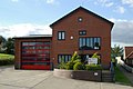 Burwash fire station - geograph.org.uk - 588023.jpg 640 × 426; 210 KB
-
 Burwash High St - geograph.org.uk - 3659783.jpg 640 × 430; 73 KB
-
 Burwash High St - geograph.org.uk - 3659830.jpg 640 × 430; 72 KB
-
 Burwash High Street - geograph.org.uk - 1404382.jpg 640 × 479; 51 KB
-
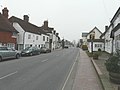 Burwash High Street - geograph.org.uk - 1404390.jpg 640 × 479; 51 KB
-
 Burwash High Street - geograph.org.uk - 5091873.jpg 800 × 600; 114 KB
-
 Burwash old fire station - geograph.org.uk - 588020.jpg 640 × 426; 226 KB
-
 Burwash open garden - geograph.org.uk - 4529871.jpg 1,024 × 768; 376 KB
-
 Burwash open garden - geograph.org.uk - 4529872.jpg 1,024 × 768; 369 KB
-
 Burwash open garden - geograph.org.uk - 4529873.jpg 768 × 1,024; 373 KB
-
 Burwash open garden - geograph.org.uk - 4529874.jpg 1,024 × 768; 306 KB
-
 Burwash open garden - geograph.org.uk - 4529875.jpg 768 × 1,024; 344 KB
-
 Burwash open garden - geograph.org.uk - 4529876.jpg 768 × 1,024; 460 KB
-
 Burwash open garden - geograph.org.uk - 4529877.jpg 1,024 × 768; 381 KB
-
 Burwash Park - geograph.org.uk - 3642702.jpg 640 × 430; 109 KB
-
 Burwash Park - geograph.org.uk - 3642709.jpg 640 × 430; 87 KB
-
 Burwash Place - geograph.org.uk - 4983357.jpg 4,608 × 3,456; 3.37 MB
-
 Burwash Post Office - geograph.org.uk - 3659786.jpg 640 × 430; 68 KB
-
 Burwash Stores - geograph.org.uk - 3659794.jpg 640 × 430; 87 KB
-
 Burwash War Memorial - geograph.org.uk - 3654298.jpg 430 × 640; 50 KB
-
 Burwash War Memorial - geograph.org.uk - 4755457.jpg 426 × 640; 70 KB
-
 Burwash War Memorial - geograph.org.uk - 4881155.jpg 4,255 × 3,247; 1.71 MB
-
 Burwash War Memorial - geograph.org.uk - 4905020.jpg 3,672 × 4,896; 5.2 MB
-
 Burwash war memorial - geograph.org.uk - 5091737.jpg 450 × 800; 77 KB
-
 Burwash war memorial and Bell Inn - geograph.org.uk - 5091741.jpg 600 × 800; 114 KB
-
 Burwash Weald - geograph.org.uk - 3692629.jpg 640 × 430; 51 KB
-
 Burwash, Park Farm - geograph.org.uk - 5155264.jpg 3,678 × 2,456; 4.81 MB
-
 Burwash, UK - panoramio (6).jpg 2,048 × 1,150; 818 KB
-
 Burwash, UK - panoramio.jpg 1,600 × 899; 272 KB
-
 Burwashstreet.jpeg 640 × 480; 140 KB
-
 Buttercup meadow - geograph.org.uk - 3670686.jpg 640 × 430; 94 KB
-
 Buttercup Meadow - geograph.org.uk - 3687402.jpg 640 × 430; 79 KB
-
 Car park, Burwash - geograph.org.uk - 3659800.jpg 640 × 430; 70 KB
-
 Cattle grid, Glydwish Wood - geograph.org.uk - 3642724.jpg 640 × 430; 83 KB
-
 Chambers Farm - geograph.org.uk - 3636695.jpg 640 × 430; 111 KB
-
 Chance Meadow - geograph.org.uk - 6426968.jpg 640 × 480; 75 KB
-
 Chant Meadow (former Calvnistic Chapel), High Street, Burwash (June 2015).JPG 2,400 × 2,400; 1.33 MB
-
 Chicken, Perch Hill Farm gardens - geograph.org.uk - 4924539.jpg 3,272 × 3,272; 3.64 MB
-
 Chilston House - geograph.org.uk - 3654573.jpg 640 × 430; 82 KB
-
 Church House - geograph.org.uk - 3654279.jpg 640 × 422; 90 KB
-
 Columbines at the roadside - geograph.org.uk - 4012432.jpg 4,000 × 3,000; 4.34 MB
-
 Community Internet Cafe - geograph.org.uk - 3659802.jpg 640 × 430; 90 KB
-
 Conifers, Leggett's Wood - geograph.org.uk - 3670714.jpg 640 × 430; 117 KB
-
 Conifers, Leggett's Wood - geograph.org.uk - 3670719.jpg 640 × 430; 126 KB
-
 Conifers, Leggett's Wood - geograph.org.uk - 3670734.jpg 640 × 430; 122 KB
-
 Converted Oast houses at Bateman's - geograph.org.uk - 3487291.jpg 4,320 × 3,240; 4.7 MB
-
 Coppiced tree by the bridleway - geograph.org.uk - 1253497.jpg 640 × 430; 130 KB
-
 Coppicing by the bridleway, Ware's Wood - geograph.org.uk - 1252988.jpg 640 × 430; 140 KB
-
 Coppicing High Wood - geograph.org.uk - 3681422.jpg 640 × 430; 143 KB


_-_geograph.org.uk_-_1253003.jpg)


_-_geograph.org.uk_-_1253559.jpg)

_-_geograph.org.uk_-_1252921.jpg)

_-_geograph.org.uk_-_1252942.jpg)
_-_geograph.org.uk_-_1252947.jpg)
_-_geograph.org.uk_-_1252959.jpg)
_-_geograph.org.uk_-_1252964.jpg)


.jpg)


,_High_Street,_Burwash_(June_2015).JPG)


