Category:Burton Pedwardine
Jump to navigation
Jump to search
English: Burton Pedwardine is a hamlet located four and a half miles south-east of the market town of Sleaford and south-west of the village of Heckington. Burton Pedwardine is located in the district of North Kesteven, which is in the county of Lincolnshire in England.
village in the United Kingdom .jpg) | |||||
| Upload media | |||||
| Instance of | |||||
|---|---|---|---|---|---|
| Location | North Kesteven, Lincolnshire, East Midlands, England | ||||
| Population |
| ||||
 | |||||
Subcategories
This category has only the following subcategory.
Media in category "Burton Pedwardine"
The following 67 files are in this category, out of 67 total.
-
 Abandoned by the track - Willoughby Gorse - geograph.org.uk - 1877681.jpg 1,500 × 996; 1.39 MB
-
 Access to a solar farm off Whitecross Lane - geograph.org.uk - 6189209.jpg 1,024 × 768; 183 KB
-
 Access to Lodge Farm - geograph.org.uk - 6189832.jpg 1,024 × 768; 153 KB
-
 Access track to farmland - Burton Pedwardine - geograph.org.uk - 1877879.jpg 1,500 × 996; 1.57 MB
-
 Barn on Whitecross Lane - Willoughby Gorse - geograph.org.uk - 1877664.jpg 1,500 × 996; 1.68 MB
-
 Bend on the Heckington Road - Burton Pedwardine - geograph.org.uk - 1881925.jpg 1,500 × 996; 1.21 MB
-
 Bend on White Cross Lane - geograph.org.uk - 3160024.jpg 2,256 × 1,504; 1.09 MB
-
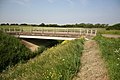
 Brackenberry Bridge - Burton Pedwardine - geograph.org.uk - 1877816.jpg 1,500 × 996; 1.45 MB
-
 Brackenberry Bridge - Burton Pedwardine - geograph.org.uk - 1877823.jpg 1,500 × 996; 1.21 MB
-
 Brackenberry Bridge - Burton Pedwardine - geograph.org.uk - 1877897.jpg 1,500 × 996; 1.5 MB
-
 Burton Pedwardine - viewed from the Heckington Road - geograph.org.uk - 1881924.jpg 1,500 × 996; 1.65 MB
-
 Cliff Beck - geograph.org.uk - 6200329.jpg 1,024 × 768; 194 KB
-
 Cliff Farm Cottage - Willoughby Gorse - geograph.org.uk - 1877711.jpg 1,500 × 996; 1.19 MB
-
 Corner of waste ground - Willoughby Gorse - geograph.org.uk - 1877753.jpg 1,500 × 996; 1.31 MB
-
 Ditch with hedge - Willoughby Gorse - geograph.org.uk - 1877759.jpg 1,500 × 996; 1.27 MB
-
 Drain off Heckington Road - geograph.org.uk - 3160297.jpg 1,504 × 2,256; 958 KB
-
 Farmland - Burton Pedwardine - geograph.org.uk - 1877887.jpg 1,500 × 996; 1.28 MB
-
 Farmland - Burton Pedwardine - geograph.org.uk - 1877934.jpg 1,500 × 996; 1.66 MB
-
 Farmland near Burton Pedwardine - geograph.org.uk - 4546366.jpg 640 × 406; 46 KB
-

-
 Fishing lake - Burton Pedwardine - geograph.org.uk - 1877923.jpg 1,500 × 996; 1.88 MB
-

-
 Flat farmland near Burton Pedwardine - geograph.org.uk - 4548253.jpg 640 × 397; 37 KB
-
 Footpath sign and gaspipe marker - Willoughby Gorse - geograph.org.uk - 1877692.jpg 1,500 × 996; 1.44 MB
-
 Footpath to Kirkby La Thorpe and Sleaford - geograph.org.uk - 6189196.jpg 1,024 × 768; 149 KB
-
 Footpath to Whitecross Lane - geograph.org.uk - 6189142.jpg 1,024 × 768; 178 KB
-
 Gaspipe marker - Willoughby Gorse - geograph.org.uk - 1877700.jpg 1,500 × 996; 1.37 MB
-
 Gate to woodland - Silk Willoughby - geograph.org.uk - 1884988.jpg 1,500 × 996; 2.07 MB
-
 Heckington Road - Burton Pedwardine - geograph.org.uk - 1881927.jpg 1,500 × 996; 1.6 MB
-
 Heckington Road - geograph.org.uk - 3160291.jpg 2,256 × 1,504; 819 KB
-
 Lane to Burton Pedwardine - geograph.org.uk - 1877804.jpg 1,500 × 996; 1.16 MB
-
 Little bridge - don't miss it - geograph.org.uk - 6512915.jpg 4,608 × 3,456; 4.93 MB
-

-

-
 Mareham Lane - Silk Willoughby - geograph.org.uk - 1877385.jpg 1,500 × 1,011; 1.41 MB
-

-
 Path to Beacon Hill - geograph.org.uk - 2726478.jpg 1,600 × 1,200; 436 KB
-
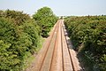
 Railway lines towards Spalding - geograph.org.uk - 3160272.jpg 2,256 × 1,504; 1.2 MB
-

-
 Road to Lodge Farm - geograph.org.uk - 3158360.jpg 2,256 × 1,504; 779 KB
-
 Scredington Road near Burton Pedwardine - geograph.org.uk - 2761185.jpg 682 × 1,024; 191 KB
-
 Sign on Brackenberry Bridge - Burton Pedwardine - geograph.org.uk - 1877831.jpg 1,500 × 996; 1.53 MB
-
 Stile on Beacon Hill - geograph.org.uk - 2726394.jpg 1,600 × 1,200; 532 KB
-
 Stubble field off Scredington Road - geograph.org.uk - 6247906.jpg 1,024 × 768; 218 KB
-
 The Heckington Road - Burton Pedwardine - geograph.org.uk - 1881926.jpg 1,500 × 996; 1.4 MB
-
 The Old Gatehouse - geograph.org.uk - 6189202.jpg 1,024 × 768; 315 KB
-

-
 Track off Whitecross Lane - Willoughby Gorse - geograph.org.uk - 1877638.jpg 1,500 × 996; 1.55 MB
-
 Track through the trees - geograph.org.uk - 3160079.jpg 1,504 × 2,256; 1.4 MB
-
 Tracks in the mist - Willoughby Gorse - geograph.org.uk - 1877720.jpg 1,500 × 996; 1.51 MB
-
 West from Brackenberry Bridge - Burton Pedwardine - geograph.org.uk - 1877952.jpg 1,500 × 996; 1.21 MB
-
 Whitecross Lane - Willoughby Gorse - geograph.org.uk - 1877627.jpg 1,500 × 1,010; 1.68 MB
-
 Asgarby Road - geograph.org.uk - 200241.jpg 640 × 427; 57 KB
-
 Burton Bridge - geograph.org.uk - 182839.jpg 640 × 427; 77 KB
-
 Eastbound - geograph.org.uk - 284486.jpg 640 × 427; 90 KB
-
 Farmland at Burton Pedwardine - geograph.org.uk - 284475.jpg 640 × 427; 57 KB
-
 Grange Farm - geograph.org.uk - 200238.jpg 640 × 427; 57 KB
-
 Highfields Farm - geograph.org.uk - 284466.jpg 640 × 427; 60 KB
-
 Hill Top Farm - geograph.org.uk - 404615.jpg 640 × 480; 88 KB
-
 North Beck - geograph.org.uk - 182837.jpg 640 × 427; 90 KB
-
 Northbound to Sleaford - geograph.org.uk - 182835.jpg 640 × 427; 97 KB
-
 Paddock on Burton Road - geograph.org.uk - 284479.jpg 640 × 427; 61 KB
-
 Poplar Farm - geograph.org.uk - 379649.jpg 640 × 424; 53 KB
-
 Power Lines - geograph.org.uk - 284481.jpg 640 × 427; 80 KB
-
 Rails leading south - geograph.org.uk - 404631.jpg 640 × 516; 107 KB
-

-
 Winter cereal - geograph.org.uk - 379651.jpg 640 × 480; 90 KB


