Category:Burton Fleming
Jump to navigation
Jump to search
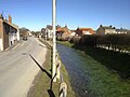
English: Burton Fleming is a village and civil parish in the East Riding of Yorkshire, England. It lies close to the border with North Yorkshire. The village is situated approximately 8 miles (13 km) north west of Bridlington and 7 miles (11 km) south of Filey in North Yorkshire.
village in East Riding of Yorkshire, England, UK Apr2006.jpg) | |||||
| Upload media | |||||
| Instance of | |||||
|---|---|---|---|---|---|
| Location | East Riding of Yorkshire, Yorkshire and the Humber, England | ||||
| Said to be the same as | Burton Fleming (Wikimedia duplicated page, civil parish) | ||||
 | |||||
Subcategories
This category has only the following subcategory.
S
Media in category "Burton Fleming"
The following 200 files are in this category, out of 299 total.
(previous page) (next page)-
 A farm track leading to Burton Fleming Grange (geograph 2749802).jpg 800 × 600; 81 KB
-
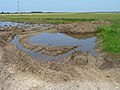
 A large field pond (geograph 6472543).jpg 1,024 × 768; 252 KB
-
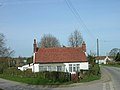
 A row of cottages, Burton Fleming - geograph.org.uk - 1293118.jpg 640 × 427; 283 KB
-
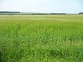
 A sea of barley on a windy day - geograph.org.uk - 3021775.jpg 1,024 × 768; 131 KB
-

-
 A winter day on North Cotes Road (Track) - geograph.org.uk - 5650595.jpg 1,024 × 765; 590 KB
-
 Access road to Refuge Farm - geograph.org.uk - 5741550.jpg 5,148 × 3,860; 6.98 MB
-
 Access track to Burton Fleming Grange (geograph 2723672).jpg 1,024 × 768; 140 KB
-
 Along Bartindale Road - geograph.org.uk - 4459387.jpg 640 × 428; 82 KB
-
 An ice covered Mill Road toward Burton Fleming - geograph.org.uk - 5650586.jpg 5,152 × 3,864; 4.6 MB
-

-
 Argam Lane - geograph.org.uk - 4459391.jpg 640 × 428; 88 KB
-
 Asymmetrical grass verges - geograph.org.uk - 3021459.jpg 1,024 × 768; 149 KB
-
 Back Street, Burton Fleming - geograph.org.uk - 4104881.jpg 640 × 480; 51 KB
-
 Barley field and shelter belt - geograph.org.uk - 4508255.jpg 1,024 × 768; 219 KB
-

-
 Barley in the field, clover at the edge - geograph.org.uk - 3021513.jpg 1,024 × 768; 177 KB
-
 Barley in Vicarage Closes (geograph 3021823).jpg 1,024 × 768; 154 KB
-
 Bartindale Road - geograph.org.uk - 4823691.jpg 640 × 480; 63 KB
-
 Bartindale Road - geograph.org.uk - 4823697.jpg 640 × 480; 53 KB
-
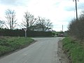 Bartindale Road Crossroads - geograph.org.uk - 1235098.jpg 640 × 480; 61 KB
-

-
 Bridge across the Gypsey Race (geograph 3021806).jpg 1,024 × 768; 200 KB
-
 Bridge Over Gypsey Race - geograph.org.uk - 1235138.jpg 640 × 480; 136 KB
-

-

-

-
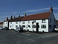
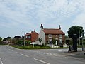
 Burton Arms, Burton Fleming - geograph.org.uk - 3802396.jpg 1,200 × 740; 292 KB
-
 Burton Fleming 1904 (archive ref PO-1-26-4) (29839264604).jpg 675 × 408; 67 KB
-
 Burton Fleming Duck Pond - geograph.org.uk - 1282195.jpg 640 × 480; 120 KB
-
 Burton Fleming floods at Christmas time.jpg 3,264 × 2,448; 3.34 MB
-
 Burton Fleming Grange - geograph.org.uk - 256953.jpg 640 × 480; 125 KB
-
 Burton Fleming Methodist Church - geograph.org.uk - 3021565.jpg 1,024 × 768; 143 KB
-
 Burton Fleming Methodist Church - geograph.org.uk - 3802383.jpg 1,200 × 798; 427 KB
-
 Burton Fleming Pond - geograph.org.uk - 4104879.jpg 640 × 480; 104 KB
-
 Burton Fleming Pond.jpg 640 × 480; 89 KB
-
 Burton Fleming Post Office - geograph.org.uk - 4849416.jpg 640 × 441; 71 KB
-
 Burton Fleming Post Office - geograph.org.uk - 4849417.jpg 2,624 × 2,031; 2.01 MB
-
 Burton Fleming Post Office - geograph.org.uk - 6397332.jpg 709 × 800; 103 KB
-
 Burton Fleming Road (geograph 6467531).jpg 800 × 535; 105 KB
-
 Burton Fleming Road - geograph.org.uk - 4103819.jpg 640 × 480; 63 KB
-
 Burton Fleming Road - geograph.org.uk - 4103846.jpg 640 × 480; 45 KB
-
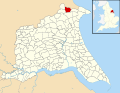 Burton Fleming UK parish locator map.svg 1,425 × 1,107; 1.68 MB
-
 Burton Fleming Village Hall - geograph.org.uk - 1330176.jpg 640 × 480; 102 KB
-
 Burton Fleming Village Hall - geograph.org.uk - 6398882.jpg 800 × 600; 105 KB
-
 Burton Fleming, Please drive carefully - geograph.org.uk - 3021473.jpg 1,024 × 768; 136 KB
-
 Burton Fleming, the post office - geograph.org.uk - 2985819.jpg 480 × 640; 53 KB
-
 BurtonFleming(StephenHorncastle)Apr2006.jpg 640 × 480; 115 KB
-
 Butcher's Lane, Burton Fleming - geograph.org.uk - 3021536.jpg 1,024 × 768; 143 KB
-
 Church View, Burton Fleming - geograph.org.uk - 6399038.jpg 800 × 600; 105 KB
-

-
 Cottage on the Junction - geograph.org.uk - 1236991.jpg 640 × 480; 59 KB
-

-
-
 Cottages on Thwing Road, Burton Fleming - geograph.org.uk - 4508200.jpg 1,024 × 768; 169 KB
-

-
 Course lof the Gypsey Race - geograph.org.uk - 4508206.jpg 1,024 × 768; 195 KB
-
 Course of the Gypsey Race - geograph.org.uk - 4104858.jpg 640 × 480; 135 KB
-
 Crop field and hedgerow off Burton Fleming Road (geograph 6467543).jpg 800 × 600; 131 KB
-
 Crop field east of Burton Fleming - geograph.org.uk - 4104889.jpg 640 × 480; 116 KB
-
 Crop field near Burton Fleming - geograph.org.uk - 4104849.jpg 640 × 480; 90 KB
-
 Crop field near Burton Fleming - geograph.org.uk - 6396506.jpg 800 × 600; 80 KB
-
 Crop field near Burton Fleming Grange - geograph.org.uk - 2723639.jpg 1,024 × 768; 112 KB
-
 Crop field near Eastfield Farm - geograph.org.uk - 4104836.jpg 640 × 480; 99 KB
-

-
 Crop field off Burton Fleming Road (geograph 6467544).jpg 800 × 600; 121 KB
-

-
 Crop field off Thwing Road - geograph.org.uk - 4856888.jpg 640 × 492; 69 KB
-
 Crop field off Thwing Road - geograph.org.uk - 4856898.jpg 640 × 480; 62 KB
-
 Crop field towards Eastfield Farm - geograph.org.uk - 4103854.jpg 640 × 480; 85 KB
-
 Crop field towards Maidensgrave Farm - geograph.org.uk - 6398875.jpg 800 × 600; 120 KB
-
 Crop field west of Nine Dikes Road - geograph.org.uk - 4856865.jpg 640 × 480; 85 KB
-
 Crop field, north-west side of the Hunmanby Road (geograph 2723658).jpg 1,024 × 768; 203 KB
-
 Crop field, White Hill - geograph.org.uk - 4856880.jpg 640 × 434; 58 KB
-

-
 Crossing over the Hunmanby Road - geograph.org.uk - 2115535.jpg 800 × 600; 200 KB
-
 Crossroads, Burton Fleming - geograph.org.uk - 6398922.jpg 640 × 480; 78 KB
-
 Driving Down Nine Dikes Road - geograph.org.uk - 4885699.jpg 2,989 × 1,986; 1.85 MB
-
 East of Burton Fleming - geograph.org.uk - 199278.jpg 640 × 480; 96 KB
-
 Edge of a crop field, west of Burton Fleming Grange (geograph 2723674).jpg 1,024 × 768; 191 KB
-
 Entering Burton Fleming - geograph.org.uk - 2115544.jpg 800 × 600; 233 KB
-
 Entering Burton Fleming - geograph.org.uk - 4104850.jpg 640 × 480; 64 KB
-
 Entering Burton Fleming on Wold Newton Road - geograph.org.uk - 5741913.jpg 1,024 × 768; 486 KB
-
 Entering North Yorkshire - geograph.org.uk - 2749825.jpg 800 × 600; 98 KB
-
 Entrance to two fields, Vicarage Closes - geograph.org.uk - 3021755.jpg 850 × 768; 141 KB
-
 Farm buildings near Burton Fleming - geograph.org.uk - 6396509.jpg 800 × 600; 96 KB
-
-

-
 Farm entrance off Burton Fleming Road (geograph 6472532).jpg 1,024 × 768; 138 KB
-
 Farm Track near Hill Farm - geograph.org.uk - 1282167.jpg 640 × 480; 80 KB
-

-
 Farm track off Bartindale Road - geograph.org.uk - 4822587.jpg 640 × 480; 104 KB
-
 Farm track off Burton Fleming Road - geograph.org.uk - 4103828.jpg 640 × 480; 72 KB
-

-

-
 Farm Track South of Eastfield Farm - geograph.org.uk - 1283982.jpg 640 × 480; 95 KB
-
 Farm Track to Burton Fleming Grange - geograph.org.uk - 1282242.jpg 640 × 480; 69 KB
-
 Farm Track, Burton Fleming Grange - geograph.org.uk - 1282249.jpg 640 × 480; 86 KB
-
 Farming off Thwing Road - geograph.org.uk - 5650173.jpg 640 × 480; 62 KB
-
 Farmland north of Burton Fleming Grange - geograph.org.uk - 2723644.jpg 1,024 × 768; 100 KB
-
 Farmland off Bartindale Road - geograph.org.uk - 4459384.jpg 640 × 428; 67 KB
-
 Farmland west of Burton Fleming Grange (geograph 2723667).jpg 1,024 × 768; 181 KB
-
 Farmyard off Nine Dikes Road - geograph.org.uk - 5946061.jpg 1,024 × 768; 193 KB
-
 Field and hedgerow - geograph.org.uk - 4104852.jpg 640 × 480; 92 KB
-
 Field and hedgerow - geograph.org.uk - 4104897.jpg 640 × 480; 82 KB
-
 Field and hedgerow - geograph.org.uk - 4822590.jpg 640 × 480; 105 KB
-
 Field and Woodland, Refuge Farm - geograph.org.uk - 1236721.jpg 640 × 480; 56 KB
-

-
 Field east of Burton Fleming - geograph.org.uk - 4104900.jpg 640 × 480; 97 KB
-
 Field edge footpath back toward Thwing - geograph.org.uk - 5741548.jpg 1,024 × 767; 528 KB
-

-
 Field entrance off Nine Dikes Road - geograph.org.uk - 4856892.jpg 640 × 480; 53 KB
-
 Field entrance, Burton Fleming - geograph.org.uk - 4104854.jpg 640 × 480; 80 KB
-
 Field off Bartindale Road - geograph.org.uk - 4823695.jpg 640 × 480; 103 KB
-
 Field off Bartindale Road - geograph.org.uk - 4823699.jpg 640 × 480; 106 KB
-
 Field towards Burton Fleming - geograph.org.uk - 4104901.jpg 640 × 480; 95 KB
-
 Field Track - geograph.org.uk - 199280.jpg 640 × 480; 109 KB
-
 Field west of Bartindale Road - geograph.org.uk - 4823690.jpg 640 × 480; 87 KB
-

-
 Fields east of Burton Fleming - geograph.org.uk - 393093.jpg 640 × 480; 64 KB
-
 Fields east of Refuge Farm - geograph.org.uk - 393083.jpg 640 × 480; 73 KB
-
-
 Fingerpost on Burton Fleming Road (geograph 6467534).jpg 800 × 600; 156 KB
-
 Fingerpost, Burton Fleming - geograph.org.uk - 6396534.jpg 800 × 600; 101 KB
-
 Flooding at Burton Fleming - geograph.org.uk - 3269135.jpg 4,000 × 3,000; 2.94 MB
-
 Flooding at the field edge - geograph.org.uk - 3021518.jpg 1,024 × 768; 176 KB
-
 Footpath, follow the field edge - geograph.org.uk - 5741541.jpg 1,024 × 757; 421 KB
-
 Fordon Road, Burton Fleming - geograph.org.uk - 1330183.jpg 640 × 480; 71 KB
-
 Front Street, Burton Fleming - geograph.org.uk - 3021572.jpg 1,024 × 768; 139 KB
-
 Front Street, Burton Fleming - geograph.org.uk - 4104870.jpg 640 × 480; 85 KB
-
 Gate Farm near Burton Fleming - geograph.org.uk - 6398878.jpg 640 × 441; 49 KB
-
 Gated farm track off Bartindale Road - geograph.org.uk - 4823692.jpg 640 × 381; 65 KB
-
 Gated field entrance - geograph.org.uk - 2723635.jpg 1,024 × 768; 166 KB
-
 George V postbox Burton Fleming Post Office - geograph.org.uk - 4849413.jpg 1,744 × 3,202; 585 KB
-
 Gypsey Race - geograph.org.uk - 1235132.jpg 640 × 480; 119 KB
-
 Gypsey Race - geograph.org.uk - 1282222.jpg 640 × 480; 118 KB
-
 Gypsey Race Burton Fleming 3 (Nigel Coates).jpg 2,592 × 1,944; 910 KB
-
 Gypsey Race Burton Fleming 5 (Nigel Coates).jpg 2,592 × 1,944; 1.54 MB
-
 Gypsey Race Burton Fleming.jpg 640 × 480; 101 KB
-
 Harvested crop - geograph.org.uk - 4104910.jpg 640 × 480; 78 KB
-
 Heading south on Bartindale Road - geograph.org.uk - 4823696.jpg 640 × 480; 57 KB
-
 Hedged strip of land - geograph.org.uk - 3021737.jpg 1,024 × 768; 204 KB
-
 Hedgerow and fence near Burton Fleming - geograph.org.uk - 6396503.jpg 800 × 600; 118 KB
-
 Hill Farm, Burton Fleming - geograph.org.uk - 394964.jpg 640 × 480; 93 KB
-
 Hill Farm, Burton Fleming - geograph.org.uk - 394967.jpg 640 × 480; 111 KB
-
 Horses off Bartindale Road - geograph.org.uk - 4459378.jpg 640 × 428; 96 KB
-
 House north of Maidensgrave Farm - geograph.org.uk - 4104896.jpg 640 × 480; 70 KB
-
 House on Wold Newton Road - geograph.org.uk - 1237040.jpg 640 × 480; 106 KB
-
 Houses on Front Street, Burton Fleming - geograph.org.uk - 6397328.jpg 800 × 529; 102 KB
-

-

-
 Hunmanby Road, Burton Fleming - geograph.org.uk - 6399053.jpg 640 × 474; 52 KB
-
 In the shadow of the roadside hedge - geograph.org.uk - 2723641.jpg 1,024 × 768; 191 KB
-

-
 Iron Age enamelled mount (FindID 189814).jpg 1,841 × 1,143; 293 KB
-
 Junction of roads on White Hill - geograph.org.uk - 5751022.jpg 4,000 × 3,000; 2.88 MB
-
 Junction of Thwing Road and South Street - geograph.org.uk - 3021551.jpg 1,024 × 768; 124 KB
-
 Junction on Burton Fleming Road - geograph.org.uk - 4103807.jpg 640 × 480; 48 KB
-

-
 Large crop field east of The Grange (geograph 2723661).jpg 1,024 × 768; 177 KB
-
 Large rectangular field, east of Burton Fleming Road (geograph 2723826).jpg 1,024 × 768; 142 KB
-
 Leaving Burton Fleming - geograph.org.uk - 4104884.jpg 640 × 480; 62 KB
-
 Left for Wold Newton, right for Hunmanby (geograph 2723676).jpg 1,024 × 768; 142 KB
-
-
 Maidensgrave Farm - geograph.org.uk - 1237129.jpg 640 × 480; 58 KB
-

-
 Mere Farm, Burton Fleming - geograph.org.uk - 6399046.jpg 800 × 600; 99 KB
-
 Methodist Chapel Burton Fleming.jpg 640 × 480; 87 KB
-
 Minor road into Burton Fleming - geograph.org.uk - 4104845.jpg 640 × 480; 65 KB
-
 Minor Road to Burton Fleming - geograph.org.uk - 1236727.jpg 640 × 480; 62 KB
-
 Minor road toward Burton Fleming - geograph.org.uk - 5741562.jpg 1,024 × 767; 440 KB
-
 Minor Road Towards Burton Fleming - geograph.org.uk - 1282155.jpg 640 × 480; 63 KB
-
 Minor road towards Grindale - geograph.org.uk - 4104892.jpg 640 × 480; 66 KB
-
 Minor road towards Grindale - geograph.org.uk - 4104906.jpg 640 × 480; 64 KB
-
 Minor road towards Grindale - geograph.org.uk - 4106625.jpg 640 × 480; 80 KB
-
 Minor Road Towards Hunmanby - geograph.org.uk - 1282232.jpg 640 × 480; 87 KB
-
 Minor Road Towards Wold Newton - geograph.org.uk - 1237030.jpg 640 × 480; 44 KB
-
 Minor roads meet at crossroads - geograph.org.uk - 5650593.jpg 1,024 × 768; 334 KB
-
 Muddy field entrance - geograph.org.uk - 3021493.jpg 1,024 × 768; 167 KB
-
 Nine Dikes Road - geograph.org.uk - 1294511.jpg 640 × 427; 298 KB
-
 Nine Dikes Road - geograph.org.uk - 4856864.jpg 640 × 480; 67 KB
-
 Nine Dikes Road at White Hill Triangulation Pillar - geograph.org.uk - 5751002.jpg 4,000 × 3,000; 2.88 MB
-
 North Burton Hall - geograph.org.uk - 1282204.jpg 640 × 480; 69 KB
-
 North Cotes Road (Track) (geograph 5738274).jpg 1,024 × 768; 587 KB
-
 North Cotes Road - geograph.org.uk - 1402647.jpg 640 × 480; 79 KB
-
 North Cotes Road - geograph.org.uk - 5521367.jpg 1,024 × 768; 159 KB
-

-
 Over the Gate - geograph.org.uk - 256980.jpg 640 × 480; 182 KB
-
-
 Poppies at the edge of a wheat field - geograph.org.uk - 3021745.jpg 1,024 × 768; 171 KB
-

-
 Post Office, Burton Fleming - geograph.org.uk - 4104874.jpg 640 × 480; 49 KB
-
 Post Office, Front Street, Burton Fleming - geograph.org.uk - 3802393.jpg 1,200 × 798; 301 KB
-
 Potato crop of Burton Fleming Road - geograph.org.uk - 4103832.jpg 640 × 480; 79 KB
-

-
 Refuge Farm - geograph.org.uk - 139428.jpg 640 × 480; 67 KB
-
 Remains of a garden, south of The Sheepwalks - geograph.org.uk - 3019132.jpg 1,024 × 768; 190 KB
-
 Road Away From Little Argham - geograph.org.uk - 1235122.jpg 640 × 480; 84 KB
-
 Road bridge over the Gypsey Race (geograph 5741900).jpg 1,024 × 758; 392 KB
-
 Road junction on Bartindale Road - geograph.org.uk - 4823703.jpg 640 × 480; 63 KB
.jpg)
.jpg)


_-_geograph.org.uk_-_5650595.jpg)

.jpg)


.jpg)


.jpg)


_(29839264604).jpg)


.jpg)


.jpg)


.jpg)


.jpg)


.jpg)


.jpg)


.jpg)


.jpg)


.jpg)
.jpg)


.jpg)


.jpg)
.jpg)

.jpg)
.jpg)


_(geograph_5738274).jpg)


.jpg)
