Category:Bursea
Jump to navigation
Jump to search
English: Bursea is a hamlet in the East Riding of Yorkshire, England. It is situated approximately 3 miles (4.8 km) south of the village of Holme-on-Spalding-Moor and 5 miles (8 km) north east of the market town of Howden. It lies to the north of the River Foulness.
village in United Kingdom  | |||||
| Upload media | |||||
| Instance of | |||||
|---|---|---|---|---|---|
| Location | Holme-on-Spalding-Moor, East Riding of Yorkshire, Yorkshire and the Humber, England | ||||
 | |||||
Media in category "Bursea"
The following 16 files are in this category, out of 16 total.
-
 A614 at Bursea Lane Ends - geograph.org.uk - 174905.jpg 640 × 480; 118 KB
-
 Arglam Lane Farm - geograph.org.uk - 177968.jpg 640 × 480; 89 KB
-
 Arglam Lane from Bursea Lane Ends - geograph.org.uk - 174904.jpg 640 × 480; 64 KB
-
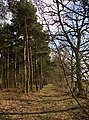 Black Plantation, Holme Common - geograph.org.uk - 1199949.jpg 476 × 640; 218 KB
-
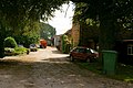
 Bursea House Farm - geograph.org.uk - 175273.jpg 640 × 480; 92 KB
-
 Bursea Lane - geograph.org.uk - 175262.jpg 640 × 480; 69 KB
-
 Bursea Lane - geograph.org.uk - 185400.jpg 640 × 480; 151 KB
-
 Church at Bursea.jpg 640 × 426; 120 KB
-
 Farm at Bursea - geograph.org.uk - 234379.jpg 640 × 426; 135 KB
-

-
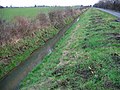 Holme Common Drain - geograph.org.uk - 128984.jpg 640 × 480; 161 KB
-
 Lane toward Grange Farm - geograph.org.uk - 1222929.jpg 640 × 480; 103 KB
-
 Plantation off Bursea lane - geograph.org.uk - 1229897.jpg 640 × 480; 105 KB
-
 Power lines towards Sand Hill farm - geograph.org.uk - 1395814.jpg 640 × 480; 65 KB
-
 Road Junction, Holme Common - geograph.org.uk - 128975.jpg 640 × 480; 83 KB
-
 Track to Sand Hill Farm - geograph.org.uk - 1395828.jpg 640 × 480; 76 KB


