Category:Burnt Islands, Scotland
Jump to navigation
Jump to search
English: The Burnt Islands are a group of islands in the Kyles of Bute, in the council area of Argyll and Bute, Scotland.
group of islands in Argyll and Bute, Scotland, UK  | |||||
| Upload media | |||||
| Instance of |
| ||||
|---|---|---|---|---|---|
| Location | Argyll and Bute, Scotland | ||||
 | |||||
Media in category "Burnt Islands, Scotland"
The following 10 files are in this category, out of 10 total.
-

-
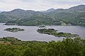
 Burnt Islands Kyles of Bute.jpg 640 × 420; 72 KB
-
 Burnt Islands seen from near Balnakailly - geograph.org.uk - 4007668.jpg 1,024 × 678; 144 KB
-
 Chart F.081 Plans in the Kyles of Bute, Issued 1941.jpg 16,285 × 11,082; 40.19 MB
-
 Eilean Buidhe, A Burnt Island - geograph.org.uk - 2742702.jpg 2,560 × 1,706; 886 KB
-
 Going through the Burnt Islands - geograph.org.uk - 970030.jpg 640 × 480; 48 KB
-
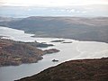
 Kyles Of Bute - geograph.org.uk - 117648.jpg 640 × 480; 85 KB
-
 Passage through the Burnt Islands - geograph.org.uk - 969586.jpg 640 × 480; 45 KB
-
 Canoeing through the Burnt Islands - geograph.org.uk - 1478297.jpg 640 × 354; 60 KB
-
 Kyles of Bute - geograph.org.uk - 616059.jpg 640 × 480; 50 KB


