Category:Burnmouth
Jump to navigation
Jump to search
village in Scottish Borders, Scotland, UK  | |||||
| Upload media | |||||
| Instance of | |||||
|---|---|---|---|---|---|
| Location |
| ||||
| Different from | |||||
 | |||||
English: Burnmouth is a small fishing village located adjacent on the A1 road on the east coast of Scotland. It is the first village in Scotland on the A1, after crossing the border with England. Burnmouth is located in the Parish of Ayton, in the Scottish Borders council area. Its coast is a Site of Special Scientific Interest.

Subcategories
This category has the following 7 subcategories, out of 7 total.
A
- Ayton Parish Church (2 F)
B
- Burnmouth Bay (14 F)
- Burnmouth Harbour (17 F)
C
- Cowdrait (8 F)
H
- Hilton Bay (4 F)
P
- Partanhall (8 F)
S
Media in category "Burnmouth"
The following 71 files are in this category, out of 71 total.
-
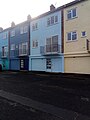
 17 and 18 Lower Burnmouth are listed.jpg 3,456 × 4,608; 882 KB
-
 19 Lower Burnmouth is listed.jpg 3,456 × 4,608; 878 KB
-
 20 Lower Burnmouth is listed.jpg 3,456 × 4,608; 789 KB
-
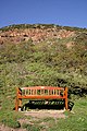 A seat overlooking Burnmouth harbour - geograph.org.uk - 1527497.jpg 427 × 640; 151 KB
-
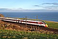 An LNER Azuma train at Burnmouth, geograph 6350005 by Walter Baxter.jpg 1,024 × 689; 479 KB
-
 Berwickshire Architecture - 14 - 20 Lower Burnmouth (geograph 2472058).jpg 2,560 × 1,920; 2.52 MB
-
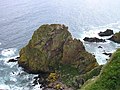 Breeches Rock - geograph.org.uk - 843571.jpg 640 × 480; 109 KB
-
 Burnmouth 17 1603280612.jpg 3,456 × 4,608; 4.54 MB
-
 Burnmouth Coast01 2009-01-18.jpg 7,413 × 1,797; 4.38 MB
-
 Burnmouth Harbour - geograph.org.uk - 4491898.jpg 640 × 480; 507 KB
-
 Burnmouth Harbour - geograph.org.uk - 6208297.jpg 640 × 427; 92 KB
-
 Burnmouth harbour from north.jpg 4,608 × 3,456; 3.45 MB
-
 Burnmouth MMB 01 East Coast Main Line.jpg 4,716 × 2,736; 5.37 MB
-
 Burnmouth MMB 07.jpg 4,239 × 2,790; 3.58 MB
-
 Burnmouth MMB 09 East Coast Main Line.jpg 4,494 × 2,487; 5.14 MB
-
 Burnmouth Outer Harbour - geograph.org.uk - 1935221.jpg 4,000 × 3,000; 3.01 MB
-
 Burnmouth Ross Bay and Ross Point geograph-3205818-by-Ben-Brooksbank.jpg 966 × 563; 806 KB
-
 Burnmouth Station site of 1950591 2ba2f43b.jpg 640 × 351; 138 KB
-
 Burnmouth viewed from south 01.jpg 4,608 × 3,456; 5.51 MB
-
 Burnmouth viewed from south 02.jpg 4,608 × 3,456; 6.37 MB
-
 Burnmouth226.jpg 2,048 × 1,306; 642 KB
-
 Coast North of Lamberton Holdings - geograph.org.uk - 6057987.jpg 3,648 × 2,736; 3.92 MB
-
 Coastline north from Catcairn Bushes - geograph.org.uk - 356616.jpg 640 × 480; 98 KB
-
 East Coast Line at Flemington - geograph.org.uk - 220368.jpg 640 × 480; 88 KB
-
 Entrance to the outer Harbour, Burnmouth - geograph.org.uk - 4491905.jpg 640 × 480; 478 KB
-
 Fishermen's cottages, Partanhall - geograph.org.uk - 1935211.jpg 4,000 × 3,000; 3 MB
-
 Hitching a ride - geograph.org.uk - 3136620.jpg 418 × 640; 266 KB
-
 Hurker's Haven - geograph.org.uk - 29601.jpg 640 × 480; 119 KB
-
 Lamberton Skerrs - geograph.org.uk - 356662.jpg 640 × 480; 169 KB
-
 Lazing on the shore - geograph.org.uk - 6701197.jpg 1,600 × 1,200; 417 KB
-

-
 Light blue is 15.jpg 3,456 × 4,608; 4.29 MB
-
 Looking towards Partanhall - geograph.org.uk - 3541971.jpg 1,024 × 768; 293 KB
-
 Number sixteen is listed 01.jpg 3,456 × 4,608; 5.31 MB
-
 Number sixteen is listed 02.jpg 3,456 × 4,608; 4.87 MB
-
 Partanhall - geograph.org.uk - 2404275.jpg 640 × 480; 300 KB
-
 Partanhall - geograph.org.uk - 4564687.jpg 1,600 × 1,201; 392 KB
-
 Partanhall from Burnmouth Harbour - geograph.org.uk - 5448775.jpg 3,264 × 2,448; 2.91 MB
-
 Partanhall From The Shore - geograph.org.uk - 5357775.jpg 1,600 × 1,201; 452 KB
-
 Ross Point - geograph.org.uk - 29598.jpg 640 × 480; 86 KB
-
 Ruin at Lamberton Skerrs - geograph.org.uk - 323965.jpg 640 × 480; 94 KB
-
 Ruined fishery, Lamberton Skerrs - geograph.org.uk - 355481.jpg 640 × 480; 101 KB
-
 Scottish Borders coastline - geograph.org.uk - 4321590.jpg 2,304 × 1,728; 415 KB
-
 T-junction on the A1 - geograph.org.uk - 1332683.jpg 640 × 480; 71 KB
-
 Telephone Box, Lower Burnmouth - geograph.org.uk - 356493.jpg 480 × 640; 138 KB
-
 The 'First and Last Inn' Burnmouth - geograph.org.uk - 1188780.jpg 640 × 480; 40 KB
-
 The entrance to Burnmouth harbour - geograph.org.uk - 3903991.jpg 640 × 480; 76 KB
-
 The harbour at Lower Burnmouth - geograph.org.uk - 5765792.jpg 800 × 472; 83 KB
-
 The harbour at Lower Burnmouth - geograph.org.uk - 5857853.jpg 640 × 536; 97 KB
-
 The harbour at Lower Burnmouth - geograph.org.uk - 5858206.jpg 640 × 387; 46 KB
-
 The Harbour Mouth, Burnmouth Outer Harbour - geograph.org.uk - 1935220.jpg 4,000 × 3,000; 2.99 MB
-
 The North end of Partanhall - geograph.org.uk - 1935218.jpg 4,000 × 3,000; 2.97 MB
-
 The North Sea coast at Lamberton - geograph.org.uk - 302998.jpg 640 × 421; 55 KB
-

-

-
 View from Burnmouth Hill - geograph.org.uk - 4496702.jpg 5,184 × 3,456; 5.75 MB
-
 A1 viewpoint looking north - geograph.org.uk - 613414.jpg 640 × 338; 69 KB
-
 Chesterbank - geograph.org.uk - 220365.jpg 640 × 480; 136 KB
-
 Chesterbank - geograph.org.uk - 221629.jpg 640 × 480; 128 KB
-

-
 Cliffs by Hilton Bay - geograph.org.uk - 302996.jpg 640 × 363; 51 KB
-
 Culvert under a grassy track - geograph.org.uk - 530833.jpg 640 × 416; 84 KB
-
 Farmhouse on a narrow asphalt road - geograph.org.uk - 530854.jpg 640 × 415; 80 KB
-
 Field with sheep and gorse - geograph.org.uk - 530848.jpg 3,598 × 2,362; 1.28 MB
-

-
 Houses at Burnmouth Harbour - geograph.org.uk - 154294.jpg 640 × 480; 76 KB
-
 Lamberton Holdings - geograph.org.uk - 302994.jpg 640 × 480; 51 KB
-

-
 Redhill Plantation - geograph.org.uk - 210839.jpg 640 × 480; 131 KB
-
 Rusty winch - geograph.org.uk - 355459.jpg 640 × 480; 141 KB
-
 Tam's Wood - geograph.org.uk - 150025.jpg 640 × 480; 162 KB


.jpg)


_at_Burnmouth_Harbour_-_geograph.org.uk_-_3138257.jpg)


