Category:Burgervlotbrug
Jump to navigation
Jump to search
| Object location | | View all coordinates using: OpenStreetMap |
|---|
village in the Netherlands   | |||||
| Upload media | |||||
| Instance of | |||||
|---|---|---|---|---|---|
| Named after |
| ||||
| Location | Schagen, North Holland, Netherlands | ||||
 | |||||
Media in category "Burgervlotbrug"
The following 19 files are in this category, out of 19 total.
-
 Map - NL - Zijpe - Wijk 00 Zijpe - Buurt 31 Burgervlotbrug.svg 375 × 375; 12 KB
-
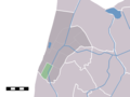 Map NL - Zijpe - Burgervlotbrug.png 800 × 600; 9 KB
-
 Floßbrücke "Burgervlotbrug" am Nordhollandkanal geöffnet.jpg 2,805 × 814; 620 KB
-
 Floßbrücke "Burgervlotbrug" am Nordhollandkanal II.jpg 3,132 × 795; 615 KB
-
 Floßbrücke "Burgervlotbrug" am Nordhollandkanal III.jpg 3,046 × 741; 575 KB
-
 Floßbrücke "Burgervlotbrug" am Nordhollandkanal.jpg 1,734 × 402; 248 KB
-
 Koestalinterieur L 7355 - Burgervlotbrug - 20488988 - RCE.jpg 915 × 888; 135 KB
-
 Koestalinterieur L 7356 - Burgervlotbrug - 20488987 - RCE.jpg 960 × 885; 141 KB
-
 Koestalinterieur L 7499 - Burgervlotbrug - 20481085 - RCE.jpg 936 × 885; 148 KB
-
 Koestalinterieur L 7500 - Burgervlotbrug - 20481088 - RCE.jpg 952 × 883; 125 KB
-
 Koestalinterieur L 7501 - Burgervlotbrug - 20481092 - RCE.jpg 944 × 885; 129 KB
-
 Koestalinterieur L 7503 - Burgervlotbrug - 20481091 - RCE.jpg 926 × 888; 129 KB
-
 Koestalinterieur L 7504 - Burgervlotbrug - 20481086 - RCE.jpg 952 × 885; 144 KB
-
 Koestalinterieur L 7505 - Burgervlotbrug - 20481090 - RCE.jpg 613 × 883; 85 KB
-
 Stalinterieur 007 - Burgervlotbrug - 20481083 - RCE.jpg 1,200 × 900; 143 KB
-
 Stalinterieur 008 - Burgervlotbrug - 20481089 - RCE.jpg 955 × 885; 140 KB
-
 Stalinterieur 0110 - Burgervlotbrug - 20481084 - RCE.jpg 931 × 891; 105 KB
-
 Stalinterieur 0111 - Burgervlotbrug - 20481087 - RCE.jpg 1,010 × 888; 156 KB
-
 Windmolen.jpg 1,280 × 852; 218 KB


