Category:Burford, Oxfordshire
Jump to navigation
Jump to search
Ænglisc: Þis gewrit is ymbe þone tūn Beorgforda in Oxanfordscīre. Sēo ēac Beorgford and stedas genemnode Beorgford.
Български: Бърфорд е град на реката Уиндръш на хълмовете Котсуолд в Оксфордшър, Англия, намиращ се на около 26 км (16 мили) западно от Оксфорд. Името произлиза от думите в Староанглийския "burh", значеща укрепен град или град на хълм, и "ford" със значение на брод. Населението на града е 1 340 души.
English: Burford ( west of Oxford. The name derives from the Old English words burh meaning fortified town or hilltown and ford meaning ford.
Español: Burford es una localidad británica perteneciente al Condado de Oxon, en el margen del Río Windrush, 26 km al oeste de Oxford. Tenía una población de 1.340 habitantes en 2001.
Français : Burford est une petite ville des Cotswolds, à côté du fleuve la Windrush dans l'Oxfordshire, en Angleterre. Elle se trouve à 27 kilomàtres à l'ouest d'Oxford.
Nederlands: Burford is een stadje aan de rivier de Windrush in het district West Oxfordshire in het graafschap Oxfordshire in het Verenigd Koninkrijk, circa 30 km ten westen van Oxford. De naam komt van het Oudengelse burh (burcht(?), heuvel) en ford (voorde, doorwaadbare plaats).
Polski: Burford - miasto w Wielkiej Brytanii, w Anglii, w regionie South East England, w hrabstwie Oxfordshire. W 2001r. miasto to zamieszkiwało 5 972 osób.
Română: Burford este un oraş în comitatul Oxfordshire, regiunea South East, Anglia. Oraşul aparţine districtului West Oxfordshire.
town and civil parish in West Oxfordshire, Oxfordshire, England  | |||||
| Upload media | |||||
| Instance of | |||||
|---|---|---|---|---|---|
| Location | West Oxfordshire, Oxfordshire, South East England, England | ||||
| Located in or next to body of water | |||||
| Population |
| ||||
| Said to be the same as | Burford (Wikimedia duplicated page, civil parish) | ||||
| official website | |||||
 | |||||
Subcategories
This category has the following 9 subcategories, out of 9 total.
B
- Burford Bridge (13 F)
M
- Clare Moody (politician) (12 F)
S
- Signet, Oxfordshire (7 F)
U
- Upton, West Oxfordshire (3 F)
V
Media in category "Burford, Oxfordshire"
The following 200 files are in this category, out of 326 total.
(previous page) (next page)-
 -i---i- (14806969880).jpg 3,264 × 2,448; 3.4 MB
-
 002osd000000020u00116000.jpg 4,000 × 2,470; 3.47 MB
-
 2002 Ford Puma.jpg 4,608 × 3,456; 5.77 MB
-
 2006 Alfa Romeo Brera.jpg 4,608 × 3,456; 1.95 MB
-
 2017 Mazda MX-5.jpg 4,608 × 3,456; 2.7 MB
-
 A river runs through it - geograph.org.uk - 2987860.jpg 1,842 × 2,771; 1.41 MB
-
 A view over the Windrush Valley - geograph.org.uk - 4052544.jpg 1,500 × 999; 140 KB
-

-
 A361 heading into Burford - geograph.org.uk - 2679184.jpg 640 × 480; 80 KB
-
 A361 towards Burford - geograph.org.uk - 6371998.jpg 1,024 × 684; 179 KB
-
 A361 View - geograph.org.uk - 2792190.jpg 800 × 600; 164 KB
-
 A40 at Boundary Covert - geograph.org.uk - 2512836.jpg 640 × 480; 62 KB
-
 A40 at the B4020 junction, Burford - geograph.org.uk - 2512866.jpg 640 × 480; 64 KB
-
 A40 at the B4425 junction - geograph.org.uk - 2512838.jpg 640 × 480; 61 KB
-
 A40 at the Westwell junction - geograph.org.uk - 2512860.jpg 640 × 480; 83 KB
-
-
-
 A40 towards Oxford - geograph.org.uk - 6371992.jpg 1,024 × 684; 218 KB
-
 A40 towards Oxford, Burford - geograph.org.uk - 6371995.jpg 1,024 × 684; 271 KB
-
 A40 trunk road - geograph.org.uk - 6273990.jpg 3,116 × 2,168; 2.16 MB
-
 A424 leaving Burford - geograph.org.uk - 1226527.jpg 640 × 427; 85 KB
-

-
 Afternoon browsers - geograph.org.uk - 2603608.jpg 800 × 601; 388 KB
-
-
 Approaching Burford on the A424 - geograph.org.uk - 1218254.jpg 640 × 480; 71 KB
-
 Approaching Whitehills Farm - geograph.org.uk - 6592432.jpg 4,608 × 3,456; 6.69 MB
-
 Autumn colour in Tanners Lane, Burford - geograph.org.uk - 1590727.jpg 640 × 427; 120 KB
-
 B4020 Shilton Road junction with A40 - geograph.org.uk - 3054620.jpg 3,648 × 2,736; 1.44 MB
-
 B4020 Shilton Road northwest of Whitehills Farm - geograph.org.uk - 3054610.jpg 2,995 × 2,379; 1.13 MB
-
 B4020 Shilton Road south of Whitehills Farm - geograph.org.uk - 3054589.jpg 3,648 × 2,439; 1.39 MB
-
 Bale tomb, Burford (geograph 7097335).jpg 4,187 × 2,630; 1.66 MB
-
 Bale tombs, Burford - geograph.org.uk - 5121281.jpg 640 × 480; 71 KB
-
 Barrington, UK - panoramio.jpg 2,592 × 1,944; 2.21 MB
-
 Bear Court, Burford (geograph 7096518).jpg 2,350 × 3,495; 1.12 MB
-

-
 Benchmark on 'The Old Court' - geograph.org.uk - 5213643.jpg 665 × 1,024; 236 KB
-
 Bend in the Carterton-Burford road - geograph.org.uk - 6592422.jpg 4,608 × 3,456; 6.78 MB
-
 Berrington Heights - geograph.org.uk - 213751.jpg 640 × 480; 109 KB
-
 Black signpost on a Burford corner - geograph.org.uk - 5654402.jpg 800 × 726; 127 KB
-
 Branch of the River Windrush, Burford, Oxon - geograph.org.uk - 6605887.jpg 1,024 × 681; 196 KB
-
 Bridge at Burford - geograph.org.uk - 6617948.jpg 6,000 × 4,000; 4.26 MB
-

-

-

-
 Bridge over the Windrush, Burford - geograph.org.uk - 6350547.jpg 1,600 × 1,040; 465 KB
-
 Bridleway to Mount Zion Bottom - geograph.org.uk - 6592441.jpg 4,608 × 3,456; 7.61 MB
-

-

-
 Floral display in Burford - geograph.org.uk - 1417622.jpg 640 × 451; 127 KB
-
 Burford , Tanner's Lane - geograph.org.uk - 6113440.jpg 6,000 × 4,000; 7.73 MB
-
 Burford , The A40 - geograph.org.uk - 6113443.jpg 6,000 × 4,000; 6.3 MB
-
 Burford , The Hill A361 - geograph.org.uk - 6113442.jpg 6,000 × 4,000; 4.28 MB
-
 Burford - geograph.org.uk - 484969.jpg 640 × 375; 72 KB
-
 Burford - The Hill - geograph.org.uk - 6406866.jpg 1,798 × 1,198; 402 KB
-
 Burford Bank Holiday Monday car boot sale - geograph.org.uk - 4973162.jpg 4,000 × 3,000; 4.77 MB
-
 Burford banner harvest, stubble fields and straw bales.jpg 3,043 × 435; 1.49 MB
-
 Burford Benches - geograph.org.uk - 2787045.jpg 800 × 577; 174 KB
-
 Burford Birds - geograph.org.uk - 2792955.jpg 800 × 600; 206 KB
-
 Burford Bridge and River Windrush, Burford, Oxon - geograph.org.uk - 6620584.jpg 1,024 × 681; 207 KB
-
 Burford Ducks - geograph.org.uk - 2792067.jpg 800 × 600; 141 KB
-
 Burford Island - geograph.org.uk - 2793016.jpg 800 × 600; 167 KB
-
 Burford Oxfordshire - geograph.org.uk - 2392987.jpg 1,376 × 976; 344 KB
-
 Burford Pavement - geograph.org.uk - 2792160.jpg 600 × 800; 142 KB
-
 Burford River - geograph.org.uk - 2792969.jpg 800 × 600; 134 KB
-
 Burford Roundabout - geograph.org.uk - 2201041.jpg 640 × 480; 78 KB
-
 Burford Stevage.jpeg 2,289 × 1,439; 1.61 MB
-
 Burford Stream - geograph.org.uk - 2792960.jpg 600 × 800; 177 KB
-
 Burford War Memorial - geograph.org.uk - 6699248.jpg 1,024 × 576; 139 KB
-
 Burford Weir - geograph.org.uk - 2792974.jpg 800 × 600; 151 KB
-
 Burford, Church Lane car park - geograph.org.uk - 4482791.jpg 5,520 × 3,680; 7.6 MB
-
 Burford, Church Lane car park - geograph.org.uk - 4482801.jpg 5,432 × 2,743; 7.72 MB
-
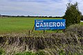 Burford, David Cameron election poster - geograph.org.uk - 4470107.jpg 3,678 × 2,456; 5.97 MB
-
 Burford, England (50231083788).jpg 4,831 × 3,107; 2.25 MB
-
 Burford, Oxfordshire, August 2006 harvest, stubble fields and straw bales 1.jpg 3,159 × 2,096; 6.79 MB
-
 Burford, Oxfordshire, August 2006 harvest, stubble fields and straw bales 2.jpg 2,532 × 2,202; 6.49 MB
-
 Burford, view down the hill - geograph.org.uk - 1095395.jpg 640 × 533; 93 KB
-
 Burford, view up the hill - geograph.org.uk - 1095396.jpg 640 × 479; 101 KB
-
 Car park entrance in Burford - geograph.org.uk - 1578682.jpg 640 × 480; 110 KB
-
 Car park in Burford - geograph.org.uk - 1521656.jpg 640 × 427; 94 KB
-
 Catholic Church of St John Fisher ^ St Thomas More - geograph.org.uk - 6636449.jpg 6,000 × 4,000; 5.26 MB
-
 Cattle by the River Windrush - geograph.org.uk - 6623702.jpg 5,846 × 3,897; 5.56 MB
-
 Clock Information - geograph.org.uk - 4352361.jpg 533 × 800; 89 KB
-
 Dead. Cardinal Beetle. Pyrochroaserraticornis - Flickr - gailhampshire.jpg 1,433 × 1,314; 218 KB
-
 DO NOT walk on the Gabion Baskets, Burford - geograph.org.uk - 6350568.jpg 1,089 × 1,515; 686 KB
-
 Down Pytts Lane, Burford - geograph.org.uk - 6421734.jpg 1,099 × 1,310; 316 KB
-

-
 Downstream along the Windrush, Burford - geograph.org.uk - 6350558.jpg 1,600 × 1,200; 632 KB
-
 Drinking point by the River Windrush - geograph.org.uk - 6623734.jpg 6,000 × 4,000; 5.91 MB
-
 Drive to Petyt House - geograph.org.uk - 4192575.jpg 640 × 480; 129 KB
-
 Ducks at Burford - geograph.org.uk - 553931.jpg 640 × 480; 78 KB
-
 Ducks on the Windrush - geograph.org.uk - 4343601.jpg 1,024 × 683; 218 KB
-
 East along Swan Lane, Burford - geograph.org.uk - 5670491.jpg 800 × 458; 121 KB
-

-
 Empty car park in Burford - geograph.org.uk - 1521628.jpg 640 × 427; 68 KB
-
-
 Entering Burford on the A361 - geograph.org.uk - 2651649.jpg 640 × 480; 97 KB
-
 Extension to Guildenford Car Park, Burford, Oxon - geograph.org.uk - 6610741.jpg 1,024 × 681; 203 KB
-

-
 Farmland at Westwell - geograph.org.uk - 5616423.jpg 3,264 × 2,448; 5.33 MB
-
 Field near Burford - geograph.org.uk - 6623739.jpg 6,000 × 4,000; 5.58 MB
-
 Fields and woods south of Taynton - geograph.org.uk - 2706411.jpg 2,592 × 1,944; 1.31 MB
-
 Fields in the Windrush Valley - geograph.org.uk - 4017056.jpg 1,500 × 999; 129 KB
-
 Fields near Burford - geograph.org.uk - 2706384.jpg 2,592 × 1,944; 1.74 MB
-
 Figures on the roundabout - geograph.org.uk - 1591721.jpg 640 × 480; 157 KB
-
 Flooded fields east of Burford - geograph.org.uk - 3853797.jpg 640 × 480; 49 KB
-
 Flooded Windrush Valley - geograph.org.uk - 6371233.jpg 1,024 × 768; 249 KB
-
 Footbridge over a stream, near Burford, Oxon - geograph.org.uk - 5051835.jpg 1,024 × 732; 297 KB
-
 Footbridge over the A40 - geograph.org.uk - 1942799.jpg 640 × 480; 84 KB
-

-
 Free car park in Burford - geograph.org.uk - 6350561.jpg 1,600 × 1,027; 352 KB
-
 Free car park this way, Burford - geograph.org.uk - 5658266.jpg 764 × 800; 141 KB
-
 Further up Guildenford - geograph.org.uk - 4343702.jpg 1,024 × 683; 101 KB
-
 Green by the A40, Burford - geograph.org.uk - 5544736.jpg 2,304 × 1,728; 792 KB
-
 Guildenford - geograph.org.uk - 4343606.jpg 1,024 × 683; 188 KB
-
 Guildenford Car Park, Burford, Oxon - geograph.org.uk - 6608949.jpg 1,024 × 681; 142 KB
-
 Guildenford, Burford - geograph.org.uk - 5654398.jpg 672 × 800; 115 KB
-
 Guildenford, Burford, Oxon - geograph.org.uk - 6619446.jpg 1,024 × 673; 199 KB
-
 Heading into Burford from Widford - geograph.org.uk - 791036.jpg 640 × 427; 88 KB
-
 Heading towards Burford - geograph.org.uk - 1479468.jpg 640 × 427; 79 KB
-
 Hidden Yard - geograph.org.uk - 4344765.jpg 533 × 800; 133 KB
-
 Island View - geograph.org.uk - 2792181.jpg 800 × 600; 152 KB
-
 Job's Lane - geograph.org.uk - 2679186.jpg 640 × 480; 112 KB
-
 Job's Lane - geograph.org.uk - 2679188.jpg 640 × 480; 88 KB
-
 Lay-by on the A361 - geograph.org.uk - 1527308.jpg 640 × 427; 91 KB
-
 Layby on the A40 near Widford - geograph.org.uk - 5863876.jpg 2,048 × 1,536; 1.52 MB
-
 Leaving Burford by the Aldsworth road - geograph.org.uk - 2706396.jpg 2,592 × 1,944; 1.9 MB
-
 Longhorn Beetle. Leptura livida. Cerambycidae - Flickr - gailhampshire.jpg 1,362 × 1,260; 223 KB
-
 Looking north across the Windrush valley - geograph.org.uk - 2706420.jpg 2,592 × 1,944; 1.3 MB
-
 Looking over the Windrush Valley - geograph.org.uk - 4017041.jpg 1,500 × 999; 116 KB
-
 Mallard pair at Burford, Oxfordshire, England.jpg 640 × 483; 72 KB
-
 Market Plantation from the Upton Road - geograph.org.uk - 4882703.jpg 1,600 × 1,066; 555 KB
-

-

-
 Mill Stream, Burford - geograph.org.uk - 1917935.jpg 3,648 × 2,736; 5.22 MB
-
 Mount Zion Bottom - geograph.org.uk - 324590.jpg 640 × 480; 136 KB
-
 Mount Zion Bottom, looking East - geograph.org.uk - 325215.jpg 640 × 480; 118 KB
-
 Oil Seed Rape Field near Signet Hill - geograph.org.uk - 2698621.jpg 2,256 × 1,496; 982 KB
-
 Old George Yard Burford Geograph-2603587-by-Jonathan-Billinger.jpg 800 × 558; 425 KB
-
 Old Milestone by White Hill, Burford Parish (geograph 6044911).jpg 527 × 800; 284 KB
-
 Optare Solo KX56 TXO Burford.jpg 1,280 × 853; 647 KB
-
 Optare SoloSR LP12BUS Burford.jpg 1,280 × 719; 597 KB
-
 Ordnance Survey Cut Mark - geograph.org.uk - 5764924.jpg 416 × 640; 87 KB
-
 Ordnance Survey Cut Mark - geograph.org.uk - 5764926.jpg 640 × 390; 103 KB
-
 Ordnance Survey Flush Bracket (S6430) - geograph.org.uk - 5764921.jpg 430 × 640; 108 KB
-
 Oxford Road to Cheltenham - geograph.org.uk - 4052530.jpg 1,500 × 999; 200 KB
-
 Oxfordshire Countryside - geograph.org.uk - 1917494.jpg 3,648 × 2,736; 3.71 MB
-

-
 P1010005 (4).jpg 1,365 × 910; 893 KB
-
 P1010006 (4).jpg 1,507 × 1,004; 1.03 MB
-
 P1010007 (4).jpg 1,588 × 1,058; 1.14 MB
-
 P1010010 (4).jpg 1,644 × 1,096; 1.3 MB
-
 P1010011 (4).jpg 1,920 × 1,280; 1.55 MB
-
 P1040504 - Flickr - gailhampshire.jpg 948 × 816; 199 KB
-
 P1040511 - Flickr - gailhampshire.jpg 1,362 × 1,226; 230 KB
-
 Passageway to Sylvester Close, Burford, Oxon - geograph.org.uk - 6610747.jpg 1,024 × 681; 261 KB
-
 Path beside the river - geograph.org.uk - 4350028.jpg 1,024 × 683; 251 KB
-

-
 Optare Solo KX56 TXP Burford.jpg 1,280 × 720; 654 KB
-
 Optare Solo SR OU13 DZE Burford.jpg 795 × 795; 545 KB
-
 Private Path - geograph.org.uk - 4344757.jpg 533 × 800; 93 KB
-
 Private woodland - geograph.org.uk - 1516158.jpg 640 × 427; 125 KB
-
 Public footpath to Widford, Oxon - geograph.org.uk - 5051898.jpg 1,024 × 683; 222 KB
-

-

-

-
 Pulhams8011.jpg 1,365 × 910; 904 KB
-
 Recycling area in Burford - geograph.org.uk - 6350542.jpg 1,600 × 1,278; 587 KB
-

-
 River Windrush - geograph.org.uk - 1826976.jpg 1,728 × 1,152; 640 KB
-
 River Windrush - geograph.org.uk - 324588.jpg 640 × 480; 81 KB
-
 River Windrush - geograph.org.uk - 3274681.jpg 640 × 480; 67 KB
-

-

-

-
 River Windrush near Burford, Oxon - geograph.org.uk - 5051719.jpg 1,024 × 683; 240 KB
-
 River Windrush near Burford, Oxon - geograph.org.uk - 5051782.jpg 1,024 × 683; 275 KB
-
 River Windrush near Burford, Oxon - geograph.org.uk - 5051851.jpg 1,024 × 683; 272 KB
-
 River Windrush, Burford - geograph.org.uk - 233833.jpg 640 × 480; 82 KB
-
 River Windrush, Burford - geograph.org.uk - 3659869.jpg 640 × 426; 98 KB
-
 River Windrush, Burford - geograph.org.uk - 3659873.jpg 426 × 640; 75 KB
-
 River Windrush, Burford - geograph.org.uk - 3659876.jpg 640 × 640; 133 KB
-
 River Windrush, Burford, Oxon - geograph.org.uk - 6605858.jpg 1,024 × 681; 207 KB
-
 Road bridge at Burford - geograph.org.uk - 6699246.jpg 1,024 × 576; 181 KB
-
 Road into Burford - geograph.org.uk - 4661018.jpg 1,066 × 800; 302 KB
-
 Road to Burford - geograph.org.uk - 1453522.jpg 640 × 427; 73 KB
-
 Road to Widford and Swinbrook - geograph.org.uk - 5878125.jpg 1,024 × 768; 262 KB
-

-
 Roundabout on the A40 - geograph.org.uk - 6636426.jpg 6,000 × 4,000; 4.69 MB
-
 Scania AlexanderDennis Enviro300 YN64 AOR Burford front.jpg 858 × 858; 589 KB
-
 Scania AlexanderDennis Enviro300 YN64 AOR Burford.jpg 864 × 864; 559 KB
-
 Sir Lawrence - geograph.org.uk - 4353328.jpg 533 × 800; 106 KB
-
 Small square in Burford - geograph.org.uk - 4139949.jpg 640 × 480; 122 KB
-
 Snowdrops abound - geograph.org.uk - 4350052.jpg 1,024 × 683; 243 KB
-

-

-
 Stile by the River Windrush - geograph.org.uk - 6623727.jpg 6,000 × 4,000; 6.33 MB
-

-
 Tanners Lane, Burford - geograph.org.uk - 1246602.jpg 640 × 427; 113 KB
-
 Tanners Lane, Burford - geograph.org.uk - 1518489.jpg 640 × 427; 77 KB
-
 Tanners Lane, Burford - geograph.org.uk - 1590724.jpg 640 × 427; 121 KB
.jpg)


.jpg)


.jpg)


,_Burford,_Oxon_-_geograph.org.uk_-_6545126.jpg)
,_Burford,_Oxon_-_geograph.org.uk_-_6545144.jpg)


.jpg)


._-_Flickr_-_gailhampshire.jpg)


.jpg)


_-_geograph.org.uk_-_5764921.jpg)


.jpg)
.jpg)
.jpg)
.jpg)
.jpg)


