Category:Bures Hamlet
Jump to navigation
Jump to search
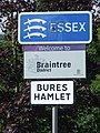
English: Bures Hamlet is a civil parish in the Braintree district of Essex, England. According to the 2001 census it had a population of 765.

civil parish in Braintree, Essex, England  | |||||
| Upload media | |||||
| Instance of | |||||
|---|---|---|---|---|---|
| Location | Braintree, Essex, East of England, England | ||||
 | |||||
Subcategories
This category has the following 3 subcategories, out of 3 total.
B
- Bures railway station (42 F)
D
- Daw's Cross (1 F)
Media in category "Bures Hamlet"
The following 130 files are in this category, out of 130 total.
-
 Artwork in Bures Railway Station Waiting Room - geograph.org.uk - 6300331.jpg 4,608 × 3,456; 3.35 MB
-
 Artwork in Bures Railway Station Waiting Room - geograph.org.uk - 6301259.jpg 2,561 × 3,331; 2.58 MB
-
 B1508 Colchester Road, Bures - geograph.org.uk - 6298426.jpg 4,608 × 3,456; 3.76 MB
-
 B1508 Colchester Road, Bures - geograph.org.uk - 6298429.jpg 4,608 × 3,456; 3.86 MB
-
 B1508 Colchester Road, Bures - geograph.org.uk - 6298759.jpg 4,608 × 3,456; 3.85 MB
-
 Barn and bales - geograph.org.uk - 4371267.jpg 640 × 480; 104 KB
-
 Barn and bales - geograph.org.uk - 4371292.jpg 640 × 480; 104 KB
-
 Bench in Bures Railway Station Waiting Room - geograph.org.uk - 6300329.jpg 4,608 × 3,456; 3.58 MB
-
 Bridge - geograph.org.uk - 3000069.jpg 1,024 × 768; 324 KB
-
 Bures Bridge on the B1508 Bridge Street - geograph.org.uk - 6300135.jpg 4,608 × 3,456; 3.99 MB
-
 Bures Hamlet Village Green - geograph.org.uk - 6300133.jpg 4,608 × 3,456; 4.06 MB
-
 Bures Hamlet Village Name sign on Bures Bridge - geograph.org.uk - 6300130.jpg 3,948 × 2,961; 4.03 MB
-
 Bures Hamlet Village Name sign on Lamarsh Hill - geograph.org.uk - 6299512.jpg 3,849 × 2,887; 3.88 MB
-
 Bures Hamlet Village sign on the B1508 Colchester Road - geograph.org.uk - 6298877.jpg 3,456 × 4,608; 3.86 MB
-
 Bures Jubilee sign on the B1508 Colchester Road - geograph.org.uk - 6298776.jpg 3,456 × 4,608; 3.9 MB
-
 Bures junction of Colchester Road and Bridge St - geograph.org.uk - 5196098.jpg 5,184 × 3,456; 6.3 MB
-
 Bures Mill - geograph.org.uk - 3627382.jpg 1,024 × 768; 248 KB
-
 Bures Railway Station car park - geograph.org.uk - 6298868.jpg 4,608 × 3,456; 3.89 MB
-
 Bures Railway Station car park - geograph.org.uk - 6298909.jpg 4,608 × 3,456; 3.74 MB
-
 Bures Railway Station car park - geograph.org.uk - 6299053.jpg 4,608 × 3,456; 4.33 MB
-
 Bures Railway Station car park sign - geograph.org.uk - 6298871.jpg 2,959 × 3,945; 4.61 MB
-
 Bures Railway Station Waiting Room - geograph.org.uk - 6298883.jpg 3,897 × 2,923; 3.9 MB
-
 Bures Station over the years - geograph.org.uk - 6301217.jpg 3,456 × 4,608; 4.13 MB
-
 Bures Station Postbox - geograph.org.uk - 6299565.jpg 4,608 × 3,456; 3.97 MB
-
 Bures Station Postbox - geograph.org.uk - 6299566.jpg 3,456 × 4,608; 3.82 MB
-
 Bures Station Postbox - geograph.org.uk - 6299813.jpg 3,456 × 4,608; 4.06 MB
-
 Bures Village Sign - geograph.org.uk - 3002306.jpg 1,024 × 768; 239 KB
-
 Bures Village sign on the B1508 Colchester Road - geograph.org.uk - 6298781.jpg 3,456 × 4,608; 3.75 MB
-
 Bures Village sign on the B1508 Colchester Road - geograph.org.uk - 6298786.jpg 3,456 × 4,608; 4.37 MB
-
 Bus Shelter on the B1508 Colchester Road - geograph.org.uk - 6298434.jpg 4,608 × 3,456; 3.93 MB
-
 Colne Road leading to Bures - geograph.org.uk - 800781.jpg 640 × 480; 75 KB
-
 Country lane from Bures to Lamarsh - geograph.org.uk - 4907651.jpg 1,600 × 1,200; 562 KB
-
 Country Road - geograph.org.uk - 3001942.jpg 768 × 1,024; 260 KB
-
 Country Track - geograph.org.uk - 3626849.jpg 768 × 1,024; 372 KB
-
 County Boundary Sign - geograph.org.uk - 3002322.jpg 768 × 1,024; 254 KB
-
 County Boundary Sign - geograph.org.uk - 3626835.jpg 768 × 1,024; 231 KB
-
 Drainage ditch and meadow, Bures - geograph.org.uk - 860248.jpg 427 × 640; 109 KB
-
 Entering Bures Hamlet on Lamarsh Hill - geograph.org.uk - 6299502.jpg 4,000 × 3,000; 4.79 MB
-
 Entrance to Bures - geograph.org.uk - 3299178.jpg 640 × 480; 76 KB
-
 Entrance to Pricketts Hall Farm - geograph.org.uk - 2457256.jpg 640 × 400; 117 KB
-
 Entrance to tree lined footpath - geograph.org.uk - 2457193.jpg 640 × 480; 268 KB
-
 Farm track entrance - geograph.org.uk - 2457035.jpg 640 × 400; 195 KB
-
 Farm track towards Butlers Farm - geograph.org.uk - 5431504.jpg 640 × 480; 159 KB
-
 Fields - geograph.org.uk - 2998860.jpg 1,024 × 768; 222 KB
-
 Footpath - geograph.org.uk - 2998675.jpg 1,024 × 768; 351 KB
-
 Footpath - geograph.org.uk - 3002257.jpg 768 × 1,024; 363 KB
-
 Footpath from Bures to Lamarsh. - geograph.org.uk - 5198901.jpg 5,184 × 3,456; 7.46 MB
-
 Footpath Sign - geograph.org.uk - 3002243.jpg 1,024 × 768; 219 KB
-
 Gathering in the onion harvest at Bures - geograph.org.uk - 2736268.jpg 1,024 × 768; 174 KB
-
 Houses in Bures - geograph.org.uk - 5196095.jpg 5,184 × 3,456; 5.57 MB
-
 Houses on The Paddocks - geograph.org.uk - 6298927.jpg 4,608 × 3,456; 3.99 MB
-
 Interior of Bury St. Edmunds Yard Signal Box - geograph.org.uk - 6300768.jpg 3,456 × 4,608; 3.74 MB
-
 Lamarsh Hill, Bures - geograph.org.uk - 4907630.jpg 1,600 × 1,200; 644 KB
-
 Lamarsh Hill, Bures - geograph.org.uk - 6299514.jpg 4,608 × 3,456; 3.5 MB
-
 Lamarsh Hill, Bures - geograph.org.uk - 6299515.jpg 4,608 × 3,456; 3.49 MB
-
 Lane towards Bakers Hall - geograph.org.uk - 5431510.jpg 640 × 480; 177 KB
-
 Looking from Essex into Suffolk - geograph.org.uk - 5890312.jpg 4,320 × 3,240; 4.39 MB
-
 Looking Into Essex - geograph.org.uk - 2998761.jpg 1,024 × 768; 281 KB
-
 Lower Jennies Farm, Bures Hamlet - geograph.org.uk - 2457271.jpg 640 × 480; 242 KB
-
 Minor Road - geograph.org.uk - 3001944.jpg 768 × 1,024; 236 KB
-
 Minor Road - geograph.org.uk - 3002375.jpg 1,024 × 768; 269 KB
-
 New Cut sign - geograph.org.uk - 6299596.jpg 4,608 × 3,456; 3.72 MB
-
 New Cut ^ Bures Station Postbox - geograph.org.uk - 6299518.jpg 4,608 × 3,456; 3.92 MB
-
 New Cut, Bures - geograph.org.uk - 6299606.jpg 4,608 × 3,456; 4 MB
-
 Nine sheep in a field - geograph.org.uk - 4723359.jpg 640 × 480; 86 KB
-
 Normandie Way Postbox - geograph.org.uk - 6298419.jpg 4,608 × 3,456; 3.98 MB
-
 Normandie Way Postbox - geograph.org.uk - 6298422.jpg 3,456 × 4,608; 4.13 MB
-
 Normandie Way Postbox - geograph.org.uk - 6298435.jpg 4,608 × 3,456; 3.92 MB
-
 Normandie Way Postbox - geograph.org.uk - 6298733.jpg 2,827 × 3,769; 3.8 MB
-
 Normandie Way sign - geograph.org.uk - 6298424.jpg 4,608 × 3,456; 3.99 MB
-
 Normandie Way sign - geograph.org.uk - 6298739.jpg 4,608 × 3,456; 3.93 MB
-
 Normandie Way, Bures - geograph.org.uk - 6298431.jpg 4,608 × 3,456; 3.91 MB
-
 Normandie Way, Bures - geograph.org.uk - 6298433.jpg 4,608 × 3,456; 3.8 MB
-
 Parsonage Hill sign - geograph.org.uk - 6299516.jpg 4,608 × 3,456; 4.34 MB
-
 Parsonage Hill, Bures - geograph.org.uk - 6299517.jpg 4,608 × 3,456; 4.1 MB
-
 Path to the Car Park ^ The Paddocks - geograph.org.uk - 6299138.jpg 4,608 × 3,456; 3.87 MB
-
 Piled bales near Polstead's Farm - geograph.org.uk - 4367866.jpg 640 × 480; 118 KB
-
 Pillbox by the River Stour - geograph.org.uk - 5198918.jpg 5,202 × 2,800; 3.08 MB
-
 Pillbox next to Bridge Street Bures - geograph.org.uk - 1626371.jpg 640 × 480; 130 KB
-
 Ploughed field - geograph.org.uk - 4371254.jpg 640 × 480; 118 KB
-
 Poster in Bures Railway Station Waiting Room - geograph.org.uk - 6301269.jpg 2,880 × 3,834; 3.09 MB
-
 Potholed track - geograph.org.uk - 4371286.jpg 640 × 480; 90 KB
-
 Railway Bridge - geograph.org.uk - 3002252.jpg 1,024 × 768; 286 KB
-
 Railway bridge, Bures - geograph.org.uk - 3299180.jpg 640 × 480; 77 KB
-
 Repairs - geograph.org.uk - 3001932.jpg 768 × 1,024; 264 KB
-
 River Stour at Bures - geograph.org.uk - 860058.jpg 427 × 640; 114 KB
-
 River Stour off Bures Bridge - geograph.org.uk - 6300128.jpg 4,608 × 3,456; 4.32 MB
-
 River Stour off Bures Bridge - geograph.org.uk - 6300129.jpg 4,608 × 3,456; 3.97 MB
-
 River Stour south of Bures - geograph.org.uk - 860228.jpg 640 × 427; 102 KB
-
 River Stour south of Bures - geograph.org.uk - 860236.jpg 427 × 640; 103 KB
-
 River Stour south of Bures - geograph.org.uk - 860239.jpg 640 × 427; 106 KB
-
 River Stour, south of Bures - geograph.org.uk - 860014.jpg 640 × 427; 83 KB
-
 Road Junction - geograph.org.uk - 3002358.jpg 1,024 × 768; 208 KB
-
 Road Sign - geograph.org.uk - 3002368.jpg 1,024 × 768; 316 KB
-
 Road to Daws Cross, Bures Hamlet - geograph.org.uk - 3984250.jpg 3,648 × 2,736; 3.31 MB
-
 Roadsigns on the B1508 Colchester Road - geograph.org.uk - 6298765.jpg 4,608 × 3,456; 3.82 MB
-
 Rural Postbox - geograph.org.uk - 3001946.jpg 1,024 × 768; 266 KB
-
 Rural road junction - geograph.org.uk - 2457006.jpg 640 × 480; 155 KB
-
 Seats at Bures Railway Station - geograph.org.uk - 6299128.jpg 4,608 × 3,456; 4.12 MB
-
 Station Hill Bures - geograph.org.uk - 6299021.jpg 4,608 × 3,456; 3.82 MB
-
 Station Hill Railway Bridge - geograph.org.uk - 6299045.jpg 3,456 × 4,608; 3.92 MB
-
 Station Hill sign - geograph.org.uk - 6298919.jpg 4,608 × 3,456; 3.81 MB
-
 Station Hill, Bures - geograph.org.uk - 6298790.jpg 4,608 × 3,456; 4.01 MB
-
 Station Hill, Bures - geograph.org.uk - 6299836.jpg 4,608 × 3,456; 3.74 MB
-
 Station Hill, Bures - geograph.org.uk - 6299838.jpg 4,608 × 3,456; 3.77 MB
-
 Stile - geograph.org.uk - 3627379.jpg 1,024 × 768; 296 KB
-
 Temporary Road - geograph.org.uk - 3001935.jpg 768 × 1,024; 343 KB
-
 The Eight Bells Public House, Bures - geograph.org.uk - 6300078.jpg 4,000 × 3,000; 3.38 MB
-
 The Ferriers - geograph.org.uk - 244395.jpg 640 × 480; 127 KB
-
 The New Millennium Footbridge, Bures - geograph.org.uk - 860038.jpg 640 × 427; 84 KB
-
 The New Millennium Footbridge, Bures - geograph.org.uk - 860046.jpg 427 × 640; 107 KB
-
 The Paddocks sign - geograph.org.uk - 6298789.jpg 4,608 × 3,456; 3.92 MB
-
 The Paddocks, Bures - geograph.org.uk - 6298791.jpg 4,608 × 3,456; 3.99 MB
-
 The Paddocks, Bures - geograph.org.uk - 6298794.jpg 4,608 × 3,456; 3.86 MB
-
 The Paddocks, Bures - geograph.org.uk - 6299123.jpg 4,608 × 3,456; 3.84 MB
-

-
 The River Stour from the bridge at Bures - geograph.org.uk - 2183648.jpg 640 × 480; 177 KB
-
 To Ferriers Barn - geograph.org.uk - 3002248.jpg 1,024 × 768; 228 KB
-
 Track near Rye Fenn - geograph.org.uk - 3984238.jpg 3,648 × 2,736; 4.1 MB
-
 Track To Butlers Farm - geograph.org.uk - 3626845.jpg 1,024 × 768; 248 KB
-
 Track to Ferriers, Bures Hamlet - geograph.org.uk - 2457229.jpg 640 × 400; 176 KB
-
 Tractor and new hedge - geograph.org.uk - 244417.jpg 640 × 480; 75 KB
-

-
 View from Bures Station - geograph.org.uk - 1464356.jpg 640 × 480; 80 KB
-
 Village Shop - geograph.org.uk - 3002316.jpg 1,024 × 768; 235 KB
-
 Village Sign - geograph.org.uk - 3002302.jpg 768 × 1,024; 264 KB
-
 Water Lane sign - geograph.org.uk - 6298918.jpg 4,608 × 3,456; 3.98 MB
-
 Water Lane, Bures - geograph.org.uk - 6298917.jpg 4,608 × 3,456; 3.94 MB
-
 Woodland track - geograph.org.uk - 4371278.jpg 640 × 480; 178 KB
-
 Village sign at Bures Hamlet - geograph.org.uk - 373089.jpg 640 × 433; 72 KB


