Category:Bunratty Castle & Folk Park
Jump to navigation
Jump to search
Subcategories
This category has the following 9 subcategories, out of 9 total.
A
- Ardcroney Church (Bunratty) (23 F)
B
- Bothan Scoir (Bunratty) (11 F)
F
G
- Golden Vale Farmhouse (44 F)
M
- Mountain Farmhouse (Bunratty) (13 F)
R
S
- Shannon Farmhouse, Bunratty C&FP (24 F)
Media in category "Bunratty Castle & Folk Park"
The following 200 files are in this category, out of 260 total.
(previous page) (next page)-
 .Bunratty Park - Site ^7 - Farm Building - geograph.org.uk - 3046333.jpg 3,008 × 2,000; 5.39 MB
-
 .Bunratty Park - Site ^7 - Farm Building - geograph.org.uk - 3046337.jpg 3,008 × 2,000; 4.16 MB
-
 .Bunratty Park - Site ^7 - Garden with Statue - geograph.org.uk - 3046348.jpg 1,832 × 2,746; 4.28 MB
-
 Blacksmith Forge 2016-09-03 08 1080.jpg 4,608 × 3,072; 5 MB
-
 Bunratty Castle Hotel - geograph.org.uk - 1610240.jpg 640 × 480; 71 KB
-
 Bunratty Castle Hotel interior - geograph.org.uk - 1606105.jpg 427 × 640; 79 KB
-
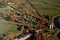 Bunratty Folk Park - Aerial View Display in the Castle - geograph.org.uk - 3041398.jpg 1,534 × 1,023; 1.06 MB
-

-
-

-

-

-

-

-

-

-
 Bunratty Folk Park - Donkey Grazing in Field near Site ^19 - geograph.org.uk - 3115970.jpg 2,430 × 1,620; 3.41 MB
-
 Bunratty Folk Park - Donkey in Field near Site ^19 - geograph.org.uk - 3115979.jpg 2,456 × 1,637; 3.36 MB
-
 Bunratty Folk Park - Entrance into Park ^ Shop - geograph.org.uk - 3114231.jpg 1,961 × 1,307; 1.72 MB
-
 Bunratty Folk Park - Goats in Field near Site ^13A - geograph.org.uk - 3115963.jpg 1,012 × 1,012; 1.43 MB
-
-
 Bunratty Folk Park - Haystack - Site^ 22 - geograph.org.uk - 1639214.jpg 640 × 426; 115 KB
-

-
 Bunratty Folk Park - Irish Wolfhound Taking a Break - geograph.org.uk - 3115877.jpg 2,164 × 1,443; 2.34 MB
-

-

-

-

-

-
 Bunratty Folk Park - Pink ^ Blue Horse-Drawn Cultivator - geograph.org.uk - 3115872.jpg 2,434 × 1,623; 4.09 MB
-
 Bunratty Folk Park - Planted Field near Site ^19 - geograph.org.uk - 3116054.jpg 2,384 × 1,589; 3.99 MB
-

-

-

-
 Bunratty Folk Park - Sheep on a Wall near Site ^7 - geograph.org.uk - 3115362.jpg 1,698 × 1,697; 2.26 MB
-
 Bunratty Folk Park - Shop adjacent to Park Entrance - geograph.org.uk - 3114216.jpg 2,780 × 1,333; 2.22 MB
-
 Bunratty Folk Park - Site ^1 - Beautiful Rooster - geograph.org.uk - 3041645.jpg 2,163 × 1,442; 2.2 MB
-
 Bunratty Folk Park - Site ^1 - Chicken by Loop Head House - geograph.org.uk - 3114254.jpg 1,828 × 1,827; 2.63 MB
-
 Bunratty Folk Park - Site ^1 - Loop Head House - geograph.org.uk - 3041565.jpg 2,894 × 1,929; 4.37 MB
-
 Bunratty Folk Park - Site ^1 - Loop Head House - geograph.org.uk - 3041578.jpg 2,905 × 1,937; 4.95 MB
-

-
 Bunratty Folk Park - Site ^1 - Loop Head House - geograph.org.uk - 3041592.jpg 1,767 × 2,650; 2.83 MB
-
 Bunratty Folk Park - Site ^1 - Loop Head House - geograph.org.uk - 3041598.jpg 2,730 × 1,910; 3.42 MB
-
 Bunratty Folk Park - Site ^1 - Loop Head House - geograph.org.uk - 3041602.jpg 2,000 × 3,000; 3.53 MB
-
 Bunratty Folk Park - Site ^1 - Loop Head House - geograph.org.uk - 3041608.jpg 1,780 × 2,670; 2.67 MB
-
 Bunratty Folk Park - Site ^1 - Loop Head House - geograph.org.uk - 3041615.jpg 2,672 × 1,781; 2.1 MB
-
 Bunratty Folk Park - Site ^1 - Loop Head House - geograph.org.uk - 3041640.jpg 2,780 × 1,853; 4.55 MB
-
 Bunratty Folk Park - Site ^1 - Loop Head House - geograph.org.uk - 3114245.jpg 2,534 × 1,689; 3.72 MB
-
 Bunratty Folk Park - Site ^1 - Loop Head House - geograph.org.uk - 3114249.jpg 2,516 × 1,677; 2.25 MB
-
 Bunratty Folk Park - Site ^1 - Loop Head House Shed - geograph.org.uk - 3041622.jpg 2,703 × 1,802; 3.99 MB
-

-
 Bunratty Folk Park - Site ^14 - Hazelbrook House - Back Side - geograph.org.uk - 3116061.jpg 1,965 × 1,310; 2.24 MB
-

-

-

-

-
 Bunratty Folk Park - Site ^2 - Blacksmith's Forge - geograph.org.uk - 3041660.jpg 2,708 × 1,805; 3.65 MB
-
 Bunratty Folk Park - Site ^2 - Blacksmith's Forge - geograph.org.uk - 3041667.jpg 3,008 × 2,000; 4.26 MB
-
 Bunratty Folk Park - Site ^2 - Blacksmith's Forge - geograph.org.uk - 3041669.jpg 2,500 × 1,667; 4.42 MB
-
 Bunratty Folk Park - Site ^21 - Vertical Mill - geograph.org.uk - 3116018.jpg 2,510 × 1,673; 3.36 MB
-

-
 Bunratty Folk Park - Site ^21 - Vertical Mill Inlet Pond - geograph.org.uk - 3116023.jpg 2,547 × 1,698; 4.38 MB
-
 Bunratty Folk Park - Site ^21 - Vertical Mill Outlet Canal - geograph.org.uk - 3116033.jpg 1,626 × 2,439; 4.03 MB
-
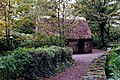
 Bunratty Folk Park - Site ^22 - Byre Dwelling - geograph.org.uk - 3116203.jpg 2,552 × 1,701; 4.95 MB
-
 Bunratty Folk Park - Site ^22 - Byre Dwelling - geograph.org.uk - 3116208.jpg 2,433 × 1,622; 3.58 MB
-

-
 Bunratty Folk Park - Site ^22 - Pigsty near Byre Dwelling - geograph.org.uk - 3116183.jpg 2,532 × 1,688; 4.63 MB
-

-
 Bunratty Folk Park - Site ^23 - Entrance-Exit - Bench - geograph.org.uk - 3041549.jpg 2,482 × 1,655; 3.79 MB
-
 Bunratty Folk Park - Site ^3 - Cashen Fisherman's House - geograph.org.uk - 3114259.jpg 2,456 × 1,637; 4.62 MB
-
 Bunratty Folk Park - Site ^3 - Cashen Fisherman's House - geograph.org.uk - 3114275.jpg 2,538 × 1,692; 4.51 MB
-
 Bunratty Folk Park - Site ^4 - Bunratty Castle - North Side - geograph.org.uk - 3116222.jpg 2,299 × 1,533; 2.93 MB
-

-
 Bunratty Folk Park - Site ^4 - Castle - Bedroom in Tower - geograph.org.uk - 3114560.jpg 2,542 × 1,695; 3.12 MB
-
 Bunratty Folk Park - Site ^4 - Castle - Cannon - geograph.org.uk - 3041753.jpg 3,008 × 2,000; 4.45 MB
-

-
 Bunratty Folk Park - Site ^4 - Castle - Chapel in Tower - geograph.org.uk - 3114570.jpg 2,284 × 1,523; 2.42 MB
-

-

-

-
 Bunratty Folk Park - Site ^4 - Castle - Fireplace - geograph.org.uk - 3114551.jpg 2,550 × 1,700; 1.93 MB
-
 Bunratty Folk Park - Site ^4 - Castle - geograph.org.uk - 3041742.jpg 1,809 × 2,714; 4.22 MB
-

-

-

-

-

-

-

-

-

-
 Bunratty Folk Park - Site ^4 - Castle - Toilet in Tower - geograph.org.uk - 3114475.jpg 1,637 × 2,455; 1.7 MB
-
 Bunratty Folk Park - Site ^4 - Castle - Top of Tower - geograph.org.uk - 3114634.jpg 2,550 × 1,700; 3.78 MB
-
 Bunratty Folk Park - Site ^4 - Castle - Top of Tower - geograph.org.uk - 3114640.jpg 1,629 × 2,444; 3.25 MB
-

-
 Bunratty Folk Park - Site ^4 - Castle - View over Wall - geograph.org.uk - 3041747.jpg 1,863 × 2,794; 2.93 MB
-
 Bunratty Folk Park - Site ^4 - Castle - View to SE - geograph.org.uk - 3041745.jpg 1,921 × 2,880; 3.73 MB
-
 Bunratty Folk Park - Site ^4 - Castle Entrance Steps - geograph.org.uk - 3041757.jpg 2,680 × 1,787; 4.02 MB
-

-

-

-
 Bunratty Folk Park - Tree with Vine near Castle - geograph.org.uk - 3041733.jpg 1,595 × 2,392; 4.6 MB
-

-

-

-
 Bunratty Folk Park - Vine-Covered Trees near Site ^19 - geograph.org.uk - 3116046.jpg 1,765 × 1,765; 3.57 MB
-

-
 Bunratty Folk Park - Walkway from Site ^14 to Site ^19 - geograph.org.uk - 3116099.jpg 2,538 × 1,692; 3.96 MB
-
 Bunratty Folk Park - Walkway from Site ^19 to Site ^14 - geograph.org.uk - 3116071.jpg 2,542 × 1,695; 4.8 MB
-
 Bunratty Folk Park - Walkway to Site ^4 - Castle - geograph.org.uk - 3041737.jpg 1,784 × 2,676; 4.1 MB
-

-
 Bunratty folk park(js).jpg 5,602 × 3,658; 13.95 MB
-
 Bunratty Folk Park, 2011 (01).jpg 4,000 × 3,000; 4.77 MB
-
 Bunratty Folk Park, 2011 (02).jpg 4,000 × 3,000; 4.71 MB
-
 Bunratty Folk Park, 2011 (03).jpg 4,000 × 3,000; 5.16 MB
-
 Bunratty Folk Park, 2011 (04).jpg 4,320 × 2,432; 4.97 MB
-
 Bunratty Folk Park, 2011 (05).jpg 4,000 × 3,000; 4.84 MB
-
 Bunratty Folk Park, 2011 (06).jpg 4,320 × 2,432; 4.54 MB
-
 Bunratty Folk Park, 2011 (07).jpg 4,000 × 3,000; 4.71 MB
-
 Bunratty Folk Park, Co. Clare - geograph.org.uk - 2260343.jpg 770 × 800; 94 KB
-
 Bunratty Folk Park1.JPG 2,592 × 1,944; 2.15 MB
-
 Bunratty House 2016-09-03 08 1306.jpg 4,608 × 3,072; 4.09 MB
-
 Bunratty House and Deer Park - geograph.org.uk - 30014.jpg 640 × 421; 86 KB
-
 Bunratty Park - East of Site ^19 - Footpath into Woods - geograph.org.uk - 3050221.jpg 1,969 × 2,954; 5.94 MB
-
 Bunratty Park - East of Site ^19 - Path into Woods - geograph.org.uk - 3050350.jpg 2,000 × 3,008; 6.58 MB
-
 Bunratty Park - Elevated Haystacks near Site ^23 - geograph.org.uk - 3047311.jpg 3,000 × 2,000; 5.36 MB
-
 Bunratty Park - Elevated Haystacks near Site ^23 - geograph.org.uk - 3047324.jpg 3,008 × 2,000; 6.52 MB
-
 Bunratty Park - Elevated Haystacks near Site ^23. - geograph.org.uk - 3047306.jpg 2,916 × 1,944; 4.49 MB
-
 Bunratty Park - Grazing Goat at Site ^13A - Traveller Wagons - geograph.org.uk - 3048903.jpg 2,781 × 1,854; 5.62 MB
-
 Bunratty Park - Irish Red Deer - geograph.org.uk - 3051638.jpg 1,681 × 2,522; 3.04 MB
-
 Bunratty Park - Irish Red Deer - geograph.org.uk - 3051643.jpg 1,863 × 2,794; 2.38 MB
-

-
 Bunratty Park - Ivy Covered Tree Trunk near Site ^14 - geograph.org.uk - 3050279.jpg 1,692 × 2,538; 2.93 MB
-
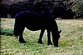
 Bunratty Park - Miniature Pony in Fenced Field - geograph.org.uk - 3048994.jpg 2,216 × 1,477; 2.12 MB
-
 Bunratty Park - Miniature Pony in Fenced Field - geograph.org.uk - 3049000.jpg 1,176 × 784; 642 KB
-

-
 Bunratty Park - Mortarless Stone Wall south of Event Field - geograph.org.uk - 3048955.jpg 3,008 × 2,000; 5.39 MB
-
 Bunratty Park - Moss-Covered Wall - geograph.org.uk - 3052395.jpg 3,008 × 2,000; 5.82 MB
-
 Bunratty Park - Multi-Coloured Ivy Leaves - geograph.org.uk - 3051770.jpg 3,008 × 2,000; 6.15 MB
-
 Bunratty Park - Pedestrian Walkway between Site ^14^19 - geograph.org.uk - 3050307.jpg 2,874 × 1,916; 4.97 MB
-
 Bunratty Park - Sheep Grazing between Sites ^3^5 - geograph.org.uk - 3045696.jpg 1,244 × 828; 903 KB
-

-
 Bunratty Park - Site ^10 - Byre-Teahouse - Cultivator - geograph.org.uk - 3046748.jpg 2,820 × 1,880; 4.48 MB
-
 Bunratty Park - Site ^10 - Byre-Teahouse - geograph.org.uk - 3046740.jpg 2,803 × 1,424; 4.13 MB
-
 Bunratty Park - Site ^10 - Byre-Teahouse - geograph.org.uk - 3046744.jpg 2,566 × 1,711; 3.65 MB
-

-
 Bunratty Park - Site ^14 - Hazelbrook House - geograph.org.uk - 3050257.jpg 2,832 × 1,888; 3.9 MB
-
 Bunratty Park - Site ^14 - Hazelbrook House - geograph.org.uk - 3050269.jpg 3,008 × 1,864; 3.88 MB
-

-
 Bunratty Park - Site ^15 - Bunratty House - geograph.org.uk - 3050493.jpg 2,626 × 1,751; 3.91 MB
-

-

-
 Bunratty Park - Site ^17 - Regency Walled Garden - geograph.org.uk - 3050377.jpg 2,805 × 1,870; 5.13 MB
-
 Bunratty Park - Site ^17 - Regency Walled Garden - geograph.org.uk - 3050381.jpg 2,906 × 1,937; 5.3 MB
-
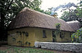
 Bunratty Park - Site ^18 - North Clare Farmhouse - geograph.org.uk - 3050446.jpg 3,008 × 2,000; 3.26 MB
-

-
 Bunratty Park - Site ^18 - North Clare Farmhouse - geograph.org.uk - 3050459.jpg 1,333 × 2,000; 986 KB
-

-

-
-

-
 Bunratty Park - Site ^18 - North Clare Farmhouse - Session - geograph.org.uk - 3050430.jpg 2,087 × 1,391; 2.47 MB
-

-

-
 Bunratty Park - Site ^18 - North Clare Farmhouse -Session - geograph.org.uk - 3050439.jpg 3,008 × 2,000; 4.47 MB
-
 Bunratty Park - Site ^19 - Wall ^ Tree east of Church - geograph.org.uk - 3050342.jpg 1,938 × 2,930; 4.21 MB
-
 Bunratty Park - Site ^20 - Horizontal Mill - geograph.org.uk - 3050182.jpg 2,824 × 1,883; 3.57 MB
-
 Bunratty Park - Site ^20 - Horizontal Mill - Inlet Side - geograph.org.uk - 3050158.jpg 2,880 × 1,920; 5.7 MB
-

-

-

-
 Bunratty Park - Site ^20- Horizontal Mill - Upstream Pond - geograph.org.uk - 3050089.jpg 3,008 × 2,000; 5.97 MB
-

-
 Bunratty Park - Site ^21 - Vertical Mill - East Side - geograph.org.uk - 3049056.jpg 2,914 × 1,943; 6.1 MB
-
 Bunratty Park - Site ^21 - Vertical Mill - geograph.org.uk - 3049029.jpg 2,973 × 1,982; 4.08 MB
-
 Bunratty Park - Site ^21 - Vertical Mill - geograph.org.uk - 3049050.jpg 1,781 × 2,672; 4.44 MB
-

-
-

-
 Bunratty Park - Site ^21 - Vertical Mill ^ Outlet Channel - geograph.org.uk - 3050002.jpg 1,845 × 2,768; 3.94 MB
-
 Bunratty Park - Site ^22 - Byre Dwelling - geograph.org.uk - 3051874.jpg 640 × 427; 145 KB
-
 Bunratty Park - Site ^22 - Byre Dwelling - geograph.org.uk - 3051962.jpg 3,008 × 2,000; 6.09 MB
-
 Bunratty Park - Site ^22 - Byre Dwelling - Protected Peat - geograph.org.uk - 3051966.jpg 3,008 × 2,000; 5.65 MB
-
 Bunratty Park - Site ^22 - Byre Dwelling Interior - Bedroom - geograph.org.uk - 3051929.jpg 1,894 × 2,841; 3.52 MB
-

-
 Bunratty Park - Site ^22 - Byre Dwelling Interior - Cupboard - geograph.org.uk - 3051909.jpg 2,000 × 3,008; 3.33 MB
-

-

-
 Bunratty Park - Site ^22 - Pigsty - geograph.org.uk - 3051881.jpg 2,747 × 1,831; 4.8 MB
-
 Bunratty Park - Site ^22 - Pigsty - geograph.org.uk - 3051944.jpg 1,806 × 1,204; 2.15 MB
-
 Bunratty Park - Site ^22 - Pigsty - geograph.org.uk - 3051950.jpg 1,828 × 2,742; 4.22 MB
-
 Bunratty Park - Site ^22 - Pigsty - geograph.org.uk - 3051953.jpg 2,926 × 1,951; 5.53 MB
-
 Bunratty Park - Site ^22 - Pigsty ^ Byre Dwelling - geograph.org.uk - 3051959.jpg 3,008 × 2,000; 5.31 MB
-
 Bunratty Park - Site ^23 - Corn Barn - Chicken - geograph.org.uk - 3051967.jpg 1,065 × 1,598; 1.4 MB
-
 Bunratty Park - Site ^23 - Corn Barn - geograph.org.uk - 3046759.jpg 640 × 265; 53 KB
-
 Bunratty Park - Site ^23 - Corn Barn - geograph.org.uk - 3046761.jpg 2,916 × 1,937; 4.31 MB
-
 Bunratty Park - Site ^23 - The Corn Barn - geograph.org.uk - 3047282.jpg 2,808 × 1,872; 3.36 MB
-
 Bunratty Park - Site ^23 - The Corn Barn - geograph.org.uk - 3047287.jpg 2,646 × 1,764; 3.67 MB
-
 Bunratty Park - Site ^23 - The Corn Barn - geograph.org.uk - 3047292.jpg 2,688 × 1,792; 3.55 MB
-


.jpg)
.jpg)
.jpg)
.jpg)
.jpg)
.jpg)
.jpg)
.jpg)


