Category:Buitenhof 34, The Hague
Jump to navigation
Jump to search
| Object location | | View all coordinates using: OpenStreetMap |
|---|
| NO WIKIDATA ID FOUND! Search for Buitenhof 34, The Hague on Wikidata | |
| Upload media |
|
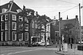
This is a category about rijksmonument number 17488
|
| Address |
|
Subcategories
This category has only the following subcategory.
G
Media in category "Buitenhof 34, The Hague"
The following 8 files are in this category, out of 8 total.
-
 Den Haag - Buitenhof 34.JPG 3,056 × 4,592; 4.11 MB
-
 DenHaag Buitenhof34.jpg 2,736 × 3,648; 4.43 MB
-
 Noordelijke gevel van valkenhofvleugel - 's-Gravenhage - 20088293 - RCE.jpg 954 × 1,200; 241 KB
-
 Oostelijke gevel valkenhofvleugel - 's-Gravenhage - 20088291 - RCE.jpg 1,200 × 951; 280 KB
-
 Oostelijke gevel van valkenhofvleugel - 's-Gravenhage - 20088290 - RCE.jpg 1,200 × 957; 281 KB
-
 Overzicht - 's-Gravenhage - 20088288 - RCE.jpg 1,200 × 804; 165 KB
-
 Westelijke gevel valkenhofvleugel - 's-Gravenhage - 20088294 - RCE.jpg 955 × 1,200; 260 KB
-
 Zuid-west hoek valkhof achter nr. - 's-Gravenhage - 20088295 - RCE.jpg 961 × 1,200; 250 KB


