Category:Buildings in Sedgley
Jump to navigation
Jump to search

Subcategories
This category has the following 4 subcategories, out of 4 total.
R
- Red Lion, Sedgley (3 F)
S
- All Saints' Church, Sedgley (10 F)
- The Seven Stars, Sedgley (3 F)
Media in category "Buildings in Sedgley"
The following 93 files are in this category, out of 93 total.
-
 "To the Pub" Christmas Day - geograph.org.uk - 639879.jpg 640 × 640; 131 KB
-
 Alan Warwick Butcher - geograph.org.uk - 1580641.jpg 480 × 640; 96 KB
-
 All Saints Church Hall - geograph.org.uk - 914857.jpg 640 × 480; 73 KB
-
 All Saints Churchyard - geograph.org.uk - 575918.jpg 640 × 480; 68 KB
-
 Beacon and Brewery - geograph.org.uk - 414152.jpg 640 × 480; 96 KB
-
 Beacon Charity Shop - geograph.org.uk - 598545.jpg 640 × 480; 56 KB
-
 BULLS HEAD HOLDENS BREWERY SEDGELEY WEST MIDLANDS JUNE 2013 (9054504673).jpg 3,496 × 2,634; 8.96 MB
-
 C D Field Butchers - geograph.org.uk - 1580636.jpg 640 × 480; 91 KB
-
 Coppice Baptist Chapel - geograph.org.uk - 268687.jpg 600 × 450; 187 KB
-
 Elite Hairdressing Sedgley - geograph.org.uk - 1075599.jpg 640 × 480; 57 KB
-
 End of Somerfield - geograph.org.uk - 1757232.jpg 640 × 480; 64 KB
-
 Horse and Jockey - geograph.org.uk - 705929.jpg 640 × 480; 80 KB
-
 Hurst Hill Tavern - geograph.org.uk - 576975.jpg 480 × 640; 49 KB
-
 Joe Jones Court - geograph.org.uk - 953770.jpg 640 × 480; 85 KB
-
 Jubilee Hall - geograph.org.uk - 418340.jpg 640 × 480; 114 KB
-
 Langland Drive Shops - geograph.org.uk - 1604083.jpg 640 × 480; 114 KB
-
 Mount Pleasant Sedgley - geograph.org.uk - 796602.jpg 480 × 640; 58 KB
-
 Northway Shopping Precinct - geograph.org.uk - 939308.jpg 640 × 480; 67 KB
-
 Northway Supermarket - geograph.org.uk - 1069656.jpg 640 × 480; 79 KB
-
 Northway Surgery - geograph.org.uk - 1225829.jpg 640 × 480; 98 KB
-
 Old houses at the top of Roberts Wynd - geograph.org.uk - 268805.jpg 640 × 480; 248 KB
-
 Old Nail Works,Sedgley - geograph.org.uk - 917746.jpg 640 × 480; 69 KB
-
 Padarn Close Housing - geograph.org.uk - 1603203.jpg 640 × 480; 125 KB
-
 Penny Farthing Arcade - geograph.org.uk - 1047077.jpg 640 × 480; 85 KB
-
 Priory Lane Sedgley - geograph.org.uk - 646733.jpg 640 × 480; 60 KB
-
 Queen Victoria School - geograph.org.uk - 917751.jpg 640 × 480; 63 KB
-
 Ridgeway Flats - geograph.org.uk - 1457816.jpg 640 × 480; 121 KB
-
 Deepest Gornal. - geograph.org.uk - 142944.jpg 640 × 526; 162 KB
-
 Ruiton Windmill - geograph.org.uk - 373084.jpg 480 × 640; 137 KB
-
 Sampling Sarah's Brews - geograph.org.uk - 414318.jpg 473 × 640; 94 KB
-
 Sarah Hughes - Home Brewed Ales - geograph.org.uk - 268983.jpg 600 × 450; 240 KB
-
 Sarah Hughes Brewery - geograph.org.uk - 268676.jpg 600 × 450; 176 KB
-
 2Tasty - geograph.org.uk - 914840.jpg 640 × 480; 87 KB
-
 Sedgley Almshouses - geograph.org.uk - 1225757.jpg 640 × 480; 72 KB
-
 Sedgley Arcade - geograph.org.uk - 1047074.jpg 480 × 640; 101 KB
-
 Sedgley Co-operative - geograph.org.uk - 1457896.jpg 480 × 640; 69 KB
-
 Sedgley Community Centre - geograph.org.uk - 459337.jpg 640 × 480; 89 KB
-
 Sedgley Ex-Serviceman's Club - geograph.org.uk - 1046145.jpg 640 × 480; 57 KB
-
 Sedgley Fire Station - geograph.org.uk - 385520.jpg 640 × 480; 149 KB
-
 Sedgley Flats - geograph.org.uk - 1201803.jpg 640 × 480; 116 KB
-
 Sedgley Health Centre - geograph.org.uk - 459345.jpg 480 × 640; 73 KB
-
 Sedgley Main Post Office - geograph.org.uk - 914818.jpg 640 × 480; 87 KB
-
 Sedgley Market - geograph.org.uk - 914849.jpg 640 × 480; 92 KB
-
 Sedgley Nick - geograph.org.uk - 415865.jpg 640 × 480; 142 KB
-
 Sedgley Red Cross Centre - geograph.org.uk - 953763.jpg 640 × 480; 98 KB
-
 Sedgley Shops - geograph.org.uk - 1457904.jpg 640 × 480; 71 KB
-
 Sedgley Youth Centre - geograph.org.uk - 1047085.jpg 640 × 480; 58 KB
-
 All Saints' Churchyard DY3 - geograph.org.uk - 575922.jpg 640 × 480; 133 KB
-
 Shell petrol filling station - geograph.org.uk - 1549150.jpg 640 × 480; 89 KB
-
 Shell Station View - geograph.org.uk - 1757240.jpg 800 × 600; 110 KB
-

-
 Snowmen in Summer - geograph.org.uk - 357704.jpg 640 × 480; 101 KB
-
 St Andrew's - geograph.org.uk - 513446.jpg 480 × 640; 88 KB
-
 St Chad's Playground - geograph.org.uk - 1580622.jpg 640 × 480; 75 KB
-
 St Chad's School - geograph.org.uk - 1580630.jpg 640 × 480; 83 KB
-
 St George's Vets - geograph.org.uk - 914829.jpg 640 × 480; 107 KB
-
 St. Chad and All Saints - geograph.org.uk - 385547.jpg 640 × 480; 121 KB
-
 Tasty Plaice - geograph.org.uk - 1225731.jpg 480 × 640; 62 KB
-
 The Bulls Head - geograph.org.uk - 513447.jpg 640 × 480; 89 KB
-
 The Cabin - geograph.org.uk - 939306.jpg 640 × 480; 94 KB
-

-
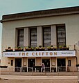
 The Clifton, Sedgley - geograph.org.uk - 1017619.jpg 640 × 480; 72 KB
-
 The Council House - geograph.org.uk - 1457889.jpg 640 × 480; 76 KB
-
 The Courthouse - geograph.org.uk - 872485.jpg 640 × 480; 52 KB
-
 The Crown Sedgley - geograph.org.uk - 796606.jpg 640 × 480; 53 KB
-
 The Dormston Centre - geograph.org.uk - 917765.jpg 640 × 480; 58 KB
-
 The Dormston School - geograph.org.uk - 513453.jpg 640 × 480; 69 KB
-
 The Quadrant - geograph.org.uk - 1063130.jpg 640 × 480; 76 KB
-

-
 The Swan Inn - geograph.org.uk - 872466.jpg 640 × 480; 54 KB
-
 The Walk meets Tower Street, Sedgley - geograph.org.uk - 1017631.jpg 640 × 480; 67 KB
-
 THE WHITE LION SEDGLEY WEST MIDLANDS JUNE 2013 (9056727374).jpg 4,883 × 2,534; 9.25 MB
-
 Thistledown Walk - geograph.org.uk - 1070373.jpg 640 × 480; 109 KB
-
 Tipton Road Methodist - geograph.org.uk - 953690.jpg 480 × 640; 89 KB
-
 Vista Flats - geograph.org.uk - 1047003.jpg 640 × 480; 69 KB
-
 WETHERSPOONS THE CLIFTON SEDGLEY WEST MIDLANDS JUNE 2013 (9056746558).jpg 2,737 × 2,889; 5.15 MB
-
 Alder Coppice School - geograph.org.uk - 422038.jpg 640 × 480; 124 KB
-
 Alderwood Precinct - geograph.org.uk - 1069651.jpg 640 × 480; 134 KB
-
 Beacon Blind Institute - geograph.org.uk - 598536.jpg 640 × 480; 72 KB
-
 Beacon Hotel near Sedgley Beacon - geograph.org.uk - 268993.jpg 600 × 450; 213 KB
-
 Fast Food and Church - geograph.org.uk - 372701.jpg 640 × 480; 121 KB
-
 Flats in Woodcross - geograph.org.uk - 268873.jpg 500 × 375; 153 KB
-
 Houses on Rock Road - geograph.org.uk - 269006.jpg 600 × 450; 263 KB
-
 Hurst Hill Tavern - geograph.org.uk - 268694.jpg 600 × 450; 179 KB
-
 Jolly Crispin, Upper Gornal - geograph.org.uk - 308130.jpg 640 × 427; 71 KB
-
 Old shop in Bath St, Sedgley - geograph.org.uk - 580706.jpg 640 × 480; 92 KB
-
 Sedgley Beacon - geograph.org.uk - 268659.jpg 500 × 525; 199 KB
-
 Sedgley Bull Ring - geograph.org.uk - 374553.jpg 640 × 480; 72 KB
-
 The Beacon Centre for the Blind - geograph.org.uk - 272346.jpg 600 × 450; 235 KB
-
 The Cabin - geograph.org.uk - 362897.jpg 640 × 480; 127 KB
-
 Unhinged Gate^ - geograph.org.uk - 268839.jpg 600 × 450; 224 KB
-
 Upper Gornal - geograph.org.uk - 372708.jpg 640 × 480; 131 KB
-
 The Sedgley House, by Cremer, James, 1821-1893.jpg 2,682 × 1,429; 1.39 MB


.jpg)


.jpg)


.jpg)


