Category:Buildings in Ramsbottom
Jump to navigation
Jump to search
Subcategories
This category has the following 10 subcategories, out of 10 total.
Media in category "Buildings in Ramsbottom"
The following 91 files are in this category, out of 91 total.
-

-
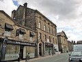
 "Davmar Construction Ltd" Garden Street, Ramsbottom - geograph.org.uk - 2126363.jpg 1,632 × 1,076; 361 KB
-

-
 "ESSO" Petrol Station, Stubbins Lane, Ramsbottom BL0 0PU - geograph.org.uk - 2160586.jpg 1,632 × 1,120; 451 KB
-

-

-

-
 Army Cadet HQ Crow Lane - geograph.org.uk - 498687.jpg 640 × 334; 51 KB
-

-
 Brewery building - geograph.org.uk - 3106523.jpg 1,024 × 768; 203 KB
-
 Buchanan Sports and Social Club - geograph.org.uk - 378235.jpg 640 × 480; 155 KB
-
 Carr Bank Lodge, Ramsbottom Lane, Ramsbottom - geograph.org.uk - 5913955.jpg 1,024 × 768; 283 KB
-
 Christ Church ^ Neighbourhood Centre - geograph.org.uk - 1933210.jpg 1,365 × 1,024; 421 KB
-
 Civic Hall Ramsbottom - geograph.org.uk - 1477782.jpg 480 × 640; 79 KB
-
 Clark Craft Products, Ramsbottom - geograph.org.uk - 1174979.jpg 640 × 480; 80 KB
-
 Co-operative Hall, Ramsbottom.jpg 1,024 × 768; 196 KB
-
 Cobden Mill - geograph.org.uk - 442786.jpg 480 × 640; 140 KB
-
 Cobden Mill, Ramsbottom - geograph.org.uk - 2174532.jpg 457 × 640; 111 KB
-

-
 Converted Flats Barley Lea Mill - geograph.org.uk - 1099131.jpg 640 × 480; 86 KB
-
 Council Chambers, Ramsbottom.jpg 1,024 × 768; 228 KB
-

-
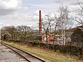
 Demolished paper mill - geograph.org.uk - 3106443.jpg 1,024 × 768; 161 KB
-
 Derelict building - geograph.org.uk - 3033646.jpg 1,024 × 850; 880 KB
-
 Derelict Mill - geograph.org.uk - 1477836.jpg 640 × 480; 71 KB
-
 Derelict Workshop 1888 - geograph.org.uk - 1419159.jpg 640 × 394; 61 KB
-
 Factory at Ramsbottom - geograph.org.uk - 4910313.jpg 640 × 480; 489 KB
-
 Flats, Garden Street, Ramsbottom - geograph.org.uk - 2126370.jpg 1,632 × 1,224; 475 KB
-
 Former bank to let, Ramsbottom - geograph.org.uk - 5910324.jpg 1,024 × 768; 159 KB
-
 Former Ramsbottom Paper Mill - geograph.org.uk - 5911353.jpg 2,816 × 2,112; 1.04 MB
-
 Formerly Market Place Methodist Church Ramsbottom - geograph.org.uk - 4223316.jpg 4,896 × 2,752; 4.67 MB
-
 Grant's Tower - geograph.org.uk - 3357354.jpg 482 × 640; 602 KB
-
 Grant's Tower - geograph.org.uk - 3357356.jpg 640 × 480; 572 KB
-
 Grant's Tower, Ramsbottom - geograph.org.uk - 3357352.jpg 640 × 481; 620 KB
-
 Grants Tower - panoramio.jpg 1,093 × 1,600; 268 KB
-

-
 Holme Mill - Cormar carpets - geograph.org.uk - 378252.jpg 640 × 480; 106 KB
-
 Houses at the northern end of Callender Street - geograph.org.uk - 5910649.jpg 1,024 × 768; 178 KB
-
 Houses in Pinners Close, Ramsbottom - geograph.org.uk - 6273292.jpg 1,024 × 683; 274 KB
-
 Irwell Works Brewery - geograph.org.uk - 2541842.jpg 3,872 × 2,592; 3.98 MB
-

-
 Kay Brow Lodge - geograph.org.uk - 354600.jpg 640 × 480; 124 KB
-
 Kay's soap factory - geograph.org.uk - 5380960.jpg 6,000 × 4,000; 5.96 MB
-
 Kay's Soap Factory Ramsbottom - geograph.org.uk - 378944.jpg 640 × 480; 96 KB
-
 Kay's soap works - close up - geograph.org.uk - 5308771.jpg 491 × 640; 119 KB
-
 Kay's soap works, Ramsbottom - geograph.org.uk - 5308763.jpg 640 × 427; 62 KB
-
 Major Hotel - geograph.org.uk - 5130798.jpg 640 × 480; 72 KB
-
 Mondi Packaging, Ramsbottom - geograph.org.uk - 2147575.jpg 640 × 480; 129 KB
-
 Oddfellows Detail - geograph.org.uk - 498856.jpg 640 × 480; 123 KB
-
 Oddfellows Hall - geograph.org.uk - 498853.jpg 640 × 434; 87 KB
-
 Paper Mill - geograph.org.uk - 355610.jpg 640 × 480; 76 KB
-

-
 Police Station - geograph.org.uk - 1319284.jpg 640 × 345; 69 KB
-
 Ramsbottom - garage and public house - geograph.org.uk - 5964550.jpg 640 × 427; 58 KB
-

-

-
 Ramsbottom Co-op - geograph.org.uk - 374384.jpg 640 × 480; 78 KB
-
 Ramsbottom Cottage Hospital - geograph.org.uk - 3311688.jpg 3,872 × 2,592; 3.12 MB
-
 Ramsbottom Cricket Club - Pavilion - geograph.org.uk - 3080880.jpg 1,600 × 1,200; 317 KB
-
 Ramsbottom Filling Station - geograph.org.uk - 277661.jpg 640 × 480; 122 KB
-
 Ramsbottom Fire Station - geograph.org.uk - 489520.jpg 640 × 480; 133 KB
-
 Ramsbottom Fire Station - geograph.org.uk - 561144.jpg 640 × 480; 72 KB
-

-
 Ramsbottom Library - geograph.org.uk - 1708645.jpg 1,024 × 768; 207 KB
-
 Ramsbottom Library - geograph.org.uk - 324804.jpg 640 × 480; 73 KB
-
 Ramsbottom Mill 2 storey Weaving Shed - geograph.org.uk - 528859.jpg 640 × 431; 47 KB
-
 Ramsbottom Mill Apprentice House - geograph.org.uk - 528856.jpg 640 × 437; 35 KB
-
 Ramsbottom Paper Mill - geograph.org.uk - 142119.jpg 640 × 426; 108 KB
-
 Ramsbottom Police Station - geograph.org.uk - 1708551.jpg 1,024 × 768; 216 KB
-
 Ramsbottom Police Station - geograph.org.uk - 3564857.jpg 4,000 × 2,248; 1.27 MB
-
 Ramsbottom Pool and Gym - geograph.org.uk - 418056.jpg 640 × 480; 149 KB
-
 Ramsbottom, Grant's Tower - geograph.org.uk - 3357353.jpg 640 × 481; 587 KB
-
 Range House - geograph.org.uk - 391593.jpg 640 × 480; 124 KB
-
 Royal British Legion Club - geograph.org.uk - 1708724.jpg 1,024 × 768; 236 KB
-

-
 Saucy - geograph.org.uk - 1914496.jpg 480 × 640; 95 KB
-
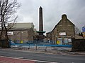
 Spencer's Mill Chimney - geograph.org.uk - 1822600.jpg 2,112 × 2,816; 978 KB
-

-
 St Pauls Church School - geograph.org.uk - 498845.jpg 640 × 435; 102 KB
-
 Station Garage Ramsbottom - geograph.org.uk - 295739.jpg 640 × 480; 71 KB
-
 Station Garage, Railway Street - geograph.org.uk - 1253732.jpg 640 × 468; 91 KB
-
 Stubbins Lane Fire Station - geograph.org.uk - 1933194.jpg 1,365 × 1,024; 250 KB
-
 Stubbins Lane Fire Station - geograph.org.uk - 1933195.jpg 1,365 × 1,024; 294 KB
-
 Stubbins Vale Mill - geograph.org.uk - 1232437.jpg 640 × 480; 65 KB
-
 Stubbins Vale Mills, 1851 - geograph.org.uk - 1232424.jpg 640 × 480; 49 KB
-
 Sub Station Datestone AD1910 - geograph.org.uk - 1532250.jpg 640 × 480; 67 KB
-
 Telephone Exchange, Crow Lane - geograph.org.uk - 1319322.jpg 640 × 480; 76 KB
-
 The demolition begins - geograph.org.uk - 4349155.jpg 6,000 × 4,000; 6.38 MB
-
 The theatre on Smithy Street, Ramsbottom - geograph.org.uk - 5910342.jpg 1,024 × 768; 186 KB
-
 Trinity-Holcombe Paper Mill, Ramsbottom, Lancashire - geograph.org.uk - 2530669.jpg 1,222 × 1,424; 393 KB
-


_-_geograph.org.uk_-_6945322.jpg)