Category:Buildings in Little Bytham
Jump to navigation
Jump to search
Subcategories
This category has the following 7 subcategories, out of 7 total.
B
L
M
S
W
Media in category "Buildings in Little Bytham"
The following 17 files are in this category, out of 17 total.
-

-

-

-
 Former Brownies Hut (geograph 3788848).jpg 4,896 × 3,672; 7.12 MB
-
 Formerly The Mallard - geograph.org.uk - 1761696.jpg 640 × 426; 76 KB
-
 Glebe Farm, Little Bytham - geograph.org.uk - 1628938.jpg 640 × 480; 56 KB
-
 Glebe Farm, Little Bytham - geograph.org.uk - 203048.jpg 640 × 480; 76 KB
-
 High Street, Little Bytham - geograph.org.uk - 1745041.jpg 640 × 427; 90 KB
-

-
 Little Bytham village hall (geograph 3788789).jpg 4,896 × 3,672; 5.01 MB
-
 Little Bytham village hall (geograph 3788793).jpg 4,896 × 3,672; 6.84 MB
-
 Looking down Church Lane, Little Bytham - geograph.org.uk - 1628841.jpg 640 × 480; 100 KB
-
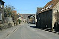
 Railway Viaduct, Little Bytham - geograph.org.uk - 1622259.jpg 640 × 480; 63 KB
-
 The Beeches - geograph.org.uk - 3788796.jpg 4,896 × 3,672; 7.11 MB
-

-
 The Tham in spate (geograph 3788770).jpg 4,896 × 3,672; 7.25 MB
-
 Viaduct, Little Bytham - geograph.org.uk - 176197.jpg 640 × 480; 76 KB


.jpg)


.jpg)
.jpg)


.jpg)
