Category:Buildings in Kielder, Northumberland
Jump to navigation
Jump to search
Subcategories
This category has the following 2 subcategories, out of 2 total.
C
- Kielder Castle (7 F)
K
- Kielder Head Bothy (6 F)
Media in category "Buildings in Kielder, Northumberland"
The following 16 files are in this category, out of 16 total.
-
 Broomylinn - geograph.org.uk - 577131.jpg 640 × 422; 172 KB
-
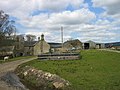
 Catcleugh - geograph.org.uk - 743462.jpg 640 × 427; 93 KB
-
 Catcleugh.jpg 640 × 421; 81 KB
-
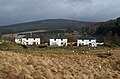
 East Kielder Farm - geograph.org.uk - 1273337.jpg 640 × 298; 69 KB
-
 East Kielder Farm - geograph.org.uk - 1273344.jpg 640 × 480; 75 KB
-
 Gauging Station - geograph.org.uk - 570122.jpg 640 × 480; 174 KB
-
 United Reformed Church - geograph.org.uk - 570168.jpg 640 × 420; 118 KB
-
 Matthews Linn, Kielder Water - geograph.org.uk - 604992.jpg 640 × 480; 147 KB
-
-
 Wainhope - geograph.org.uk - 1142749.jpg 640 × 405; 62 KB
-
 Wainhope - geograph.org.uk - 1142769.jpg 640 × 480; 87 KB
-
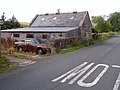
 Wainhope Abandoned Farm - geograph.org.uk - 1753799.jpg 1,718 × 1,072; 311 KB
-
 Wainhope Mountain Bothy - geograph.org.uk - 1753818.jpg 600 × 450; 317 KB
-
 Yarrowmoor - geograph.org.uk - 700893.jpg 640 × 480; 130 KB
-
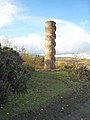 The Kielder Column, Bakethin Weir - geograph.org.uk - 604995.jpg 480 × 640; 102 KB
-
 United Reformed Church in Kielder - geograph.org.uk - 203826.jpg 640 × 480; 202 KB


