Category:Buildings in Horsforth
Jump to navigation
Jump to search
Subcategories
This category has the following 23 subcategories, out of 23 total.
- Cafés in Horsforth (9 F)
- Housing in Horsforth (13 F)
B
C
- Calverley Bridge (A6120) (17 F)
H
- Horsforth Conservative Club (2 F)
- Horsforth Museum (7 F)
L
N
P
- Packhorse Bridge, Calverley (19 F)
R
- Rawdon Crematorium (13 F)
S
Media in category "Buildings in Horsforth"
The following 33 files are in this category, out of 33 total.
-
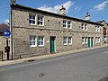 79,81 And 83, Town Street.jpg 4,608 × 3,456; 5.27 MB
-
 Across Oil Mill Beck, Horsforth - geograph.org.uk - 99334.jpg 480 × 640; 99 KB
-
 Baptist Church, With Chapel Cottage Attached.jpg 3,289 × 2,467; 1.98 MB
-
 Bar Lane, Horsforth - geograph.org.uk - 642528.jpg 640 × 480; 116 KB
-
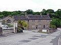
 Barn south of Low Hall Farmhouse, Horsforth.jpg 1,280 × 853; 596 KB
-

-
-
 Building - Hall Park - Hall Lane - geograph.org.uk - 748112.jpg 640 × 498; 54 KB
-
 Cemetery Lodge - Calverley Lane - geograph.org.uk - 694665.jpg 640 × 447; 68 KB
-
 Cricket pavilion, Calverley Lane - geograph.org.uk - 5000827.jpg 1,024 × 768; 225 KB
-

-

-

-
 Hayward Commercial - New Road Side - geograph.org.uk - 1600551.jpg 640 × 494; 85 KB
-
 Lee Lane Farm, Horsforth - geograph.org.uk - 289051.jpg 640 × 480; 99 KB
-
 Leeds Building Society - Town Street - geograph.org.uk - 1604619.jpg 640 × 555; 92 KB
-
 Low Fold.jpg 4,019 × 3,013; 1.99 MB
-
 Low Hall Barn, Horsforth.jpg 640 × 480; 118 KB
-
 Low Hall, Horsforth - geograph.org.uk - 406170.jpg 640 × 481; 79 KB
-
 Old Toll House (geograph 6114893).jpg 640 × 465; 293 KB
-

-
 Owlet Grange.jpg 2,812 × 1,875; 708 KB
-
 South Field - Calverley Lane - geograph.org.uk - 2458066.jpg 640 × 480; 98 KB
-
 Springfield Farm, Horsforth.jpg 1,024 × 768; 139 KB
-

-
 Stanhope Hotel, Calverley Lane, Leeds - geograph.org.uk - 4932919.jpg 1,280 × 852; 726 KB
-
 Station House With Horsforth Pottery And Barn (Both Attached).jpg 4,217 × 3,162; 3.12 MB
-
 Turner and Townsend, Calverley Lane - geograph.org.uk - 5000801.jpg 1,024 × 768; 246 KB
-
 Woodland Sheds, beside Calverley Lane - geograph.org.uk - 4862955.jpg 800 × 534; 127 KB
-
 Woodlands seen from Horsforth railway station (21st August 2020).jpg 5,152 × 3,864; 3.86 MB
-
 Woodside Methodist Hall, Horsforth.jpg 1,024 × 768; 159 KB
-

-


,_Horsforth,_Leeds_-_geograph.org.uk_-_1537047.jpg)
,_Horsforth,_Leeds_-_geograph.org.uk_-_1537067.jpg)


.jpg)


.jpg)


.jpg)


