Category:Buildings in Holyhead
Jump to navigation
Jump to search
Subcategories
This category has the following 11 subcategories, out of 11 total.
C
E
- Ellins Tower (69 F)
H
- Holyhead Town Hall (5 F)
M
- Holyhead Maritime Museum (3 F)
- Market Hall, Holyhead (6 F)
P
- Pubs in Holyhead (23 F)
S
- Shops in Holyhead (26 F)
Media in category "Buildings in Holyhead"
The following 73 files are in this category, out of 73 total.
-
 20230625 1641 Holyhead, Wales.jpg 3,648 × 2,736; 3.54 MB
-

-
 Air raid shelter - geograph.org.uk - 924597.jpg 640 × 485; 123 KB
-

-
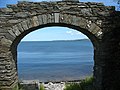 Arch leading to Pwll y Gwman - geograph.org.uk - 875141.jpg 640 × 480; 96 KB
-

-

-
 Boston Street from Victoria Road - geograph.org.uk - 877032.jpg 640 × 480; 58 KB
-
 Caergybi (3).jpg 3,968 × 2,976; 2.45 MB
-
 Caffi Empire Cafe - geograph.org.uk - 386531.jpg 640 × 480; 89 KB
-

-
 CT's Speed Feed, Opening Soon, Holyhead - panoramio.jpg 1,536 × 2,048; 2.37 MB
-
 Days of Yore. Admirality Arch - A5 - Marble Arch - panoramio.jpg 2,048 × 1,536; 1.06 MB
-
-
 Empire Cinema - geograph.org.uk - 386529.jpg 640 × 480; 80 KB
-
 Farm sheds and dairy at Penrhos Farm - geograph.org.uk - 875405.jpg 640 × 480; 70 KB
-
 Ffynnon Y Wrach, Holyhead, Anglesey. - geograph.org.uk - 123308.jpg 640 × 480; 92 KB
-

-

-
 Gunpowder Magazine, Holyhead Breakwater.jpg 5,240 × 3,912; 17.12 MB
-
 Harbour View Town houses - geograph.org.uk - 872178.jpg 640 × 410; 43 KB
-

-
 HM Coastguard Rescue Equipment Store - geograph.org.uk - 869146.jpg 640 × 480; 44 KB
-

-
 Holyhead Fire Station - geograph.org.uk - 404562.jpg 640 × 480; 51 KB
-
 Holyhead Harbour Office and Customs House.jpg 4,608 × 3,456; 3.54 MB
-
 Holyhead Harbour Office.jpg 2,494 × 2,397; 4.5 MB
-
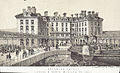 Holyhead Hotel - London & North Western Railway.jpeg 900 × 551; 364 KB
-
 Holyhead Maritime Museum - geograph.org.uk - 926876.jpg 640 × 485; 111 KB
-
 HolyheadMuseumAndHarbour.jpg 856 × 642; 65 KB
-
 Houses in Cytir Road - geograph.org.uk - 1442086.jpg 640 × 412; 59 KB
-
 Hungry Bees Cafe DSCF0920cc.jpg 1,002 × 1,000; 231 KB
-
 Infilling on Lon yr Ogof - geograph.org.uk - 895164.jpg 640 × 480; 61 KB
-
-

-

-

-
 Market place, Holy Head, Anglesea.jpeg 900 × 664; 421 KB
-
 McDonalds, Kingsland Road - geograph.org.uk - 895973.jpg 640 × 305; 37 KB
-
 Melin-yr-Ogof, Kingsland - geograph.org.uk - 895127.jpg 640 × 480; 75 KB
-
 Modern developments in Parc Road - geograph.org.uk - 1414289.jpg 640 × 357; 51 KB
-

-
 Penrhos Farmhouse - geograph.org.uk - 875399.jpg 640 × 414; 64 KB
-
 Plas Alltran, Holyhead 01.jpg 2,304 × 3,456; 2.71 MB
-
 Plas Alltran, Holyhead 02.jpg 2,304 × 3,456; 2.76 MB
-

-
 St Georges Mill, Kingsland (geograph 4619905).jpg 2,448 × 3,264; 2.9 MB
-
 Stanley Hospital Holyhead, Anglesey.jpg 315 × 176; 24 KB
-
 Stena House, Holyhead Harbour - geograph.org.uk - 1732036.jpg 768 × 1,024; 144 KB
-

-
 The Boathouse Hotel, Porthyfelin - geograph.org.uk - 873737.jpg 640 × 373; 40 KB
-

-
 The dairy at Penrhos Farm - geograph.org.uk - 875402.jpg 640 × 480; 62 KB
-
 The derelict Government House - geograph.org.uk - 873774.jpg 640 × 480; 72 KB
-
 The entrance to Kingsland Mill - geograph.org.uk - 1441293.jpg 479 × 640; 56 KB
-
 The Holyhead Signal Box - geograph.org.uk - 1464936.jpg 640 × 372; 45 KB
-
-
 The Kingsland Mill - geograph.org.uk - 1414284.jpg 640 × 249; 27 KB
-
 The Kingsland Mill from the north - geograph.org.uk - 1441289.jpg 640 × 459; 48 KB
-
 The Market Cross, Holyhead - geograph.org.uk - 1412568.jpg 480 × 640; 82 KB
-
 The MEM Factory at Maes Awelon - geograph.org.uk - 875560.jpg 640 × 385; 56 KB
-
 The Mount Hotel, London Road - geograph.org.uk - 878328.jpg 640 × 480; 64 KB
-

-
 The Newry Community Centre - geograph.org.uk - 869451.jpg 640 × 439; 42 KB
-

-
-
 The town clock - geograph.org.uk - 743678.jpg 640 × 480; 59 KB
-
 Travelodge, Holyhead - geograph.org.uk - 849365.jpg 640 × 480; 59 KB
-

-
 Ucheldre Centre 1.jpg 3,750 × 2,149; 2.98 MB
-
 Ucheldre Centre 2.jpg 4,096 × 2,277; 3.12 MB
-
 Victorian warehouses at Holyhead Port - geograph.org.uk - 874182.jpg 640 × 480; 62 KB
-
 Where the locals eat - the Captain's Table, Holyhead, Anglesey, Wales - panoramio.jpg 1,536 × 2,048; 1.52 MB


.jpg)


.jpg)


