Category:Buildings in Hales
Jump to navigation
Jump to search
Subcategories
This category has the following 3 subcategories, out of 3 total.
H
- Hales Hospital (149 F)
M
Media in category "Buildings in Hales"
The following 19 files are in this category, out of 19 total.
-
 Barn at Hales Green - geograph.org.uk - 982702.jpg 640 × 477; 66 KB
-
 Buildings at Church Farm - geograph.org.uk - 5521978.jpg 640 × 480; 338 KB
-
 Chapel at Hales - geograph.org.uk - 982682.jpg 640 × 477; 105 KB
-
 Disused containers at Church Farm - geograph.org.uk - 5521980.jpg 640 × 480; 346 KB
-
 Fence surrounding Church Farm - geograph.org.uk - 5521983.jpg 640 × 476; 296 KB
-
 Garage in Yarmouth Road - geograph.org.uk - 1505315.jpg 640 × 452; 68 KB
-
 K6 telephone box - geograph.org.uk - 1505323.jpg 484 × 640; 89 KB
-
 Lane to Hales House - geograph.org.uk - 982447.jpg 640 × 477; 103 KB
-
 Large shed at Church Farm - geograph.org.uk - 5521988.jpg 640 × 480; 306 KB
-
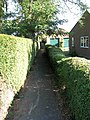 Path from Yarmouth Road to Preston Lane - geograph.org.uk - 1505334.jpg 480 × 640; 133 KB
-
 Shed on the edge of Low Plantation - geograph.org.uk - 5522041.jpg 640 × 469; 370 KB
-
 Sheds at Church Farm - geograph.org.uk - 5521977.jpg 640 × 466; 326 KB
-
 The Garden House public house - geograph.org.uk - 1505327.jpg 640 × 480; 92 KB
-

-
 Toll Road^ No just shed sales - geograph.org.uk - 2012968.jpg 640 × 480; 75 KB
-
 Track leading past Church Farm - geograph.org.uk - 5521981.jpg 640 × 480; 325 KB
-
 Track past Church Farm - geograph.org.uk - 5521985.jpg 640 × 480; 384 KB
-
 Track skirting Church Farm - geograph.org.uk - 5521984.jpg 640 × 480; 324 KB
-


