Category:Buildings in Angmering
Jump to navigation
Jump to search
Subcategories
This category has the following 7 subcategories, out of 7 total.
- Barns in Angmering (8 F)
H
- Haskins Roundstone (5 F)
L
- Angmering Library (9 F)
V
- The Vestry Hall, Angmering (3 F)
Media in category "Buildings in Angmering"
The following 58 files are in this category, out of 58 total.
-
 Angmering Community entre - geograph.org.uk - 1924672.jpg 640 × 428; 83 KB
-
 Angmering Manor Hotel - geograph.org.uk - 1250719.jpg 480 × 640; 93 KB
-
 Angmering Manor Hotel - geograph.org.uk - 6217844.jpg 1,024 × 768; 215 KB
-
 Angmering Medical Centre - geograph.org.uk - 1517933.jpg 640 × 472; 103 KB
-
 Angmering Medical Centre - geograph.org.uk - 6119446.jpg 1,024 × 750; 192 KB
-
 Angmering Park - geograph.org.uk - 1887794.jpg 640 × 428; 84 KB
-
 Angmering Park House - geograph.org.uk - 5543468.jpg 640 × 476; 40 KB
-
 Angmering Park Stud Farm - geograph.org.uk - 5704898.jpg 640 × 428; 127 KB
-
 Angmering railway station, West Sussex - geograph.org.uk - 3429129.jpg 1,024 × 768; 232 KB
-
 Angmering Station - geograph.org.uk - 6118832.jpg 1,024 × 768; 197 KB
-
 Angmering station - geograph.org.uk - 6263994.jpg 640 × 480; 103 KB
-
 Angmering Village Hall - geograph.org.uk - 6119454.jpg 1,024 × 768; 170 KB
-
 Angmering, Church Farmhouse (geograph 6119651).jpg 1,024 × 768; 151 KB
-
 Arun Angling Centre - geograph.org.uk - 3675760.jpg 1,600 × 1,200; 692 KB
-
 Barn and Silo, Lee Farm - geograph.org.uk - 3626033.jpg 640 × 480; 64 KB
-
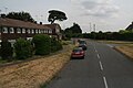
 Dapper's Lane junction with Water Lane Angmering - geograph.org.uk - 3100271.jpg 3,264 × 2,448; 4.12 MB
-
 Entrance to "Quiet Waters" - geograph.org.uk - 4756844.jpg 800 × 600; 141 KB
-
 Entrance to Hangleton Farm - geograph.org.uk - 4685101.jpg 800 × 600; 150 KB
-
 Greenhouse effect - geograph.org.uk - 28567.jpg 640 × 480; 59 KB
-
 Hammerpot Garage, Hammerpot - geograph.org.uk - 5519137.jpg 524 × 640; 62 KB
-

-
 Haskins Garden Centre - geograph.org.uk - 2690525.jpg 1,600 × 1,200; 490 KB
-
 Haskins Garden Centre - geograph.org.uk - 2959642.jpg 1,500 × 992; 160 KB
-
 Haskins Garden Centre. Roundstone - geograph.org.uk - 4197918.jpg 1,600 × 1,200; 598 KB
-
 Norfolk House - geograph.org.uk - 5702551.jpg 640 × 428; 132 KB
-

-
 Northdown Farm - geograph.org.uk - 5489639.jpg 640 × 434; 55 KB
-
 Old Place Farm - geograph.org.uk - 1250796.jpg 640 × 480; 83 KB
-
 Old Selden Farm, Selden Lane - geograph.org.uk - 5519203.jpg 640 × 496; 96 KB
-
-
 Outbuildings on the Angmering Park Estate - geograph.org.uk - 2480046.jpg 4,000 × 3,000; 3.45 MB
-
 Outbuildings, Ecclesden Farm - geograph.org.uk - 5521929.jpg 640 × 453; 50 KB
-

-

-
 Roundstone Farm - geograph.org.uk - 2607555.jpg 640 × 315; 30 KB
-
 Roundstone Farm and Garden Shop, Littlehampton - geograph.org.uk - 2032740.jpg 1,600 × 1,200; 477 KB
-
 Roundstone Farm entrance - geograph.org.uk - 4210012.jpg 640 × 428; 258 KB
-
 Roundstone PYO Farm - entrance - geograph.org.uk - 4209987.jpg 640 × 428; 219 KB
-
 Rustington Golf Centre - clubhouse - geograph.org.uk - 1943390.jpg 640 × 428; 78 KB
-
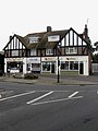
 Shops, Arundel Road - geograph.org.uk - 1250741.jpg 640 × 501; 60 KB
-
 Shops, Arundel Road - geograph.org.uk - 1250744.jpg 480 × 640; 63 KB
-

-
 The Angmering School.jpg 4,032 × 3,024; 3.33 MB
-

-
 The Leas at the junction of Station Road - geograph.org.uk - 5823262.jpg 2,006 × 1,478; 1.34 MB
-
 The Malthouse, Weavers Hill - geograph.org.uk - 1250640.jpg 480 × 640; 67 KB
-
 The Old Forge House, Arundel Road - geograph.org.uk - 1250769.jpg 480 × 640; 70 KB
-

-
 The Vinery Industrial Units - geograph.org.uk - 3100283.jpg 3,264 × 2,448; 3.5 MB
-
 The Vinery, Poling - geograph.org.uk - 3465780.jpg 1,024 × 695; 164 KB
-
 The White House, Angmering (1).jpg 3,521 × 2,347; 1.32 MB
-
 The White House, Angmering (2).jpg 3,888 × 2,592; 2.04 MB
-
 The Woodmans Arms, Hammerpot - geograph.org.uk - 5519146.jpg 521 × 640; 125 KB
-
 The Worthing Ferring Garden Centre - geograph.org.uk - 2959652.jpg 1,500 × 1,000; 122 KB
-
 Water Lane, Angmering - geograph.org.uk - 6217778.jpg 1,024 × 768; 195 KB
-
 Weavers, Angmering.jpg 2,442 × 2,618; 1.76 MB
-
 West Preston, station entrance - geograph.org.uk - 6119038.jpg 1,024 × 768; 156 KB
-
 Woodman's Arms, Hammerpot-Worthing - geograph.org.uk - 4379.jpg 640 × 480; 66 KB


.jpg)


.jpg)
.jpg)


