Category:Buckland in the Moor
Jump to navigation
Jump to search
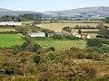
English: Buckland in the Moor is a village and civil parish in the Teignbridge district of Devon, England. According to the 2001 census it had a population of 94. The village is in Dartmoor.
village in United Kingdom  | |||||
| Upload media | |||||
| Instance of | |||||
|---|---|---|---|---|---|
| Location | Teignbridge, Devon, South West England, England | ||||
 | |||||
Subcategories
This category has only the following subcategory.
P
Media in category "Buckland in the Moor"
The following 200 files are in this category, out of 261 total.
(previous page) (next page)-
 A Dartmoor valley - geograph.org.uk - 1070759.jpg 640 × 480; 89 KB
-
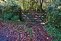
 A gate on the bridleway - geograph.org.uk - 5946213.jpg 4,320 × 3,240; 4.6 MB
-
 A modern arrangement of stones on Dartmoor - geograph.org.uk - 3976826.jpg 1,536 × 1,152; 1.24 MB
-
 A wet day at Higher Pudsham - geograph.org.uk - 5304431.jpg 1,600 × 1,200; 602 KB
-
 Approaching Buckland Beacon - geograph.org.uk - 3418498.jpg 640 × 424; 234 KB
-
 Approaching Elliot's Hill Farm - geograph.org.uk - 4236498.jpg 800 × 532; 105 KB
-
 Approaching North Wood, Buckland in the Moor - geograph.org.uk - 5304435.jpg 1,600 × 1,200; 859 KB
-
 Barn and cartshed (geograph 5946204).jpg 4,320 × 3,240; 3.91 MB
-
 Barton Plantation, north of Buckland in the Moor - geograph.org.uk - 5304434.jpg 1,600 × 1,200; 759 KB
-
 BBQ bucket on Dartmoor.jpg 3,120 × 4,160; 8.1 MB
-
 Below Buckland Beacon - geograph.org.uk - 151042.jpg 640 × 480; 115 KB
-
 Beware of the camel - geograph.org.uk - 5946192.jpg 4,320 × 3,240; 3.76 MB
-
 Blackslade Water - geograph.org.uk - 5304368.jpg 1,600 × 1,200; 844 KB
-
 Bluebells near Buckland in The Moor - geograph.org.uk - 3967339.jpg 1,912 × 2,319; 1,005 KB
-
 Boundary Marker, Buckland Common - geograph.org.uk - 6164872.jpg 1,600 × 1,200; 696 KB
-
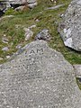
 Boundary stone - geograph.org.uk - 5948752.jpg 3,240 × 4,320; 4.91 MB
-
 Boundary stone near Blackslade - geograph.org.uk - 3418492.jpg 640 × 639; 387 KB
-
 Boundary stone near Blackslade Ford - geograph.org.uk - 3976834.jpg 1,151 × 1,536; 1.14 MB
-
 Boundary stone near Cold East Cross - geograph.org.uk - 3690801.jpg 640 × 480; 103 KB
-
 Boundary stone near Cold East Cross - geograph.org.uk - 5304353.jpg 1,600 × 1,200; 721 KB
-
 Boundary stone near Dry Bridge - geograph.org.uk - 3976840.jpg 1,536 × 1,152; 1.26 MB
-
 Boundary stone near Dry Bridge - geograph.org.uk - 621946.jpg 640 × 480; 105 KB
-
 Boundary stone, Buckland Common - geograph.org.uk - 4910349.jpg 2,000 × 1,333; 3.18 MB
-
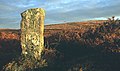 Boundary Stone, Cold East Cross - geograph.org.uk - 11976.jpg 636 × 375; 305 KB
-
 Bowden - geograph.org.uk - 1228857.jpg 640 × 480; 93 KB
-
 Bowden Farmhouse (geograph 5946197).jpg 4,320 × 3,240; 3.88 MB
-
 Bridge - geograph.org.uk - 1607653.jpg 640 × 427; 112 KB
-
 Bridge at Bridge - geograph.org.uk - 1607656.jpg 640 × 427; 142 KB
-
 Bridge at Bridge - geograph.org.uk - 3966239.jpg 1,920 × 1,440; 921 KB
-
 Bridge Cottage (geograph 5950229).jpg 4,071 × 3,055; 4.61 MB
-
 Bridge Cottage, Bridge - geograph.org.uk - 4236312.jpg 800 × 532; 183 KB
-
 Bridge over Blackslade Water - geograph.org.uk - 5304367.jpg 1,600 × 960; 698 KB
-
 Bridge over Ruddycleave Water - geograph.org.uk - 1164814.jpg 640 × 427; 88 KB
-
 Bridge over Ruddycleave Water, near Buckland-in-the-Moor - geograph.org.uk - 3756984.jpg 2,560 × 1,920; 2.97 MB
-
 Bridleway to Buckland Common - geograph.org.uk - 1228859.jpg 480 × 640; 142 KB
-
 Bridleway to Buckland in the Moor - geograph.org.uk - 4237651.jpg 800 × 532; 166 KB
-
 Brimstone, Grey Park Wood - geograph.org.uk - 3967024.jpg 1,409 × 977; 257 KB
-
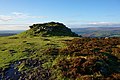
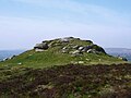
 Buckland Beacon (1) - geograph.org.uk - 5948805.jpg 4,320 × 3,240; 2.29 MB
-
 Buckland Beacon (2) - geograph.org.uk - 5948806.jpg 4,109 × 3,083; 2.77 MB
-
 Buckland Beacon (3) - geograph.org.uk - 5950134.jpg 4,320 × 3,240; 5.77 MB
-
 Buckland Beacon (4) - geograph.org.uk - 5950137.jpg 4,320 × 3,240; 4.85 MB
-
 Buckland Beacon (5) - geograph.org.uk - 5950139.jpg 4,109 × 3,083; 3.09 MB
-
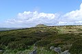
 Buckland Beacon - geograph.org.uk - 1020940.jpg 640 × 427; 68 KB
-
 Buckland Beacon - geograph.org.uk - 1021858.jpg 640 × 427; 82 KB
-
 Buckland Beacon - geograph.org.uk - 1228927.jpg 640 × 480; 98 KB
-
 Buckland Beacon - geograph.org.uk - 4234738.jpg 800 × 532; 140 KB
-
 Buckland Beacon - geograph.org.uk - 64909.jpg 640 × 425; 78 KB
-
 Buckland Beacon commandments.jpg 4,288 × 2,848; 5.98 MB
-
 Buckland Beacon stitch.jpg 7,584 × 2,568; 7.35 MB
-
 Buckland Beacon, Dartmoor - geograph.org.uk - 4910686.jpg 2,000 × 1,333; 2.3 MB
-
 Buckland Beacon.jpg 2,048 × 1,536; 993 KB
-
 Buckland churchyard - geograph.org.uk - 17309.jpg 640 × 425; 120 KB
-
 Buckland Common - geograph.org.uk - 1228843.jpg 640 × 414; 52 KB
-
 Buckland Common - geograph.org.uk - 1229146.jpg 640 × 480; 93 KB
-
 Buckland Common, Dartmoor - geograph.org.uk - 4910428.jpg 2,000 × 1,333; 2.94 MB
-
 Buckland in the Moor, Bridge - geograph.org.uk - 2718156.jpg 640 × 427; 551 KB
-
 Buckland in the Moor, Buckland Common - geograph.org.uk - 2585431.jpg 640 × 427; 409 KB
-
 Buckland in the Moor, Buckland Wood - geograph.org.uk - 2718186.jpg 640 × 427; 560 KB
-

-
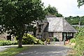
 Buckland in the Moor, Church Cottage - geograph.org.uk - 1942151.jpg 640 × 427; 433 KB
-
 Buckland in the Moor, confluence - geograph.org.uk - 2718180.jpg 640 × 427; 549 KB
-
 Buckland in the Moor, cottages at Bridge - geograph.org.uk - 2718201.jpg 640 × 427; 490 KB
-
 Buckland in the Moor, Devon, England, 21 April 2011 - Flickr - PhillipC.jpg 4,288 × 2,848; 6.32 MB
-
 Buckland in the Moor, hamlet at Bridge - geograph.org.uk - 2699697.jpg 640 × 428; 373 KB
-
-

-
 Buckland in the Moor, small waterfall - geograph.org.uk - 2718170.jpg 640 × 427; 525 KB
-

-

-

-

-
 Buckland in the Moor, waterfalls - geograph.org.uk - 2718174.jpg 427 × 640; 498 KB
-
 Buckland Lodge - geograph.org.uk - 178177.jpg 640 × 480; 124 KB
-
 Cattle grid near Challamoor - geograph.org.uk - 5304414.jpg 1,600 × 1,198; 762 KB
-
 Challamoor Farm entrance - geograph.org.uk - 4237633.jpg 800 × 532; 187 KB
-
 Chimney stack on the east end of St Peter's church - geograph.org.uk - 5304444.jpg 1,200 × 1,600; 803 KB
-
 Church Cottage (1) - geograph.org.uk - 5950292.jpg 4,320 × 3,240; 4.31 MB
-
 Church Cottage (geograph 5950296).jpg 4,320 × 3,240; 4.5 MB
-
 Church Cottage, Buckland in The Moor - geograph.org.uk - 3967425.jpg 1,920 × 1,425; 650 KB
-
 Church Cottage, Buckland in the Moor - geograph.org.uk - 6164949.jpg 1,600 × 1,200; 642 KB
-
 Churchyard of St Peter's, Buckland in the Moor - geograph.org.uk - 5304445.jpg 1,600 × 1,200; 923 KB
-
 Cockingford - geograph.org.uk - 177733.jpg 640 × 480; 117 KB
-
 Commandments 1.JPG 1,536 × 2,048; 1.22 MB
-
 Commandments 4.JPG 2,048 × 1,536; 1.35 MB
-
 Community Hall, Buckland in the Moor - geograph.org.uk - 4236487.jpg 640 × 381; 103 KB
-
 Cottage and church, Buckland in The Moor - geograph.org.uk - 3968059.jpg 1,861 × 1,272; 541 KB
-
 Cottage at Bridge - geograph.org.uk - 3966201.jpg 1,920 × 1,440; 859 KB
-
 Cottage, Buckland in The Moor - geograph.org.uk - 2294288.jpg 640 × 480; 81 KB
-
 Cottages at Buckland - geograph.org.uk - 3418542.jpg 640 × 427; 223 KB
-
 Cottages at Buckland in the Moor, Devon. 1967 - geograph.org.uk - 3941522.jpg 1,600 × 1,002; 472 KB
-
 Cottages near the bridge - geograph.org.uk - 2920059.jpg 1,721 × 1,408; 650 KB
-
 Dartmoor Lovers Leap.jpg 616 × 457; 152 KB
-
 Dartmoor, Stone Cross - geograph.org.uk - 438771.jpg 640 × 480; 129 KB
-
 Delightful Devon (1) - geograph.org.uk - 5948728.jpg 4,320 × 3,240; 3.66 MB
-
 Delightful Devon (2) - geograph.org.uk - 5948741.jpg 4,320 × 3,240; 3.59 MB
-
 Delightful Devon (3) - geograph.org.uk - 5948748.jpg 4,109 × 3,083; 4.06 MB
-
 Door in wall, Buckland in The Moor - geograph.org.uk - 3966048.jpg 1,920 × 2,432; 1,023 KB
-
 Doronicums, Grey Park Wood - geograph.org.uk - 3966391.jpg 1,920 × 1,408; 257 KB
-
 Doronicums, Grey Park Wood - geograph.org.uk - 3966429.jpg 1,920 × 2,560; 614 KB
-
 Down Beacon Hill (1) - geograph.org.uk - 5950142.jpg 4,320 × 3,240; 5.86 MB
-
 Down Beacon Hill (2) - geograph.org.uk - 5950144.jpg 3,240 × 4,320; 5.58 MB
-
 Down Beacon Hill (3) - geograph.org.uk - 5950146.jpg 3,240 × 4,320; 4.36 MB
-
 Down Beacon Hill (5) - geograph.org.uk - 5950151.jpg 4,320 × 3,240; 5.1 MB
-
 Drystone wall, Buckland Common - geograph.org.uk - 4910331.jpg 2,000 × 1,333; 2.66 MB
-

-
 Elliots Hill - geograph.org.uk - 5946158.jpg 4,320 × 3,240; 3.84 MB
-
 Elliots Hill Farm (1) - geograph.org.uk - 5946170.jpg 4,320 × 3,240; 2.54 MB
-
 Elliots Hill farm (2) - geograph.org.uk - 5946171.jpg 4,320 × 3,240; 4.19 MB
-
 Elliots Hill farm (3) - geograph.org.uk - 5946173.jpg 4,320 × 3,240; 4.25 MB
-
 Elliots Hill Farm (4) - geograph.org.uk - 5946174.jpg 4,320 × 3,240; 3.29 MB
-
 Enjoying the sun - geograph.org.uk - 5946185.jpg 4,320 × 3,240; 3.46 MB
-
 Entrance to Beacon Cottages - geograph.org.uk - 4234777.jpg 800 × 532; 208 KB
-
 Entrance to Greypark Wood - geograph.org.uk - 4236322.jpg 800 × 532; 242 KB
-
 Entrance to Pine Lodge, Southbrook - geograph.org.uk - 4234796.jpg 800 × 532; 117 KB
-
 Entrance to private woodland - geograph.org.uk - 4236493.jpg 800 × 532; 226 KB
-
 Fallen trunk, Grey Park Wood - geograph.org.uk - 3966477.jpg 1,920 × 2,560; 1.35 MB
-
 Farm access road on Pudsham Down - geograph.org.uk - 5304419.jpg 1,600 × 799; 554 KB
-
 Farm storage - geograph.org.uk - 5946219.jpg 4,320 × 3,240; 4.12 MB
-
 Fern by Ruddycleave Water - geograph.org.uk - 3966492.jpg 1,920 × 2,568; 733 KB
-
 Fern, Grey Park Wood - geograph.org.uk - 3967007.jpg 1,920 × 1,430; 907 KB
-
 Fern, Ruddycleave Water - geograph.org.uk - 3966955.jpg 1,920 × 2,371; 1.15 MB
-
 Ferns, Grey Park Wood - geograph.org.uk - 3966594.jpg 1,920 × 2,560; 1.03 MB
-
 Ferns, Grey Park Wood - geograph.org.uk - 3966604.jpg 1,920 × 2,208; 785 KB
-
 Ferns, Grey Park Wood - geograph.org.uk - 3966686.jpg 1,920 × 2,162; 482 KB
-
 Ferns, Grey Park Wood - geograph.org.uk - 3966728.jpg 1,920 × 2,761; 1.26 MB
-
 Field entrance near Buckland in The Moor - geograph.org.uk - 3967295.jpg 1,920 × 1,440; 767 KB
-
 Field gate at Higher Pudsham - geograph.org.uk - 4481225.jpg 800 × 600; 126 KB
-
 Fields near Southbrook - geograph.org.uk - 5581234.jpg 2,048 × 1,536; 515 KB
-
 Foals by Blackslade Water, 1983 - geograph.org.uk - 3371032.jpg 410 × 640; 96 KB
-

-
 Gate and moor - geograph.org.uk - 5946165.jpg 4,320 × 3,240; 4.57 MB
-
 Gently flows the stream - geograph.org.uk - 5946217.jpg 3,240 × 4,320; 4.42 MB
-
 Great Lot Road - geograph.org.uk - 3967267.jpg 1,920 × 2,560; 1.4 MB
-
 Grey Park Wood - geograph.org.uk - 1780687.jpg 1,024 × 683; 304 KB
-
 Grey Park Wood - geograph.org.uk - 1780699.jpg 1,024 × 683; 341 KB
-
 Grey Park Wood - geograph.org.uk - 1780710.jpg 1,024 × 683; 320 KB
-
 Grey Park Wood - geograph.org.uk - 3966585.jpg 1,920 × 2,560; 1.63 MB
-
 Grey Park Wood - geograph.org.uk - 3967029.jpg 1,920 × 1,440; 1.12 MB
-
 Grey Park Wood - geograph.org.uk - 3967040.jpg 1,920 × 1,440; 1.2 MB
-
 Grey Park Wood - geograph.org.uk - 3967053.jpg 1,920 × 1,440; 988 KB
-
 Hedgerow tree, Buckland in The Moor - geograph.org.uk - 3967409.jpg 1,853 × 1,427; 440 KB
-
 Higher Pudsham - geograph.org.uk - 177708.jpg 640 × 480; 119 KB
-
 Hole in the wall, Buckland Common - geograph.org.uk - 4910726.jpg 2,000 × 1,333; 2.84 MB
-
 Lane leaves the road - geograph.org.uk - 5946183.jpg 4,320 × 3,240; 3.6 MB
-
 Lane to Buckland Bridge - geograph.org.uk - 3967318.jpg 1,920 × 2,560; 1.58 MB
-
 Lane to Buckland in the Moor - geograph.org.uk - 3967074.jpg 1,920 × 2,560; 1.61 MB
-
 Lane to Buckland in the Moor - geograph.org.uk - 3967260.jpg 1,920 × 2,560; 1.4 MB
-
 Lane to Buckland in the Moor - geograph.org.uk - 3967328.jpg 1,920 × 2,560; 1.18 MB
-
 Little Brook - geograph.org.uk - 5950221.jpg 4,320 × 3,240; 3.34 MB
-
 Lover's Leap - geograph.org.uk - 1558843.jpg 640 × 480; 124 KB
-
 Lover's Leap rapid - geograph.org.uk - 1558833.jpg 640 × 480; 135 KB
-
 Lower Pudsham - geograph.org.uk - 177703.jpg 640 × 480; 91 KB
-
 Minor road at Pudsham Down - geograph.org.uk - 4481218.jpg 640 × 480; 90 KB
-
 Minor road to Buckland in the Moor - geograph.org.uk - 4234767.jpg 800 × 532; 205 KB
-
 New Glebe House - geograph.org.uk - 5946176.jpg 4,320 × 3,240; 3.55 MB
-
 No fares collected recently - geograph.org.uk - 5946161.jpg 4,320 × 3,240; 2.99 MB
-
 On Buckland Common (1) - geograph.org.uk - 5948735.jpg 4,320 × 3,240; 4.32 MB
-
 On Buckland Common (2) - geograph.org.uk - 5948742.jpg 4,320 × 3,240; 4.27 MB
-
 On Buckland Common (3) - geograph.org.uk - 5948758.jpg 4,320 × 3,240; 2.65 MB
-
 On Buckland Common (4) - geograph.org.uk - 5948763.jpg 4,320 × 3,240; 2.97 MB
-
 On Buckland Common (5) - geograph.org.uk - 5948765.jpg 4,320 × 3,240; 2.71 MB
-
 On Buckland Common (6) - geograph.org.uk - 5948798.jpg 4,320 × 3,240; 4.69 MB
-
 On Pudsham Down in the rain - geograph.org.uk - 5304415.jpg 1,600 × 1,066; 708 KB
-
 Parish church (4) - geograph.org.uk - 5950756.jpg 4,320 × 3,240; 3.68 MB
-
 Parish church (geograph 5950763).jpg 4,320 × 3,240; 3.61 MB
-
 Path in Greypark Wood - geograph.org.uk - 4236361.jpg 800 × 532; 253 KB
-
 Path meets the road - geograph.org.uk - 5950152.jpg 3,240 × 4,320; 4.5 MB
-
 Path on Buckland Common - geograph.org.uk - 1228934.jpg 640 × 480; 111 KB
-
 Path, Grey Park Wood - geograph.org.uk - 3966922.jpg 1,920 × 2,560; 1.55 MB
-
 Phone box in Southbrook - geograph.org.uk - 5311895.jpg 1,600 × 1,200; 820 KB
-
 Pine clump, Buckland Common - geograph.org.uk - 4910435.jpg 2,000 × 1,333; 3.02 MB
-
 Ponies in the lane near Scobitor - geograph.org.uk - 177681.jpg 640 × 480; 81 KB
-
 Ponies on Dartmoor - geograph.org.uk - 106352.jpg 640 × 480; 84 KB
-
 Postbox, Buckland in The Moor - geograph.org.uk - 2295561.jpg 481 × 640; 97 KB
-
 Pudsham Down - geograph.org.uk - 1164883.jpg 640 × 427; 77 KB
-
 Pudsham Down - geograph.org.uk - 177668.jpg 640 × 480; 130 KB
-
 Pudsham Down - geograph.org.uk - 1932785.jpg 640 × 480; 329 KB
-
 Pudsham Down - geograph.org.uk - 1932792.jpg 640 × 480; 330 KB
-
 Road on Buckland Common - geograph.org.uk - 5304362.jpg 1,600 × 800; 554 KB
-
 Road scene with woodland, just outside Buckland-in-the-Moor - geograph.org.uk - 3756988.jpg 2,560 × 1,920; 3.03 MB
-
 Road to Buckland in the Moor - geograph.org.uk - 4234783.jpg 800 × 532; 192 KB
-
 Road to Buckland in the Moor from Stone Cross - geograph.org.uk - 5304423.jpg 1,600 × 1,200; 689 KB
-
 Road to Cockingford from Stone Cross - geograph.org.uk - 5304422.jpg 1,600 × 1,065; 661 KB
-
 Road west of Cold East Cross - geograph.org.uk - 4104069.jpg 640 × 480; 64 KB
-
 Road works, Buckland in The Moor - geograph.org.uk - 3966070.jpg 1,920 × 2,334; 1.04 MB
-
 Roadside bluebells near Buckland - geograph.org.uk - 3967351.jpg 1,920 × 1,440; 786 KB
-
 Rough path from Buckland Beacon - geograph.org.uk - 4234751.jpg 800 × 532; 190 KB
-
 Ruddycleave Cottage (geograph 5950230).jpg 4,320 × 3,240; 4.36 MB
-
 Ruddycleave stone maze - geograph.org.uk - 3418593.jpg 640 × 427; 210 KB
-
 Ruddycleave Water - geograph.org.uk - 3418574.jpg 640 × 427; 243 KB
-
 Ruddycleave Water - geograph.org.uk - 3966350.jpg 1,920 × 1,440; 835 KB
-
 Ruddycleave Water - geograph.org.uk - 3966509.jpg 1,920 × 1,403; 771 KB
-
 Ruddycleave Water - geograph.org.uk - 3966521.jpg 1,920 × 2,560; 1.34 MB
-
 Ruddycleave Water - geograph.org.uk - 4236355.jpg 800 × 532; 217 KB
-
 Sheep creep 2.JPG 2,048 × 1,536; 1.23 MB
-
 Sheep drift near Buckland Beacon.jpg 3,744 × 2,848; 6.7 MB
-
 Small flow - geograph.org.uk - 5950203.jpg 4,320 × 3,240; 4 MB
-
 Southbrook - geograph.org.uk - 151034.jpg 640 × 480; 96 KB
-
 Southbrook Farm - geograph.org.uk - 5950220.jpg 4,320 × 3,240; 3.18 MB
-
 Southbrook Farmhouse (geograph 5950216).jpg 4,320 × 3,240; 2.74 MB


.jpg)


.jpg)


.jpg)


_-_geograph.org.uk_-_5950292.jpg)
.jpg)


_-_geograph.org.uk_-_5948728.jpg)
_-_geograph.org.uk_-_5948741.jpg)
_-_geograph.org.uk_-_5948748.jpg)


_-_geograph.org.uk_-_5946170.jpg)
_-_geograph.org.uk_-_5946171.jpg)
_-_geograph.org.uk_-_5946173.jpg)
_-_geograph.org.uk_-_5946174.jpg)


_-_geograph.org.uk_-_5948735.jpg)
_-_geograph.org.uk_-_5948742.jpg)
_-_geograph.org.uk_-_5948758.jpg)
_-_geograph.org.uk_-_5948763.jpg)
_-_geograph.org.uk_-_5948765.jpg)
_-_geograph.org.uk_-_5948798.jpg)

_-_geograph.org.uk_-_5950756.jpg)
.jpg)


.jpg)


.jpg)
_-_geograph.org.uk_-_5948805.jpg)
_-_geograph.org.uk_-_5948806.jpg)
_-_geograph.org.uk_-_5950134.jpg)
_-_geograph.org.uk_-_5950137.jpg)
_-_geograph.org.uk_-_5950139.jpg)
_-_geograph.org.uk_-_5950142.jpg)
_-_geograph.org.uk_-_5950144.jpg)
_-_geograph.org.uk_-_5950146.jpg)
_-_geograph.org.uk_-_5950151.jpg)