Category:Buckland Brewer
Jump to navigation
Jump to search
English: Buckland Brewer is a village and civil parish in the Torridge district of Devon, England, about 5 miles south of Bideford. Historically the parish formed part of Shebbear Hundred. According to the 2001 census it had a population of 777.
Português: Buckland Brewer é um vilarejo e paróquia civil localizada no distrito de Torridge, em Devon, Inglaterra. Situa-se cinco milhas ao sul de Bideford. Em 2001, sua população era de 777 habitantes.
village in United Kingdom  | |||||
| Upload media | |||||
| Instance of | |||||
|---|---|---|---|---|---|
| Location | Torridge, Devon, South West England, England | ||||
| Population |
| ||||
 | |||||
Subcategories
This category has the following 4 subcategories, out of 4 total.
B
M
O
Media in category "Buckland Brewer"
The following 135 files are in this category, out of 135 total.
-
 A bridge over the river Yeo at Orleigh Mills - geograph.org.uk - 3813784.jpg 1,600 × 1,200; 719 KB
-
 A bridge over the river Yeo at Orleigh Mills - geograph.org.uk - 3813788.jpg 1,600 × 1,200; 690 KB
-

-

-
 A pointless cattle grid - geograph.org.uk - 4564970.jpg 800 × 531; 116 KB
-

-
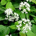 Allium ursinum - geograph.org.uk - 1301855.jpg 640 × 640; 131 KB
-
 Arable land north-east of Burrough - geograph.org.uk - 660873.jpg 640 × 298; 60 KB
-
 Beeches near Craneham - geograph.org.uk - 700058.jpg 480 × 640; 114 KB
-

-
 Brendon Crossroads - geograph.org.uk - 4563589.jpg 800 × 531; 104 KB
-
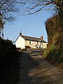
 Bridge at Buckland Mill - geograph.org.uk - 700156.jpg 458 × 640; 122 KB
-
 Bridge, Buckland Mill - geograph.org.uk - 700135.jpg 640 × 480; 147 KB
-
 Buckland Brewer primary school - geograph.org.uk - 667170.jpg 640 × 480; 68 KB
-
 Buckland Brewer, Buckland Mill - geograph.org.uk - 2680556.jpg 640 × 420; 318 KB
-
 Buckland Brewer, waterwheel at Orleigh Mills - geograph.org.uk - 5761999.jpg 1,600 × 1,071; 861 KB
-
 Buckland Mill - geograph.org.uk - 660341.jpg 640 × 480; 128 KB
-
 Building at Barton Court - geograph.org.uk - 3951759.jpg 640 × 480; 160 KB
-
 Buildings at Barton Court - geograph.org.uk - 3951755.jpg 640 × 480; 168 KB
-
 Bungalows at Little Collingsdown - geograph.org.uk - 6103309.jpg 1,600 × 940; 496 KB
-
 Butchers shop and Methodist church - geograph.org.uk - 666244.jpg 640 × 480; 82 KB
-
 Cattle grid at Thornworthy - geograph.org.uk - 4565116.jpg 1,024 × 680; 274 KB
-
 Cattle grid on Thorne Moor - geograph.org.uk - 6103283.jpg 1,600 × 1,200; 548 KB
-
 Collingsdown Cross, road junction - geograph.org.uk - 3288778.jpg 640 × 480; 97 KB
-
 Contrasting hedges near Collingsdown - geograph.org.uk - 6103307.jpg 1,600 × 994; 706 KB
-
 Cottage at Tythecott - geograph.org.uk - 692399.jpg 480 × 640; 86 KB
-
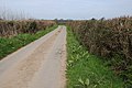
 Country road near Bilsford - geograph.org.uk - 4563667.jpg 800 × 531; 121 KB
-
 Country road near Collingsdown - geograph.org.uk - 4565034.jpg 1,024 × 680; 284 KB
-
 Country road near Eckworthy - geograph.org.uk - 4471976.jpg 800 × 531; 93 KB
-
 Country road on Thorne Moor - geograph.org.uk - 4565013.jpg 800 × 531; 119 KB
-
 Datestone on the Methodist Chapel, Buckland Brewer - geograph.org.uk - 1820604.jpg 2,000 × 1,450; 751 KB
-
 DenysOfOrleighArms.PNG 924 × 1,064; 74 KB
-
 Devon farmland - geograph.org.uk - 4564906.jpg 1,024 × 680; 288 KB
-
 Devon lanes - geograph.org.uk - 660272.jpg 640 × 480; 61 KB
-
 Dog's Olympics training ground - geograph.org.uk - 660324.jpg 640 × 480; 88 KB
-
 Drive to Orleigh Court - geograph.org.uk - 667292.jpg 640 × 359; 70 KB
-
 Eastacott Moor - geograph.org.uk - 5803456.jpg 4,288 × 2,848; 2.22 MB
-
 Eastacott Moor - geograph.org.uk - 5803526.jpg 4,150 × 2,711; 2.26 MB
-
 Entrance to West Eckworthy - geograph.org.uk - 4471975.jpg 800 × 531; 91 KB
-
 Farmland above the Duntz valley - geograph.org.uk - 4462507.jpg 800 × 531; 106 KB
-
 Farmland near Bilsford - geograph.org.uk - 4563623.jpg 1,024 × 680; 255 KB
-
 Farmland near Buckland Brewer - geograph.org.uk - 4462479.jpg 800 × 531; 121 KB
-
 Farmland near Buckland Brewer - geograph.org.uk - 4471467.jpg 1,024 × 680; 287 KB
-
 Farmland near Goutisland - geograph.org.uk - 4471990.jpg 1,024 × 680; 282 KB
-
 Farmland near Tythecott - geograph.org.uk - 4471954.jpg 800 × 531; 152 KB
-
 Farmland to the east of Buckland Brewer - geograph.org.uk - 4457044.jpg 800 × 531; 109 KB
-
 Farmland, Galsworthy Moor - geograph.org.uk - 4564979.jpg 800 × 531; 124 KB
-
 Farmland, Twitchen Hill - geograph.org.uk - 4563572.jpg 1,024 × 680; 294 KB
-
 Field above Buckland Wood - geograph.org.uk - 692299.jpg 640 × 401; 67 KB
-

-
 Field entrance - geograph.org.uk - 4471450.jpg 800 × 531; 142 KB
-
 Field near Tythecott - geograph.org.uk - 4471957.jpg 800 × 531; 117 KB
-
 Fields near Thornewidger - geograph.org.uk - 698193.jpg 640 × 480; 118 KB
-
 Flooded stream at Bilsford - geograph.org.uk - 660268.jpg 640 × 480; 141 KB
-
 Footpath and property entrance - geograph.org.uk - 4471968.jpg 1,024 × 680; 292 KB
-
 Galsworthy Wind Farm - geograph.org.uk - 4564939.jpg 800 × 531; 93 KB
-
 Gateway into a field on Collingsdown - geograph.org.uk - 1880928.jpg 640 × 480; 70 KB
-
 Gravestones, Thornehillhead - geograph.org.uk - 700002.jpg 640 × 480; 72 KB
-

-
 Great Gorwood - geograph.org.uk - 692359.jpg 640 × 465; 66 KB
-
 Holwell Farm Ford - geograph.org.uk - 5924890.jpg 4,032 × 3,024; 5.93 MB
-
 Hooper's Water Farm - geograph.org.uk - 6604756.jpg 1,024 × 781; 181 KB
-
 House at Buckland Mill - geograph.org.uk - 700164.jpg 459 × 640; 77 KB
-
 Lane at the River Duntz - geograph.org.uk - 981546.jpg 640 × 480; 126 KB
-
 Lane at Thornehillhead - geograph.org.uk - 700034.jpg 640 × 443; 70 KB
-
 Lane crossing Thorne Moor - geograph.org.uk - 4109228.jpg 800 × 526; 129 KB
-
 Lane down to Tythecott Mill Bridge, Buckland Brewer - geograph.org.uk - 1820585.jpg 2,000 × 1,500; 798 KB
-
 Lane near Holwell Farm - geograph.org.uk - 4109231.jpg 1,024 × 660; 200 KB
-
 Lane to Bulkworthy Moor - geograph.org.uk - 5803550.jpg 4,288 × 2,848; 2.27 MB
-
 Lane to Craneham - geograph.org.uk - 692367.jpg 480 × 640; 86 KB
-
 Lane to Thorne Moor - geograph.org.uk - 5803369.jpg 2,848 × 4,288; 2.28 MB
-
 Lane to Winslade at Higher Twitchen - geograph.org.uk - 660256.jpg 640 × 480; 152 KB
-

-
 Looking up the River Yeo from a bridge at Orleigh Mills - geograph.org.uk - 3813808.jpg 1,600 × 1,200; 971 KB
-
 Lydeland Water valley - geograph.org.uk - 4471456.jpg 800 × 531; 121 KB
-
 Lydeland Water valley - geograph.org.uk - 700047.jpg 640 × 441; 76 KB
-
 Milford Farm - geograph.org.uk - 660213.jpg 640 × 480; 150 KB
-
 Minor road to Yeo Bridge - geograph.org.uk - 6604764.jpg 1,024 × 768; 208 KB
-
 Monkleigh Mill Lane - geograph.org.uk - 5279859.jpg 1,024 × 680; 264 KB
-
 Monkleigh Mill Lane - geograph.org.uk - 5279860.jpg 1,024 × 659; 235 KB
-
 Oak and North Hele - geograph.org.uk - 692331.jpg 640 × 409; 71 KB
-
 Old Downs Lane Ford - geograph.org.uk - 5924847.jpg 3,662 × 2,744; 2.08 MB
-
 Orleigh Court Farm - geograph.org.uk - 660869.jpg 640 × 480; 75 KB
-
 Orleigh Mills - geograph.org.uk - 6605201.jpg 1,024 × 689; 120 KB
-
 Pastures east of Danesmoor - geograph.org.uk - 660226.jpg 640 × 480; 101 KB
-
 Pylon line, Thorne Wood - geograph.org.uk - 692415.jpg 480 × 640; 57 KB
-
 Pylon north of Stibb Cross - geograph.org.uk - 6103280.jpg 1,600 × 1,200; 734 KB
-
 River Duntz - downstream - geograph.org.uk - 667172.jpg 640 × 480; 121 KB
-
 River Duntz - upstream - geograph.org.uk - 667178.jpg 640 × 480; 135 KB
-

-
 River Duntz at Buckland Mill - geograph.org.uk - 700125.jpg 480 × 640; 144 KB
-
 Road junction beside the River Duntz - geograph.org.uk - 4462485.jpg 800 × 531; 202 KB
-
 Road junction near Collingsdown - geograph.org.uk - 4563649.jpg 800 × 531; 114 KB
-
 Road junction on Thorne Moor - geograph.org.uk - 4564997.jpg 800 × 531; 103 KB
-
 Road passing Buckland Mill - geograph.org.uk - 4462499.jpg 1,024 × 680; 344 KB
-
 Road repairs at the road junction for Milford - geograph.org.uk - 6103302.jpg 1,600 × 1,003; 600 KB
-
 Road to Babeleigh Barton - geograph.org.uk - 4563582.jpg 800 × 531; 111 KB
-
 Road to Galsworthy Moor - geograph.org.uk - 6103297.jpg 1,600 × 994; 723 KB
-
 Road to Thorne Moor - geograph.org.uk - 5790497.jpg 4,288 × 2,848; 2.73 MB
-
 Shed, Thornewidger - geograph.org.uk - 698361.jpg 640 × 452; 92 KB
-
 Sheep at Thornwidger - geograph.org.uk - 699996.jpg 640 × 480; 106 KB
-
 Sheep by the Duntz - geograph.org.uk - 700116.jpg 463 × 640; 148 KB
-
 Sheep grazing near Goutisland - geograph.org.uk - 4471998.jpg 800 × 531; 112 KB
-
 Sheep pasture east of Brendon - geograph.org.uk - 660285.jpg 640 × 480; 97 KB
-
 Shop and chapel, Buckland Brewer - geograph.org.uk - 1820705.jpg 2,000 × 1,455; 891 KB
-
 Stream in flood at Vennmills - geograph.org.uk - 660235.jpg 640 × 480; 154 KB
-

-
 The Methodist Chapel, Thornhill Head, Buckland Brewer - geograph.org.uk - 1820576.jpg 2,000 × 1,500; 710 KB
-

-
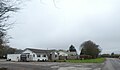
 The village street, Buckland Brewer - geograph.org.uk - 1820595.jpg 2,000 × 1,431; 636 KB
-
 Thorne Moor - geograph.org.uk - 5803069.jpg 4,288 × 2,848; 2.1 MB
-
 Thorne Moor - geograph.org.uk - 5803124.jpg 4,277 × 2,652; 1.29 MB
-
 Thorne Moor - geograph.org.uk - 5803204.jpg 4,242 × 2,306; 1.94 MB
-
 Thorne Moor - geograph.org.uk - 5803230.jpg 4,284 × 2,760; 1.62 MB
-
 Thorne Moor - geograph.org.uk - 5803356.jpg 4,282 × 2,658; 2.37 MB
-
 Thorne Moor - geograph.org.uk - 660191.jpg 640 × 480; 114 KB
-
 Thorne Moor - geograph.org.uk - 666243.jpg 640 × 480; 119 KB
-
 Thornehill Head, road junction - geograph.org.uk - 3288736.jpg 640 × 493; 54 KB
-
 Thornehillhead Methodist Church - geograph.org.uk - 700027.jpg 640 × 480; 68 KB
-
 Trees near Tythecott Mill - geograph.org.uk - 700040.jpg 640 × 480; 71 KB
-
 Triangulation pillar, Thorne Moor, Buckland Brewer - geograph.org.uk - 1820560.jpg 2,000 × 1,409; 652 KB
-
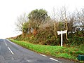
 Turning for Buckland Brewer - geograph.org.uk - 3288758.jpg 640 × 480; 64 KB
-
 Turning to Holwell - geograph.org.uk - 5803032.jpg 640 × 425; 89 KB
-
 Under Buckland Mill bridge - geograph.org.uk - 700132.jpg 640 × 480; 87 KB
-
 Valley near Tythecott Mill Bridge - geograph.org.uk - 4471952.jpg 1,024 × 680; 321 KB
-
 VielstoneBucklandBrewerDevon.jpg 3,648 × 2,736; 2.12 MB
-
 View north of Little Collingsdown - geograph.org.uk - 660219.jpg 640 × 480; 105 KB
-
 View to Buckland Brewer - geograph.org.uk - 4457045.jpg 800 × 531; 113 KB
-
 View to Buckland Brewer - geograph.org.uk - 4462513.jpg 800 × 531; 118 KB
-
 View to distant wind turbines - geograph.org.uk - 4471995.jpg 531 × 800; 94 KB
-
 Well, Thornewidger - geograph.org.uk - 699157.jpg 640 × 480; 165 KB
-
 Wet west Devon - geograph.org.uk - 660203.jpg 640 × 480; 95 KB
-
 Wild daffodil above Buckland Mill - geograph.org.uk - 700110.jpg 521 × 640; 58 KB
-
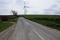
 Wind turbine near Buckland Brewer - geograph.org.uk - 4471448.jpg 1,024 × 680; 219 KB
-
 Woods above Tythecott Mill - geograph.org.uk - 692387.jpg 640 × 480; 101 KB


