Category:Buckland, Oxfordshire
Jump to navigation
Jump to search
village and civil parish in Vale of White Horse district, Oxfordshire, England .jpg) | |||||
| Upload media | |||||
| Instance of | |||||
|---|---|---|---|---|---|
| Location | Vale of White Horse, Oxfordshire, South East England, England | ||||
| Population |
| ||||
| Area |
| ||||
| official website | |||||
 | |||||
English: Buckland is a village and civil parish in the Vale of White Horse district of the English county of Oxfordshire. In 1974 it was transferred from Berkshire.
Subcategories
This category has the following 11 subcategories, out of 11 total.
B
- Buckland House, Oxfordshire (10 F)
C
- Carswell Manor (3 F)
G
- Gainfield (3 F)
- St George's church, Buckland (3 F)
H
L
- Lamb Inn, Buckland (3 F)
M
- St Mary's Church, Buckland (7 F)
T
- Tadpole Bridge (20 F)
- Tenfoot Bridge (5 F)
- The Trout, Buckland (9 F)
Media in category "Buckland, Oxfordshire"
The following 200 files are in this category, out of 302 total.
(previous page) (next page)-
 1-4 Barcote Cottages, Buckland - geograph.org.uk - 6199272.jpg 4,000 × 3,000; 4.64 MB
-
 5-8 Barcote Cottages, Buckland - geograph.org.uk - 6199268.jpg 4,000 × 3,000; 4.88 MB
-
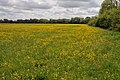
 A field of daisies - geograph.org.uk - 6495439.jpg 5,472 × 3,648; 3.86 MB
-
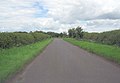
 A420 passing woods near Buckland - geograph.org.uk - 2745579.jpg 800 × 600; 340 KB
-

-
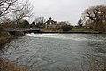 Across the weir pool - geograph.org.uk - 2279240.jpg 1,024 × 683; 211 KB
-
 Allotments, Summerside Road - geograph.org.uk - 6493169.jpg 5,066 × 3,224; 3.31 MB
-
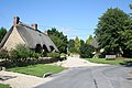 An attractive corner of Buckland - geograph.org.uk - 2685150.jpg 640 × 427; 94 KB
-
 Another bend - geograph.org.uk - 2231089.jpg 1,024 × 683; 179 KB
-
 Approaching the turning to Buckland - geograph.org.uk - 1878165.jpg 640 × 480; 77 KB
-

-
 Arch Plantation - geograph.org.uk - 6697379.jpg 1,024 × 768; 607 KB
-
 Armco by the fencing - geograph.org.uk - 2277688.jpg 1,024 × 683; 308 KB
-
 B4508 towards Pusey - geograph.org.uk - 6267833.jpg 640 × 480; 85 KB
-
 B4508 towards Pusey - geograph.org.uk - 6267836.jpg 800 × 600; 111 KB
-
 Barcote Barn, Barcote Lane - geograph.org.uk - 6199277.jpg 4,000 × 3,000; 4.82 MB
-
 Barcote Barn, Barcote Lane - geograph.org.uk - 6200263.jpg 4,000 × 3,000; 4.47 MB
-
 Barcote Cottages - geograph.org.uk - 6200260.jpg 4,000 × 3,000; 4.83 MB
-
 Barcote Lane - geograph.org.uk - 3985017.jpg 640 × 428; 97 KB
-
 Barcote Lane - geograph.org.uk - 6201169.jpg 4,000 × 3,000; 4.91 MB
-
 Barley field, Buckland Marsh - geograph.org.uk - 2427212.jpg 1,024 × 680; 165 KB
-
 Barns at Rectory Farm - geograph.org.uk - 2115091.jpg 800 × 600; 99 KB
-
 Benchmark by the door - geograph.org.uk - 2279201.jpg 533 × 800; 152 KB
-
 Benchmark on bridge of St George's Road - geograph.org.uk - 2119539.jpg 800 × 600; 219 KB
-

-

-
 Benchmark on Dairy Cottages - geograph.org.uk - 2115073.jpg 600 × 800; 201 KB
-
 Benchmark on gatepost of Stud Cottage - geograph.org.uk - 2115129.jpg 768 × 1,024; 288 KB
-
 Benchmark on Pusey Furze Cottage - geograph.org.uk - 2113599.jpg 600 × 800; 219 KB
-
 Benchmark on St Mary's Church - geograph.org.uk - 2114947.jpg 600 × 800; 149 KB
-

-
 Benchmark on ^8 Barcote Cottages - geograph.org.uk - 2119556.jpg 768 × 1,024; 327 KB
-
 Blue Tractor - geograph.org.uk - 2454517.jpg 3,816 × 2,232; 1.71 MB
-
 Boat by a Willow - geograph.org.uk - 2236042.jpg 1,024 × 683; 185 KB
-
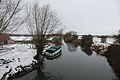
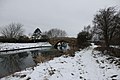
 Boats in the snow - geograph.org.uk - 2225787.jpg 1,024 × 683; 189 KB
-
 Boats moored near the weir at Rushey Lock - geograph.org.uk - 2202281.jpg 1,024 × 742; 364 KB
-
 Boats on the Thames - geograph.org.uk - 2236031.jpg 1,024 × 683; 129 KB
-
 Bridge in the distance - geograph.org.uk - 2232291.jpg 1,024 × 683; 179 KB
-
 Bridge on St. George's Road - geograph.org.uk - 6697367.jpg 1,024 × 768; 538 KB
-
 Bridlepath to Buckland Marsh - geograph.org.uk - 6199412.jpg 4,000 × 3,000; 4.65 MB
-
 Bridleway at Carswell Marsh - geograph.org.uk - 6533750.jpg 4,537 × 3,462; 2.63 MB
-
 Bridleway heading to Buckland - geograph.org.uk - 3269709.jpg 1,024 × 768; 204 KB
-
 Bridleway near the Thames - geograph.org.uk - 6196889.jpg 4,000 × 3,000; 5.03 MB
-
 Bridleway to St Hugh's School - geograph.org.uk - 2400111.jpg 1,500 × 1,000; 191 KB
-
 Bridleway West of Carswell - geograph.org.uk - 2399994.jpg 3,552 × 2,232; 2.03 MB
-
 Lamb Inn Buckland Oxfordshire.jpg 640 × 480; 124 KB
-
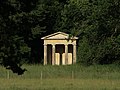 Buckland Aviary.jpg 949 × 712; 587 KB
-
 Buckland Fundamental Bench Mark - geograph.org.uk - 2119583.jpg 600 × 800; 211 KB
-
 Buckland Fundamental Bench mark - geograph.org.uk - 2277672.jpg 533 × 800; 144 KB
-
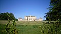 Buckland House - geograph.org.uk - 2404427.jpg 3,968 × 2,232; 1.82 MB
-
 Buckland in late spring - geograph.org.uk - 873642.jpg 640 × 480; 88 KB
-
 Buckland manorial buildings - geograph.org.uk - 6196874.jpg 4,000 × 3,000; 4.8 MB
-
 Buckland on the hill - geograph.org.uk - 2233397.jpg 1,024 × 683; 176 KB
-
 Buckland Road - geograph.org.uk - 6697441.jpg 1,024 × 768; 342 KB
-
 Buckland Road approaches junction with Summerside Road - geograph.org.uk - 3043664.jpg 3,516 × 2,551; 1.8 MB
-
 Buckland Road approaches Tadpole Bridge and passes The Trout - geograph.org.uk - 3043728.jpg 3,574 × 2,433; 1.16 MB
-
 Buckland Road beside the Arch Plantation - geograph.org.uk - 3043704.jpg 3,438 × 2,525; 1.76 MB
-
 Buckland Road enters Buckland Marsh - geograph.org.uk - 3043713.jpg 3,431 × 2,446; 1.34 MB
-

-
 Buckland Road northeast of Gainfield Farm - geograph.org.uk - 3043600.jpg 3,495 × 2,591; 1.23 MB
-
 Buckland Road west of Mount Pleasant Farm - geograph.org.uk - 3043654.jpg 3,460 × 2,399; 1.04 MB
-
 Buckland Roman Catholic church - geograph.org.uk - 6697390.jpg 1,024 × 768; 344 KB
-
 Buckland Telephone Exchange, Oxon - geograph.org.uk - 5533093.jpg 2,592 × 1,944; 1.36 MB
-
 Buckland, road near the church - geograph.org.uk - 6493160.jpg 4,365 × 3,411; 2.75 MB
-

-

-
 Carswell Marsh - geograph.org.uk - 3269728.jpg 1,024 × 768; 244 KB
-
 Carswell Marsh Farm - geograph.org.uk - 6199388.jpg 4,000 × 3,000; 4.78 MB
-
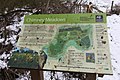 Chimney Meadows - geograph.org.uk - 2228478.jpg 1,024 × 683; 188 KB
-
 Church of St Mary, Buckland, Oxfordshire - geograph.org.uk - 4514677.jpg 1,024 × 663; 197 KB
-
 Corrugated sides - geograph.org.uk - 2282624.jpg 1,024 × 683; 156 KB
-

-
 Cottages, Buckland - geograph.org.uk - 6697382.jpg 1,024 × 768; 319 KB
-
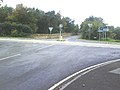 Cross roads on the A420 - geograph.org.uk - 2113709.jpg 800 × 600; 105 KB
-
 Crossroads on the B4508, Gainfield - geograph.org.uk - 6269039.jpg 5,184 × 3,888; 5.18 MB
-
 Disappears past the pillbox - geograph.org.uk - 2281605.jpg 1,024 × 683; 89 KB
-
 Down the other side - geograph.org.uk - 2233361.jpg 533 × 800; 194 KB
-

-
 Elizabeth II postbox on the B4508, Gainfield - geograph.org.uk - 6269035.jpg 2,685 × 4,128; 3.66 MB
-
 Entrance to Croft Lodge off A420 - geograph.org.uk - 2119605.jpg 800 × 600; 131 KB
-
 Farmland near Ragnell Copse - geograph.org.uk - 6199297.jpg 4,000 × 3,000; 4.76 MB
-
 Farmland, Buckland - geograph.org.uk - 2678354.jpg 640 × 480; 170 KB
-
 Farmland, Buckland - geograph.org.uk - 2678416.jpg 640 × 480; 151 KB
-
 Farmland, Buckland - geograph.org.uk - 2816199.jpg 640 × 480; 185 KB
-
 Farmland, Buckland - geograph.org.uk - 2816213.jpg 640 × 480; 140 KB
-
 Farmland, Buckland - geograph.org.uk - 2816311.jpg 640 × 480; 145 KB
-
 Farmland, Buckland - geograph.org.uk - 2816317.jpg 640 × 480; 115 KB
-
 Farmland, Buckland - geograph.org.uk - 6185701.jpg 1,024 × 683; 243 KB
-
 Farmland, Buckland - geograph.org.uk - 6185702.jpg 1,024 × 683; 228 KB
-
 Farmland, Buckland - geograph.org.uk - 6185703.jpg 1,024 × 683; 267 KB
-
 Farmland, Buckland - geograph.org.uk - 6185705.jpg 1,024 × 683; 188 KB
-
 Farmland, Buckland - geograph.org.uk - 6190581.jpg 1,024 × 683; 195 KB
-
 Farmland, Buckland - geograph.org.uk - 6190588.jpg 1,024 × 683; 157 KB
-
 Farmland, Buckland - geograph.org.uk - 6190594.jpg 1,024 × 683; 159 KB
-
 Farmland, Buckland - geograph.org.uk - 6190603.jpg 1,024 × 675; 173 KB
-
 Farmland, Duxford - geograph.org.uk - 387330.jpg 640 × 480; 145 KB
-
 Fenced off by the road - geograph.org.uk - 2277667.jpg 533 × 800; 180 KB
-
 Field and pylons near Buckland - geograph.org.uk - 3647679.jpg 640 × 332; 34 KB
-
 Field of rape by Buckland - geograph.org.uk - 2400092.jpg 1,500 × 1,000; 211 KB
-
 Field of rape by the bridleway - geograph.org.uk - 2400107.jpg 1,500 × 1,000; 271 KB
-
 Field of rape near Buckland - geograph.org.uk - 2400102.jpg 1,500 × 1,000; 266 KB
-
 Fill point at the moorings - geograph.org.uk - 2279249.jpg 1,024 × 683; 200 KB
-
 Filling station and cafe by A420 - geograph.org.uk - 2745588.jpg 800 × 600; 361 KB
-
 Filling station on the A420 - geograph.org.uk - 3813430.jpg 640 × 480; 147 KB
-
 First one in sight - geograph.org.uk - 2227639.jpg 1,024 × 683; 279 KB
-
 Fisherman on Tenfoot Bridge - geograph.org.uk - 6195313.jpg 4,000 × 3,000; 4.62 MB
-
 Fishing round the bend - geograph.org.uk - 2227529.jpg 1,024 × 683; 228 KB
-
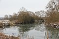
 Flooding at Rushey Lock (1), River Thames - geograph.org.uk - 2202294.jpg 1,024 × 756; 273 KB
-
 Flooding at Rushey Lock (2), River Thames - geograph.org.uk - 2202306.jpg 1,024 × 753; 273 KB
-
 Flowers by the Path - geograph.org.uk - 6493166.jpg 3,500 × 4,807; 3.71 MB
-
 Fly tipping, Buckland Road - geograph.org.uk - 3985166.jpg 640 × 480; 117 KB
-
 Footbridge over Rushey Weir - geograph.org.uk - 2427467.jpg 1,024 × 680; 238 KB
-

-

-
 Footpath from the bridge - geograph.org.uk - 2233390.jpg 533 × 800; 146 KB
-
 Footpath Over Carswell Golf Course - geograph.org.uk - 2472584.jpg 1,600 × 900; 484 KB
-
 Footpath to Carswell - geograph.org.uk - 5074635.jpg 2,592 × 1,944; 2.05 MB
-
 Frog from the side - geograph.org.uk - 2279195.jpg 1,024 × 683; 239 KB
-
 Fundamental Benchmark - geograph.org.uk - 2277677.jpg 533 × 800; 114 KB
-
 Gate from the road - geograph.org.uk - 2239788.jpg 1,024 × 683; 241 KB
-
 Gate in the path - geograph.org.uk - 2281569.jpg 1,024 × 683; 185 KB
-
 Gates and lodge, Barcote Park - geograph.org.uk - 3985050.jpg 640 × 428; 119 KB
-
 Gateway, Barcote Park - geograph.org.uk - 6697266.jpg 1,024 × 684; 516 KB
-
 Gateway, Carswell Manor - geograph.org.uk - 6532558.jpg 4,162 × 2,943; 1.83 MB
-
 Grasses by the bank - geograph.org.uk - 2281586.jpg 1,024 × 683; 97 KB
-
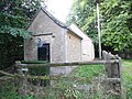
 Hall's Barn - geograph.org.uk - 309784.jpg 640 × 480; 85 KB
-
 Heading for the A420 - geograph.org.uk - 1004812.jpg 640 × 427; 59 KB
-
 High water at Tadpole Bridge, near Bampton, Oxon - geograph.org.uk - 5889239.jpg 1,024 × 681; 236 KB
-
 Horseshoe Bend - geograph.org.uk - 2282644.jpg 2,093 × 755; 308 KB
-
 Hotel on the A420 near Buckland - geograph.org.uk - 6603911.jpg 1,024 × 768; 207 KB
-
 Houses at Carswell Marsh - geograph.org.uk - 6532889.jpg 3,017 × 1,555; 1.47 MB
-
 Ice by the bridge - geograph.org.uk - 2225782.jpg 1,024 × 683; 181 KB
-
 Ice flow by the bridge - geograph.org.uk - 2236047.jpg 1,024 × 683; 124 KB
-
 Ice on the river - geograph.org.uk - 2227640.jpg 1,024 × 683; 175 KB
-

-
 Junction power pole by Barcote Lane - geograph.org.uk - 6697243.jpg 768 × 1,024; 387 KB
-

-
 Log piles, Buckland Warren - geograph.org.uk - 6532548.jpg 3,638 × 1,775; 1.11 MB
-
 Looking at the bend - geograph.org.uk - 2231079.jpg 1,024 × 683; 236 KB
-
 Looking at the front - geograph.org.uk - 2231072.jpg 1,024 × 683; 293 KB
-
 Looking downstream - geograph.org.uk - 2232310.jpg 1,024 × 683; 143 KB
-
 Looking North from Marriage Hill - geograph.org.uk - 6493318.jpg 4,221 × 2,826; 2 MB
-
 Looking north towards Buckland Marsh - geograph.org.uk - 2121594.jpg 800 × 600; 133 KB
-
 Looking over a field to Ayre's Common Plantation - geograph.org.uk - 2568108.jpg 1,500 × 1,000; 130 KB
-
 Meadow at Little Ragnell - geograph.org.uk - 6495775.jpg 4,775 × 3,275; 2.96 MB
-
 Meadowland to the east of Radcot - geograph.org.uk - 2427422.jpg 1,024 × 680; 280 KB
-
 Meandering Thames - geograph.org.uk - 2427424.jpg 1,024 × 680; 177 KB
-
 Minor road towards Buckland - geograph.org.uk - 6267835.jpg 800 × 600; 122 KB
-
 Minor road, Gainfield - geograph.org.uk - 6268533.jpg 800 × 600; 102 KB
-
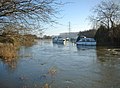 Moored boats on a flooded River Thames - geograph.org.uk - 2201283.jpg 1,024 × 753; 326 KB
-
 More bends - geograph.org.uk - 2281610.jpg 1,024 × 683; 113 KB
-
 More ice on the bend - geograph.org.uk - 2227587.jpg 1,024 × 683; 237 KB
-
 Neglected Footpath, Buckland Marsh - geograph.org.uk - 6533026.jpg 3,565 × 2,232; 2.99 MB
-
 Neglected footpath, Buckland Marsh Farm - geograph.org.uk - 6199400.jpg 4,000 × 3,000; 5.31 MB
-
 Oilseed rape crop, Gainfield - geograph.org.uk - 6267839.jpg 800 × 600; 102 KB
-
 Old Milestone north of Buckland (geograph 5622213).jpg 1,040 × 1,618; 297 KB
-
 On the other bank - geograph.org.uk - 2282602.jpg 1,024 × 683; 74 KB
-
 Open entrance - geograph.org.uk - 2281598.jpg 1,024 × 683; 214 KB
-
 Orchard House, Buckland, Oxfordshire - geograph.org.uk - 4522556.jpg 617 × 640; 155 KB
-
 Parish Notices on the Wall - geograph.org.uk - 6493179.jpg 4,818 × 3,648; 2.64 MB
-
 Park fence, St. George's Road - geograph.org.uk - 6697374.jpg 1,024 × 768; 450 KB
-
 Pasture at Ragnell Farm - geograph.org.uk - 6495774.jpg 2,987 × 2,102; 943 KB
-
 Path by the bends - geograph.org.uk - 2231091.jpg 1,024 × 683; 274 KB
-
 Path heading to Rushey Lock - geograph.org.uk - 3269733.jpg 1,024 × 768; 253 KB
-
 Path near Rectory Farm - geograph.org.uk - 6196879.jpg 4,000 × 3,000; 4.63 MB
-
 Path to Marriage Hill - geograph.org.uk - 3269726.jpg 1,024 × 768; 210 KB
-
 Path towards Ragnell Cottages - geograph.org.uk - 3269738.jpg 1,024 × 768; 180 KB
-
 Path under the branch - geograph.org.uk - 2233383.jpg 1,024 × 683; 329 KB
-
 Peeking through the ... - geograph.org.uk - 2281616.jpg 1,024 × 683; 211 KB
-
 Picnicking beside the Thames near Tadpole Bridge - geograph.org.uk - 6480108.jpg 2,500 × 1,875; 3.98 MB
-
 Pile of Posts - geograph.org.uk - 2408350.jpg 3,968 × 2,232; 2.05 MB
-

-
 Pillbox by the Thames - geograph.org.uk - 911434.jpg 640 × 426; 66 KB
-
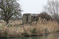
 Pillbox in the field - geograph.org.uk - 2282607.jpg 1,024 × 683; 158 KB
-
 Pillbox on the bend - geograph.org.uk - 2281582.jpg 1,024 × 683; 238 KB
-
 Pine Avenue near Buckland - geograph.org.uk - 2527231.jpg 3,620 × 2,232; 1.71 MB
-
 Plant in front - geograph.org.uk - 2279205.jpg 533 × 800; 132 KB
-
 Ploughed field near Mount Pleasant Farm - geograph.org.uk - 2568111.jpg 1,500 × 1,000; 178 KB
-
 Poppies by St George's Church Wall - geograph.org.uk - 6493100.jpg 5,078 × 3,448; 3.78 MB
-
 Public bridleway to Buckland Warren - geograph.org.uk - 6203153.jpg 4,000 × 3,000; 4.66 MB
-
 Public footpath to Buckland - geograph.org.uk - 6196856.jpg 4,000 × 3,000; 4.71 MB
-
 Public footpath to Buckland Marsh Farm - geograph.org.uk - 6199422.jpg 4,000 × 3,000; 4.76 MB
-
 Public footpath to Gimbro Copse - geograph.org.uk - 6202235.jpg 4,000 × 3,000; 4.47 MB
-

-
 Quadtrac farm tractor - geograph.org.uk - 2052407.jpg 2,304 × 1,704; 1.4 MB
-
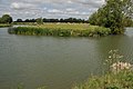
 River Thames - geograph.org.uk - 3269784.jpg 1,024 × 768; 134 KB
-
 River Thames - geograph.org.uk - 3269797.jpg 1,024 × 768; 257 KB
-
 River Thames - geograph.org.uk - 3269802.jpg 1,024 × 768; 267 KB
-
 River Thames - geograph.org.uk - 3269809.jpg 1,024 × 768; 204 KB
-
 River Thames - geograph.org.uk - 3269823.jpg 1,024 × 768; 169 KB
-
 River Thames - geograph.org.uk - 911482.jpg 640 × 426; 63 KB
-
 River Thames - geograph.org.uk - 911492.jpg 640 × 422; 68 KB
-
 River Thames - geograph.org.uk - 911522.jpg 640 × 417; 62 KB
-

-
 River Thames near Buckand - geograph.org.uk - 3647645.jpg 640 × 417; 76 KB
-
 River Thames near Buckland - geograph.org.uk - 3641872.jpg 640 × 495; 104 KB
-
 River Thames near Buckland - geograph.org.uk - 3641902.jpg 640 × 399; 56 KB
-
 River Thames near Buckland - geograph.org.uk - 3641913.jpg 587 × 640; 84 KB
-
 River Thames near Buckland - geograph.org.uk - 3641951.jpg 640 × 430; 74 KB
-
 River Thames near Buckland - geograph.org.uk - 3641954.jpg 640 × 431; 97 KB


,_River_Thames_-_geograph.org.uk_-_2202294.jpg)
,_River_Thames_-_geograph.org.uk_-_2202306.jpg)


.jpg)


