Category:Buckland, Buckinghamshire
Jump to navigation
Jump to search
English: Buckland is a village and civil parish within in Aylesbury Valedistrict in Buckinghamshire, England. It is near the border with Hertfordshire, adjacent to Aston Clinton.
village and civil parish in Buckinghamshire, UK  | |||||
| Upload media | |||||
| Instance of | |||||
|---|---|---|---|---|---|
| Location | Buckinghamshire, South East England, England | ||||
| Said to be the same as | Buckland (Wikimedia duplicated page, civil parish) | ||||
 | |||||
Subcategories
This category has the following 3 subcategories, out of 3 total.
B
- Buckland War Memorial (1 F)
D
- Dancers End House (2 F)
Media in category "Buckland, Buckinghamshire"
The following 134 files are in this category, out of 134 total.
-
 "There's no such thing as the Dog Poo Fairy" - geograph.org.uk - 4166505.jpg 3,648 × 2,736; 2.07 MB
-

-
 A Row of Cottages at Buckland - geograph.org.uk - 2900140.jpg 3,384 × 2,538; 1.39 MB
-

-
 A41 crosses the Grand Union Canal - geograph.org.uk - 3010290.jpg 640 × 480; 48 KB
-
 A41 going Aylesbury way - geograph.org.uk - 6422291.jpg 1,600 × 1,066; 300 KB
-
 A41 heading towards Aylesbury - geograph.org.uk - 2680097.jpg 640 × 480; 58 KB
-
 A41 north of the Grand Union Canal - geograph.org.uk - 3010294.jpg 640 × 480; 49 KB
-
 A41 overbridge near Cherry Farm - geograph.org.uk - 4871752.jpg 640 × 480; 29 KB
-
 Accommodation bridge at Bucklandwharf - geograph.org.uk - 4396547.jpg 1,181 × 1,000; 1.1 MB
-
 All Saints Church - geograph.org.uk - 2167416.jpg 640 × 480; 79 KB
-
 All Saints' church, Buckland - geograph.org.uk - 6422323.jpg 1,600 × 1,200; 382 KB
-
 Arla Dairy Site - A New Road under construction - geograph.org.uk - 2903951.jpg 1,782 × 1,337; 597 KB
-
 Arla Dairy Site - April 2012 - geograph.org.uk - 2903939.jpg 3,556 × 2,370; 1.82 MB
-
 Arla Dairy Site - More parked machinery - geograph.org.uk - 2903947.jpg 2,030 × 1,522; 669 KB
-
 Arla Dairy Site - Reaching for the Sky - geograph.org.uk - 2903943.jpg 2,704 × 1,803; 1.14 MB
-
 Arla Dairy Site - View from Canal Bridge - geograph.org.uk - 2903952.jpg 2,847 × 2,135; 1.23 MB
-
 Arla panorama (under construction) - geograph.org.uk - 3288451.jpg 3,937 × 1,000; 2.87 MB
-
 Arla super dairy - geograph.org.uk - 5212937.jpg 5,202 × 3,465; 3.43 MB
-
 Arla under construction - geograph.org.uk - 3288453.jpg 1,333 × 1,000; 1.06 MB
-
 Aston Clinton By-Pass - geograph.org.uk - 135938.jpg 640 × 480; 90 KB
-
 Aylesbury Ring footpath - geograph.org.uk - 6422321.jpg 1,600 × 1,056; 418 KB
-
 Aylesbury Ring signs - geograph.org.uk - 6006558.jpg 4,608 × 3,456; 3.39 MB
-
 B489 bridge, northbound A41 - geograph.org.uk - 3010298.jpg 640 × 480; 51 KB
-
 Beeches at The Crong - geograph.org.uk - 2958986.jpg 1,333 × 1,000; 2.45 MB
-
 Bees Cottage, Buckland, Buckinghamshire - geograph.org.uk - 2900168.jpg 3,000 × 2,250; 1.06 MB
-

-
 Bracket Fungus in Buckland Hoo Wood - geograph.org.uk - 1542708.jpg 640 × 480; 75 KB
-
 Buckland - All Saints - Altar - geograph.org.uk - 4012946.jpg 1,000 × 801; 698 KB
-
 Buckland - All Saints - interior view of nave - geograph.org.uk - 4012949.jpg 1,000 × 744; 566 KB
-

-

-
 Buckland - All Saints - Stained Glass (1) - geograph.org.uk - 4013946.jpg 750 × 1,000; 564 KB
-
 Buckland - All Saints - Stained Glass (2) - geograph.org.uk - 4013953.jpg 769 × 1,000; 608 KB
-
 Buckland - All Saints - Stained Glass (3) - geograph.org.uk - 4013956.jpg 836 × 1,000; 640 KB
-
 Buckland - All Saints - Stained Glass (4) - geograph.org.uk - 4013960.jpg 750 × 1,000; 531 KB
-
 Buckland - All Saints Church - geograph.org.uk - 4012913.jpg 1,000 × 750; 652 KB
-
 Buckland - All Saints Church tower - geograph.org.uk - 4012922.jpg 671 × 1,000; 562 KB
-

-

-
 Buckland - Grand Union Canal Aylesbury Arm Bridge Number 8 - 20231125113323.jpg 4,000 × 3,000; 3.58 MB
-
 Buckland - Grand Union Canal Aylesbury Arm Bridge Number 8 - 20231125113343.jpg 4,000 × 3,000; 3.15 MB
-
 Buckland - Grand Union Canal Aylesbury Arm Bridge Number 8 - 20231125113422.jpg 4,000 × 3,000; 3.18 MB
-
 Buckland - Grand Union Canal Aylesbury Arm Bridge Number 8 - 20231125114033.jpg 4,000 × 3,000; 5.5 MB
-
 Buckland Bridge No 8 - geograph.org.uk - 4890790.jpg 800 × 498; 140 KB
-
 Buckland church - geograph.org.uk - 4014143.jpg 640 × 500; 107 KB
-
 Buckland Parish Church from the War Memorial - geograph.org.uk - 2900111.jpg 3,645 × 2,734; 1.54 MB
-
 Buckland Road, Aston Clinton - geograph.org.uk - 5642576.jpg 2,304 × 1,728; 1.03 MB
-
 Buckland Wharf - geograph.org.uk - 135999.jpg 640 × 480; 181 KB
-
 Bucklandwharf - A section of Wendover Arm canal - geograph.org.uk - 4396589.jpg 1,036 × 1,000; 1.05 MB
-
 Cherry Farm - geograph.org.uk - 135942.jpg 640 × 480; 74 KB
-
 Cherry Farm bridge, A41 - geograph.org.uk - 3010308.jpg 640 × 480; 68 KB
-
 Church Farm, Buckland - geograph.org.uk - 1201485.jpg 2,468 × 1,915; 1.14 MB
-
 Church Leys, Buckland - geograph.org.uk - 1201483.jpg 3,264 × 2,448; 1.93 MB
-
 Cottages at Buckland Wharf - geograph.org.uk - 571617.jpg 640 × 480; 109 KB
-
 Crong Radio Site - geograph.org.uk - 3183922.jpg 1,000 × 1,437; 1.02 MB
-
 Dancers End Lane - geograph.org.uk - 4014170.jpg 640 × 480; 158 KB
-
 Dancers End Lane, Tring - geograph.org.uk - 139508.jpg 640 × 480; 123 KB
-
 Field by the Aylesbury Arm - geograph.org.uk - 5212219.jpg 5,202 × 3,465; 3.4 MB
-

-

-
 Footpath gets a Re-tread - geograph.org.uk - 579557.jpg 640 × 480; 113 KB
-
 Footpath into Buckland - geograph.org.uk - 6422293.jpg 1,600 × 1,066; 690 KB
-
 Footpath into Buckland - geograph.org.uk - 6422312.jpg 1,600 × 1,066; 332 KB
-
 Former New Inn, Bucklandwharf - geograph.org.uk - 4014081.jpg 640 × 480; 93 KB
-
 GOC Tring & Wendover Woods 023 Northill Wood, Buckland (33947203543).jpg 3,456 × 4,608; 5.2 MB
-
 GOC Tring & Wendover Woods 026 Northill Wood, Buckland (33947205403).jpg 4,608 × 3,456; 4.92 MB
-
 GOC Tring & Wendover Woods 095 Wendover Arm Canal, Buckland (34051182733).jpg 4,229 × 3,178; 4.27 MB
-
 GOC Tring & Wendover Woods 097 Wendover Arm Canal, Buckland (34861134345).jpg 4,608 × 3,456; 5.1 MB
-

-
 Grand Union Canal - geograph.org.uk - 2166964.jpg 640 × 480; 107 KB
-

-

-
 Lay-by on the northbound A41 - geograph.org.uk - 3010296.jpg 640 × 480; 49 KB
-
 Layby on the A41, Buckland - geograph.org.uk - 6179666.jpg 1,892 × 1,236; 1.19 MB
-

-
 Looking along the Wendover Arm to Bucklandwharf - geograph.org.uk - 4396596.jpg 1,333 × 1,000; 1.23 MB
-
 Looking back downhill towards The Crong - geograph.org.uk - 89830.jpg 640 × 480; 127 KB
-
 Looking uphill from near The Crong - geograph.org.uk - 89834.jpg 480 × 640; 143 KB
-
 Lower Farm, Buckland, Buckinghamshire - geograph.org.uk - 2900157.jpg 3,273 × 2,454; 1.72 MB
-

-
 Manor Farm, Buckland, Buckinghamshire - geograph.org.uk - 2899989.jpg 2,860 × 2,145; 1.58 MB
-
 Mast at Northill Wood - geograph.org.uk - 1566170.jpg 640 × 480; 65 KB
-
 Narrowboat at Buckland Lock No 12 - geograph.org.uk - 4890809.jpg 800 × 623; 148 KB
-
 Nield's Farm, Buckinghamshire - geograph.org.uk - 2900001.jpg 3,280 × 2,460; 2.17 MB
-
 No longer the Rothschild Arms, Aston Clinton - geograph.org.uk - 5642575.jpg 2,208 × 1,592; 984 KB
-
 No Open Arms Here - geograph.org.uk - 4715621.jpg 3,780 × 2,664; 2.3 MB
-
 Northill Wood, near The Crong - geograph.org.uk - 167625.jpg 640 × 480; 141 KB
-
 Path by Buckland Hoo - geograph.org.uk - 6029160.jpg 640 × 480; 144 KB
-
 Pegg House, Peggs Lane, Buckland - geograph.org.uk - 1201478.jpg 3,264 × 2,448; 2.29 MB
-
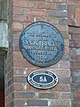 Plaque on Saxon Way Bridge - geograph.org.uk - 4398996.jpg 3,000 × 4,000; 3.68 MB
-
 Probable former course of Wendover Arm - geograph.org.uk - 4396807.jpg 1,333 × 1,000; 1.46 MB
-
 Queuing on the Halton Road - geograph.org.uk - 5974324.jpg 3,133 × 2,088; 992 KB
-
 Radio mast by Bottom Road - geograph.org.uk - 4014902.jpg 640 × 480; 103 KB
-
 Reeds and sluice mechanism, Wendover Arm - geograph.org.uk - 4396819.jpg 1,333 × 1,000; 1.43 MB
-
 Reeds beside the Wendover Arm - geograph.org.uk - 4396831.jpg 1,102 × 1,000; 1.01 MB
-
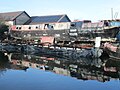 Reflections at Bates’s Boatyard, Puttenham - geograph.org.uk - 6006555.jpg 4,608 × 3,456; 3.79 MB
-
 Remembering the Dead of the First World War at Buckland - geograph.org.uk - 2900048.jpg 3,698 × 2,803; 1.36 MB
-
 Remembering the Dead of the First World War at Buckland - geograph.org.uk - 2900056.jpg 3,669 × 2,764; 983 KB
-
 Remembering the Dead of the Second World War at Buckland - geograph.org.uk - 2900079.jpg 3,114 × 2,335; 1.26 MB
-
 Reservoirs by Bottom Lane - geograph.org.uk - 4014209.jpg 640 × 480; 116 KB
-
 Road north from Bridge 8, Aylesbury Arm canal - geograph.org.uk - 4166580.jpg 3,648 × 2,736; 3.34 MB
-
 Road over canal bridge 8 - geograph.org.uk - 5212235.jpg 5,202 × 3,465; 3.74 MB
-
 Saxon Way Bridge on the Wendover Arm - geograph.org.uk - 4396839.jpg 1,333 × 1,000; 1.05 MB
-
 Stream by the field edge - geograph.org.uk - 6422300.jpg 1,600 × 1,066; 425 KB
-
 Thatched Houses, Buckland - geograph.org.uk - 135987.jpg 640 × 480; 91 KB
-
 The Beefeater car park on Tring Hill - geograph.org.uk - 5640693.jpg 2,048 × 1,536; 1,003 KB
-
 The Beefeater on Tring Hill - geograph.org.uk - 5640696.jpg 2,024 × 1,504; 694 KB
-
 The Church Tower and South Porch, Buckland - geograph.org.uk - 2900024.jpg 2,419 × 3,225; 1.21 MB
-
 The Crong - geograph.org.uk - 167417.jpg 480 × 640; 127 KB
-
 The Gospel Hall has gone, Buckland Wharf - geograph.org.uk - 1427088.jpg 640 × 480; 101 KB
-
 The Gospel Hall, Buckland Wharf - geograph.org.uk - 1260882.jpg 640 × 480; 79 KB
-
 The Gospel Hall, Buckland Wharf - geograph.org.uk - 1260895.jpg 640 × 480; 70 KB
-
-
 The Old Dukes Head, Peggs Lane, Buckland - geograph.org.uk - 1201480.jpg 3,264 × 2,448; 2.34 MB
-
 The Old New Inn - geograph.org.uk - 4688592.jpg 3,626 × 2,579; 1.47 MB
-
 The Old Plough, Peggs Lane, Buckland - geograph.org.uk - 1201475.jpg 3,247 × 2,436; 1.73 MB
-
 The Only Road to Buckland Village - geograph.org.uk - 2899964.jpg 3,096 × 2,322; 1.03 MB
-
 The Parish Church from the North East, Buckland - geograph.org.uk - 2900126.jpg 3,240 × 2,430; 1.94 MB
-
 The Wendover Arm near Buckland Wharf - geograph.org.uk - 579584.jpg 640 × 480; 102 KB
-
-
 Tring Hill - geograph.org.uk - 5640725.jpg 2,048 × 1,536; 1.51 MB
-

-
 Upper Icknield Way near Buckland Wharf - geograph.org.uk - 571589.jpg 640 × 480; 107 KB
-
 View south from Dancers End Lane - geograph.org.uk - 4014157.jpg 640 × 480; 133 KB
-
 View through Saxon Way Bridge - geograph.org.uk - 4396844.jpg 1,333 × 1,000; 1.25 MB
-
 Wendover Arm - bifurcation - geograph.org.uk - 4396800.jpg 1,333 × 1,000; 1.33 MB
-
 Wendover Arm - view WSW from bifurcation - geograph.org.uk - 4396825.jpg 1,000 × 1,333; 1.16 MB
-
 Wendover Arm of the Grand Union Canal at Bucklandwharf - geograph.org.uk - 6008867.jpg 4,608 × 3,456; 6.03 MB
-

-

-

-
 Yew Tree Cottage, Buckland - geograph.org.uk - 135990.jpg 640 × 480; 104 KB
-
 Bridge No. 7, Aylesbury Arm at Puttenham - geograph.org.uk - 1480404.jpg 640 × 480; 129 KB


_-_geograph.org.uk_-_4012952.jpg)
_-_geograph.org.uk_-_4012956.jpg)
_-_geograph.org.uk_-_4013946.jpg)
_-_geograph.org.uk_-_4013953.jpg)
_-_geograph.org.uk_-_4013956.jpg)
_-_geograph.org.uk_-_4013960.jpg)


.jpg)
.jpg)
.jpg)
.jpg)
_in_Bucklandwharf_-_geograph.org.uk_-_515910.jpg)


_-_geograph.org.uk_-_4171350.jpg)


_-_geograph.org.uk_-_3288451.jpg)