Category:Buckinghamshire photographs taken on 2016-07-09
Jump to navigation
Jump to search
Media in category "Buckinghamshire photographs taken on 2016-07-09"
The following 169 files are in this category, out of 169 total.
-
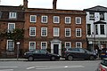
 1 - 5, London Rd - geograph.org.uk - 5264434.jpg 640 × 426; 83 KB
-
 14 - 15, Easton St - geograph.org.uk - 5264444.jpg 426 × 640; 74 KB
-
 24 - 7, High St - geograph.org.uk - 5264528.jpg 640 × 426; 77 KB
-
 39, High St - geograph.org.uk - 5264589.jpg 640 × 426; 80 KB
-
 41, High St - geograph.org.uk - 5251664.jpg 640 × 426; 91 KB
-
 65, High St - geograph.org.uk - 5251672.jpg 640 × 426; 73 KB
-
 80, High St - geograph.org.uk - 5251695.jpg 640 × 426; 73 KB
-
 90, High St - geograph.org.uk - 5251691.jpg 640 × 426; 65 KB
-
 A40 - geograph.org.uk - 5255781.jpg 640 × 426; 86 KB
-
 A40 - geograph.org.uk - 5255782.jpg 640 × 426; 80 KB
-
 A40 - geograph.org.uk - 5264431.jpg 640 × 426; 83 KB
-
 A4155 - geograph.org.uk - 5251713.jpg 640 × 426; 69 KB
-
 All weather pitches - geograph.org.uk - 5255863.jpg 640 × 426; 97 KB
-
 Assembly House - geograph.org.uk - 5251707.jpg 640 × 492; 72 KB
-
 Barclays Bank - geograph.org.uk - 5251648.jpg 640 × 560; 98 KB
-
 Bassetbury Lane - geograph.org.uk - 5260261.jpg 640 × 426; 83 KB
-
 Bassetbury Manor - geograph.org.uk - 5260748.jpg 640 × 426; 75 KB
-
 Bassetbury Manor - geograph.org.uk - 5260760.jpg 640 × 425; 66 KB
-
 Bassettsbury Lane - geograph.org.uk - 5255883.jpg 640 × 426; 74 KB
-
 Bowls Club - geograph.org.uk - 5260754.jpg 640 × 426; 114 KB
-
 Brampton House - geograph.org.uk - 5251692.jpg 640 × 426; 71 KB
-
 Bridge Close School - geograph.org.uk - 5251677.jpg 426 × 640; 78 KB
-
 Buckingham New University - geograph.org.uk - 5251792.jpg 640 × 426; 72 KB
-
 Buckingham New University - geograph.org.uk - 5251795.jpg 640 × 426; 54 KB
-
 Buckingham New University - geograph.org.uk - 5251799.jpg 640 × 426; 75 KB
-
 Bulrushes. River Wye - geograph.org.uk - 5261122.jpg 640 × 426; 110 KB
-
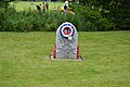 Burma War Memorial - geograph.org.uk - 5264433.jpg 640 × 426; 95 KB
-
 Cafe, The Rye - geograph.org.uk - 5255795.jpg 640 × 426; 93 KB
-
 Chestnut Avenue - geograph.org.uk - 5260276.jpg 640 × 426; 58 KB
-
 Church of All Saints - geograph.org.uk - 5251687.jpg 640 × 426; 76 KB
-
 Church of All Saints - geograph.org.uk - 5264604.jpg 426 × 640; 80 KB
-
 Cottage, Bassettbury Lane - geograph.org.uk - 5260263.jpg 640 × 426; 91 KB
-
 Easton St - geograph.org.uk - 5264442.jpg 640 × 426; 64 KB
-
 Easton St - geograph.org.uk - 5264443.jpg 640 × 426; 72 KB
-
 Easton Street car Park - geograph.org.uk - 5264445.jpg 640 × 454; 76 KB
-
 Eden Centre - geograph.org.uk - 5270077.jpg 640 × 426; 70 KB
-
 Eden Shopping Centre - geograph.org.uk - 5251731.jpg 640 × 426; 68 KB
-
 Eden Shopping Centre - geograph.org.uk - 5251787.jpg 640 × 426; 54 KB
-
 Eden Shopping Centre - geograph.org.uk - 5251788.jpg 640 × 426; 68 KB
-
 Entrance to The Rye - geograph.org.uk - 5264441.jpg 640 × 426; 95 KB
-
 Footbridge. River Wye - geograph.org.uk - 5255871.jpg 640 × 426; 91 KB
-
 Footpath to Bassettsbury Lane - geograph.org.uk - 5255879.jpg 640 × 426; 113 KB
-
 Footpath to Bassettsbury Lane - geograph.org.uk - 5255880.jpg 640 × 426; 116 KB
-
 Footpath to Bassettsbury Lane - geograph.org.uk - 5255881.jpg 640 × 426; 122 KB
-
 Friends House, High Wycombe - geograph.org.uk - 5261130.jpg 640 × 426; 84 KB
-
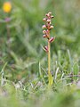 Frog Orchid (27939432820).jpg 750 × 1,000; 141 KB
-
 Funges Farm - geograph.org.uk - 5255884.jpg 640 × 426; 114 KB
-
 Guildhall - geograph.org.uk - 5270071.jpg 640 × 425; 64 KB
-
 Harlow Rd - geograph.org.uk - 5260944.jpg 640 × 426; 81 KB
-
 High St - geograph.org.uk - 5251699.jpg 426 × 640; 64 KB
-
 High St - geograph.org.uk - 5264447.jpg 640 × 426; 66 KB
-
 High St - geograph.org.uk - 5264529.jpg 640 × 426; 61 KB
-
 High Wycombe Liberal Club - geograph.org.uk - 5256278.jpg 640 × 488; 92 KB
-
 High Wycombe Travelodge - geograph.org.uk - 5251734.jpg 426 × 640; 57 KB
-
 House on London Rd - geograph.org.uk - 5264430.jpg 640 × 426; 82 KB
-
 House on London Rd - geograph.org.uk - 5264848.jpg 640 × 425; 82 KB
-
 Houses on Bassettsbury Lane - geograph.org.uk - 5255886.jpg 640 × 426; 113 KB
-
 Houses on London Rd - geograph.org.uk - 5264850.jpg 640 × 426; 76 KB
-
 Imperial Club - geograph.org.uk - 5255767.jpg 640 × 426; 74 KB
-
 Institute Rd - geograph.org.uk - 5251666.jpg 640 × 426; 60 KB
-
 Keep Hill Rd - geograph.org.uk - 5255873.jpg 640 × 426; 77 KB
-
 Keep Hill Rd - geograph.org.uk - 5260273.jpg 640 × 426; 92 KB
-
 Lily's Walk - geograph.org.uk - 5251791.jpg 640 × 426; 65 KB
-
 Lily's Way - geograph.org.uk - 5251786.jpg 640 × 426; 70 KB
-
 Liston Court - geograph.org.uk - 5251659.jpg 640 × 426; 81 KB
-
 Liston Court - geograph.org.uk - 5251660.jpg 640 × 426; 93 KB
-
 Lloyds Bank - geograph.org.uk - 5251654.jpg 640 × 426; 73 KB
-
 London Rd, A40 - geograph.org.uk - 5260905.jpg 640 × 426; 73 KB
-
 Lytton House - geograph.org.uk - 5260908.jpg 640 × 472; 79 KB
-
 Magazin Romanesc - geograph.org.uk - 5264870.jpg 640 × 426; 75 KB
-
 Market on High St - geograph.org.uk - 5264530.jpg 640 × 426; 82 KB
-
 Marlow War Memorial - geograph.org.uk - 5251682.jpg 426 × 640; 91 KB
-
 Marlow War Memorial - geograph.org.uk - 5251686.jpg 438 × 640; 57 KB
-
 Millennium Clock - geograph.org.uk - 5270069.jpg 426 × 640; 62 KB
-
 Obelisk - geograph.org.uk - 5251644.jpg 2,000 × 3,008; 1.5 MB
-
 Obelisk - geograph.org.uk - 5251710.jpg 640 × 426; 69 KB
-
 Off Warren Wood Rd - geograph.org.uk - 5255874.jpg 640 × 426; 90 KB
-
 Off Warren Wood Rd - geograph.org.uk - 5255877.jpg 640 × 426; 90 KB
-
 Old Mill Cottage - geograph.org.uk - 5260254.jpg 640 × 426; 86 KB
-
 One way, A40 - geograph.org.uk - 5264437.jpg 640 × 426; 78 KB
-
 Park House - geograph.org.uk - 5261124.jpg 640 × 426; 68 KB
-
 Passing Funges Farm - geograph.org.uk - 5255885.jpg 640 × 426; 97 KB
-
 Paths, The Rye - geograph.org.uk - 5255788.jpg 640 × 426; 102 KB
-
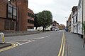
 Pedestrianised street - geograph.org.uk - 5270073.jpg 640 × 426; 65 KB
-
 Penguin Fish Bar - geograph.org.uk - 5251650.jpg 640 × 426; 56 KB
-
 Police Station, High Wycombe - geograph.org.uk - 5255773.jpg 640 × 426; 73 KB
-
 Renovating a building - geograph.org.uk - 5264862.jpg 640 × 425; 63 KB
-
 Renovation - geograph.org.uk - 5264864.jpg 640 × 458; 82 KB
-
 River Wye - geograph.org.uk - 5255772.jpg 640 × 426; 127 KB
-
 River Wye - geograph.org.uk - 5255775.jpg 640 × 426; 123 KB
-
 River Wye - geograph.org.uk - 5255778.jpg 640 × 426; 115 KB
-
 River Wye - geograph.org.uk - 5255866.jpg 640 × 426; 114 KB
-
 River Wye - geograph.org.uk - 5255870.jpg 640 × 426; 131 KB
-
 River Wye - geograph.org.uk - 5260258.jpg 640 × 426; 107 KB
-
 River Wye - geograph.org.uk - 5260762.jpg 640 × 426; 98 KB
-
 River Wye - geograph.org.uk - 5260767.jpg 640 × 471; 111 KB
-
 River Wye - geograph.org.uk - 5260771.jpg 640 × 426; 110 KB
-
 River Wye - geograph.org.uk - 5260798.jpg 640 × 426; 109 KB
-
 River Wye - geograph.org.uk - 5260823.jpg 640 × 426; 106 KB
-
 River Wye - geograph.org.uk - 5260838.jpg 640 × 426; 104 KB
-
 River Wye - geograph.org.uk - 5260841.jpg 640 × 426; 125 KB
-
 River Wye - geograph.org.uk - 5260915.jpg 640 × 426; 113 KB
-
 Rooftops, High Wycombe - geograph.org.uk - 5251727.jpg 640 × 426; 68 KB
-
 Roundabout, A404 - geograph.org.uk - 5251803.jpg 640 × 426; 68 KB
-
 Ruins of St John's Hospital - geograph.org.uk - 5264438.jpg 640 × 426; 131 KB
-
 Ruins of St John's Hospital - geograph.org.uk - 5264439.jpg 640 × 426; 118 KB
-
 Ruins of St John's Hospital - geograph.org.uk - 5264440.jpg 640 × 426; 113 KB
-
 Sainsbury's - geograph.org.uk - 5251635.jpg 640 × 426; 58 KB
-
 Stuart Rd - geograph.org.uk - 5261129.jpg 640 × 426; 79 KB
-
 Terrace, London Rd - geograph.org.uk - 5264432.jpg 640 × 425; 95 KB
-
 The Assembly Rooms - geograph.org.uk - 5251640.jpg 426 × 640; 70 KB
-
 The Dyke - geograph.org.uk - 5255827.jpg 640 × 426; 101 KB
-
 The Dyke - geograph.org.uk - 5255836.jpg 640 × 426; 105 KB
-
 The Dyke - geograph.org.uk - 5255848.jpg 640 × 426; 85 KB
-
 The Dyke - geograph.org.uk - 5255859.jpg 640 × 426; 78 KB
-
 The Dyke - geograph.org.uk - 5255861.jpg 640 × 426; 85 KB
-
 The Dyke - geograph.org.uk - 5255862.jpg 640 × 426; 93 KB
-
 The Dyke - geograph.org.uk - 5255864.jpg 640 × 426; 89 KB
-
 The Dyke - geograph.org.uk - 5255887.jpg 640 × 426; 98 KB
-
 The Dyke - geograph.org.uk - 5255888.jpg 640 × 426; 78 KB
-
 The Dyke, The Rye - geograph.org.uk - 5255797.jpg 640 × 426; 110 KB
-
 The End House - geograph.org.uk - 5251690.jpg 640 × 426; 81 KB
-
 The ex Nags Head - geograph.org.uk - 5260895.jpg 640 × 426; 60 KB
-
 The ex Nags Head - geograph.org.uk - 5260900.jpg 640 × 426; 74 KB
-
 The Falcon - geograph.org.uk - 5264597.jpg 640 × 426; 77 KB
-
 The Guildhall - geograph.org.uk - 5264595.jpg 640 × 426; 66 KB
-
 The Guildhall - geograph.org.uk - 5264600.jpg 640 × 426; 81 KB
-
 The Guildhall - geograph.org.uk - 5264602.jpg 640 × 426; 88 KB
-
 The Hobgoblin - geograph.org.uk - 5264531.jpg 640 × 426; 77 KB
-
 The Hobgoblin - geograph.org.uk - 5264536.jpg 640 × 426; 65 KB
-
 The Little Market House - geograph.org.uk - 5264591.jpg 640 × 425; 77 KB
-
 The Little Market House - geograph.org.uk - 5264593.jpg 640 × 426; 79 KB
-
 The Little Market House - geograph.org.uk - 5264598.jpg 640 × 426; 80 KB
-
 The Little Market House - geograph.org.uk - 5270072.jpg 640 × 426; 81 KB
-
 The Rye - geograph.org.uk - 5255792.jpg 640 × 426; 73 KB
-
 The Rye - geograph.org.uk - 5255826.jpg 640 × 426; 48 KB
-
 The Rye - geograph.org.uk - 5255834.jpg 640 × 426; 49 KB
-
 The Rye - geograph.org.uk - 5255840.jpg 640 × 426; 63 KB
-
 The Rye - geograph.org.uk - 5255846.jpg 640 × 426; 49 KB
-
 The Rye - geograph.org.uk - 5255857.jpg 640 × 426; 55 KB
-
 The Rye - geograph.org.uk - 5255858.jpg 640 × 426; 54 KB
-
 The Rye and Holywell Meads - geograph.org.uk - 5261125.jpg 640 × 426; 86 KB
-
 The Rye ^ Holywell Mead - geograph.org.uk - 5260279.jpg 640 × 426; 67 KB
-
 The Rye ^ Holywell Mead - geograph.org.uk - 5260733.jpg 640 × 426; 76 KB
-
 The Rye ^ Holywell Mead - geograph.org.uk - 5260743.jpg 640 × 426; 41 KB
-
 The Rye ^ Holywell Mead - geograph.org.uk - 5260826.jpg 640 × 426; 63 KB
-
 Town centre dereliction - geograph.org.uk - 5270074.jpg 640 × 426; 47 KB
-
 Track, The Rye - geograph.org.uk - 5255790.jpg 640 × 426; 98 KB
-
 Track, The Rye - geograph.org.uk - 5260741.jpg 640 × 426; 91 KB
-
 Trinity UR Church - geograph.org.uk - 5264435.jpg 640 × 426; 68 KB
-
 Trinity UR Church - geograph.org.uk - 5264436.jpg 640 × 426; 76 KB
-
 Trinity UR Church - geograph.org.uk - 5264855.jpg 426 × 640; 74 KB
-
 Trinity UR Church - geograph.org.uk - 5264858.jpg 425 × 640; 72 KB
-
 Union Baptist Church - geograph.org.uk - 5264446.jpg 640 × 426; 69 KB
-
 Victorian Postbox - geograph.org.uk - 5251678.jpg 426 × 640; 68 KB
-
 Warren Wood Drive - geograph.org.uk - 5255872.jpg 640 × 426; 79 KB
-
 Warren Wood Rd - geograph.org.uk - 5255875.jpg 640 × 426; 76 KB
-
 Warren Wood Rd - geograph.org.uk - 5255878.jpg 640 × 426; 83 KB
-
 WHSmith - geograph.org.uk - 5251704.jpg 640 × 387; 68 KB
-
 Wimpy - geograph.org.uk - 5251701.jpg 426 × 640; 83 KB
-
 Woodbine Cottage - geograph.org.uk - 5260904.jpg 640 × 412; 76 KB
-
 Woodland, The Rye - geograph.org.uk - 5260727.jpg 640 × 426; 74 KB
-
 Wycombe Fire Station - geograph.org.uk - 5251801.jpg 640 × 426; 59 KB
-
 Wycombe Rye Lido - geograph.org.uk - 5260778.jpg 640 × 426; 70 KB
-
 Wycombe Rye Lido - geograph.org.uk - 5260786.jpg 640 × 426; 62 KB
-
 Wycombe Rye Lido - geograph.org.uk - 5260793.jpg 640 × 426; 65 KB
-
 Wycombe Rye Lido - geograph.org.uk - 5260805.jpg 640 × 426; 76 KB
-
 Wycombe Swan - geograph.org.uk - 5255766.jpg 640 × 426; 83 KB
-
 Zizzi, Marlow - geograph.org.uk - 5251696.jpg 640 × 426; 80 KB


.jpg)


