Category:Buckerell
Jump to navigation
Jump to search
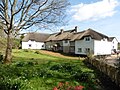
English: Buckerell is a village and civil parish in the East Devon district of Devon, England. According to the 2001 census it had a population of 270. It is about 3½ miles west of Honiton.
village in United Kingdom  | |||||
| Upload media | |||||
| Instance of | |||||
|---|---|---|---|---|---|
| Location | East Devon, Devon, South West England, England | ||||
| Population |
| ||||
| Area |
| ||||
 | |||||
Subcategories
This category has only the following subcategory.
Media in category "Buckerell"
The following 71 files are in this category, out of 71 total.
-
 A giant perhaps - Deer Park Buckerell - geograph.org.uk - 4715497.jpg 1,024 × 768; 298 KB
-
 A373 on the slope of Hembury Fort - geograph.org.uk - 3091302.jpg 1,024 × 768; 606 KB
-
 Avenhayes - geograph.org.uk - 5453093.jpg 1,024 × 768; 207 KB
-
 Avenhayes, Buckerell - geograph.org.uk - 2783445.jpg 640 × 480; 81 KB
-
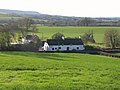
 Buckerell village - geograph.org.uk - 3091278.jpg 768 × 1,024; 474 KB
-
 Buckerell, The Lodge - geograph.org.uk - 191089.jpg 640 × 427; 293 KB
-
 Buckerell, towards Gittisham - geograph.org.uk - 191100.jpg 640 × 427; 189 KB
-
 Buckerell, Treaslake Farm - geograph.org.uk - 130586.jpg 640 × 427; 156 KB
-
 Cattle shed, Sowton Farm - geograph.org.uk - 5453087.jpg 1,024 × 802; 203 KB
-
 Cherry Bridge - geograph.org.uk - 2784606.jpg 640 × 486; 88 KB
-
 Cherry Bridge - geograph.org.uk - 2784635.jpg 640 × 476; 91 KB
-
 Church interior - Buckerell - geograph.org.uk - 4713087.jpg 800 × 600; 114 KB
-
 Church of St Mary and St Giles, Buckerell - geograph.org.uk - 5342282.jpg 1,024 × 768; 201 KB
-
 Colhayes - geograph.org.uk - 2451676.jpg 640 × 415; 60 KB
-
 Cottage, Buckerell - geograph.org.uk - 2783480.jpg 640 × 423; 65 KB
-
 Cottages, Buckerell - geograph.org.uk - 5342362.jpg 1,024 × 768; 144 KB
-
 Crops in a field and a small woodland - geograph.org.uk - 3091271.jpg 1,024 × 768; 511 KB
-
 Curscombe Lane - geograph.org.uk - 6057188.jpg 678 × 1,024; 965 KB
-
 Dead tree - geograph.org.uk - 316251.jpg 480 × 640; 89 KB
-
 Deer Park Farm - geograph.org.uk - 5342270.jpg 1,024 × 764; 225 KB
-
 East Devon , Grassy Field ^ Cattle - geograph.org.uk - 5777546.jpg 6,000 × 4,000; 6.99 MB
-
 East Devon , The River Otter - geograph.org.uk - 3128447.jpg 3,264 × 2,448; 3.91 MB
-
 East Devon , The River Otter - geograph.org.uk - 3128450.jpg 3,264 × 2,448; 3.98 MB
-
 East Devon , Track - geograph.org.uk - 5777548.jpg 6,000 × 4,000; 7.5 MB
-
 East Devon , Track - geograph.org.uk - 5777549.jpg 6,000 × 4,000; 7.32 MB
-
 East Devon , Track - geograph.org.uk - 5777552.jpg 4,000 × 6,000; 7.86 MB
-
 East Devon , Track - geograph.org.uk - 5777562.jpg 6,000 × 4,000; 5.96 MB
-
 Farm buildings at Sowton - geograph.org.uk - 3091261.jpg 800 × 600; 88 KB
-
 Farm buildings at Sowton - geograph.org.uk - 3720544.jpg 1,920 × 1,440; 375 KB
-
 Farm track near Avenhayes - geograph.org.uk - 5453089.jpg 1,024 × 818; 307 KB
-
 Field by Summerhayes Farm - geograph.org.uk - 2783725.jpg 640 × 487; 67 KB
-
 Field near Sowton - geograph.org.uk - 3720506.jpg 2,048 × 1,536; 713 KB
-
 Ford at Weston - geograph.org.uk - 4195105.jpg 3,872 × 2,592; 5.52 MB
-
 Gate and field, Sowton - geograph.org.uk - 3719730.jpg 1,920 × 2,560; 1.31 MB
-
 Green lane junction - geograph.org.uk - 2783619.jpg 640 × 471; 87 KB
-
 Hillside Houses, Buckerell - geograph.org.uk - 5342388.jpg 1,024 × 768; 181 KB
-
 Jemima Puddleduck and "friend" - geograph.org.uk - 316262.jpg 640 × 480; 133 KB
-
 Lane north of Summerhayes Farm - geograph.org.uk - 2783776.jpg 480 × 640; 102 KB
-
 Lane past Buckerell House - geograph.org.uk - 2783542.jpg 640 × 480; 66 KB
-
 Lane past Summerhayes Farm - geograph.org.uk - 2783734.jpg 640 × 480; 89 KB
-
 Lane, north of Buckerell - geograph.org.uk - 5342437.jpg 1,024 × 768; 230 KB
-
 Leaving the north side of Buckerell - geograph.org.uk - 3091283.jpg 1,024 × 767; 565 KB
-
 Meadow by the Wolf - geograph.org.uk - 2784616.jpg 640 × 480; 78 KB
-
 Memorial Cross, Buckerell - geograph.org.uk - 5342278.jpg 1,024 × 768; 210 KB
-
 Minor road to Buckerell - geograph.org.uk - 5453096.jpg 1,024 × 768; 300 KB
-
 Old Post Office, Buckerell, Devon. (2565412816).jpg 1,280 × 960; 246 KB
-
 Otter valley south of Buckerell - geograph.org.uk - 2451702.jpg 640 × 416; 65 KB
-
 Outbuildings at Sowton Farm - geograph.org.uk - 5453084.jpg 1,024 × 799; 161 KB
-
 Outbuildings at Summerhayes Farm - geograph.org.uk - 5342400.jpg 1,024 × 768; 153 KB
-
 Potato patch at Sowton Farm - geograph.org.uk - 190034.jpg 640 × 480; 90 KB
-

-
 River Wolf from Cherry Bridge - geograph.org.uk - 2784664.jpg 480 × 640; 123 KB
-
 Road junction west of Buckerell - geograph.org.uk - 2136279.jpg 640 × 480; 122 KB
-
 Sewage works at Buckerell Cross - geograph.org.uk - 3719589.jpg 2,048 × 1,536; 608 KB
-
 St Mary and St Giles Church, Buckerell - geograph.org.uk - 4713068.jpg 800 × 600; 127 KB
-
 Summerhayes Farmhouse - geograph.org.uk - 5342395.jpg 1,024 × 768; 209 KB
-
 Tape Lane - geograph.org.uk - 5342257.jpg 1,024 × 768; 318 KB
-
 Telephone box, Buckerell - geograph.org.uk - 5342378.jpg 1,024 × 768; 142 KB
-

-
 The Deer Park - Buckerell - geograph.org.uk - 1110562.jpg 640 × 417; 80 KB
-
 The Old Rectory, Buckerell - geograph.org.uk - 5342286.jpg 1,024 × 788; 201 KB
-

-
 The road that passes Combehayes Farm - geograph.org.uk - 2136303.jpg 640 × 480; 120 KB
-
 The road to Curscombe - geograph.org.uk - 3409243.jpg 1,024 × 768; 177 KB
-
 The working area of Summerhayes farm - geograph.org.uk - 3091289.jpg 1,024 × 767; 505 KB
-
 Track to Colhayes - geograph.org.uk - 2783603.jpg 640 × 454; 87 KB
-
 Tracks to Combehayes Farm - geograph.org.uk - 3091293.jpg 1,024 × 768; 731 KB
-
 Treaselake Farm - geograph.org.uk - 5342275.jpg 1,024 × 768; 261 KB
-
 View from near Hembury Fort Cross - geograph.org.uk - 6055064.jpg 1,024 × 678; 724 KB
-
 View to the south from Hembury Hill Fort - geograph.org.uk - 5178944.jpg 1,024 × 792; 234 KB
-
 Weston Lane - geograph.org.uk - 2784673.jpg 640 × 470; 76 KB


.jpg)


