Category:Bubwith
Jump to navigation
Jump to search
English: Bubwith is a village and civil parish in the East Riding of Yorkshire, England. The village is situated about 8 miles (13 km) north east of Selby, and 6 miles (9.7 km) north of Goole. It is situated on the east bank of the River Derwent, west of which is the Selby district of North Yorkshire. It lies on the A163 road.
village and civil parish in East Riding of Yorkshire, United Kingdom  | |||||
| Upload media | |||||
| Instance of | |||||
|---|---|---|---|---|---|
| Location | East Riding of Yorkshire, Yorkshire and the Humber, England | ||||
| Has part(s) | |||||
| Population |
| ||||
 | |||||
Subcategories
This category has the following 8 subcategories, out of 8 total.
A
B
- Bubwith railway station (2 F)
- Bubwith War Memorial (1 F)
D
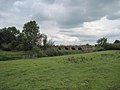
- Derwent Bridge, Bubwith (5 F)
G
- Gunby, East Riding of Yorkshire (11 F)
H
- High Field railway station (3 F)
W
- Willitoft (22 F)
Media in category "Bubwith"
The following 200 files are in this category, out of 280 total.
(previous page) (next page)-
 78 Squadron Bomber Command Memorial - geograph.org.uk - 5489118.jpg 1,065 × 1,600; 1.04 MB
-
 A colourful collection of farm machinery - geograph.org.uk - 5322311.jpg 1,024 × 768; 182 KB
-
 A flooded Derwent Valley - geograph.org.uk - 5272335.jpg 1,024 × 768; 127 KB
-
 A Footpath To Bubwith - geograph.org.uk - 218047.jpg 640 × 480; 98 KB
-
 A Former View From The Train - geograph.org.uk - 214849.jpg 640 × 480; 104 KB
-
 A Framed Drain - geograph.org.uk - 214998.jpg 640 × 480; 111 KB
-
 A parting of the ways, Bubwith - geograph.org.uk - 793341.jpg 640 × 480; 302 KB
-
 A Plain Drain - geograph.org.uk - 215002.jpg 640 × 480; 103 KB
-
 A163 passing Highfield Garage - geograph.org.uk - 3729740.jpg 1,500 × 1,000; 964 KB
-
 A163 towards Selby - geograph.org.uk - 2348268.jpg 1,600 × 1,200; 539 KB
-
 Access to the Bubwith Rail Trail off Gunby Lane - geograph.org.uk - 5272246.jpg 1,024 × 768; 372 KB
-
 Across the Derwent - geograph.org.uk - 3566733.jpg 640 × 427; 90 KB
-
 Across the fields to Drax from Highfield, Bubwith - geograph.org.uk - 3227599.jpg 4,606 × 2,764; 2.42 MB
-
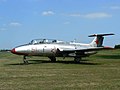 Aero L-29 Delfín - geograph.org.uk - 2041120.jpg 2,816 × 2,112; 2.03 MB
-
 Airfield entrance - geograph.org.uk - 3566609.jpg 640 × 427; 49 KB
-
 All Saints Church Graveyard, Bubwith - geograph.org.uk - 5489819.jpg 1,600 × 1,065; 885 KB
-
 All Saints Church, Bubwith - geograph.org.uk - 2348257.jpg 1,600 × 1,200; 446 KB
-
 All Saints Church, Bubwith - geograph.org.uk - 5489589.jpg 1,600 × 1,065; 762 KB
-
 All Saints Church, Bubwith - geograph.org.uk - 5489602.jpg 1,600 × 1,065; 814 KB
-
 All Saints Church, Bubwith - geograph.org.uk - 5489815.jpg 1,600 × 1,065; 669 KB
-
 All Saints Church, Bubwith - geograph.org.uk - 6071019.jpg 1,024 × 768; 286 KB
-
 All Saints Church, Bubwith - geograph.org.uk - 807981.jpg 480 × 640; 238 KB
-
 Along the rail trail - geograph.org.uk - 5365524.jpg 427 × 640; 258 KB
-
 Along the rail trail - geograph.org.uk - 5365526.jpg 640 × 427; 275 KB
-
 Alongside the Bubwith Rail Trail - geograph.org.uk - 5272277.jpg 1,024 × 768; 249 KB
-
 Annumhills Road - geograph.org.uk - 1214980.jpg 640 × 480; 53 KB
-
 Approaching Clay Lane, Breighton - geograph.org.uk - 5321891.jpg 1,024 × 768; 227 KB
-
 Approaching Derwent Bridge - geograph.org.uk - 2466655.jpg 800 × 600; 202 KB
-
 Approaching Elder Farm - geograph.org.uk - 6071073.jpg 1,024 × 768; 267 KB
-
 Area known as Windman Hills - geograph.org.uk - 6071109.jpg 1,024 × 768; 194 KB
-
 Autumn sown crop near Bubwith - geograph.org.uk - 5651263.jpg 1,024 × 768; 166 KB
-
 B1228 at Highfield - geograph.org.uk - 3566561.jpg 640 × 427; 91 KB
-
 B1228 towards Howden - geograph.org.uk - 2348279.jpg 1,600 × 1,200; 514 KB
-
 B1228 towards Sutton upon Derwent - geograph.org.uk - 2359192.jpg 1,600 × 1,200; 431 KB
-
 Bales on Breighton airfield - geograph.org.uk - 3566605.jpg 640 × 427; 37 KB
-
 Banks of the Derwent - geograph.org.uk - 3566732.jpg 640 × 427; 104 KB
-
 Behind the hedge, Northfield Road, Bubwith - geograph.org.uk - 5651267.jpg 1,024 × 768; 135 KB
-
 Bend in Clay Lane - geograph.org.uk - 5322318.jpg 1,024 × 786; 174 KB
-
 Boats on the River Derwent near Breighton - geograph.org.uk - 5272240.jpg 1,024 × 768; 202 KB
-
 Breighton - geograph.org.uk - 3566729.jpg 640 × 427; 94 KB
-
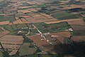 Breighton aerodrome, aerial 2016 - geograph.org.uk - 5092786.jpg 640 × 427; 59 KB
-
 Breighton aerodrome, aerial 2016 - geograph.org.uk - 5092791.jpg 440 × 640; 55 KB
-

-

-

-

-

-

-

-

-
 Breighton to the River Derwent - geograph.org.uk - 2638557.jpg 3,264 × 2,448; 2.57 MB
-
 Brick Arches - geograph.org.uk - 6074111.jpg 4,608 × 3,456; 6.78 MB
-
 Bridleway junction - geograph.org.uk - 5365525.jpg 640 × 427; 318 KB
-
 Bubwith Almshouses Chapel (47147253971).jpg 4,160 × 3,120; 8.61 MB
-
 Bubwith and Harlthorpe Drain - geograph.org.uk - 3940782.jpg 1,024 × 768; 208 KB
-
 Bubwith and Harlthorpe Drain - geograph.org.uk - 6073753.jpg 1,024 × 768; 288 KB
-
 Bubwith and Harlthorpe Drain - geograph.org.uk - 6073755.jpg 1,024 × 768; 278 KB
-
 Bubwith and Harlthorpe Drain, East Yorks. - geograph.org.uk - 793261.jpg 480 × 640; 283 KB
-
 Bubwith Ings - geograph.org.uk - 1198688.jpg 640 × 480; 82 KB
-
 Bubwith ings over Bottoms Drain - geograph.org.uk - 1229718.jpg 640 × 480; 37 KB
-
 Bubwith ings over Ings Drain - geograph.org.uk - 1229724.jpg 640 × 480; 39 KB
-
 Bubwith Ings over Ings Drain - geograph.org.uk - 789653.jpg 640 × 480; 40 KB
-
 Bubwith Parish War Memorial - geograph.org.uk - 5489128.jpg 1,065 × 1,600; 780 KB
-
 Bubwith Rail Trail (2) - geograph.org.uk - 3940773.jpg 1,024 × 768; 225 KB
-
 Bubwith rail trail - geograph.org.uk - 3566568.jpg 427 × 640; 154 KB
-
 Bubwith Rail Trail - geograph.org.uk - 3940769.jpg 1,024 × 768; 204 KB
-
 Bubwith sewage works - geograph.org.uk - 5272274.jpg 1,024 × 768; 136 KB
-
 Bubwith UK parish locator map.svg 1,425 × 1,107; 1.68 MB
-
 Bubwith Village - geograph.org.uk - 1199381.jpg 640 × 480; 70 KB
-

-
-
 By the River Derwent - geograph.org.uk - 5272341.jpg 1,024 × 768; 273 KB
-
 Cereal field near Breighton - geograph.org.uk - 5274461.jpg 1,024 × 768; 198 KB
-
 Chain Bar House, Bubwith - geograph.org.uk - 5274565.jpg 1,024 × 781; 163 KB
-
 Church Street, Bubwith - geograph.org.uk - 5489088.jpg 1,600 × 1,065; 536 KB
-
 Church Street, Bubwith - geograph.org.uk - 5489101.jpg 1,600 × 1,065; 592 KB
-
 Church Street, Bubwith - geograph.org.uk - 5489105.jpg 1,600 × 1,065; 636 KB
-
 Church Street, Bubwith.jpg 640 × 480; 138 KB
-
 Clay Lane - geograph.org.uk - 3395616.jpg 3,024 × 4,032; 5.11 MB
-
 Clay Lane - geograph.org.uk - 5322419.jpg 1,024 × 768; 182 KB
-
 Clay Lane and fly-tipped tyres - geograph.org.uk - 5321752.jpg 1,024 × 768; 273 KB
-
 Clay Lane, Breighton - geograph.org.uk - 2348231.jpg 1,600 × 1,200; 496 KB
-
 Clay Lane, Breighton - geograph.org.uk - 2348241.jpg 1,600 × 1,200; 492 KB
-
 Clay Lane, Breighton - geograph.org.uk - 6071046.jpg 1,024 × 768; 261 KB
-
 Commemorative Stone on Dyon Way, Bubwith - geograph.org.uk - 5490021.jpg 1,600 × 1,065; 811 KB
-
 Converging paths - geograph.org.uk - 3566350.jpg 640 × 427; 137 KB
-
 Cottages on Willitoft Road - geograph.org.uk - 3941139.jpg 1,024 × 768; 161 KB
-
 Cottages, Church Street, Bubwith - geograph.org.uk - 2348260.jpg 1,600 × 1,200; 498 KB
-
 Crops growing beside Northfield Road - geograph.org.uk - 5365517.jpg 640 × 427; 260 KB
-

-
 Crossroad east of Bubwith on A163 - geograph.org.uk - 5409027.jpg 1,910 × 1,364; 1,017 KB
-
 Derwent Bridge - geograph.org.uk - 6071011.jpg 1,024 × 768; 247 KB
-
 Derwent Bridge near Bubwith - geograph.org.uk - 5490034.jpg 1,600 × 1,065; 478 KB
-
 Derwent Bridge, Bubwith - geograph.org.uk - 2748533.jpg 3,264 × 2,448; 1.21 MB
-
 Derwent Bridge, Bubwith - geograph.org.uk - 5272331.jpg 1,024 × 768; 155 KB
-
 Dismantled Railway and River Derwent - geograph.org.uk - 2638576.jpg 3,264 × 2,448; 1.56 MB
-
 Downstream along the Derwent - geograph.org.uk - 2748541.jpg 3,208 × 2,372; 1.22 MB
-
 Dyon Walk, Bubwith - geograph.org.uk - 5490024.jpg 1,600 × 1,065; 436 KB
-
 East from Bubwith on Main Street the A163 - geograph.org.uk - 5408968.jpg 2,088 × 1,368; 1.15 MB
-
 Entering Bubwith - geograph.org.uk - 248352.jpg 640 × 426; 433 KB
-
 Entering Bubwith on the B1228 - geograph.org.uk - 2277156.jpg 800 × 600; 200 KB
-
 Entering Willitoft - geograph.org.uk - 2348182.jpg 1,600 × 1,200; 605 KB
-
 Entrance to All Saints Church, Bubwith - geograph.org.uk - 5489111.jpg 1,600 × 1,065; 823 KB
-
 Entrance to Breighton Airfield and Aeroplane Museum - geograph.org.uk - 4494346.jpg 1,600 × 1,200; 233 KB
-
 Entrance to Gunby Hall - geograph.org.uk - 3566602.jpg 640 × 427; 126 KB
-
 Farm machinery along the rail trail - geograph.org.uk - 3566566.jpg 640 × 427; 127 KB
-
 Farm track south of Breighton - geograph.org.uk - 2348224.jpg 1,600 × 1,200; 377 KB
-
 Farm Track to Breighton - geograph.org.uk - 2638547.jpg 3,264 × 2,448; 1.52 MB
-
 Farm track towards the Burtles - geograph.org.uk - 2348179.jpg 1,600 × 1,200; 671 KB
-
 Farmland east of the B1228 - geograph.org.uk - 2348277.jpg 1,600 × 1,200; 696 KB
-
 Farmland near Willitoft - geograph.org.uk - 2347850.jpg 1,600 × 1,200; 560 KB
-
 Farmland next to Northfield Road - geograph.org.uk - 5365514.jpg 640 × 427; 236 KB
-
 Farmland off Lund Lane - geograph.org.uk - 3566735.jpg 640 × 427; 116 KB
-
 Farmland off Northfield Road - geograph.org.uk - 5365515.jpg 640 × 427; 251 KB
-
 Farmland off the B1228 - geograph.org.uk - 2359190.jpg 1,600 × 1,200; 456 KB
-
 Farmland south of Breighton - geograph.org.uk - 2348225.jpg 640 × 480; 67 KB
-
 Farmland south of Highfield - geograph.org.uk - 2348170.jpg 1,600 × 1,200; 616 KB
-
 Farmland west of the B1228 - geograph.org.uk - 2348274.jpg 1,600 × 1,200; 780 KB
-
 Farmland, Breighton - geograph.org.uk - 2348244.jpg 1,600 × 1,200; 654 KB
-
 Farmland, Bubwith - geograph.org.uk - 2348264.jpg 1,600 × 1,200; 452 KB
-
 Farmland, Highfield - geograph.org.uk - 2348164.jpg 1,600 × 1,200; 713 KB
-
 Field Boundary - geograph.org.uk - 2348272.jpg 1,600 × 1,200; 640 KB
-
 Field boundary - geograph.org.uk - 5321887.jpg 1,024 × 768; 180 KB
-
 Field edge footpath in Rape field - geograph.org.uk - 5975754.jpg 4,608 × 3,456; 4.38 MB
-
 Field edge footpath on a corner, turn right - geograph.org.uk - 5975753.jpg 4,608 × 3,456; 4.99 MB
-
 Field path at Willitoft - geograph.org.uk - 6071077.jpg 1,024 × 768; 327 KB
-
 Field path near Breighton - geograph.org.uk - 6071050.jpg 1,024 × 768; 140 KB
-
 Fields from Intakefield Road - geograph.org.uk - 5365519.jpg 640 × 427; 246 KB
-
 Fields off Northfield Road - geograph.org.uk - 1214989.jpg 640 × 480; 51 KB
-
 Flooded Ings at Breighton (geograph 5274451).jpg 1,024 × 768; 139 KB
-
 Floods at Derwent Bridge, Bubwith - geograph.org.uk - 5729023.jpg 1,024 × 768; 98 KB
-
 Footpath closed by flooding - geograph.org.uk - 5729035.jpg 1,024 × 768; 84 KB
-
 Footpath from Foggathorpe - geograph.org.uk - 218053.jpg 640 × 480; 100 KB
-
 Footpath through windbreak trees and dry ditch - geograph.org.uk - 5975761.jpg 4,608 × 3,456; 5.69 MB
-
 Fork in Minor Road - geograph.org.uk - 248350.jpg 640 × 426; 324 KB
-
 Former Arts theatre - geograph.org.uk - 1214984.jpg 640 × 480; 65 KB
-

-
 From The Other Side Of The Train - geograph.org.uk - 214853.jpg 640 × 480; 102 KB
-
 Gap in the bridge - geograph.org.uk - 5272261.jpg 1,024 × 768; 404 KB
-
 Gated farm track of Willitoft Road - geograph.org.uk - 2348174.jpg 1,600 × 1,200; 661 KB
-
 Gunby Hall Farm - geograph.org.uk - 5272260.jpg 1,024 × 768; 212 KB
-
 Gunby Road towards Breighton - geograph.org.uk - 2277170.jpg 800 × 600; 306 KB
-
 Gunby Road towards Bubwith - geograph.org.uk - 2348251.jpg 1,600 × 1,200; 735 KB
-
 Highfield Garage - geograph.org.uk - 2348166.jpg 1,600 × 944; 228 KB
-
 Highfield Grange - geograph.org.uk - 5272327.jpg 1,024 × 660; 200 KB
-
 Highfield Road, Bubwith - geograph.org.uk - 5488970.jpg 1,600 × 1,065; 609 KB
-
 Highfield Road, Bubwith - geograph.org.uk - 5488973.jpg 1,600 × 1,065; 559 KB
-
 Highfield Road, Bubwith - geograph.org.uk - 5488976.jpg 1,600 × 1,065; 448 KB
-
 Honey Pot off Church Street, Bubwith - geograph.org.uk - 5489094.jpg 1,600 × 1,065; 580 KB
-
 Horses by the River Derwent (geograph 5274456).jpg 1,024 × 768; 218 KB
-
 Horses on the Bubwith rail trail - geograph.org.uk - 3566560.jpg 640 × 427; 126 KB
-
 Horses on the riverbank - geograph.org.uk - 3566734.jpg 640 × 427; 98 KB
-
 House on Church Street, Bubwith - geograph.org.uk - 5274559.jpg 1,024 × 672; 153 KB
-
 House on Clay Lane, Breighton - geograph.org.uk - 2348236.jpg 1,600 × 1,200; 407 KB
-
 House on Staithe Street, Bubwith - geograph.org.uk - 5489598.jpg 1,600 × 1,065; 766 KB
-
 Houses on Breighton Road - geograph.org.uk - 3566600.jpg 640 × 427; 96 KB
-
 Jug ^ Bottle on Main Street, Bubwith - geograph.org.uk - 5489018.jpg 1,600 × 1,065; 691 KB
-
 Jug ^ Bottle on Main Street, Bubwith - geograph.org.uk - 5489024.jpg 1,018 × 1,600; 415 KB
-
 Junction on Northfield Road - geograph.org.uk - 5365510.jpg 640 × 427; 233 KB
-
 Kissing Gate - geograph.org.uk - 249090.jpg 640 × 426; 428 KB
-
 Looking Downriver from the Derwent Bridge - geograph.org.uk - 197212.jpg 640 × 480; 110 KB
-
 Looking Towards Airfield - geograph.org.uk - 249084.jpg 640 × 426; 341 KB
-

-
 Lych gate at All Saints Church, Bubwith - geograph.org.uk - 5489610.jpg 1,600 × 1,065; 792 KB
-
 Main Street, Bubwith - geograph.org.uk - 2277161.jpg 800 × 600; 211 KB
-
 Main Street, Bubwith - geograph.org.uk - 5365522.jpg 640 × 427; 222 KB
-
 Main Street, Bubwith - geograph.org.uk - 5488876.jpg 1,600 × 1,065; 541 KB
-
 Main Street, Bubwith - geograph.org.uk - 5488986.jpg 1,600 × 1,065; 542 KB
-
 Main Street, Bubwith - geograph.org.uk - 5488995.jpg 1,600 × 1,065; 612 KB
-
 Main Street, Bubwith - geograph.org.uk - 5489000.jpg 1,600 × 1,065; 596 KB
-
 Main Street, Bubwith - geograph.org.uk - 5489082.jpg 1,600 × 1,065; 545 KB
-
 Main Street, Bubwith - geograph.org.uk - 5489853.jpg 1,600 × 1,065; 490 KB
-
 Main Street, Bubwith - geograph.org.uk - 5490015.jpg 1,600 × 1,065; 474 KB
-
 Mill House Farm - geograph.org.uk - 5365520.jpg 640 × 427; 233 KB
-
 Millhill Farm - geograph.org.uk - 3566727.jpg 640 × 427; 91 KB
-
 Minor road junction near Willitoft - geograph.org.uk - 2347847.jpg 1,600 × 1,200; 379 KB
-
 Mulberry House, Bubwith - geograph.org.uk - 5274546.jpg 1,024 × 752; 146 KB
-
 Nature Builds A Tunnel - geograph.org.uk - 214848.jpg 640 × 480; 108 KB
-
 New Moor Lands - geograph.org.uk - 1299080.jpg 640 × 390; 62 KB
-
 North Covert - geograph.org.uk - 2348186.jpg 1,600 × 1,200; 546 KB
-
 Northfield Road - geograph.org.uk - 217691.jpg 640 × 480; 112 KB
-
 Northfield Road - geograph.org.uk - 5365516.jpg 640 × 427; 257 KB
-
 Not Really A Bend - geograph.org.uk - 214855.jpg 640 × 480; 108 KB
-
 Notices at Breighton airfield - geograph.org.uk - 2278293.jpg 800 × 600; 167 KB
-

-
 Old rail viaduct - geograph.org.uk - 6071028.jpg 1,024 × 768; 386 KB
-
 One of three - geograph.org.uk - 5322219.jpg 1,024 × 759; 147 KB
-
 Paddocks near Millhill Farm - geograph.org.uk - 5274448.jpg 1,024 × 768; 125 KB
-
 Passing Mill House Farm - geograph.org.uk - 5365521.jpg 640 × 427; 226 KB
-
 Path by the River Derwent, Bubwith - geograph.org.uk - 5272322.jpg 1,024 × 768; 330 KB
-
 Path leading to Main Street, Bubwith - geograph.org.uk - 5488872.jpg 1,600 × 1,065; 666 KB
-
 Path leading towards Harlthorpe - geograph.org.uk - 5487544.jpg 1,600 × 1,065; 857 KB
-
 Path leading towards Harlthorpe - geograph.org.uk - 5487547.jpg 1,600 × 1,065; 708 KB
-
 Path leading towards Harlthorpe - geograph.org.uk - 5487550.jpg 1,600 × 1,065; 820 KB
-
 Path leading towards Harlthorpe - geograph.org.uk - 5487752.jpg 1,600 × 1,065; 832 KB
-
 Path leading towards Harlthorpe - geograph.org.uk - 5487755.jpg 1,600 × 1,065; 1.1 MB
-
 Path leading towards Harlthorpe - geograph.org.uk - 5487759.jpg 1,600 × 1,065; 976 KB
-
 Picnic area by the River Derwent at Bubwith - geograph.org.uk - 5729006.jpg 1,024 × 768; 278 KB
-
 Ploughed field and hidden tip - geograph.org.uk - 5323625.jpg 1,024 × 768; 255 KB
-
 Post office ^ shop on Main Street, Bubwith - geograph.org.uk - 5489039.jpg 1,600 × 1,065; 550 KB


_fly-in,_August_2012_-_geograph.org.uk_-_3068897.jpg)
_fly-in,_August_2012_-_geograph.org.uk_-_3068915.jpg)
_fly-in,_August_2012_-_geograph.org.uk_-_3068936.jpg)
_fly-in,_August_2012_-_geograph.org.uk_-_3068949.jpg)
_fly-in,_August_2012_-_geograph.org.uk_-_3068959.jpg)
_fly-in,_August_2012_-_geograph.org.uk_-_3068975.jpg)
_fly-in,_August_2012_-_geograph.org.uk_-_3068999.jpg)
_fly-in,_August_2012_-_geograph.org.uk_-_3069001.jpg)


.jpg)


_-_geograph.org.uk_-_3940773.jpg)


.jpg)


.jpg)


