Category:Brymbo
Jump to navigation
Jump to search
Cymraeg: Pentref ar gyrion Wrecsam a ward o'r dref honno yng ngogledd-ddwyrain Cymru yw Brymbo. Bu Melin Dur Brymbo yn gyflogwr pwysig yn yr ardal tan iddo gau yn ddiweddar.
English: Brymbo is a village in the county borough of Wrexham, Wales. It forms part of the Wrexham Urban Area (pop 63,000) and is also a local government ward. At the 2001 Census, the population of the village was 3,482, although the population of Brymbo Ward was only 2,653.
village and community in Wrexham County Borough, Wales   | |||||
| Upload media | |||||
| Instance of | |||||
|---|---|---|---|---|---|
| Location | Wrexham County Borough, Wales | ||||
| Population |
| ||||
| Area |
| ||||
 | |||||
Subcategories
This category has the following 3 subcategories, out of 3 total.
B
- Brymbo (GWR) railway station (2 F)
- Brymbo Steelworks (48 F)
Media in category "Brymbo"
The following 142 files are in this category, out of 142 total.
-
 "Brymbo Bottle" in scrubland - geograph.org.uk - 3771739.jpg 1,600 × 1,200; 671 KB
-
 A calm day for fishing - geograph.org.uk - 3769475.jpg 3,264 × 2,448; 3.84 MB
-
 Autumn colour - geograph.org.uk - 6317908.jpg 5,184 × 3,888; 4.53 MB
-
 Autumnal bridleway - geograph.org.uk - 6317922.jpg 5,184 × 3,888; 6.48 MB
-
 Autumnal footpath - geograph.org.uk - 6347496.jpg 3,888 × 5,184; 7.31 MB
-

-
 B5430 - geograph.org.uk - 5112748.jpg 3,229 × 4,563; 1.85 MB
-
 B5430 - geograph.org.uk - 5112754.jpg 4,780 × 3,315; 1.74 MB
-
 Benches and boulders in Lodge near Wrexham - geograph.org.uk - 6228461.jpg 1,600 × 1,201; 445 KB
-
 Bend in New Road south of Brymbo - geograph.org.uk - 5232779.jpg 800 × 600; 126 KB
-
 Bridleway near Glascoed Hall - geograph.org.uk - 3765377.jpg 3,264 × 2,448; 6.15 MB
-
 Bridleway under dismantled railway - geograph.org.uk - 6317918.jpg 5,184 × 3,888; 6 MB
-
 Brombo House 1794.jpg 820 × 686; 454 KB
-

-
 Broughton Road houses in Lodge near Wrexham - geograph.org.uk - 6228471.jpg 1,500 × 1,600; 414 KB
-
 Broughton Road houses, Moss near Wrexham - geograph.org.uk - 5854076.jpg 1,024 × 951; 124 KB
-
 Broughton Road houses, Moss near Wrexham - geograph.org.uk - 5854441.jpg 1,024 × 896; 162 KB
-
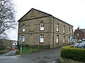 Brymbo chapel.jpg 640 × 480; 85 KB
-
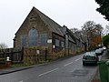 Brymbo Church of England School - geograph.org.uk - 623945.jpg 640 × 480; 64 KB
-
 Brymbo Enterprise Centre - geograph.org.uk - 6021769.jpg 3,736 × 2,803; 1.9 MB
-
 Brymbo Hall.png 852 × 786; 1.02 MB
-
 Brymbo Heritage Site - geograph.org.uk - 881966.jpg 480 × 640; 102 KB
-
 Brymbo houses - geograph.org.uk - 6017687.jpg 3,924 × 2,835; 2.01 MB
-
 Brymbo memorial park - geograph.org.uk - 623949.jpg 480 × 640; 136 KB
-
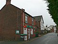
 Brymbo Post Office - geograph.org.uk - 5232647.jpg 800 × 600; 107 KB
-
-
 Bryn Melyn, Brymbo - geograph.org.uk - 5232643.jpg 800 × 676; 123 KB
-
 Bwlchgwyn War Memorial - geograph.org.uk - 5004682.jpg 3,264 × 2,448; 3.39 MB
-
 Bwlchgwyn War Memorial - geograph.org.uk - 5848276.jpg 640 × 480; 88 KB
-
 Cae Adar Lane - geograph.org.uk - 4994921.jpg 3,264 × 2,448; 3.79 MB
-
 Capel Nebo, Bwlchgwyn - geograph.org.uk - 2480433.jpg 640 × 480; 62 KB
-
 Cefn Road near Wrexham - geograph.org.uk - 5232736.jpg 800 × 664; 87 KB
-
 Cemetery at St Mary's Church, Brymbo - geograph.org.uk - 623438.jpg 640 × 480; 135 KB
-
 Christ Church, Bwlchgwyn - geograph.org.uk - 6317890.jpg 5,184 × 3,888; 3.7 MB
-
 Closed quarry on the edge of Coed Mawr - geograph.org.uk - 5004147.jpg 3,264 × 2,448; 3.69 MB
-
 Concrete structure, Nant y Ffrith - geograph.org.uk - 2885496.jpg 640 × 480; 155 KB
-
 Country Lane Junction - geograph.org.uk - 284793.jpg 640 × 480; 101 KB
-
 D Furnace - Brymbo Steelworks 1990 - geograph.org.uk - 3333706.jpg 4,771 × 5,964; 1.78 MB
-
 Derelict building beside the road - geograph.org.uk - 5004152.jpg 3,264 × 2,448; 3.64 MB
-
 Derelict farm buildings - geograph.org.uk - 623435.jpg 640 × 480; 96 KB
-

-
 Disused railway bridge on the B5101 - geograph.org.uk - 6017732.jpg 3,738 × 2,662; 3.07 MB
-
 Dyke Street Brymbo - geograph.org.uk - 5132878.jpg 800 × 561; 84 KB
-
 Dyke Street, Brymbo - geograph.org.uk - 5132881.jpg 800 × 633; 113 KB
-
 End of the 30 zone beyond Brymbo - geograph.org.uk - 5232792.jpg 800 × 600; 161 KB
-
 Entrance to Brymbo Enterprise Centre - geograph.org.uk - 5232650.jpg 800 × 541; 109 KB
-
 Fairfield, Brymbo - geograph.org.uk - 5232679.jpg 800 × 530; 93 KB
-
 Ffrwd - geograph.org.uk - 623432.jpg 640 × 392; 61 KB
-
 Footbridge and stream in autumn woodland - geograph.org.uk - 3769496.jpg 3,264 × 2,448; 6.15 MB
-
 Footbridge over stream in woodland - geograph.org.uk - 3765364.jpg 3,264 × 2,448; 5.93 MB
-
 Footbridge over the Afon Gwenfro - geograph.org.uk - 3747494.jpg 3,264 × 2,448; 6.33 MB
-
 Footpath beside security fence - geograph.org.uk - 3747744.jpg 3,264 × 2,448; 4.94 MB
-
 Footpath beside Vron Farm - geograph.org.uk - 3747844.jpg 640 × 480; 98 KB
-
 Fork in the road, Lodge near Wrexham - geograph.org.uk - 6228467.jpg 1,600 × 1,326; 393 KB
-
 Former Brymbo Library - geograph.org.uk - 5132879.jpg 800 × 476; 67 KB
-
 Former Lodge Methodist Chapel, Moss near Wrexham - geograph.org.uk - 5854398.jpg 1,024 × 880; 218 KB
-
 Four Crosses - geograph.org.uk - 4094136.jpg 640 × 480; 78 KB
-
 Four Crosses - geograph.org.uk - 5112746.jpg 2,536 × 1,778; 1.5 MB
-
 Four Crosses - geograph.org.uk - 5114562.jpg 5,184 × 2,900; 1.72 MB
-
 Glascoed Road - geograph.org.uk - 333867.jpg 640 × 426; 113 KB
-
 Grass fields to the houses on the "Old Road" - geograph.org.uk - 4995776.jpg 3,264 × 2,448; 3.45 MB
-
 Grazing fields and woodland north of Coedpoeth - geograph.org.uk - 3747520.jpg 3,264 × 2,448; 4.3 MB
-
 Grazing fields east of Vron Farm - geograph.org.uk - 3747787.jpg 640 × 480; 89 KB
-
 Grazing fields south of Vron Farm - geograph.org.uk - 3747836.jpg 3,264 × 2,448; 3.77 MB
-
 Grazing fields west of the B5101 - geograph.org.uk - 3762660.jpg 3,264 × 2,448; 5.78 MB
-
 Group of houses on Rhodfa Glascoed (Glascoed Road) - geograph.org.uk - 5004142.jpg 3,264 × 2,448; 3.64 MB
-
 Hall in Lodge near Wrexham - geograph.org.uk - 6228413.jpg 1,600 × 1,315; 506 KB
-

-
 House near Smelt Wood - geograph.org.uk - 2798082.jpg 640 × 480; 49 KB
-
 House on Ruthin Road, Bwlchgwyn - geograph.org.uk - 6394618.jpg 2,880 × 2,160; 1.02 MB
-
 Houses on the A525 - geograph.org.uk - 5004669.jpg 3,264 × 2,448; 3.44 MB
-

-

-
 Kent Road bus stop and shelter, Moss - geograph.org.uk - 5853943.jpg 1,024 × 913; 265 KB
-
 Kent Road bus stop near Moss - geograph.org.uk - 5232746.jpg 800 × 560; 135 KB
-
 Kent Road houses, Moss near Wrexham - geograph.org.uk - 5853939.jpg 2,696 × 1,989; 1.46 MB
-
 Kissing gate and footpath - geograph.org.uk - 3747573.jpg 3,264 × 2,448; 5.56 MB
-
 Milestone - Minera 2 - geograph.org.uk - 4608491.jpg 480 × 640; 132 KB
-
 Moors Inn, Four Crosses - geograph.org.uk - 1409951.jpg 640 × 406; 55 KB
-
 Moors Inn, Four Crosses - geograph.org.uk - 4094131.jpg 640 × 480; 65 KB
-
 Morse House, Brymbo - geograph.org.uk - 5132882.jpg 800 × 691; 114 KB
-
 Mount Isa Drive, Brymbo - geograph.org.uk - 5232638.jpg 800 × 560; 108 KB
-
 Nant Court houses, Brymbo - geograph.org.uk - 5232807.jpg 800 × 476; 89 KB
-
 Nant-y-Ffrith Reservoir, Four Crosses - geograph.org.uk - 6326972.jpg 5,184 × 2,920; 5.85 MB
-

-
 Offa's Dyke at Mount Sion, Brymbo, 1961 - geograph.org.uk - 6444141.jpg 1,280 × 838; 188 KB
-
 Offa's Dyke at Mount Sion, Brymbo, 1961 - geograph.org.uk - 6444160.jpg 846 × 1,280; 246 KB
-

-

-
 Ordnance Survey Rivet - geograph.org.uk - 4608499.jpg 480 × 640; 123 KB
-
 Pasture land north of Brymbo - geograph.org.uk - 3762679.jpg 3,264 × 2,448; 5.92 MB
-
 Pen-y-Graig Road, Brymbo - geograph.org.uk - 5132889.jpg 800 × 622; 101 KB
-
 Penrhos Engine House - geograph.org.uk - 2798089.jpg 640 × 480; 44 KB
-
 Penrhos Engine House - geograph.org.uk - 2798093.jpg 640 × 480; 55 KB
-
 Penrhos Engine House - geograph.org.uk - 310955.jpg 640 × 427; 83 KB
-
 Penrhos Engine House from road - geograph.org.uk - 3960909.jpg 3,968 × 2,976; 2.2 MB
-
 Pylons on the March - geograph.org.uk - 43379.jpg 640 × 480; 102 KB
-
 Queen Elizabeth II postbox, Broughton Road, Moss - geograph.org.uk - 5854412.jpg 1,000 × 1,024; 189 KB
-

-
 Railway Road, Brymbo - geograph.org.uk - 5232730.jpg 800 × 782; 164 KB
-
 Read Construction entrance, Brymbo - geograph.org.uk - 5232661.jpg 800 × 600; 155 KB
-
 Road Junction near Coedpoeth - geograph.org.uk - 151680.jpg 640 × 472; 66 KB
-
 Site of Brymbo West Crossing Halt - geograph.org.uk - 1929001.jpg 640 × 388; 112 KB
-
 South side of Y Tai pub, Brymbo - geograph.org.uk - 5232724.jpg 800 × 770; 149 KB
-
 Southwest end of Edwards Avenue, Brymbo - geograph.org.uk - 5132886.jpg 800 × 578; 105 KB
-
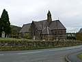 St Mary's Church, Brymbo - geograph.org.uk - 623442.jpg 640 × 480; 57 KB
-

-

-
 Stile and footpath sign - geograph.org.uk - 6317913.jpg 3,888 × 5,184; 4.1 MB
-
 Stile between grazing fields - geograph.org.uk - 3769514.jpg 3,264 × 2,448; 5.69 MB
-
 Stile on footpath from Plas Mostyn Mawr farm - geograph.org.uk - 3747537.jpg 3,264 × 2,448; 5.06 MB
-
 Stone houses, Broughton Road, Moss near Wrexham - geograph.org.uk - 5854083.jpg 1,024 × 1,002; 226 KB
-
 Stream by a footbridge in woodland - geograph.org.uk - 3765355.jpg 3,264 × 2,448; 5.83 MB
-
 Tan-y-bwlch - geograph.org.uk - 5112596.jpg 5,184 × 3,456; 1.93 MB
-

-
 The King's Head, Bwlchgwyn - geograph.org.uk - 5848280.jpg 640 × 480; 73 KB
-
 The Kings Head Inn, Bwlchgwyn - geograph.org.uk - 2480404.jpg 640 × 480; 58 KB
-
 The Moors Inn - geograph.org.uk - 4995782.jpg 4,608 × 3,456; 5.19 MB
-
 The Old Police Station, Bwlchgwyn - geograph.org.uk - 2480417.jpg 640 × 480; 44 KB
-
 Towards Nant Court, Brymbo - geograph.org.uk - 5232810.jpg 800 × 522; 77 KB
-

-
 Up Davies Avenue, Brymbo - geograph.org.uk - 5132884.jpg 800 × 484; 82 KB
-
 View across to Moss and the transmitter - geograph.org.uk - 3748223.jpg 3,648 × 2,736; 4.65 MB
-
 Vron Close, Brymbo - geograph.org.uk - 5232640.jpg 800 × 620; 101 KB
-
 Wales Wrexham Community Brymbo map.svg 512 × 362; 495 KB
-
 War Memorial, Brymbo - geograph.org.uk - 623951.jpg 480 × 640; 83 KB
-

-
 Well kept footpath to Bwlchgwyn - geograph.org.uk - 5004660.jpg 3,264 × 2,448; 3.74 MB
-
 West along Brake Road, Brymbo - geograph.org.uk - 5132888.jpg 800 × 790; 225 KB
-
 Westminster Arms, Bwlchgwyn - geograph.org.uk - 2480440.jpg 640 × 480; 60 KB
-
 Woodland strip west of Miners Road - the B5102 - geograph.org.uk - 3765347.jpg 3,264 × 2,448; 6.88 MB
-
 Y Tai pub name sign, Brymbo - geograph.org.uk - 5232690.jpg 607 × 800; 87 KB
-
 Y Tai pub, Brymbo - geograph.org.uk - 5232669.jpg 800 × 557; 107 KB
-
 Brymbo English Methodist Church - geograph.org.uk - 623953.jpg 640 × 480; 96 KB
-
 Brymbo High Street - geograph.org.uk - 623957.jpg 640 × 480; 59 KB
-
 Engedi, Brymbo - geograph.org.uk - 621590.jpg 480 × 640; 69 KB
-
 Major Landscaping Project - geograph.org.uk - 43372.jpg 640 × 480; 141 KB
-
 Old Cemetery, Bwlchgwyn - geograph.org.uk - 606248.jpg 640 × 480; 131 KB
-
 Ongoing Conversion - geograph.org.uk - 623958.jpg 640 × 480; 136 KB
-
 Plas Mostyn Mawr - geograph.org.uk - 320496.jpg 640 × 426; 91 KB
-
 Plas Mostyn Mawr drive - geograph.org.uk - 333423.jpg 640 × 426; 89 KB
-
 Road along Offa's Dyke - geograph.org.uk - 182020.jpg 640 × 480; 122 KB


_-_geograph.org.uk_-_5004142.jpg)


