Category:Brumstead
Jump to navigation
Jump to search
English: Brumstead is a village and a civil parish in the English county of Norfolk. The village is north of the town of Stalham.The nearest railway station is at North Walsham for the Bittern Line which runs between Cromer and Norwich. The nearest airport is Norwich International Airport. The l parish had in 2001 census, a population of 84. For the purposes of local government, the parish falls within the district of North Norfolk. The village is situated on the route of the B1159 that runs between the town of Cromer and the town of Stalham .
Nederlands: Brumstead is een dorp (inwonertal 84) nabij Stalham in het bestuurlijke gebied North Norfolk, in het Engelse graafschap Norfolk.
village and civil parish in Norfolk, UK  | |||||
| Upload media | |||||
| Instance of | |||||
|---|---|---|---|---|---|
| Location | North Norfolk, Norfolk, East of England, England | ||||
| Population |
| ||||
| Area |
| ||||
 | |||||
Subcategories
This category has the following 5 subcategories, out of 5 total.
M
N
P
S
Media in category "Brumstead"
The following 37 files are in this category, out of 37 total.
-
 Boyton's View from Brunstead churchyard - geograph.org.uk - 5330001.jpg 3,456 × 2,592; 3.89 MB
-
 Brunstead Grange - geograph.org.uk - 4558215.jpg 1,024 × 768; 338 KB
-
 Brunstead Hall - geograph.org.uk - 966522.jpg 640 × 426; 111 KB
-
 Brunstead Hall - geograph.org.uk - 966523.jpg 640 × 426; 97 KB
-
 Brunstead Hall - geograph.org.uk - 966527.jpg 640 × 419; 102 KB
-
 Brunstead village sign - geograph.org.uk - 4295977.jpg 480 × 640; 64 KB
-
 Brunstead War Memorial - geograph.org.uk - 5330156.jpg 2,476 × 2,476; 1.3 MB
-
 Cow parsley and flowering oilseed rape - geograph.org.uk - 3956343.jpg 640 × 626; 326 KB
-
 Cow parsley growing beside rural lane - geograph.org.uk - 3956350.jpg 640 × 480; 263 KB
-
 Cultivated field by Moat Hill Plantation - geograph.org.uk - 3956355.jpg 640 × 480; 195 KB
-
 Fingerpost on the B1159 at Brunstead - geograph.org.uk - 4558205.jpg 1,024 × 768; 527 KB
-
 Oilseed rape by Oldbarn Farm - geograph.org.uk - 3956334.jpg 640 × 480; 156 KB
-
 Poultry houses at Brunstead - geograph.org.uk - 4558212.jpg 1,024 × 768; 368 KB
-
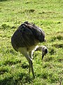 Rhea - geograph.org.uk - 564169.jpg 480 × 640; 115 KB
-
 Road from St Peter, Brunstead, Norfolk - geograph.org.uk - 966462.jpg 426 × 640; 107 KB
-
 Road past church - geograph.org.uk - 966465.jpg 640 × 426; 110 KB
-
 Roadside ditch by Oldbarn Farm - geograph.org.uk - 3956340.jpg 640 × 480; 247 KB
-
 Root vegetable field by Weavers' Way - geograph.org.uk - 5972138.jpg 1,600 × 1,200; 455 KB
-
 The Avenue to Brunstead Hall - geograph.org.uk - 5968952.jpg 1,600 × 1,064; 858 KB
-
 The Bungalow, Brunstead Grange - geograph.org.uk - 522031.jpg 640 × 480; 54 KB
-
 This way to the B1159 road - geograph.org.uk - 3956338.jpg 640 × 480; 229 KB
-
 Unmarked concrete farm road - geograph.org.uk - 564231.jpg 640 × 480; 75 KB
-
 View along Parker's Lane - geograph.org.uk - 3956358.jpg 496 × 640; 206 KB
-
 View east from the B1159 - geograph.org.uk - 564123.jpg 640 × 480; 63 KB
-
 View from church - geograph.org.uk - 966475.jpg 640 × 426; 87 KB
-
 View south across The Carr - geograph.org.uk - 798463.jpg 640 × 453; 146 KB
-
 View towards Moat Hill Plantation - geograph.org.uk - 3956351.jpg 640 × 480; 187 KB
-

-
 Weavers' Way following old railway line - geograph.org.uk - 5972124.jpg 1,600 × 1,132; 381 KB
-
 Weavers' Way following old railway line - geograph.org.uk - 5979426.jpg 1,600 × 1,334; 425 KB
-

-
 WW1 Memorial ^ Roll of Honour - geograph.org.uk - 5970529.jpg 1,075 × 1,600; 394 KB
-
 WW1 Memorial ^ Roll of Honour - geograph.org.uk - 5970530.jpg 1,600 × 1,013; 405 KB
-
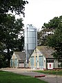 Agricultural sheds and silo - geograph.org.uk - 564203.jpg 480 × 640; 81 KB
-
 Brunstead Grange - geograph.org.uk - 522034.jpg 640 × 480; 73 KB
-
 Entrance to Brunstead House and Farm - geograph.org.uk - 564197.jpg 640 × 480; 72 KB
-


_-_geograph.org.uk_-_564116.jpg)


