Category:Brue
Jump to navigation
Jump to search
village in the Outer Hebrides, Scotland, UK | |||||
| Upload media | |||||
| Instance of | |||||
|---|---|---|---|---|---|
| Location |
| ||||
 | |||||
English: Brue (Brù) is a village on the Isle of Lewis in the West Side district, in the Outer Hebrides, Scotland. It is a crofting township and it is composed of two areas: Am Baile Staigh, which is nearer the coast, and Pàirc Bhrù, which runs towards the moor. In total it covers a road distance of 2.5 km. The name Brue is an anglicised form of the Scottish Gaelic Brù which in turn comes from an Old Norse word which is believed to have meant old bridge; this reflects the centuries of Viking occupation and settlement in the Outer Hebrides.
Media in category "Brue"
The following 14 files are in this category, out of 14 total.
-
 Alderbury, Brue - geograph.org.uk - 2031253.jpg 3,072 × 2,304; 3.42 MB
-
 Alderbury, Brue - geograph.org.uk - 2031259.jpg 3,072 × 2,304; 3.32 MB
-
 Alderbury, Brue - geograph.org.uk - 2031262.jpg 3,072 × 2,304; 3.28 MB
-
 Alderbury, Brue - geograph.org.uk - 2031266.jpg 3,072 × 2,304; 3.23 MB
-
 Alderbury, Brue - geograph.org.uk - 2031270.jpg 3,072 × 2,304; 3.52 MB
-
 Brue, Isle of Lewis - geograph.org.uk - 2031250.jpg 3,072 × 2,304; 3.11 MB
-
 Ceann Rathad Bhru.jpg 10,000 × 977; 2.58 MB
-
 Shieling Barvas and Brue 01.jpg 4,080 × 3,072; 7.61 MB
-
 Shieling Barvas and Brue 02.jpg 4,080 × 3,072; 6.97 MB
-
 Shieling Barvas and Brue 03.jpg 4,080 × 3,072; 5.84 MB
-
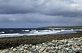 Brue Beach on a stormy day - geograph.org.uk - 746249.jpg 640 × 417; 218 KB
-
 Brue, Old and New - geograph.org.uk - 207082.jpg 640 × 480; 69 KB
-
 New Home in Brue - geograph.org.uk - 207080.jpg 640 × 480; 75 KB
-
 Ruin in Brue - geograph.org.uk - 207083.jpg 640 × 480; 59 KB


